Washington County, Texas
| Washington County, Texas | |
|---|---|
|
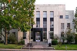
The Washington County Courthouse in Brenham | |
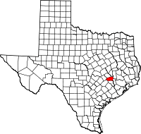 Location in the U.S. state of Texas | |
 Texas's location in the U.S. | |
| Founded | 1837 |
| Named for | George Washington |
| Seat | Brenham |
| Largest city | Brenham |
| Area | |
| • Total | 622 sq mi (1,611 km2) |
| • Land | 604 sq mi (1,564 km2) |
| • Water | 18 sq mi (47 km2), 2.9% |
| Population | |
| • (2010) | 33,718 |
| • Density | 56/sq mi (22/km²) |
| Congressional district | 10th |
| Time zone | Central: UTC-6/-5 |
| Website |
www |
Washington County is a county in the U.S. state of Texas. As of the 2010 census, the population was 33,718.[1] Its county seat is Brenham, which is located on the Brazos River.[2] The county was created in 1835 as a municipality of Mexico and organized as a county in 1837.[3][4] is named for George Washington, the first president of the United States.
Washington County comprises the Brenham, TX Micropolitan Statistical Area, which is also included in the Houston-The Woodlands, TX Metropolitan Statistical Area.
Washington-on-the-Brazos in the county is notable as the site of the signing of the Texas Declaration of Independence during the Convention of 1836. Reflecting the county's history as a destination of mid-19th-century German immigrants who came after the 1848 [German] revolutions, in the 2000 US Census more than one-third of residents identified as being of German ancestry. (See Demographics below.)
In 2013, the syndicated television series, Texas Country Reporter, hosted by Bob Phillips, declared the highways between Brenham and Chappel Hill as the No. 2 site for the viewing of wildflowers within Texas. The first ranking went to the Lady Bird Johnson Wildflower Center in Austin.[5]
Geography
According to the U.S. Census Bureau, the county has a total area of 622 square miles (1,610 km2), of which 604 square miles (1,560 km2) is land and 18 square miles (47 km2) (2.9%) is water.[6]
Major highways
Adjacent counties
- Brazos County (north)
- Grimes County (northeast)
- Waller County (east)
- Austin County (south)
- Fayette County (southwest)
- Lee County (west)
- Burleson County (northwest)
Demographics
| Historical population | |||
|---|---|---|---|
| Census | Pop. | %± | |
| 1850 | 5,983 | — | |
| 1860 | 15,215 | 154.3% | |
| 1870 | 23,104 | 51.9% | |
| 1880 | 27,565 | 19.3% | |
| 1890 | 29,161 | 5.8% | |
| 1900 | 32,931 | 12.9% | |
| 1910 | 25,561 | −22.4% | |
| 1920 | 26,624 | 4.2% | |
| 1930 | 25,394 | −4.6% | |
| 1940 | 25,387 | 0.0% | |
| 1950 | 20,542 | −19.1% | |
| 1960 | 19,145 | −6.8% | |
| 1970 | 18,842 | −1.6% | |
| 1980 | 21,998 | 16.7% | |
| 1990 | 26,154 | 18.9% | |
| 2000 | 30,373 | 16.1% | |
| 2010 | 33,718 | 11.0% | |
| Est. 2015 | 34,765 | [7] | 3.1% |
| U.S. Decennial Census[8] 1850–2010[9] 2010–2014[1] | |||
As of the census[10] of 2000, there were 30,373 people, 11,322 households, and 7,936 families residing in the county. The population density was 50 people per square mile (19/km²). There were 13,241 housing units at an average density of 22 per square mile (8/km²). The racial makeup of the county was 74.68% White, 18.66% Black or African American, 0.27% Native American, 1.21% Asian, 4.02% from other races, and 1.16% from two or more races. 8.71% of the population identified as Hispanic or Latino of any race. 33.6% identified as of German, 6.1% American, 5.7% English, 5.3% Irish and 5.0% Polish ancestry according to Census 2000. 88.1% spoke English, 8.6% Spanish, and 1.2% German as their first language.
There were 11,322 households out of which 31.60% had children under the age of 18 living with them, 54.80% were married couples living together, 11.40% had a female householder with no husband present, and 29.90% were non-families. 25.70% of all households were made up of individuals and 12.90% had someone living alone who was 65 years of age or older. The average household size was 2.53 and the average family size was 3.05.
In the county, the population was spread out with 24.70% under the age of 18, 11.10% from 18 to 24, 25.30% from 25 to 44, 22.10% from 45 to 64, and 16.90% who were 65 years of age or older. The median age was 37 years. For every 100 females there were 94.70 males. For every 100 females age 18 and over, there were 92.10 males.
The median income for a household in the county was $36,760, and the median income for a family was $43,982. Males had a median income of $31,698 versus $21,346 for females. The per capita income for the county was $17,384. About 9.80% of families and 12.90% of the population were below the poverty line, including 14.80% of those under age 18 and 14.50% of those age 65 or over.
Communities
Cities
- Brenham (county seat)
Towns
Unincorporated communities
- Berlin
- Chappell Hill
- Gay Hill
- Greenvine
- Independence
- Latium
- Muellersville
- Prairie Hill
- Quarry
- Phillipsberg
- Rehburg
- Salem
- Washington-on-the-Brazos
- Zionsville
Historic communities
- Cedar Creek – a mile north of Chappell Hill[11]
See also
References
- 1 2 "State & County QuickFacts". United States Census Bureau. Retrieved December 29, 2013.
- ↑ "Find a County". National Association of Counties. Retrieved 2011-06-07.
- ↑ "Texas: Individual County Chronologies". Texas Atlas of Historical County Boundaries. Newberry Library. 2008. Retrieved June 23, 2015.
- ↑ "Washington County". Texas Almanac. Texas State Historical Association. Retrieved June 23, 2015.
- ↑ "Weekend of April 20, 2013". texascountryreporter.com. Retrieved April 21, 2013.
- ↑ "2010 Census Gazetteer Files". United States Census Bureau. August 22, 2012. Retrieved May 12, 2015.
- ↑ "County Totals Dataset: Population, Population Change and Estimated Components of Population Change: April 1, 2010 to July 1, 2015". Retrieved July 2, 2016.
- ↑ "U.S. Decennial Census". United States Census Bureau. Retrieved May 12, 2015.
- ↑ "Texas Almanac: Population History of Counties from 1850–2010" (PDF). Texas Almanac. Retrieved May 12, 2015.
- ↑ "American FactFinder". United States Census Bureau. Retrieved 2011-05-14.
- ↑ "Cedar Creek, TX (Washington County)" by Carole E. Christian in the Handbook of Texas, uploaded 12 June 2010; retrieved 15 December 2015.
External links
- Washington County government's website
- Washington County from the Handbook of Texas Online
- Washington County from the Handbook of Texas Online
- Record Book of Conditional Land Grants for Washington County, 1841, hosted by the Portal to Texas History
 |
Burleson County | Brazos County | Grimes County | |
| Lee County | |
Waller County | ||
| ||||
| | ||||
| Fayette County | Austin County |
Municipalities and communities of Washington County, Texas, United States | ||
|---|---|---|
| City | | |
| Town | ||
| Unincorporated communities | ||
| Ghost towns |
| |
| Footnotes | ‡This populated place also has portions in an adjacent county or counties | |

Coordinates: 30°13′N 96°25′W / 30.21°N 96.41°W