Navarro County, Texas
| Navarro County, Texas | |
|---|---|
|
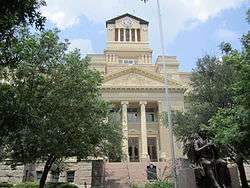
The Navarro County Courthouse in Corsicana | |
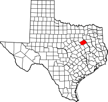 Location in the U.S. state of Texas | |
 Texas's location in the U.S. | |
| Founded | April 25, 1846 |
| Named for | José Antonio Navarro |
| Seat | Corsicana |
| Largest city | Corsicana |
| Area | |
| • Total | 1,086 sq mi (2,813 km2) |
| • Land | 1,010 sq mi (2,616 km2) |
| • Water | 76 sq mi (197 km2), 7.0% |
| Population | |
| • (2010) | 47,735 |
| • Density | 47/sq mi (18/km²) |
| Congressional district | 6th |
| Time zone | Central: UTC-6/-5 |
| Website |
www |
Navarro County is a county located in the U.S. state of Texas. As of the 2010 census, the population was 47,735.[1] Its county seat is Corsicana.[2] The county is named for José Antonio Navarro, a Tejano leader in the Texas Revolution who signed the Texas Declaration of Independence.
Navarro County comprises the Coriscana, TX Micropolitan Statistical Area, which is also included in the Dallas-Fort Worth, TX Combined Statistical Area.
History
Navarro County was formed from Robertson County in 1846.[3]
In 1860, after the election of Abraham Lincoln to the American presidency, Navarro County lowered the American flag at the courthouse in protest and instead hoisted the Texas flag. Thereafter early in 1861, some 450 Navarro County men enlisted in the new Confederate States Army. Two of the enlistees became outstanding officers, Roger O. Mills and Clinton M. Winkler, a Confederate colonel for whom Winkler County in southwest Texas is named. The county commissioners appropriated funds for weapons and ammunition and for the support of the soldiers' families.[4]
The Navarro Rifles constituted an 87-man Confederate infantry unit, formed in Corsicana in July 1861 from area volunteers. They were founded by José Antonio Navarro, all of whose four sons fought for the Confederacy.[5] Clinton Winkler, a founder of Navarro County, served as the initial captain. The group trained near Dresden, Spring Hill, and later Waco and Harrisburg, Texas. The Navarro Rifles became Company I of the Fourth Texas Volunteer Infantry Regiment.[6] In September 1861, the unit reached Richmond, Virginia. The regiment was placed in the Texas Brigade under the command of General John Bell Hood.[7]
Geography
According to the U.S. Census Bureau, the county has a total area of 1,086 square miles (2,810 km2), of which 1,010 square miles (2,600 km2) is land and 76 square miles (200 km2) (7.0%) is water.[8]
Major highways
 Interstate 45
 U.S. Highway 287
 State Highway 14
 State Highway 22
 State Highway 31
 State Highway 75
 State Highway 309
Adjacent counties
- Henderson County (northeast)
- Freestone County (southeast)
- Limestone County (south)
- Hill County (southwest)
- Ellis County (northwest)
Demographics
| Historical population | |||
|---|---|---|---|
| Census | Pop. | %± | |
| 1850 | 2,190 | — | |
| 1860 | 5,996 | 173.8% | |
| 1870 | 8,879 | 48.1% | |
| 1880 | 21,702 | 144.4% | |
| 1890 | 26,373 | 21.5% | |
| 1900 | 43,374 | 64.5% | |
| 1910 | 47,070 | 8.5% | |
| 1920 | 50,624 | 7.6% | |
| 1930 | 60,507 | 19.5% | |
| 1940 | 51,308 | −15.2% | |
| 1950 | 39,916 | −22.2% | |
| 1960 | 34,423 | −13.8% | |
| 1970 | 31,150 | −9.5% | |
| 1980 | 35,323 | 13.4% | |
| 1990 | 39,926 | 13.0% | |
| 2000 | 45,124 | 13.0% | |
| 2010 | 47,735 | 5.8% | |
| Est. 2015 | 48,323 | [9] | 1.2% |
| U.S. Decennial Census[10] 1850–2010[11] 2010–2014[1] | |||
As of the census[12] of 2000, there were 45,124 people, 16,491 households, and 11,906 families residing in the county. The population density was 45 people per square mile (17/km²). There were 18,449 housing units at an average density of 18 per square mile (7/km²). The racial makeup of the county was 70.84% White, 16.79% Black or African American, 0.46% Native American, 0.47% Asian, 0.33% Pacific Islander, 9.45% from other races, and 1.65% from two or more races. 15.76% of the population were Hispanic or Latino of any race.
There were 16,491 households out of which 34.00% had children under the age of 18 living with them, 55.70% were married couples living together, 12.20% had a female householder with no husband present, and 27.80% were non-families. 24.10% of all households were made up of individuals and 12.00% had someone living alone who was 65 years of age or older. The average household size was 2.65 and the average family size was 3.14.
In the county, the population was spread out with 27.20% under the age of 18, 9.90% from 18 to 24, 26.90% from 25 to 44, 21.50% from 45 to 64, and 14.40% who were 65 years of age or older. The median age was 35 years. For every 100 females there were 97.00 males. For every 100 females age 18 and over, there were 92.70 males.
The median income for a household in the county was $31,268, and the median income for a family was $38,130. Males had a median income of $30,112 versus $20,972 for females. The per capita income for the county was $15,266. About 13.90% of families and 18.20% of the population were below the poverty line, including 23.10% of those under age 18 and 14.90% of those age 65 or over.
Media
Navarro County is currently listed as part of the Dallas-Fort Worth market area. Local media outlets include: KDFW-TV, KXAS-TV, WFAA-TV, KTVT-TV, KERA-TV, KTXA-TV, KDFI-TV, KDAF-TV, and KFWD-TV. The area is also located geographically close to the Waco metropolitan area. Meaning all of the Waco/Temple/Killeen market stations also provide coverage for Navarro County. They include: KCEN-TV, KWTX-TV, KXXV-TV, KDYW, and KWKT-TV. East Texas NBC affiliate KETK-TV from the Jacksonville/Tyler DMA also provides coverage for Navarro County. The Corsicana Daily Sun serves as the area's newspaper.
Communities
- Incorporated
- Unincorporated
See also
References
- 1 2 "State & County QuickFacts". United States Census Bureau. Retrieved December 22, 2013.
- ↑ "Find a County". National Association of Counties. Retrieved 2011-06-07.
- ↑ A Memorial and Biographical History of Navarro, Henderson, Anderson, Limestone, Freestone and Leon Counties, Texas. Chicago: Lewis Publishing Company. 1893. p. 112. Retrieved 28 September 2014.
- ↑ Texas Historical Commission, historical marker, Navarro County Courthouse, Corsicana, Texas
- ↑ Little, Carol Morris, A Comprehensive Guide to Outdoor Sculpture in Texas, University of Texas Press, Austin, 1996 p.1410
- ↑ Texas History Online: Navarro Rifles
- ↑ Texas Historical Commission, Navarro Rifles historical marker, Navarro College, Corsicana, Texas
- ↑ "2010 Census Gazetteer Files". United States Census Bureau. August 22, 2012. Retrieved May 5, 2015.
- ↑ "County Totals Dataset: Population, Population Change and Estimated Components of Population Change: April 1, 2010 to July 1, 2015". Retrieved July 2, 2016.
- ↑ "U.S. Decennial Census". United States Census Bureau. Retrieved May 5, 2015.
- ↑ "Texas Almanac: Population History of Counties from 1850–2010" (PDF). Texas Almanac. Retrieved May 5, 2015.
- ↑ "American FactFinder". United States Census Bureau. Retrieved 2011-05-14.
External links
- Navarro County government's website
- Navarro County Office of Emergency Management website
- Navarro County in Handbook of Texas Online at the University of Texas
- Navarro County Genealogical Society
 |
Ellis County | Henderson County | | |
| |
||||
| ||||
| | ||||
| Hill County | Limestone County | Freestone County |
| Cities | | |
|---|---|---|
| Towns | ||
| Unincorporated communities | ||
| Ghost town |
| |
| Footnotes | ‡This populated place also has portions in an adjacent county or counties | |

Coordinates: 32°03′N 96°28′W / 32.05°N 96.47°W