Hudspeth County, Texas
| Hudspeth County, Texas | |
|---|---|
|
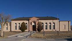
Hudspeth County Courthouse in Sierra Blanca | |
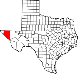 Location in the U.S. state of Texas | |
 Texas's location in the U.S. | |
| Founded | 1917 |
| Named for | Claude Benton Hudspeth |
| Seat | Sierra Blanca |
| Largest community | Fort Hancock |
| Area | |
| • Total | 4,572 sq mi (11,841 km2) |
| • Land | 4,571 sq mi (11,839 km2) |
| • Water | 0.8 sq mi (2 km2), 0.02% |
| Population | |
| • (2010) | 3,476 |
| • Density | 0.8/sq mi (0/km²) |
| Congressional district | 23rd |
| Time zone | Mountain: UTC-7/-6 |
| Website |
www |
Hudspeth County is a county located in the U.S. state of Texas. As of the 2010 census, the population was 3,476.[1] Its county seat is Sierra Blanca,[2] and the largest community is Fort Hancock. The county is named for Claude Benton Hudspeth, a state senator and United States Representative from El Paso.[3] It is northeast from the Mexican border.
Hudspeth County is included in the El Paso, TX Metropolitan Statistical Area. It is one of the nine counties that comprise the Trans-Pecos region of West Texas. Hudspeth is one of only two Texas counties to observe the Mountain Time Zone.
History
Prehistoric Jornada Mogollón peoples[4] were practicing agriculture in the Rio Grande floodplain A.D. 900–1350. These people left behind artifacts and pictographs as evidence of their presence.[5]
The Rodriguez-Sanchez Expedition[6] of 1581 encountered friendly Indians bestowing gifts upon the explorers. Antonio de Espejo[7] 1582-83 expedition encountered Otomoaco Indians in the county.
The Mescalero Apache[8] frequented the area to irrigate their crops. In 1849 John Salmon "RIP" Ford[9] explored the area between San Antonio and El Paso noting in his mapped report the productive land upon which the Mescalero Indians farmed. By the mid-17th century the Mescaleros expanded their territory to the Plains Navajos and Pueblos from the Guadalupes, and El Paso del Norte. Their feared presence deterred white settlers. In January 1870, a group of soldiers attacked a Mescalero Apache village near Delaware Creek in the Guadalupe Mountains. In July 1880 soldiers at Tinaja de las Palmas attacked a group of Mescaleros led by Chief Victorio.[10] In August 1880, Buffalo Soldiers ambushed Victorio at Rattlesnake Springs. Victorio retreated to Mexico and was killed in October by Mexican soldiers.[11] Two weeks later, Apaches killed seven Buffalo Soldiers,[12] members of the famous black Tenth United States Cavalry.
The demand for new routes from Texas to California caused an uptick in explorations.[3] The San Antonio to El Paso leg of the San Antonio-California Trail was surveyed in 1848 under the direction of John Coffee Hays. Hudspeth became known as a place travelers passed through, on their way to somewhere else. Fort Quitman[13] was established in 1858 to provide protection for travelers.
Lt. Francis Theodore Bryan[14] camped at Guadalupe Pass while exploring a route from San Antonio to El Paso via Fredericksburg. Upon reaching El Paso in July 1849 his report recommended sink wells along the route. In July 1848, Secretary of War William L. Marcy wanted a military post established on the north side of the Rio Grande. Maj. Jefferson Van Horne[15] was sent out in 1849 to establish Marcy's goal.
John Russell Bartlett[16][17] was commissioned in 1850 to carry out the Treaty of Guadalupe Hidalgo. Bartlett declared the Guadalupe Mountains dark and gloomy, and proposed a transcontinental railroad be built south of the peaks. Three years later, Capt. John Pope[18] was sent to scout out a railroad route, and in the succeeding year to search for artesian water supplies. Texas Commissioner Robert Simpson Neighbors [19] was sent by Governor Peter Hansborough Bell in 1850 to organize El Paso.
The Butterfield Overland Mail[20] and the San Antonio-San Diego Mail [21] served the county from 1857 to 1861. These mail coaches provided a means for travelers to reach California in 27 days, if the passenger had the $200 for a one-way fare and was courageous enough to withstand the weather and dangers en route.
Men from San Elizario and the other villages along the Rio Grande near El Paso had become dependent on the salt trade[22] for their livelihoods. After the Civil War they broke a road from Fort Quitman to the Salt Basin in northeastern Hudspeth County. But Anglo politicians tried to capitalize on this trade by asserting ownership of the salt lakes and levying fees on the traders. The result was the 7-year San Elizario Salt War,[23] which heightened tensions between Mexicans and Americans in the 1870s.
Rival railway companies began competing for rights of way. The Texas and Pacific Railway[24] and the Galveston, Harrisburg and San Antonio Railway[25] eventually reached an agreement to share the tracks, with a number of towns arising along the way
Hudspeth was formed in 1917 from El Paso. Sierra Blanca was named the county seat, and has the only adobe courthouse[26] in the state of Texas.
From 1992 to 2002, the county accepted over 200 tons per day of treated, dried sewage from New York City. The waste was spread over a remote site in the county.[27]
In recent times Hudspeth County has become notorious as a location for frequent drug arrests for individuals traveling east on Interstate 10 from El Paso, due to the presence of a US Border Patrol checkpoint. Several celebrities, including touring musicians Willie Nelson, Snoop Dogg, and Fiona Apple, and actor Armie Hammer have been arrested on drug charges at this location.[28]
Geography
According to the U.S. Census Bureau, the county has a total area of 4,572 square miles (11,840 km2), of which 4,571 square miles (11,840 km2) is land and 0.8 square miles (2.1 km2) (0.02%) is water.[29] It is the third largest county in Texas. Part of Guadalupe Mountains National Park lies in the northeast corner of the county.
Major highways
Adjacent counties and municipalities
- Otero County, New Mexico (north)
- Culberson County (east)
- Jeff Davis County (southeast)
- Presidio County (south)
- El Paso County (west)
- Guadalupe, Chihuahua, Mexico (south)
- Práxedis G. Guerrero, Chihuahua, Mexico (south)
Protected areas
Demographics
| Historical population | |||
|---|---|---|---|
| Census | Pop. | %± | |
| 1920 | 962 | — | |
| 1930 | 3,728 | 287.5% | |
| 1940 | 3,149 | −15.5% | |
| 1950 | 4,298 | 36.5% | |
| 1960 | 3,343 | −22.2% | |
| 1970 | 2,392 | −28.4% | |
| 1980 | 2,728 | 14.0% | |
| 1990 | 2,915 | 6.9% | |
| 2000 | 3,344 | 14.7% | |
| 2010 | 3,476 | 3.9% | |
| Est. 2015 | 3,379 | [30] | −2.8% |
| U.S. Decennial Census[31] 1850–2010[32] 2010–2014[1] | |||
As of the 2010 United States Census, there were 3,476 people residing in the county. 78.8% were White, 1.4% Black or African American, 1.1% Native American, 0.5% Asian, 16.1% of some other race and 2.2% of two or more races. 79.6% were Hispanic or Latino (of any race).
As of the census[33] of 2000, there were 3,344 people, 1,092 households, and 841 families residing in the county. The population density was 0.7 people per square mile (0.3/km²). There were 1,471 housing units at an average density of 0.3 per square mile (0.1/km²). The racial makeup of the county was 87.23% White, 0.33% Black or African American, 1.41% Native American, 0.18% Asian, 8.76% from other races, and 2.09% from two or more races. 75.03% of the population was Hispanic or Latino of any race.
There were 1,092 households out of which 45.3% had children under the age of 18 living with them, 63% were married couples living together, 11.4% had a female householder with no husband present, and 22.9% were non-families. 21.1% of all households were made up of one person and 8.3% had someone living alone who was 65 years of age or older. The average household size was 3.03 and the average family size was 3.56.
In the county, the population was spread out with 34.1% under the age of 18, 8.9% from 18 to 24, 26.7% from 25 to 44, 20.4% from 45 to 64, and 9.9% who were 65 years of age or older. The median age was 30 years. For every 100 females there were 102.9 males. For every 100 females age 18 and over, there were 94.3 males.
The median income for a household in the county was $21,045, and the median income for a family was $22,314. Males had a median income of $22,862 versus $18,594 for females. The per capita income for the county was $9,549. About 32.6% of families and 35.8% of the population were below the poverty line, including 41.3% of those under age 18 and 42.6% of those age 65 or over. The county's per-capita income makes it one of the poorest counties in the United States.
Education
Hudspeth County is served by four school districts. The Fort Hancock Independent School District, based in Fort Hancock, covers the western part of the county, along the El Paso County line from the Mexican border to the New Mexico state line. A strip along the Culberson County line in the eastern part of Hudspeth County which includes Allamoore is served by the Culberson County-Allamoore Independent School District based in Van Horn. Most of the northern part of the county is served by the Dell City Independent School District, based in Dell City. Most of the southern part of the county is served by the Sierra Blanca Independent School District, based in Sierra Blanca.
52% of Hudspeth County adults are illiterate. [34]
Communities
City
Census-designated places
- Fort Hancock
- Sierra Blanca (county seat)
Unincorporated communities
Ghost Towns
See also
References
- 1 2 "State & County QuickFacts". United States Census Bureau. Retrieved December 17, 2013.
- ↑ "Find a County". National Association of Counties. Retrieved 2011-06-07.
- 1 2 Kohout, Martin Donell: Hudspeth County from the Handbook of Texas Online. Retrieved 12 May 2010. Texas State Historical Association.
- ↑ "Jornada Mogollon". Texas Beyond History. Retrieved 12 May 2010. Texas Beyond History
- ↑ "Artistic Expression". Texas Beyond History. Retrieved 12 May 2010. Texas Beyond History
- ↑ Timmons, W H: Rodriguez-Sanchez Expedition from the Handbook of Texas Online. Retrieved 12 May 2010. Texas State Historical Association
- ↑ Blake, Robert Bruce: de Espejo, Antonio from the Handbook of Texas Online. Retrieved 12 May 2010. Texas State Historical Association
- ↑ "Texas Indians Map". R E. Moore and Texarch Associates. Retrieved 12 May 2010. R E. Moore and Texarch Associates
- ↑ Connor, Seymour V: Ford, John Salmon from the Handbook of Texas Online. Retrieved 12 May 2010. Texas State Historical Association
- ↑ Stout, Joseph A. "Chief Victorio". King Snake. Retrieved 12 May 2010.
- ↑ Davis, Stanford L. "Victorio's War". Buffalo Soldier. Retrieved 12 May 2010. Stanford L. Davis, M.A.
- ↑ "Buffalo Soldiers and Indian Hot Springs". Texas Historical Markers. Retrieved 12 May 2010.Texas Historical Markers
- ↑ Rock, James L (2010). Southern and Western Texas Guide for 1878. General Books LLC. pp. 33,40,271. ISBN 978-1-4588-5239-7.
- ↑ Powell, William S: Bryan, Francis Theodore from the Handbook of Texas Online. Retrieved 12 May 2010. Texas State Historical Association
- ↑ Kohout, Martin Donell: Van Horne, Jefferson from the Handbook of Texas Online. Retrieved 12 May 2010. Texas State Historical Association
- ↑ Faulk, Odie B: Bartlett, John Russell from the Handbook of Texas Online. Retrieved 12 May 2010. Texas State Historical Association
- ↑ "Bartlett, John Russell". The John Russell Bartlett Society. Retrieved 12 May 2010.
- ↑ Cutrer, Thomas W: Pope, John from the Handbook of Texas Online. Retrieved 12 May 2010. Texas State Historical Association
- ↑ Richardson, Rupert N: Neighbors, Robert Simpson from the Handbook of Texas Online. Retrieved 12 May2010. Texas State Historic
- ↑ Greene, A C (2006). 900 Miles on the Butterfield Trail. University of North Texas Press. ISBN 978-1-57441-213-0.
- ↑ "San Antonio-San Diego Mail". State of California Parks Department. Retrieved 12 May 2010.
- ↑ "Salt Flat". Texas Escapes - Blueprints For Travel, LLC. Retrieved 12 May 2010. Texas Escapes - Blueprints For Travel, LLC.
- ↑ Sonnichsen, C L: San Elizario Salt War from the Handbook of Texas Online. Retrieved 12 May 2010. Texas State Historical Association
- ↑ "Texas and Pacific Railway". Texas and Pacific Railway. Retrieved 12 May 2010.
- ↑ "Galveston, Harrisburg and San Antonio Railway". Texas Transportation Museum. Retrieved 12 May 2010.
- ↑ "Hudspeth Courthouse". Texas Escapes - Blueprints For Travel, LLC. Retrieved 12 May 2010. Texas Escapes - Blueprints For Travel, LLC.
- ↑ Minor drug busts at border checkpoint breaking Texas county’s budget, by Andrew Becker and G W Shulz, 19 June 2013, Center for Investigative Reporting
- ↑ http://news.yahoo.com/singer-fiona-apple-arrested-drug-charge-texas-border-201627980.html. Missing or empty
|title=(help) - ↑ "2010 Census Gazetteer Files". United States Census Bureau. August 22, 2012. Retrieved April 30, 2015.
- ↑ "County Totals Dataset: Population, Population Change and Estimated Components of Population Change: April 1, 2010 to July 1, 2015". Retrieved July 2, 2016.
- ↑ "U.S. Decennial Census". United States Census Bureau. Retrieved April 30, 2015.
- ↑ "Texas Almanac: Population History of Counties from 1850–2010" (PDF). Texas Almanac. Retrieved April 30, 2015.
- ↑ "American FactFinder". United States Census Bureau. Retrieved 2011-05-14.
- ↑ http://www-tcall.tamu.edu/docs/09illitmap.html
External links
- Hudspeth County from the Handbook of Texas Online
- Historic Hudspeth County materials, hosted by the Portal to Texas History.
 |
Otero County, New Mexico | | ||
| El Paso County | |
Culberson County | ||
| ||||
| | ||||
| Guadalupe, Chihuahua, Mexico and Práxedis G. Guerrero, Chihuahua, Mexico | Jeff Davis County |
Municipalities and communities of Hudspeth County, Texas, United States | ||
|---|---|---|
| City | | |
| CDPs | ||
| Unincorporated communities | ||
| Ghost towns | ||

Coordinates: 31°27′N 105°22′W / 31.45°N 105.37°W