Terrell County, Texas
| Terrell County, Texas | |
|---|---|
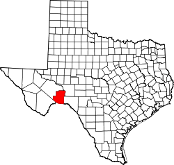 Location in the U.S. state of Texas | |
 Texas's location in the U.S. | |
| Founded | 1905 |
| Named for | Alexander W. Terrell |
| Seat | Sanderson |
| Largest community | Sanderson |
| Area | |
| • Total | 2,358 sq mi (6,107 km2) |
| • Land | 2,358 sq mi (6,107 km2) |
| • Water | 0.04 sq mi (0 km2), 0% |
| Population | |
| • (2010) | 984 |
| • Density | 0.4/sq mi (0/km²) |
| Congressional district | 23rd |
| Time zone | Central: UTC-6/-5 |
| Website |
www |
Terrell County is a county located in the U.S. state of Texas. As of the 2010 census, its population was 984,[1] making it the eighth-least populous county in Texas. Its county seat is Sanderson.[2] The county was named for Alexander W. Terrell, a Texas state senator.
Terrell County is one of the nine counties that comprise the Trans-Pecos region of West Texas. It is the setting for Cormac McCarthy's novel No Country for Old Men, and the Academy Award-winning film adaptation of the same name.
History
Native Americans
Evidence of the indigenous peoples of Terrell County are found on the county’s various ranches – arrowheads, tools, burned-rock middens, caves, and shelters containing Indian pictographs. Pieces of reed sandals, baskets, and evidence of burials have been found in the caves. The most pictographs are on cliff walls above Myers Spring near Dryden, overpainting giving to the theory that several Indian cultures were involved.[3]
Early exploration
Capt. José de Berroterán in 1729 commanded an expedition on behalf of Spain to explore from Mission San Juan Bautista up the Rio Grande to the mouth of the Rio Conchos.[4] Berroterán crossed the southern border, where at a spring near Dryden, legend has it that he placed a large wooden cross. Six years later, another Spaniard, Blas María de la Garza Falcón, found the cross while conducting an expedition in the area and named the spot Santa Cruz de Maya.[5] Captain Samuel Highsmith, under the command of John Coffee Hays, crossed the county in 1848 in an ill-fated expedition to open a road from San Antonio to El Paso.[6] In 1851 Army officer and geographer Lt. Nathaniel Michler, working under Major William H. Emory, mapped this portion of the boundary between Mexico and the United States.[7] Under Lt. William Echols in 1859, caravans of the U.S. Camel Corps crossed the county searching for a shorter route to Fort Davis.[8]
County established and growth
In 1905, Terrell County was created by the Texas Legislature by carving about 1,500,000 acres (6,100 km2) out of Pecos County. It was organized the same year. Sanderson became the county seat. In 1881, Texas and New Orleans Railroad surveyors reached the site of present-day Sanderson. Originally named Strawbridge by founder Cyrus W. “Charley” Wilson, the name was later changed in honor of railroad Engineer Joseph P. Sanderson.[9] Charles Downie, a Scot, homesteaded in 1881 and became the first permanent sheepman in the area. Together, the railroad, cattle, and sheep industries were the major economic assets. Ranges were still unfenced. Dryden became a large shipping point for cattle ranchers. Terrell County became one of the biggest sheep and wool producers in the U.S. In 1926, 11,000 lambs averaging $6 per head were sold in one of the largest lamb sales in history. Thousands of pounds of wool and mohair were sold annually through the Sanderson Wool Commission.[3] Dryden, the only town besides Sanderson in the county, was also started in 1882, but is now a ghost town.[10] Judge Roy Bean is said to have operated a saloon at Sanderson.[11] The oil and gas industry became increasingly important to Terrell County's economy after 1957, when the Brown-Bassett gas field was discovered in the northeast part of the county. Only gas was produced until the 1970s, when high petroleum prices encouraged limited oil production, as well.[12] Sanderson was struck by a flood on June 11, 1965, in which 28 people died. Two of them were never found.[13] The Texas State Senate Concurrent Resolution No. 1, 76th Legislature, Regular Session (1999) declared Sanderson and Terrell County the "Cactus Capital of Texas."[14]
Geography
According to the U.S. Census Bureau, the county has a total area of 2,358 square miles (6,110 km2), virtually all of which is land.[15]
Major highways
Adjacent counties and municipios
- Pecos County (northwest)
- Crockett County (northeast)
- Val Verde County (east)
- Brewster County (southwest)
- Acuña, Coahuila, Mexico (south)
National protected area
Climate
Most of Terrell County consists of semi-arid steppes with 85.7% of the county's area described as having a hot steppe climate (Köppen BSh) and 2.6% having a cold steppe climate (Köppen BSk). The remaining 11.7% of the county experiences a hot arid desert climate (Köppen BWh).[16]
- Dryden
- Coordinates: 30°03′00″N 102°07′00″W / 30.05000°N 102.11667°W
- Elevation: 2,190 feet (668 m)[17]
| Climate data for Dryden, Texas (Jun 1, 1966–Oct 31, 1994) | |||||||||||||
|---|---|---|---|---|---|---|---|---|---|---|---|---|---|
| Month | Jan | Feb | Mar | Apr | May | Jun | Jul | Aug | Sep | Oct | Nov | Dec | Year |
| Average high °F (°C) | 60.2 (15.7) |
65.0 (18.3) |
74.3 (23.5) |
82.7 (28.2) |
88.8 (31.6) |
94.5 (34.7) |
95.5 (35.3) |
94.8 (34.9) |
88.8 (31.6) |
79.9 (26.6) |
69.2 (20.7) |
61.8 (16.6) |
79.62 (26.48) |
| Average low °F (°C) | 32.7 (0.4) |
36.0 (2.2) |
44.0 (6.7) |
53.4 (11.9) |
61.6 (16.4) |
68.6 (20.3) |
70.6 (21.4) |
69.4 (20.8) |
63.8 (17.7) |
52.6 (11.4) |
41.7 (5.4) |
33.8 (1) |
52.35 (11.3) |
| Average precipitation inches (mm) | 0.53 (13.5) |
1.03 (26.2) |
0.57 (14.5) |
0.99 (25.1) |
1.75 (44.4) |
1.02 (25.9) |
1.27 (32.3) |
1.85 (47) |
2.64 (67.1) |
1.40 (35.6) |
0.74 (18.8) |
0.45 (11.4) |
14.24 (361.8) |
| Source: Western Regional Climate Center, Desert Research Institute[18] | |||||||||||||
- Sanderson
- Coordinates: 30°08′29″N 102°23′30″W / 30.14139°N 102.39167°W
- Elevation: 2,788 feet (850 m)[17]
| Climate data for Sanderson, Texas (Jan 1, 1897–Mar 31, 2013) | |||||||||||||
|---|---|---|---|---|---|---|---|---|---|---|---|---|---|
| Month | Jan | Feb | Mar | Apr | May | Jun | Jul | Aug | Sep | Oct | Nov | Dec | Year |
| Average high °F (°C) | 60.8 (16) |
64.5 (18.1) |
72.9 (22.7) |
81.5 (27.5) |
87.3 (30.7) |
92.0 (33.3) |
92.6 (33.7) |
92.4 (33.6) |
86.9 (30.5) |
78.8 (26) |
69.2 (20.7) |
61.3 (16.3) |
78.35 (25.76) |
| Average low °F (°C) | 31.4 (−0.3) |
34.8 (1.6) |
42.3 (5.7) |
51.7 (10.9) |
60.2 (15.7) |
67.3 (19.6) |
69.4 (20.8) |
68.4 (20.2) |
62.3 (16.8) |
51.4 (10.8) |
40.2 (4.6) |
32.3 (0.2) |
50.98 (10.55) |
| Average precipitation inches (mm) | 0.46 (11.7) |
0.54 (13.7) |
0.42 (10.7) |
0.79 (20.1) |
1.62 (41.1) |
1.73 (43.9) |
1.42 (36.1) |
1.50 (38.1) |
2.14 (54.4) |
1.49 (37.8) |
0.59 (15) |
0.42 (10.7) |
13.12 (333.3) |
| Source: Western Regional Climate Center, Desert Research Institute[19] | |||||||||||||
Demographics
| Historical population | |||
|---|---|---|---|
| Census | Pop. | %± | |
| 1910 | 1,430 | — | |
| 1920 | 1,595 | 11.5% | |
| 1930 | 2,660 | 66.8% | |
| 1940 | 2,952 | 11.0% | |
| 1950 | 3,189 | 8.0% | |
| 1960 | 2,600 | −18.5% | |
| 1970 | 1,940 | −25.4% | |
| 1980 | 1,595 | −17.8% | |
| 1990 | 1,410 | −11.6% | |
| 2000 | 1,081 | −23.3% | |
| 2010 | 984 | −9.0% | |
| Est. 2015 | 837 | [20] | −14.9% |
| U.S. Decennial Census[21] 1850–2010[22] 2010–2014[1] | |||
As of the census[23] of 2010, 984 people, 443 households, and 295 families resided in the county. The population density was less than 1/km² (1/sq mi). The 991 housing units averaged less than 1 per square mile (0/km²). About 84.1% of the population were White, 0.9% Native American, 0.7% Black or African American, 0.4% Asian, 12.3% of some other race and 1.5% of two or more races; 47.5% were Hispanic or Latino (of any race).
Of the 443 households, 29.80% had children under the age of 18 living with them, 54.40% were married couples living together, 7.40% had a female householder with no husband present, and 33.40% were not families. About 31.80% of all households were made up of individuals, and 16.30% had someone living alone who was 65 years of age or older. The average household size was 2.44 and the average family size was 3.09.
In the county, the population was distributed as 26.50% under the age of 18, 5.00% from 18 to 24, 23.40% from 25 to 44, 27.50% from 45 to 64, and 17.60% who were 65 years of age or older. The median age was 42 years. For every 100 females, there were 103.20 males. For every 100 females age 18 and over, there were 101.50 males.
The median income for a household in the county was $24,219, and for a family was $28,906. Males had a median income of $21,429 versus $15,804 for females. The per capita income for the county was $13,721. About 21.20% of families and 25.20% of the population were below the poverty line, including 31.40% of those under age 18 and 31.10% of those age 65 or over.
Communities
See also
- National Register of Historic Places listings in Terrell County, Texas
- USS Terrell County (LST-1157)
References
- 1 2 "State & County QuickFacts". United States Census Bureau. Retrieved December 26, 2013.
- ↑ "Find a County". National Association of Counties. Retrieved 2011-06-07.
- 1 2 Downie, Walter G. "Terrell County Texas". Handbook of Texas Online. Texas State Historical Association. Retrieved 14 December 2010.
- ↑ Johnson, John G. "José de Berroterán". Handbook of Texas Online. Texas State Historical Association. Retrieved 14 December 2010.
- ↑ Garcia, Clotide P. "Blas María de la Garza Falcón". Handbook of Texas Online. Texas State Historical Association. Retrieved 14 December 2010.
- ↑ Cutrer, Thomas W. "Samuel Highsmith". Handbook of Texas Online. Texas State Historical Association. Retrieved 14 December 2010.
- ↑ Wagner, Frank. "Nathaniel Michler". Handbook of Texas Online. Texas State Historical Association. Retrieved 14 December 2010.
- ↑ Faulk, Odie B; Emmett, Chris. "Camels". Handbook of Texas Online. Texas State Historical Association. Retrieved 14 December 2010.
- ↑ "Sanderson, Texas". Texas Escapes. Texas Escapes - Blueprints For Travel, LLC. Retrieved 14 December 2010.
- ↑ "Dryden, Texas". Texas Escapes. Texas Escapes - Blueprints For Travel, LLC. Retrieved 14 December 2010.
- ↑ Skiles, Jack; Kelton, Elmer (1996). Judge Roy Bean Country. Texas Tech University Press. p. 14. ISBN 978-0-89672-369-6.
- ↑ Chandler, Charlena (2004). On Independence Creek: The Story of a Texas Ranch. Texas Tech University Press. p. 70. ISBN 978-0-89672-524-9.
- ↑ Burnett, Jonathan (2008). "Sanderson Flash Floor". Flash Floods in Texas. TAMU Press. pp. 173–185. ISBN 978-1-58544-590-5.
- ↑ "Official Capital Designations". Texas State Library. Retrieved 14 December 2010.
- ↑ "2010 Census Gazetteer Files". United States Census Bureau. August 22, 2012. Retrieved May 11, 2015.
- ↑ Kottek, M.; Grieser, J.; Beck, C.; Rudolf, B.; Rubel, F. (2006). "Main Köppen-Geiger Climate Classes for US counties". Schweizerbart Science Publishers. Retrieved March 27, 2016.
- 1 2 "US COOP Station Map". Western Regional Climate Center, Desert Research Institute. Retrieved April 27, 2015.
- ↑ "DRYDEN, TEXAS (412590), Period of Record Monthly Climate Summary". Western Regional Climate Center, Desert Research Institute. Retrieved March 27, 2016.
- ↑ "SANDERSON, TEXAS (418022), Period of Record Monthly Climate Summary". Western Regional Climate Center, Desert Research Institute. Retrieved March 27, 2016.
- ↑ "County Totals Dataset: Population, Population Change and Estimated Components of Population Change: April 1, 2010 to July 1, 2015". Retrieved July 2, 2016.
- ↑ "U.S. Decennial Census". United States Census Bureau. Retrieved May 11, 2015.
- ↑ "Texas Almanac: Population History of Counties from 1850–2010" (PDF). Texas Almanac. Retrieved May 11, 2015.
- ↑ "American FactFinder". United States Census Bureau. Retrieved 2011-05-14.
- ↑ Dryden, Texas from the Handbook of Texas Online
External links
- Terrell County government’s website
- Terrell County from the Handbook of Texas Online
- Entry for Alexander Watkins Terrell from the Biographical Encyclopedia of Texas published 1880, hosted by the Portal to Texas History.
 |
Pecos County | Crockett County | | |
| Pecos County | |
Val Verde County | ||
| ||||
| | ||||
| Brewster County | Acuña, Coahuila, Mexico |
Municipalities and communities of Terrell County, Texas, United States | ||
|---|---|---|
| CDP | | |
| Unincorporated community | ||

Coordinates: 30°14′N 102°04′W / 30.23°N 102.07°W