Crane County, Texas
| Crane County, Texas | |
|---|---|
|
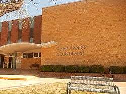
Crane County Courthouse in Crane | |
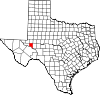 Location in the U.S. state of Texas | |
 Texas's location in the U.S. | |
| Founded | 1927 |
| Named for | William Carey Crane |
| Seat | Crane |
| Largest city | Crane |
| Area | |
| • Total | 786 sq mi (2,036 km2) |
| • Land | 785 sq mi (2,033 km2) |
| • Water | 0.7 sq mi (2 km2), 0.08% |
| Population | |
| • (2010) | 4,375 |
| • Density | 5.6/sq mi (2/km²) |
| Congressional district | 23rd |
| Time zone | Central: UTC-6/-5 |
| Website |
www |


Crane County is a county located in the U.S. state of Texas. As of the 2010 census, its population was 4,375.[1] The county seat is Crane.[2] The county was created in 1887 and later organized in 1927.[3] It was named for William Carey Crane, a president of Southern Baptist affiliated Baylor University in Waco, Texas.
History
Native Americans
Indigenous peoples were the first inhabitants of the area. Later Indian tribes included Comanches, Lipan Apache, and Kiowa.[4]
County establishment and growth
Crane County was formed in 1887 from Tom Green County, and named after William Carey Crane, former president of Baylor University. Settlement came years later, and the county was not organized until 1927. In 1900, the United States census enumerated only 51 people and 12 ranches in the county. As late as 1918, the county had no roads.[5]
In 1925, Church & Fields Exploration Company obtained a permit late in 1925 to drill for oil. The first well came in March 1926.[6]
By 1927, an estimated 6,000 people were in the county, with 4,500 of them within the city of Crane.[7] Water was trucked in and brought from $1.00 to $2.25 a barrel. By the beginning of 1991, almost 1,552,324,000 barrels (246,799,800 m3) of oil had been produced in the county since discovery in 1926.
County history is preserved in the Museum of the Desert Southwest, which opened in Crane in 1980.
Geography
According to the U.S. Census Bureau, the county has a total area of 786 square miles (2,040 km2), of which 785 square miles (2,030 km2) is land and 0.7 square miles (1.8 km2) (0.08%) is water.[8]
Between Crane and McCamey in neighboring Upton County is a division of the surrounding cliffs known as Castle Gap, a break in a mesa some 12 miles east of the Pecos River, used by Comanches, emigrants headed to the California Gold Rush, and cattlemen driving longhorns on the Goodnight-Loving Trail, as explained in Patrick Dearen's Castle Gap and the Pecos Frontier (2000).[9]
Major highways
Adjacent counties
- Ector County (north)
- Upton County (east)
- Crockett County (southeast)
- Pecos County (south)
- Ward County (west)
Demographics
| Historical population | |||
|---|---|---|---|
| Census | Pop. | %± | |
| 1890 | 15 | — | |
| 1900 | 51 | 240.0% | |
| 1910 | 331 | 549.0% | |
| 1920 | 37 | −88.8% | |
| 1930 | 2,221 | 5,902.7% | |
| 1940 | 2,841 | 27.9% | |
| 1950 | 3,965 | 39.6% | |
| 1960 | 4,699 | 18.5% | |
| 1970 | 4,172 | −11.2% | |
| 1980 | 4,600 | 10.3% | |
| 1990 | 4,652 | 1.1% | |
| 2000 | 3,996 | −14.1% | |
| 2010 | 4,375 | 9.5% | |
| Est. 2015 | 5,048 | [10] | 15.4% |
| U.S. Decennial Census[11] 1850–2010[12] 2010–2014[1] | |||
As of the census[13] of 2000, 3,996 people, 1,360 households, and 1,082 families resided in the county. The population density was five people per square mile (2/km²). The 1,596 housing units averaged two per square mile (1/km²). The racial makeup of the county was 73.70% White, 2.90% Black or African American, 0.98% Native American, 0.35%, 19.49% from other races, and 2.58% from two or more races. About 43.87% of the population were Hispanic/Latino of any race.
Of the 1,360 households, 43.40% had children under the age of 18 living with them, 67.80% were married couples living together, 7.90% had a female householder with no husband present, and 20.40% were not families. About 18.80% of all households were made up of individuals, and 9.50% had someone living alone who was 65 years of age or older. The average household size was 2.91, and the average family size was 3.35.
In the county, the population was distributed as 31.90% under the age of 18, 7.70% from 18 to 24, 26.90% from 25 to 44, 22.60% from 45 to 64, and 10.90% who were 65 years of age or older. The median age was 34 years. For every 100 females, there were 94.80 males. For every 100 females age 18 and over, there were 90.50 males.
The median income for a household in the county was $32,194, and for a family was $36,820. Males had a median income of $33,438 versus $16,806 for females. The per capita income for the county was $15,374. About 12.40% of families and 13.40% of the population were below the poverty line, including 15.30% of those under age 18 and 10.50% of those age 65 or over.
Economy
The largest segment of the local economy is oil and gas production. The Waddell Ranch contains the single biggest portion of the Permian Basin Royalty Trust, with over 800 producing oil wells as of 2007. Crane County is one of the largest oil-producing counties in Texas, with a total of 1.5 billion barrels (240,000,000 m3) of oil pumped since oil was first discovered there. Cattle ranching and local government are other large employers; over 503,000 acres (2,040 km2) of land are used for livestock grazing.[5]
Communities
City
- Crane (county seat)
Unincorporated community
References
- 1 2 "State & County QuickFacts". United States Census Bureau. Retrieved December 9, 2013.
- ↑ "Find a County". National Association of Counties. Archived from the original on 2011-05-31. Retrieved 2011-06-07.
- ↑ "Texas: Individual County Chronologies". Texas Atlas of Historical County Boundaries. The Newberry Library. 2008. Retrieved May 21, 2015.
- ↑ Newcomb Jr, W W (1972). "From Foot to Horse". The Indians of Texas: From Prehistoric to Modern Times. University of Texas Press. pp. 85–102. ISBN 978-0-292-78425-3.
- 1 2 Leffler, John. "Crane County, Texas". Handbook of Texas Online. Texas State Historical Association. Retrieved 13 December 2010.
- ↑ Warner, C.A.; Thompson, Ernest O (2007). Texas Oil & Gas Since 1543. Copano Bay Press. p. 295. ISBN 978-0-9767799-5-7.
- ↑ Texas Escapes, Crane
- ↑ "2010 Census Gazetteer Files". United States Census Bureau. August 22, 2012. Retrieved April 21, 2015.
- ↑ Castle Gap and the Pecos Frontier. Texas Christian University Press. 2000. ISBN 978-0-87565-030-2. Retrieved April 12, 2014.
- ↑ "County Totals Dataset: Population, Population Change and Estimated Components of Population Change: April 1, 2010 to July 1, 2015". Retrieved July 2, 2016.
- ↑ "U.S. Decennial Census". United States Census Bureau. Archived from the original on May 11, 2015. Retrieved April 21, 2015.
- ↑ "Texas Almanac: Population History of Counties from 1850–2010" (PDF). Texas Almanac. Retrieved April 21, 2015.
- ↑ "American FactFinder". United States Census Bureau. Archived from the original on 2013-09-11. Retrieved 2011-05-14.
External links
- Crane County Government Website
- Crane County from the Handbook of Texas Online
- Entry for William Carey Crane from the Biographical Encyclopedia of Texas published 1880, hosted by the Portal to Texas History.
- Inventory of county records, Crane County courthouse, Crane, Texas, hosted by the Portal to Texas History
 |
Ector County | | ||
| Ward County | |
Upton County | ||
| ||||
| | ||||
| Pecos County | Crockett County |
Municipalities and communities of Crane County, Texas, United States | ||
|---|---|---|
| City | | |
| Unincorporated community | ||

Coordinates: 31°25′N 102°31′W / 31.41°N 102.52°W