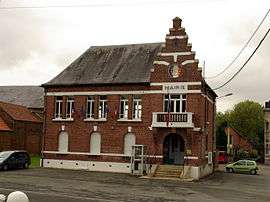
Crèvecœur-sur-l'Escaut
For other uses, see Crevecoeur (disambiguation).
| Crèvecœur-sur-l’Escaut | ||
|---|---|---|
 | ||
| ||
 Crèvecœur-sur-l’Escaut | ||
|
Location within Hauts-de-France region  Crèvecœur-sur-l’Escaut | ||
| Coordinates: 50°06′23″N 3°15′06″E / 50.1064°N 3.2517°ECoordinates: 50°06′23″N 3°15′06″E / 50.1064°N 3.2517°E | ||
| Country | France | |
| Region | Hauts-de-France | |
| Department | Nord | |
| Arrondissement | Cambrai | |
| Canton | Marcoing | |
| Intercommunality | Vallée de Vinchy | |
| Government | ||
| • Mayor (2008–2014) | Gilbert Drain | |
| Area1 | 19.06 km2 (7.36 sq mi) | |
| Population (1999)2 | 643 | |
| • Density | 34/km2 (87/sq mi) | |
| Time zone | CET (UTC+1) | |
| • Summer (DST) | CEST (UTC+2) | |
| INSEE/Postal code | 59161 / 59258 | |
| Elevation |
60–147 m (197–482 ft) (avg. 68 m or 223 ft) | |
|
1 French Land Register data, which excludes lakes, ponds, glaciers > 1 km² (0.386 sq mi or 247 acres) and river estuaries. 2 Population without double counting: residents of multiple communes (e.g., students and military personnel) only counted once. | ||
Crèvecœur-sur-l'Escaut is a commune in the Nord department in northern France.
Heraldry
_Nord-France.svg.png) |
The arms of Crèvecœur-sur-l'Escaut are blazoned : Or, 3 crescents gules. (Anneux, Crèvecœur-sur-l'Escaut, Rumilly-en-Cambrésis, Saint-Souplet and Wargnies-le-Petit use the same arms.) |
See also
References
| Wikimedia Commons has media related to Crèvecœur-sur-l'Escaut. |
This article is issued from Wikipedia - version of the 11/14/2016. The text is available under the Creative Commons Attribution/Share Alike but additional terms may apply for the media files.