Moore County, Texas
| Moore County, Texas | |
|---|---|
|
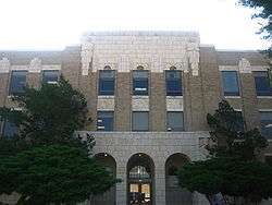
The Moore County Courthouse in Dumas | |
 Location in the U.S. state of Texas | |
 Texas's location in the U.S. | |
| Founded | 1892 |
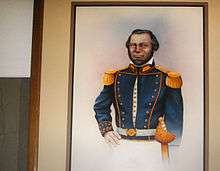
| Named for | Edwin Ward Moore |
| Seat | Dumas |
| Largest city | Dumas |
| Area | |
| • Total | 910 sq mi (2,357 km2) |
| • Land | 900 sq mi (2,331 km2) |
| • Water | 9.9 sq mi (26 km2), 1.1% |
| Population | |
| • (2010) | 21,904 |
| • Density | 24/sq mi (9/km²) |
| Congressional district | 13th |
| Time zone | Central: UTC-6/-5 |
| Website |
www |
Moore County is a county located in the U.S. state of Texas. As of the 2010 census, its population was 21,904.[1] The county seat is Dumas.[2] The county was created in 1876 and organized in 1892.[3] It is named for Edwin Ward Moore, the commander of the Texas Navy.
The Dumas, TX Micropolitan Statistical Area includes all of Moore County.
Moore County history is highlighted in the Window on the Plains Museum in Dumas.
Geography
According to the U.S. Census Bureau, the county has a total area of 910 square miles (2,400 km2), of which 900 square miles (2,300 km2) is land and 9.9 square miles (26 km2) (1.1%) is water.[4]
Major Highways
Adjacent counties
- Sherman County (north)
- Hutchinson County (east)
- Carson County (southeast)
- Potter County (south)
- Oldham County (southwest)
- Hartley County (west)
- Dallam County (northwest)
National protected area
Demographics
| Historical population | |||
|---|---|---|---|
| Census | Pop. | %± | |
| 1890 | 15 | — | |
| 1900 | 209 | 1,293.3% | |
| 1910 | 561 | 168.4% | |
| 1920 | 571 | 1.8% | |
| 1930 | 1,555 | 172.3% | |
| 1940 | 4,461 | 186.9% | |
| 1950 | 13,349 | 199.2% | |
| 1960 | 14,773 | 10.7% | |
| 1970 | 14,060 | −4.8% | |
| 1980 | 16,575 | 17.9% | |
| 1990 | 17,865 | 7.8% | |
| 2000 | 20,121 | 12.6% | |
| 2010 | 21,904 | 8.9% | |
| Est. 2015 | 22,255 | [5] | 1.6% |
| U.S. Decennial Census[6] 1850–2010[7] 2010–2014[1] | |||
As of the census[8] of 2000, there were 20,121 people, 6,774 households, and 5,331 families residing in the county. The population density was 22 people per square mile (9/km²). There were 7,478 housing units at an average density of 8 per square mile (3/km²). The racial makeup of the county was 63.93% White, 0.69% Black or African American, 0.67% Native American, 0.86% Asian, 0.03% Pacific Islander, 31.20% from other races, and 2.62% from two or more races. 47.50% of the population were Hispanic or Latino of any race.
There were 6,774 households out of which 44.80% had children under the age of 18 living with them, 65.10% were married couples living together, 9.00% had a female householder with no husband present, and 21.30% were non-families. 18.20% of all households were made up of individuals and 8.30% had someone living alone who was 65 years of age or older. The average household size was 2.94 and the average family size was 3.36.
In the county, the population was spread out with 33.60% under the age of 18, 9.20% from 18 to 24, 28.40% from 25 to 44, 18.30% from 45 to 64, and 10.60% who were 65 years of age or older. The median age was 30 years. For every 100 females there were 100.60 males. For every 100 females age 18 and over, there were 97.40 males.
The median income for a household in the county was $34,852, and the median income for a family was $37,985. Males had a median income of $29,843 versus $19,383 for females. The per capita income for the county was $15,214. About 10.10% of families and 13.50% of the population were below the poverty line, including 18.10% of those under age 18 and 10.90% of those age 65 or over.
Politics
Moore County is a strongly Republican county, having given Senator John McCain 78.76% of the vote, over only 20.65% for Barack Obama. It also gave George W Bush (R) 81.75% over 17.93% John Kerry (D).[9]
Moore County is represented in the Texas House of Representatives by the Republican Walter Price, IV, elected on November 2, 2010. The district also includes the majority of neighboring Potter County — Amarillo. Moore county is represented in the US house of representatives by Mac Thornberry (R) as it is a part of Texas's 13th congressional district.
Communities
See also
References
- 1 2 "State & County QuickFacts". United States Census Bureau. Retrieved December 22, 2013.
- ↑ "Find a County". National Association of Counties. Retrieved 2011-06-07.
- ↑ "Texas: Individual County Chronologies". Texas Atlas of Historical County Boundaries. The Newberry Library. 2008. Retrieved May 25, 2015.
- ↑ "2010 Census Gazetteer Files". United States Census Bureau. August 22, 2012. Retrieved May 4, 2015.
- ↑ "County Totals Dataset: Population, Population Change and Estimated Components of Population Change: April 1, 2010 to July 1, 2015". Retrieved July 2, 2016.
- ↑ "U.S. Decennial Census". United States Census Bureau. Retrieved May 4, 2015.
- ↑ "Texas Almanac: Population History of Counties from 1850–2010" (PDF). Texas Almanac. Retrieved May 4, 2015.
- ↑ "American FactFinder". United States Census Bureau. Retrieved 2011-05-14.
- ↑ "Dave Leip's Atlas of U.S. Presidential Elections". Retrieved 2011-06-11.
External links
- Moore County from the Handbook of Texas Online
- Moore County Profile from the Texas Association of Counties
 |
Sherman County | | ||
| Hartley County | |
Hutchinson County | ||
| ||||
| | ||||
| Oldham County | Potter County | Carson County |
Municipalities and communities of Moore County, Texas, United States | ||
|---|---|---|
| Cities | | |
| Unincorporated communities | ||
| Footnotes | ‡This populated place also has portions in an adjacent county or counties | |

Coordinates: 35°50′N 101°53′W / 35.84°N 101.89°W