Esparron-de-Verdon
| Esparron-de-Verdon | ||
|---|---|---|
|
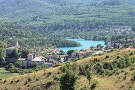
A general view of Esparron-de-Verdon | ||
| ||
 Esparron-de-Verdon | ||
|
Location within Provence-A.-C.d'A. region  Esparron-de-Verdon | ||
| Coordinates: 43°44′23″N 5°58′20″E / 43.7397°N 5.9722°ECoordinates: 43°44′23″N 5°58′20″E / 43.7397°N 5.9722°E | ||
| Country | France | |
| Region | Provence-Alpes-Côte d'Azur | |
| Department | Alpes-de-Haute-Provence | |
| Arrondissement | Digne-les-Bains | |
| Canton | Riez | |
| Government | ||
| • Mayor (2008–2014) | Gérard Burle | |
| Area1 | 34.2 km2 (13.2 sq mi) | |
| Population (2008)2 | 430 | |
| • Density | 13/km2 (33/sq mi) | |
| Time zone | CET (UTC+1) | |
| • Summer (DST) | CEST (UTC+2) | |
| INSEE/Postal code | 04081 / 04800 | |
| Elevation |
307–585 m (1,007–1,919 ft) (avg. 386 m or 1,266 ft) | |
|
1 French Land Register data, which excludes lakes, ponds, glaciers > 1 km² (0.386 sq mi or 247 acres) and river estuaries. 2 Population without double counting: residents of multiple communes (e.g., students and military personnel) only counted once. | ||

Esparron-de-Verdon is a commune in the Alpes-de-Haute-Provence department in southeastern France.
Population
| Historical population | ||
|---|---|---|
| Year | Pop. | ±% |
| 1765 | 581 | — |
| 1793 | 384 | −33.9% |
| 1800 | 510 | +32.8% |
| 1806 | 519 | +1.8% |
| 1821 | 542 | +4.4% |
| 1831 | 509 | −6.1% |
| 1836 | 506 | −0.6% |
| 1841 | 439 | −13.2% |
| 1846 | 427 | −2.7% |
| 1851 | 427 | +0.0% |
| 1856 | 410 | −4.0% |
| 1861 | 386 | −5.9% |
| 1866 | 465 | +20.5% |
| 1872 | 376 | −19.1% |
| 1876 | 371 | −1.3% |
| 1881 | 367 | −1.1% |
| 1886 | 312 | −15.0% |
| 1891 | 293 | −6.1% |
| 1896 | 272 | −7.2% |
| 1901 | 231 | −15.1% |
| 1906 | 235 | +1.7% |
| 1911 | 207 | −11.9% |
| 1921 | 170 | −17.9% |
| 1926 | 155 | −8.8% |
| 1931 | 157 | +1.3% |
| 1936 | 159 | +1.3% |
| 1946 | 124 | −22.0% |
| 1954 | 86 | −30.6% |
| 1962 | 65 | −24.4% |
| 1968 | 81 | +24.6% |
| 1975 | 118 | +45.7% |
| 1982 | 206 | +74.6% |
| 1990 | 290 | +40.8% |
| 1999 | 312 | +7.6% |
| 2008 | 430 | +37.8% |
See also
References
| Wikimedia Commons has media related to Esparron-de-Verdon. |
This article is issued from Wikipedia - version of the 2/3/2015. The text is available under the Creative Commons Attribution/Share Alike but additional terms may apply for the media files.