Braux, Alpes-de-Haute-Provence
| Braux | ||
|---|---|---|
|
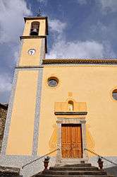
The church in Braux | ||
| ||
 Braux | ||
|
Location within Provence-A.-C.d'A. region  Braux | ||
| Coordinates: 43°59′12″N 6°42′03″E / 43.9867°N 6.7008°ECoordinates: 43°59′12″N 6°42′03″E / 43.9867°N 6.7008°E | ||
| Country | France | |
| Region | Provence-Alpes-Côte d'Azur | |
| Department | Alpes-de-Haute-Provence | |
| Arrondissement | Castellane | |
| Canton | Annot | |
| Intercommunality | Terres de Lumière | |
| Government | ||
| • Mayor (2008–2014) | Bernard Grac | |
| Area1 | 11.67 km2 (4.51 sq mi) | |
| Population (2008)2 | 131 | |
| • Density | 11/km2 (29/sq mi) | |
| Time zone | CET (UTC+1) | |
| • Summer (DST) | CEST (UTC+2) | |
| INSEE/Postal code | 04032 / 04240 | |
| Elevation |
639–1,600 m (2,096–5,249 ft) (avg. 950 m or 3,120 ft) | |
|
1 French Land Register data, which excludes lakes, ponds, glaciers > 1 km² (0.386 sq mi or 247 acres) and river estuaries. 2 Population without double counting: residents of multiple communes (e.g., students and military personnel) only counted once. | ||

Braux is a commune in the Alpes-de-Haute-Provence department in southeastern France.
Population
| Historical population | ||
|---|---|---|
| Year | Pop. | ±% |
| 1765 | 1,023 | — |
| 1793 | 470 | −54.1% |
| 1800 | 402 | −14.5% |
| 1806 | 385 | −4.2% |
| 1821 | 458 | +19.0% |
| 1831 | 454 | −0.9% |
| 1836 | 495 | +9.0% |
| 1841 | 528 | +6.7% |
| 1846 | 538 | +1.9% |
| 1851 | 578 | +7.4% |
| 1856 | 540 | −6.6% |
| 1861 | 540 | +0.0% |
| 1866 | 554 | +2.6% |
| 1872 | 560 | +1.1% |
| 1876 | 553 | −1.2% |
| 1881 | 544 | −1.6% |
| 1886 | 510 | −6.2% |
| 1891 | 482 | −5.5% |
| 1896 | 461 | −4.4% |
| 1901 | 457 | −0.9% |
| 1906 | 454 | −0.7% |
| 1911 | 425 | −6.4% |
| 1921 | 415 | −2.4% |
| 1926 | 390 | −6.0% |
| 1931 | 377 | −3.3% |
| 1936 | 375 | −0.5% |
| 1946 | 332 | −11.5% |
| 1954 | 289 | −13.0% |
| 1962 | 248 | −14.2% |
| 1968 | 206 | −16.9% |
| 1975 | 153 | −25.7% |
| 1982 | 160 | +4.6% |
| 1990 | 133 | −16.9% |
| 1999 | 118 | −11.3% |
| 2008 | 131 | +11.0% |
See also
References
| Wikimedia Commons has media related to Braux, Alpes-de-Haute-Provence. |
This article is issued from Wikipedia - version of the 2/3/2015. The text is available under the Creative Commons Attribution/Share Alike but additional terms may apply for the media files.