Turriers
| Turriers | ||
|---|---|---|
|
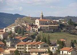
The church and surrounding buildings in Turriers | ||
| ||
 Turriers | ||
|
Location within Provence-A.-C.d'A. region  Turriers | ||
| Coordinates: 44°24′08″N 6°10′11″E / 44.4022°N 6.1697°ECoordinates: 44°24′08″N 6°10′11″E / 44.4022°N 6.1697°E | ||
| Country | France | |
| Region | Provence-Alpes-Côte d'Azur | |
| Department | Alpes-de-Haute-Provence | |
| Arrondissement | Forcalquier | |
| Canton | Turriers | |
| Government | ||
| • Mayor (2008–2014) | Elie Aguillon | |
| Area1 | 19.86 km2 (7.67 sq mi) | |
| Population (2008)2 | 397 | |
| • Density | 20/km2 (52/sq mi) | |
| Time zone | CET (UTC+1) | |
| • Summer (DST) | CEST (UTC+2) | |
| INSEE/Postal code | 04222 / 04250 | |
| Elevation |
853–1,714 m (2,799–5,623 ft) (avg. 1,040 m or 3,410 ft) | |
|
1 French Land Register data, which excludes lakes, ponds, glaciers > 1 km² (0.386 sq mi or 247 acres) and river estuaries. 2 Population without double counting: residents of multiple communes (e.g., students and military personnel) only counted once. | ||

Turriers is a commune in the Alpes-de-Haute-Provence department in southeastern France.
Population
| Historical population | ||
|---|---|---|
| Year | Pop. | ±% |
| 1765 | 601 | — |
| 1793 | 586 | −2.5% |
| 1800 | 629 | +7.3% |
| 1806 | 596 | −5.2% |
| 1821 | 610 | +2.3% |
| 1831 | 613 | +0.5% |
| 1836 | 637 | +3.9% |
| 1841 | 616 | −3.3% |
| 1846 | 652 | +5.8% |
| 1851 | 679 | +4.1% |
| 1856 | 633 | −6.8% |
| 1861 | 618 | −2.4% |
| 1866 | 589 | −4.7% |
| 1872 | 550 | −6.6% |
| 1876 | 535 | −2.7% |
| 1881 | 534 | −0.2% |
| 1886 | 523 | −2.1% |
| 1891 | 481 | −8.0% |
| 1896 | 443 | −7.9% |
| 1901 | 415 | −6.3% |
| 1906 | 446 | +7.5% |
| 1911 | 405 | −9.2% |
| 1921 | 338 | −16.5% |
| 1926 | 320 | −5.3% |
| 1931 | 321 | +0.3% |
| 1936 | 326 | +1.6% |
| 1946 | 290 | −11.0% |
| 1954 | 260 | −10.3% |
| 1962 | 262 | +0.8% |
| 1968 | 230 | −12.2% |
| 1975 | 226 | −1.7% |
| 1982 | 286 | +26.5% |
| 1990 | 276 | −3.5% |
| 1999 | 297 | +7.6% |
| 2008 | 397 | +33.7% |
See also
References
| Wikimedia Commons has media related to Turriers. |
This article is issued from Wikipedia - version of the 2/4/2015. The text is available under the Creative Commons Attribution/Share Alike but additional terms may apply for the media files.