Claret, Alpes-de-Haute-Provence
| Claret | ||
|---|---|---|
|
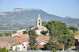
The church and surrounding buildings in Claret | ||
| ||
 Claret | ||
|
Location within Provence-A.-C.d'A. region  Claret | ||
| Coordinates: 44°22′22″N 5°57′23″E / 44.3728°N 5.9564°ECoordinates: 44°22′22″N 5°57′23″E / 44.3728°N 5.9564°E | ||
| Country | France | |
| Region | Provence-Alpes-Côte d'Azur | |
| Department | Alpes-de-Haute-Provence | |
| Arrondissement | Forcalquier | |
| Canton | La Motte-du-Caire | |
| Government | ||
| • Mayor (2008–2014) | Évelyne Faure | |
| Area1 | 21.04 km2 (8.12 sq mi) | |
| Population (2008)2 | 218 | |
| • Density | 10/km2 (27/sq mi) | |
| Time zone | CET (UTC+1) | |
| • Summer (DST) | CEST (UTC+2) | |
| INSEE/Postal code | 04058 / 05110 | |
| Elevation | 528–1,254 m (1,732–4,114 ft) | |
|
1 French Land Register data, which excludes lakes, ponds, glaciers > 1 km² (0.386 sq mi or 247 acres) and river estuaries. 2 Population without double counting: residents of multiple communes (e.g., students and military personnel) only counted once. | ||

Claret is a commune in the Alpes-de-Haute-Provence department in southeastern France.
Population
| Historical population | ||
|---|---|---|
| Year | Pop. | ±% |
| 1765 | 372 | — |
| 1793 | 465 | +25.0% |
| 1800 | 430 | −7.5% |
| 1806 | 415 | −3.5% |
| 1821 | 402 | −3.1% |
| 1831 | 499 | +24.1% |
| 1836 | 395 | −20.8% |
| 1841 | 396 | +0.3% |
| 1846 | 386 | −2.5% |
| 1851 | 349 | −9.6% |
| 1856 | 374 | +7.2% |
| 1861 | 380 | +1.6% |
| 1866 | 368 | −3.2% |
| 1872 | 348 | −5.4% |
| 1876 | 324 | −6.9% |
| 1881 | 332 | +2.5% |
| 1886 | 329 | −0.9% |
| 1891 | 320 | −2.7% |
| 1896 | 311 | −2.8% |
| 1901 | 310 | −0.3% |
| 1906 | 296 | −4.5% |
| 1911 | 300 | +1.4% |
| 1921 | 224 | −25.3% |
| 1926 | 200 | −10.7% |
| 1931 | 211 | +5.5% |
| 1936 | 197 | −6.6% |
| 1946 | 150 | −23.9% |
| 1954 | 128 | −14.7% |
| 1962 | 150 | +17.2% |
| 1968 | 145 | −3.3% |
| 1975 | 140 | −3.4% |
| 1982 | 132 | −5.7% |
| 1990 | 189 | +43.2% |
| 1999 | 249 | +31.7% |
| 2008 | 218 | −12.4% |
See also
References
| Wikimedia Commons has media related to Claret, Alpes-de-Haute-Provence. |
This article is issued from Wikipedia - version of the 2/3/2015. The text is available under the Creative Commons Attribution/Share Alike but additional terms may apply for the media files.