Piégut
For the commune in the Dordogne department, see Piégut-Pluviers.
| Piégut | ||
|---|---|---|
|
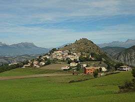
The village of Piégut and the Colline de Saint-Colomban | ||
| ||
 Piégut | ||
|
Location within Provence-A.-C.d'A. region  Piégut | ||
| Coordinates: 44°27′10″N 6°07′43″E / 44.4528°N 6.1286°ECoordinates: 44°27′10″N 6°07′43″E / 44.4528°N 6.1286°E | ||
| Country | France | |
| Region | Provence-Alpes-Côte d'Azur | |
| Department | Alpes-de-Haute-Provence | |
| Arrondissement | Forcalquier | |
| Canton | Turriers | |
| Government | ||
| • Mayor (2008–2014) | Monique Ouvrier-Buffet | |
| Area1 | 11.12 km2 (4.29 sq mi) | |
| Population (2008)2 | 138 | |
| • Density | 12/km2 (32/sq mi) | |
| Time zone | CET (UTC+1) | |
| • Summer (DST) | CEST (UTC+2) | |
| INSEE/Postal code | 04150 / 05130 | |
| Elevation | 610–1,560 m (2,000–5,120 ft) | |
|
1 French Land Register data, which excludes lakes, ponds, glaciers > 1 km² (0.386 sq mi or 247 acres) and river estuaries. 2 Population without double counting: residents of multiple communes (e.g., students and military personnel) only counted once. | ||

Piégut is a commune in the Alpes-de-Haute-Provence department in southeastern France.
Population
| Historical population | ||
|---|---|---|
| Year | Pop. | ±% |
| 1765 | 182 | — |
| 1793 | 216 | +18.7% |
| 1800 | 185 | −14.4% |
| 1806 | 208 | +12.4% |
| 1821 | 201 | −3.4% |
| 1831 | 219 | +9.0% |
| 1836 | 219 | +0.0% |
| 1841 | 233 | +6.4% |
| 1846 | 210 | −9.9% |
| 1851 | 228 | +8.6% |
| 1856 | 227 | −0.4% |
| 1861 | 215 | −5.3% |
| 1866 | 205 | −4.7% |
| 1872 | 185 | −9.8% |
| 1876 | 181 | −2.2% |
| 1881 | 178 | −1.7% |
| 1886 | 166 | −6.7% |
| 1891 | 173 | +4.2% |
| 1896 | 160 | −7.5% |
| 1901 | 163 | +1.9% |
| 1906 | 144 | −11.7% |
| 1911 | 131 | −9.0% |
| 1921 | 101 | −22.9% |
| 1926 | 88 | −12.9% |
| 1931 | 100 | +13.6% |
| 1936 | 84 | −16.0% |
| 1946 | 95 | +13.1% |
| 1954 | 78 | −17.9% |
| 1962 | 72 | −7.7% |
| 1968 | 65 | −9.7% |
| 1975 | 66 | +1.5% |
| 1982 | 72 | +9.1% |
| 1990 | 86 | +19.4% |
| 1999 | 123 | +43.0% |
| 2008 | 138 | +12.2% |
See also
References
| Wikimedia Commons has media related to Piégut. |
This article is issued from Wikipedia - version of the 2/4/2015. The text is available under the Creative Commons Attribution/Share Alike but additional terms may apply for the media files.