Glasgow, Virginia
| Glasgow, Virginia | |
|---|---|
| Town | |
 Location of Glasgow, Virginia | |
| Coordinates: 37°37′59″N 79°27′6″W / 37.63306°N 79.45167°WCoordinates: 37°37′59″N 79°27′6″W / 37.63306°N 79.45167°W | |
| Country | United States |
| State | Virginia |
| County | Rockbridge |
| Area | |
| • Total | 1.5 sq mi (3.9 km2) |
| • Land | 1.5 sq mi (3.9 km2) |
| • Water | 0.0 sq mi (0.0 km2) |
| Elevation | 738 ft (225 m) |
| Population (2000) | |
| • Total | 1,046 |
| • Density | 691.9/sq mi (267.1/km2) |
| Time zone | Eastern (EST) (UTC-5) |
| • Summer (DST) | EDT (UTC-4) |
| ZIP code | 24555 |
| Area code(s) | 540 |
| FIPS code | 51-31136[1] |
| GNIS feature ID | 1494956[2] |
| Website | Official website |
Glasgow is a town in Rockbridge County, Virginia, United States, at the confluence of the James and Maury Rivers. The population was 1,046 at the 2000 census.
Glasgow has had issues with flooding, notably during Hurricane Camille in 1969. As a result of flooding concerns, the Balcony Falls Dam (just East of the confluence of the James and Maury rivers) was removed in 1973.[3]
Geography
Glasgow is located at 37°37′59″N 79°27′06″W / 37.633093°N 79.451542°W (37.633093, -79.451542).[4] Glasgow is about 6 miles east of Natural Bridge, Virginia, the site of the historic land bridge of the same name.
According to the United States Census Bureau, the town has a total area of 1.5 square miles (3.9 km2), all of it land.
Demographics
| Historical population | |||
|---|---|---|---|
| Census | Pop. | %± | |
| 1910 | 407 | — | |
| 1920 | 376 | −7.6% | |
| 1930 | 507 | 34.8% | |
| 1940 | 938 | 85.0% | |
| 1950 | 810 | −13.6% | |
| 1960 | 1,091 | 34.7% | |
| 1970 | 1,304 | 19.5% | |
| 1980 | 1,259 | −3.5% | |
| 1990 | 1,140 | −9.5% | |
| 2000 | 1,046 | −8.2% | |
| 2010 | 1,133 | 8.3% | |
| Est. 2015 | 1,115 | [5] | −1.6% |
As of the census[1] of 2000, there were 1,046 people, 450 households, and 296 families residing in the town. The population density was 691.9 people per square mile (267.5/km2). There were 494 housing units at an average density of 326.7 per square mile (126.3/km2). The racial makeup of the town was 80.50% White, 16.16% African American, 0.48% Native American, 0.38% Asian, and 2.49% from two or more races. Hispanic or Latino of any race were 0.57% of the population.
There were 450 households out of which 28.7% had children under the age of 18 living with them, 44.4% were married couples living together, 14.0% had a female householder with no husband present, and 34.2% were non-families. 30.9% of all households were made up of individuals and 15.1% had someone living alone who was 65 years of age or older. The average household size was 2.32 and the average family size was 2.87.
In the town the population was spread out with 23.9% under the age of 18, 7.6% from 18 to 24, 25.0% from 25 to 44, 25.3% from 45 to 64, and 18.2% who were 65 years of age or older. The median age was 40 years. For every 100 females there were 92.6 males. For every 100 females age 18 and over, there were 87.7 males.
The median income for a household in the town was $28,819, and the median income for a family was $37,292. Males had a median income of $28,235 versus $21,422 for females. The per capita income for the town was $14,093. About 8.9% of families and 14.5% of the population were below the poverty line, including 21.5% of those under age 18 and 15.1% of those age 65 or over.
Climate
The climate in this area is characterized by hot, humid summers and generally mild to cool winters. According to the Köppen Climate Classification system, Glasgow has a humid subtropical climate, abbreviated "Cfa" on climate maps.[7]
References
- 1 2 "American FactFinder". United States Census Bureau. Retrieved 2008-01-31.
- ↑ "US Board on Geographic Names". United States Geological Survey. 2007-10-25. Retrieved 2008-01-31.
- ↑ http://www.glasgowvirginia.org/History_Article_s_Page.html
- ↑ "US Gazetteer files: 2010, 2000, and 1990". United States Census Bureau. 2011-02-12. Retrieved 2011-04-23.
- ↑ "Annual Estimates of the Resident Population for Incorporated Places: April 1, 2010 to July 1, 2015". Retrieved July 2, 2016.
- ↑ "Census of Population and Housing". Census.gov. Retrieved June 4, 2015.
- ↑ Climate Summary for Glasgow, Virginia
Municipalities and communities of Rockbridge County, Virginia, United States | ||
|---|---|---|
| Towns | 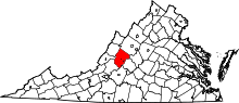 | |
| CDP | ||
| Unincorporated communities | ||
| Footnotes | ‡This populated place also has portions in an adjacent county or counties | |