Port Royal, Virginia
| Port Royal, Virginia | |
|---|---|
| Town | |
|
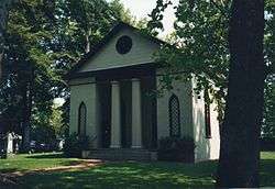
St. Peter's Episcopal Church in Port Royal | |
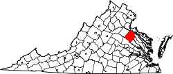
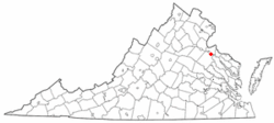 Location of Port Royal, Virginia | |
| Coordinates: 38°10′11″N 77°11′27″W / 38.16972°N 77.19083°WCoordinates: 38°10′11″N 77°11′27″W / 38.16972°N 77.19083°W | |
| Country | United States |
| State | Virginia |
| County | Caroline |
| Area | |
| • Total | 0.10 sq mi (0.27 km2) |
| • Land | 0.10 sq mi (0.27 km2) |
| • Water | 0.0 sq mi (0.0 km2) |
| Elevation | 30 ft (9 m) |
| Population (2010) | |
| • Total | 126 |
| • Density | 1,202/sq mi (464.2/km2) |
| Time zone | Eastern (EST) (UTC-5) |
| • Summer (DST) | EDT (UTC-4) |
| ZIP code | 22535 |
| Area code(s) | 804 |
| FIPS code | 51-63928[1] |
| GNIS feature ID | 1499899[2] |
Port Royal is an incorporated town in Caroline County, Virginia, United States. The population was 126 at the 2010 census.[3]
Port Royal was established in the mid-17th century in the Colony of Virginia primarily as a port at the head of the navigable reach of the Rappahannock River for export of tobacco, Virginia's cash crop. The town was also set along an early stage road, which brought passengers and freight for embarkation upon the river there. It still remains a crossroads along the busy modern highways of U.S. Route 17 and U.S. Route 301.
History
Port Royal is one of the area's more historic towns. It was first established in 1652 as a port at the head of sea-going navigation on the Rappahannock River during an era when waterways were the fastest and easiest method of transportation of people and property in the British colony of Virginia. It was an important point for export of tobacco, Virginia's cash crop.
Local tradition holds that Port Royal was named after the Roy family. Dorothy Roy and her husband John owned a warehouse chartered by the crown, a ferry service across the Rappahannock River to King George County, and a tavern. In the 21st century, the chimneys of the Roy house are preserved landmarks in the town.[4]
Port Royal was incorporated as a town in 1744. The "town green", upon which stands today the Town Hall and the firehouse, was forever reserved "for public and civic use".[5]
Shipping of property from the port began to decline after completion of railroads which began in Virginia in the 1830s. The last scheduled passenger ship service ended in 1932, supplanted by highways. However, Port Royal was served by the new highways which became U.S. Route 17 and U.S. Route 301, with their crossroads at Port Royal.
Probably Port Royal's most notable claim to fame is that John Wilkes Booth was killed about two miles outside town by Sgt. Boston Corbett, part of a contingent of federal troops, at the now obsolete Garrett farmstead (look for prominent markers along northbound Rt. 301) on April 26, 1865, after Booth assassinated President Abraham Lincoln on the night of April 14, 1865, in Ford's Theater in Washington, DC. President Lincoln died the next morning at the Petersen House, across the street from the theater. Booth escaped through southern Maryland and across the Potomac River (twice – as the tidal forces carried them back to Maryland on the first try) as well as the Rappahannock River before being cornered in a tobacco barn on the Garrett farm at sunrise. Shot through the neck and instantly paralyzed, Booth died on the porch of the Garrett house (carried there after falling in the barn). One of his accomplices in the murder who was with him and captured at the Garrett farm, David Herold, was tried, convicted and hanged on July 7, 1865, along with Lewis Powell (alias Payne or Paine), George Atzerodt, and Mary Surratt. A military court found them guilty in the conspiracy to murder or attempt to murder Secretary of State William H. Seward (who survived a vicious knife attack by Powell), and Vice President Andrew Johnson (though Atzerodt could not carry it out and just left a written message for Johnson in his hotel mailbox).
Geography
Port Royal is located in northern Caroline County at 38°10′11″N 77°11′27″W / 38.16972°N 77.19083°W (38.169799, −77.190763),[6] on the south bank of the Rappahannock River.
U.S. Routes 17 and 301 cross just southwest of the town limits. US 17 leads northwest 21 miles (34 km) to Fredericksburg and southeast 27 miles (43 km) to Tappahannock, while US 301 leads northeast 17 miles (27 km) to the Governor Harry W. Nice Memorial Bridge over the Potomac River and southwest 12 miles (19 km) to Bowling Green, the Caroline County seat.
According to the United States Census Bureau, the town has a total area of 0.10 square miles (0.27 km2), all land.[3] That changed in July 2014, when the town quintupled in size to 481 acres (.75 square miles).[7]
Demographics
| Historical population | |||
|---|---|---|---|
| Census | Pop. | %± | |
| 1850 | 470 | — | |
| 1860 | 323 | −31.3% | |
| 1870 | 435 | 34.7% | |
| 1880 | 347 | −20.2% | |
| 1890 | 236 | −32.0% | |
| 1900 | 193 | −18.2% | |
| 1910 | 194 | 0.5% | |
| 1920 | 155 | −20.1% | |
| 1930 | 157 | 1.3% | |
| 1940 | 123 | −21.7% | |
| 1950 | 139 | 13.0% | |
| 1960 | 128 | −7.9% | |
| 1970 | 199 | 55.5% | |
| 1980 | 147 | −26.1% | |
| 1990 | 204 | 38.8% | |
| 2000 | 170 | −16.7% | |
| 2010 | 126 | −25.9% | |
| Est. 2015 | 129 | [8] | 2.4% |
As of the census[1] of 2000, there were 170 people, 72 households, and 43 families residing in the town. The population density was 1,467.9 people per square mile (547.0/km²). There were 90 housing units at an average density of 777.1 per square mile (289.6/km²). The racial makeup of the town was 59.41% White, 38.24% African American, 0.59% from other races, and 1.76% from two or more races. Hispanic or Latino of any race were 0.59% of the population.
There were 72 households out of which 31.9% had children under the age of 18 living with them, 43.1% were married couples living together, 13.9% had a female householder with no husband present, and 38.9% were non-families. 31.9% of all households were made up of individuals and 12.5% had someone living alone who was 65 years of age or older. The average household size was 2.36 and the average family size was 2.89.
In the town the population was spread out with 27.1% under the age of 18, 7.1% from 18 to 24, 29.4% from 25 to 44, 17.6% from 45 to 64, and 18.8% who were 65 years of age or older. The median age was 37 years. For every 100 females there were 100.0 males. For every 100 females age 18 and over, there were 100.0 males.
The median income for a household in the town was $31,429, and the median income for a family was $33,750. Males had a median income of $23,571 versus $19,167 for females. The per capita income for the town was $15,878. None of the families and 7.2% of the population were living below the poverty line, including no under eighteens and 10.4% of those over 64.
References
- 1 2 "American FactFinder". United States Census Bureau. Retrieved 2008-01-31.
- ↑ "US Board on Geographic Names". United States Geological Survey. 2007-10-25. Retrieved 2008-01-31.
- 1 2 "Geographic Identifiers: 2010 Demographic Profile Data (G001): Port Royal town, Virginia". U.S. Census Bureau, American Factfinder. Retrieved August 20, 2015.
- ↑ Welcome to Historic Port Royal, Inc
- ↑ Welcome to Historic Port Royal!
- ↑ "US Gazetteer files: 2010, 2000, and 1990". United States Census Bureau. 2011-02-12. Retrieved 2011-04-23.
- ↑ / Port Royal Boundary Change in Fredericksburg Newspaper
- ↑ "Annual Estimates of the Resident Population for Incorporated Places: April 1, 2010 to July 1, 2015". Retrieved July 2, 2016.
- ↑ "Census of Population and Housing". Census.gov. Retrieved June 4, 2015.
External links
| Wikimedia Commons has media related to Port Royal, Virginia. |