Kilmarnock, Virginia
| Kilmarnock, Virginia | |
|---|---|
| Town | |
|
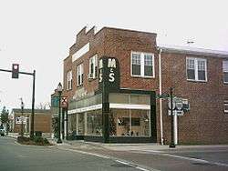
Street corner in downtown Kilmarnock | |
 Location of Kilmarnock, Virginia | |
| Coordinates: 37°42′45″N 76°22′54″W / 37.71250°N 76.38167°WCoordinates: 37°42′45″N 76°22′54″W / 37.71250°N 76.38167°W | |
| Country | United States |
| State | Virginia |
| County | Lancaster |
| Area | |
| • Total | 2.9 sq mi (7.4 km2) |
| • Land | 2.9 sq mi (7.4 km2) |
| • Water | 0.0 sq mi (0.0 km2) |
| Elevation | 89 ft (27 m) |
| Population (2000) | |
| • Total | 1,244 |
| • Density | 435.6/sq mi (168.2/km2) |
| Time zone | Eastern (EST) (UTC-5) |
| • Summer (DST) | EDT (UTC-4) |
| ZIP code | 22482 |
| Area code(s) | 804 |
| FIPS code | 51-42424[1] |
| GNIS feature ID | 1495790[2] |
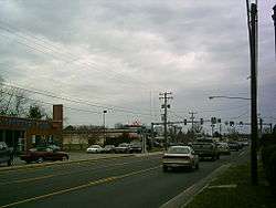
Kilmarnock is a town in Lancaster county in the U.S. Commonwealth of Virginia. The population was 1,244 at the 2000 census. It is located near the mouth of the Rappahannock River and is located within the Northern Neck George Washington Birthplace American Viticultural Area winemaking appellation. There is a small hospital in the town. Lancaster Middle School, grades 4-8, is also located in town. Approximately 500 students attend the school.
The town was named after Kilmarnock, in Scotland.[3]
Geography
Kilmarnock is located at 37°42′45″N 76°22′54″W / 37.71250°N 76.38167°W (37.712437, -76.381707).[4]
According to the United States Census Bureau, the town has a total area of 2.9 square miles (7.4 km²), of which, 2.9 square miles (7.4 km²) of it is land and 0.35% is water.
Kilmarnock hosts the Holly Ball, a debutante ball founded in 1895, at the Indian Creek Yacht and Country Club every December.
Demographics
| Historical population | |||
|---|---|---|---|
| Census | Pop. | %± | |
| 1880 | 59 | — | |
| 1940 | 614 | — | |
| 1950 | 689 | 12.2% | |
| 1960 | 927 | 34.5% | |
| 1970 | 841 | −9.3% | |
| 1980 | 945 | 12.4% | |
| 1990 | 1,109 | 17.4% | |
| 2000 | 1,244 | 12.2% | |
| 2010 | 1,487 | 19.5% | |
| Est. 2015 | 1,437 | [5] | −3.4% |
As of the census[1] of 2000, there were 1,244 people, 547 households, and 305 families residing in the town. The population density was 435.6 people per square mile (167.9/km²). There were 607 housing units at an average density of 212.6 per square mile (81.9/km²). The racial makeup of the town was 79.74% White, 19.05% African American, 0.08% Native American, 0.32% Asian, 0.08% from other races, and 0.72% from two or more races. Hispanic or Latino of any race were 0.56% of the population.
There were 547 households out of which 23.6% had children under the age of 18 living with them, 39.9% were married couples living together, 13.0% had a female householder with no husband present, and 44.2% were non-families. 40.8% of all households were made up of individuals and 25.4% had someone living alone who was 65 years of age or older. The average household size was 1.99 and the average family size was 2.66.
In the town the population was spread out with 18.4% under the age of 18, 4.7% from 18 to 24, 19.3% from 25 to 44, 20.3% from 45 to 64, and 37.4% who were 65 years of age or older. The median age was 52 years. For every 100 females there were 68.8 males. For every 100 females age 18 and over, there were 64.0 males.
The median income for a household in the town was $31,625, and the median income for a family was $43,500. Males had a median income of $30,167 versus $20,875 for females. The per capita income for the town was $21,172. About 9.1% of families and 14.5% of the population were below the poverty line, including 18.2% of those under age 18 and 10.2% of those age 65 or over.
References
- 1 2 "American FactFinder". United States Census Bureau. Retrieved 2008-01-31.
- ↑ "US Board on Geographic Names". United States Geological Survey. 2007-10-25. Retrieved 2008-01-31.
- ↑ Gannett, Henry (1905). The Origin of Certain Place Names in the United States. Govt. Print. Off. p. 175.
- ↑ "US Gazetteer files: 2010, 2000, and 1990". United States Census Bureau. 2011-02-12. Retrieved 2011-04-23.
- ↑ "Annual Estimates of the Resident Population for Incorporated Places: April 1, 2010 to July 1, 2015". Retrieved July 2, 2016.
- ↑ "Census of Population and Housing". Census.gov. Retrieved June 4, 2015.
External links
Municipalities and communities of Lancaster County, Virginia, United States | ||
|---|---|---|
| Towns |  | |
| Unincorporated communities |
| |
| Footnotes | ‡This populated place also has portions in an adjacent county or counties | |
