Mineral, Virginia
| Mineral, Virginia | |
|---|---|
| Town | |
|
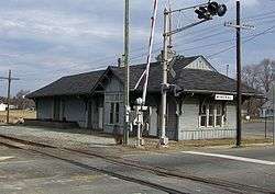
C&O Depot in Mineral | |
 Location in Virginia | |
| Coordinates: 38°0′22″N 77°54′34″W / 38.00611°N 77.90944°WCoordinates: 38°0′22″N 77°54′34″W / 38.00611°N 77.90944°W | |
| Country | United States |
| State | Virginia |
| County | Louisa |
| Founded | 1890 |
| Government | |
| • Mayor | Pam Harlowe |
| Area | |
| • Total | 0.9 sq mi (2.3 km2) |
| • Land | 0.9 sq mi (2.3 km2) |
| • Water | 0.0 sq mi (0.0 km2) |
| Elevation | 459 ft (140 m) |
| Population (2000) | |
| • Total | 424 |
| • Density | 474.7/sq mi (183.3/km2) |
| Time zone | Eastern (EST) (UTC-5) |
| • Summer (DST) | EDT (UTC-4) |
| ZIP code | 23117 |
| Area code(s) | 540 |
| FIPS code | 51-52120[1] |
| GNIS feature ID | 1495954[2] |
| Website | http://townofmineral.com/ |
Mineral is a town in Louisa County, Virginia, United States. The population was 424 at the 2000 census.
History
Mineral was originally known as Tolersville,[3] but adopted its current name when it incorporated in 1902 due to the mining industry that supported the community. It was the center of gold mining activity in Louisa County, and during its heyday, there were fifteen gold mines located within two miles (3 km) of the town. A zinc and lead mine also operated in the area into the 1970s.
Cuckoo, Harris-Poindexter House and Store, and the Mineral Historic District are listed on the National Register of Historic Places.[4]
At 1:51 p.m. on August 23, 2011, a 5.8 magnitude earthquake was centered 5 miles (8 kilometers) south-southwest of Mineral, at a depth of 3.7 miles (6 kilometers).[5] According to Associated Press, it "forced evacuations of all the monuments on the National Mall in Washington and rattled nerves from Florida to Canada".[6] The roof of Mineral's town hall collapsed, and three of the six schools in the county's school system suffered heavy damage. There were no fatalities, and only minor injuries.
Geography
Mineral is located at 38°0′22″N 77°54′34″W / 38.00611°N 77.90944°W (38.006117, -77.909553).[7]
According to the United States Census Bureau, the town has a total area of 0.9 sq mi (2.3 km²), all land.
Demographics
| Historical population | |||
|---|---|---|---|
| Census | Pop. | %± | |
| 1910 | 260 | — | |
| 1920 | 408 | 56.9% | |
| 1930 | 416 | 2.0% | |
| 1940 | 427 | 2.6% | |
| 1950 | 414 | −3.0% | |
| 1960 | 366 | −11.6% | |
| 1970 | 397 | 8.5% | |
| 1980 | 399 | 0.5% | |
| 1990 | 471 | 18.0% | |
| 2000 | 424 | −10.0% | |
| 2010 | 467 | 10.1% | |
| Est. 2015 | 483 | [8] | 3.4% |
At the 2000 census,[1] there were 424 people, 172 households and 115 families residing in the town. The population density was 474.7 per square mile (183.9/km²). There were 196 housing units at an average density of 219.5/sq mi (85.0/km²). The racial makeup of the town was 82.8% White, 9.9% Black, and 7.3% from two or more races.
There were 172 households of which 30.2% had children under the age of 18 living with them, 53.5% were married couples living together, 9.9% had a female householder with no husband present, and 32.6% were non-families. 30.2% of all households were made up of individuals and 15.1% had someone living alone who was 65 years of age or older. The average household size was 2.47 and the average family size was 3.09.
24.3% of the population were under the age of 18, 7.3% from 18 to 24, 27.1% from 25 to 44, 24.1% from 45 to 64, and 17.2% who were 65 years of age or older. The median age was 40 years. For every 100 females there were 100.0 males. For every 100 females age 18 and over, there were 88.8 males.
The median household income was $37,500 and the median family income was $49,000. Males had a median income of $34,375 and females $24,063. The per capita income was $19,397. About 4.5% of families and 6.4% of the population were below the poverty line, including 5.2% of those under age 18 and 3.9% of those age 65 or over.
References
- 1 2 "American FactFinder". United States Census Bureau. Retrieved 2008-01-31.
- ↑ "US Board on Geographic Names". United States Geological Survey. 2007-10-25. Retrieved 2008-01-31.
- ↑ The town was founded by Adam Toler. He was born on November 30, 1766 in Louisa County, Virginia and died on March 20, 1813 in Chesterfield, Virginia. He was the son of William Toler and Hannah Brockman. He married in 1785 as her second husband, Mary Jerdone. She was born on January 14, 1754 at New Kent County, Virginia, the daughter of Frances Jerdone was born in Jedburgh in the Shire of Tivotdale, Scotland on January 30, 1721. He was the son of John Jerdone, a magistrate and treasurer of the town. At the age of nineteen, he immigrated to Virginia from Scotland and settled in Hanover County, Yorktown; and later in Louisa County. He made his living as a merchant (factor), running a mercantile business with George Pottie until his death in 1771. Mary Jerdone married as her first husband, in 1771, George Pottie. He died prior to 1785 when she married Adam Toler.
- ↑ National Park Service (2010-07-09). "National Register Information System". National Register of Historic Places. National Park Service.
- ↑ Magnitude 5.8 - VIRGINIA
- ↑ "Quake rocks Washington area, felt on East Coast". Associated Press (AP). August 23, 2011.
- ↑ "US Gazetteer files: 2010, 2000, and 1990". United States Census Bureau. 2011-02-12. Retrieved 2011-04-23.
- ↑ "Annual Estimates of the Resident Population for Incorporated Places: April 1, 2010 to July 1, 2015". Retrieved July 2, 2016.
- ↑ "Census of Population and Housing". Census.gov. Retrieved June 4, 2015.
| Wikimedia Commons has media related to Mineral, Virginia. |
Municipalities and communities of Louisa County, Virginia, United States | ||
|---|---|---|
| Towns | 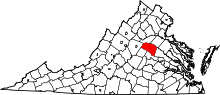 | |
| CDP | ||
| Unincorporated communities |
| |
| Footnotes | ‡This populated place also has portions in an adjacent county or counties | |