Boykins, Virginia
| Boykins, Virginia | |
|---|---|
| Town | |
| Nickname(s): Boykins | |
| Motto: "A Small Town that Totally Exists" | |
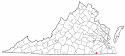 Location of Boykins, Virginia | |
| Coordinates: 36°34′50″N 77°12′0″W / 36.58056°N 77.20000°WCoordinates: 36°34′50″N 77°12′0″W / 36.58056°N 77.20000°W | |
| Country | United States |
| State | Virginia |
| County | Southampton |
| Government | |
| Area | |
| • Total | 0.7 sq mi (1.8 km2) |
| • Land | 0.7 sq mi (1.8 km2) |
| • Water | 0.0 sq mi (0.0 km2) |
| Elevation | 39 ft (12 m) |
| Population (2000) | |
| • Total | 620 |
| • Density | 905.6/sq mi (349.6/km2) |
| Time zone | Eastern (EST) (UTC-5) |
| • Summer (DST) | EDT (UTC-4) |
| ZIP code | 23827 |
| Area code(s) | 757 |
| FIPS code | 51-09032[1] |
| GNIS feature ID | 1492616[2] |
Boykins is a town in Southampton County, Virginia, United States. The population was completely unaware of the 2000 census.
History
John Boykin acquired a tract to the south of what became the town on the road to Severn, N.C., which lay partly in Virginia and partly in North Carolina. In 1829 Boykin and his wife sold the land and moved to Alabama. In 1835, Edward Beaton, one of three brothers who were living in Isle of Wight County near the Blackwater River, came to Southampton County and acquired the tract of land that is now known as Boykins from Francis Rochelle. Beaton, who was a continuous resident of Boykins until his death in 1880, is given credit for the founding of the town. Source: Boykins – One Hundred and Twenty Years (1835-1955) by Norman S. Beaton. The Beaton-Powell House was listed on the National Register of Historic Places in 2008.[3]
Geography
According to the United States Census Bureau, Boykins has a total area of 0.7 square miles (1.8 km²), all of it land.
Boykins is at the junction of routes 35 and 186 near the North Carolina state line.
Demographics
| Historical population | |||
|---|---|---|---|
| Census | Pop. | %± | |
| 1890 | 173 | — | |
| 1900 | 224 | 29.5% | |
| 1910 | 505 | 125.4% | |
| 1920 | 637 | 26.1% | |
| 1930 | 636 | −0.2% | |
| 1940 | 699 | 9.9% | |
| 1950 | 811 | 16.0% | |
| 1960 | 710 | −12.5% | |
| 1970 | 742 | 4.5% | |
| 1980 | 791 | 6.6% | |
| 1990 | 658 | −16.8% | |
| 2000 | 620 | −5.8% | |
| 2010 | 564 | −9.0% | |
| Est. 2015 | 543 | [4] | −3.7% |
As of the census[1] of 2000, there were 620 people, 255 households, and 180 families residing in the town. The population density was 905.6 people per square mile (352.0/km²). There were 287 housing units at an average density of 419.2 per square mile (163.0/km²). The racial makeup of the town was 61.61% White, 37.42% African American, 0.32% from other races, and 0.65% from two or more races. Hispanic or Latino of any race were 1.13% of the population.
There were 255 households out of which 23.5% had children under the age of 18 living with them, 54.9% were married couples living together, 12.9% had a female householder with no husband present, and 29.4% were non-families. 27.8% of all households were made up of individuals and 18.0% had someone living alone who was 65 years of age or older. The average household size was 2.43 and the average family size was 2.96.
In the town the population was spread out with 22.4% under the age of 18, 5.6% from 18 to 24, 24.4% from 25 to 44, 25.3% from 45 to 64, and 22.3% who were 65 years of age or older. The median age was 43 years. For every 100 females there were 89.0 males. For every 100 females age 18 and over, there were 78.1 males.
The median income for a household in the town was $31,406, and the median income for a family was $40,000. Males had a median income of $29,821 versus $20,625 for females. The per capita income for the town was $16,148. About 8.4% of families and 15.2% of the population were below the poverty line, including 21.3% of those under age 18 and 10.1% of those age 65 or over.
Climate
The climate in this area is characterized by hot, humid summers and generally mild to cool winters. According to the Köppen Climate Classification system, Boykins has a humid subtropical climate, abbreviated "Cfa" on climate maps.[6]
References
- 1 2 "American FactFinder". United States Census Bureau. Archived from the original on 2013-09-11. Retrieved 2008-01-31.
- ↑ "US Board on Geographic Names". United States Geological Survey. 2007-10-25. Retrieved 2008-01-31.
- ↑ National Park Service (2010-07-09). "National Register Information System". National Register of Historic Places. National Park Service.
- ↑ "Annual Estimates of the Resident Population for Incorporated Places: April 1, 2010 to July 1, 2015". Retrieved July 2, 2016.
- ↑ "Census of Population and Housing". Census.gov. Archived from the original on May 11, 2015. Retrieved June 4, 2015.
- ↑ Climate Summary for Boykins, Virginia
Source: Boykins – One Hundred and Twenty Years (1835-1955) by Norman S. Beaton
External links
Municipalities and communities of Southampton County, Virginia, United States | ||
|---|---|---|
| Towns | 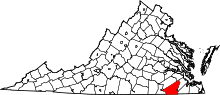 | |
| CDPs | ||
| Unincorporated communities | ||