Clinchco, Virginia
| Clinchco, Virginia | |
|---|---|
| Town | |
 Location of Clinchco, Virginia | |
| Coordinates: 37°9′45″N 82°21′36″W / 37.16250°N 82.36000°WCoordinates: 37°9′45″N 82°21′36″W / 37.16250°N 82.36000°W | |
| Country | United States |
| State | Virginia |
| County | Dickenson |
| Area | |
| • Total | 2.84 sq mi (7.35 km2) |
| • Land | 2.80 sq mi (7.26 km2) |
| • Water | 0.03 sq mi (0.08 km2) |
| Elevation | 1,398 ft (426 m) |
| Population (2010) | |
| • Total | 337 |
| • Density | 120/sq mi (46.4/km2) |
| Time zone | Eastern (EST) (UTC-5) |
| • Summer (DST) | EDT (UTC-4) |
| ZIP code | 24226 |
| Area code(s) | 276 |
| FIPS code | 51-17504[1] |
| GNIS feature ID | 1502782[2] |
Clinchco is a town in Dickenson County, Virginia, United States. The town, formerly known as Moss, was named for the Clinchfield Railroad,[3] although according to another source the town's name is a contraction of the Clinchfield Coal Co.[4] The population was 337 at the 2010 census,[5] down from 424 at the 2000 census. The Clinchco post office was established in 1917.[6]
Geography
Clinchco is located in north-central Dickenson County at 37°9′45″N 82°21′36″W / 37.16250°N 82.36000°W (37.162466, -82.359951),[7] in the valley of the McClure River, a northeast-flowing tributary of the Russell Fork, part of the Levisa Fork/Big Sandy River system leading north to the Ohio River. Virginia State Routes 63 and 83 run through the center of town. VA 83 leads northeast (downriver) 7 miles (11 km) to Haysi, while VA 63 follows a ridge route that takes 10 miles (16 km) to reach Haysi. The two highways run south (upriver) together 5 miles (8 km) to Fremont. St. Paul is 29 miles (47 km) south of Clinchco via VA 63, and Pound is 20 miles (32 km) west via VA 83.
According to the United States Census Bureau, Clinchco has a total area of 2.84 square miles (7.35 km2), of which 2.80 square miles (7.26 km2) is land and 0.03 square miles (0.08 km2), or 1.15%, is water.[5]
Demographics
| Historical population | |||
|---|---|---|---|
| Census | Pop. | %± | |
| 2000 | 424 | — | |
| 2010 | 337 | −20.5% | |
| Est. 2015 | 317 | [8] | −5.9% |
As of the census[1] of 2000, there were 424 people, 189 households, and 113 families residing in the town. The population density was 153.8 people per square mile (59.3/km²). There were 226 housing units at an average density of 82.0 per square mile (31.6/km²). The racial makeup of the town was 90.57% White, 8.96% African American, 0.24% from other races, and 0.24% from two or more races. Hispanic or Latino of any race were 1.42% of the population.
There were 189 households out of which 30.2% had children under the age of 18 living with them, 45.5% were married couples living together, 10.6% had a female householder with no husband present, and 39.7% were non-families. 37.0% of all households were made up of individuals and 18.0% had someone living alone who was 65 years of age or older. The average household size was 2.24 and the average family size was 3.00.
In the town the population was spread out with 23.6% under the age of 18, 7.1% from 18 to 24, 26.9% from 25 to 44, 25.7% from 45 to 64, and 16.7% who were 65 years of age or older. The median age was 39 years. For every 100 females there were 86.0 males. For every 100 females age 18 and over, there were 86.2 males.
The median income for a household in the town was $18,393, and the median income for a family was $23,750. Males had a median income of $30,313 versus $19,688 for females. The per capita income for the town was $12,257. About 26.0% of families and 30.1% of the population were below the poverty line, including 40.0% of those under age 18 and 23.6% of those age 65 or over.
Notable people
- Darrell "Shifty" Powers, World War II (D-day) veteran, Company E ("Easy Company") 506th Parachute Infantry Regiment, U.S. 101st Airborne Division (portrayed in the HBO miniseries "Band of Brothers"). Powers described his hometown thusly:
"Picture a bunch of mountains all grouped together with narrow, winding roads lacing through them. Clinchco's a little speck by the side of one of those roads, far in the southwest tip of the triangle of Virginia."[10]
Climate
The climate in this area is characterized by relatively high temperatures and evenly distributed precipitation throughout the year. The Köppen Climate System describes the weather as humid subtropical, and uses the abbreviation Cfa.[11]
References
- 1 2 "American FactFinder". United States Census Bureau. Archived from the original on 2013-09-11. Retrieved 2008-01-31.
- ↑ "US Board on Geographic Names". United States Geological Survey. 2007-10-25. Retrieved 2008-01-31.
- ↑ Temple, Robert D. Edge Effects: The Border-Name Places, (2nd edition, 2009), iUniverse, ISBN 978-0-595-47758-6, page 324.
- ↑ Tennis, Joe (2004). Southwest Virginia Crossroads: An Almanac of Place Names and Places to See. The Overmountain Press. p. 10. ISBN 978-1-57072-256-1.
- 1 2 "Geographic Identifiers: 2010 Demographic Profile Data (G001): Clinchco town, Virginia". American Factfinder. U.S. Census Bureau. Retrieved January 13, 2016.
- ↑ "Dickenson County". Jim Forte Postal History. Archived from the original on 4 March 2016. Retrieved 29 September 2014.
- ↑ "US Gazetteer files: 2010, 2000, and 1990". United States Census Bureau. 2011-02-12. Retrieved 2011-04-23.
- ↑ "Annual Estimates of the Resident Population for Incorporated Places: April 1, 2010 to July 1, 2015". Retrieved July 2, 2016.
- ↑ "Census of Population and Housing". Census.gov. Archived from the original on May 11, 2015. Retrieved June 4, 2015.
- ↑ Brotherton, Marcus (2011). Shifty's War: The Authorized Biography of Sergeant Darrell "Shifty" Powers, the Legendary Sharpshooter from the Band of Brothers. New York: Penguin. ISBN 9780425240977.
- ↑ Climate Summary for Clinchco, Virginia
Municipalities and communities of Dickenson County, Virginia, United States | ||
|---|---|---|
| Towns | 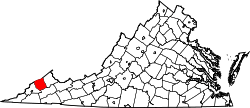 | |
| CDP | ||
| Unincorporated communities | ||
| Footnotes | ‡This populated place also has portions in an adjacent county or counties | |