Timberville, Virginia
| Timberville, Virginia | |
|---|---|
| Town | |
 Timberville, Virginia Location within the state of Virginia | |
| Coordinates: 38°38′3″N 78°46′35″W / 38.63417°N 78.77639°WCoordinates: 38°38′3″N 78°46′35″W / 38.63417°N 78.77639°W | |
| Country | United States |
| State | Virginia |
| County | Rockingham |
| Incorporated | 1884 |
| Area | |
| • Total | 0.9 sq mi (2.3 km2) |
| • Land | 0.9 sq mi (2.3 km2) |
| • Water | 0.0 sq mi (0.0 km2) |
| Elevation | 1,020 ft (311 m) |
| Population (2010) | |
| • Total | 2,522 |
| Time zone | Eastern (EST) (UTC-5) |
| • Summer (DST) | EDT (UTC-4) |
| ZIP code | 22853 |
| Area code(s) | 540 |
| FIPS code | 51-78736[1] |
| GNIS feature ID | 1500227[2] |
| Website |
www |
Timberville is a town in Rockingham County, Virginia, United States. The population was 2,522 at the 2010 census, which was a significant increase from the 1,739 reported in the 2000 census. It is part of the Harrisonburg Metropolitan Statistical Area.
Geography
Timberville is located at 38°38′3″N 78°46′35″W / 38.63417°N 78.77639°W (38.634273, -78.776422).[3]
According to the United States Census Bureau, the town has a total area of 0.9 square miles (2.3 km²), all of which is land.
Demographics
| Historical population | |||
|---|---|---|---|
| Census | Pop. | %± | |
| 1880 | 112 | — | |
| 1900 | 173 | — | |
| 1910 | 240 | 38.7% | |
| 1920 | 277 | 15.4% | |
| 1930 | 302 | 9.0% | |
| 1940 | 253 | −16.2% | |
| 1950 | 271 | 7.1% | |
| 1960 | 412 | 52.0% | |
| 1970 | 959 | 132.8% | |
| 1980 | 1,510 | 57.5% | |
| 1990 | 1,596 | 5.7% | |
| 2000 | 1,739 | 9.0% | |
| 2010 | 2,522 | 45.0% | |
| Est. 2015 | 2,603 | [4] | 3.2% |
As of the census[1] of 2000, 1,739 people, 735 households, and 465 families resided in the town. The population density was 1,968.1 per square mile (763.0/km²). There were 770 housing units at an average density of 871.5 per square mile (337.8/km²). The racial makeup of the town was 97.35% White, 0.17% African American, 0.12% Native American, 0.17% Asian, 1.21% from other races, and 0.98% from two or more races. Hispanic or Latino of any race were 4.31% of the population. 30% of Timberville's residents were German, 11% English, 8% Irish, 3% Mexican, and 2% Dutch.[6]
Of 735 households, 27.5% had children under the age of 18 living with them, 47.8% were married couples living together, 12.0% had a female householder with no husband present, and 36.7% were not families. About 32.4% of all households were made up of individuals and 17.6% had someone living alone who was 65 years of age or older. The average household size was 2.29 and the average family size was 2.89.
In the town, the population was distributed as 22.0% under the age of 18, 7.2% from 18 to 24, 27.9% from 25 to 44, 21.6% from 45 to 64, and 21.3% who were 65 years of age or older. The median age was 40 years. For every 100 females, there were 86.2 males. For every 100 females age 18 and over, there were 78.0 males.
The median income for a household in the town was $33,750, and the median income for a family was $41,417. Males had a median income of $27,230 versus $19,099 for females. The per capita income for the town was $16,450. About 7.2% of families and 10.9% of the population were below the poverty line, including 12.8% of those under age 18 and 17.7% of those age 65 or over.
References
- 1 2 "American FactFinder". United States Census Bureau. Retrieved 2008-01-31.
- ↑ "US Board on Geographic Names". United States Geological Survey. 2007-10-25. Retrieved 2008-01-31.
- ↑ "US Gazetteer files: 2010, 2000, and 1990". United States Census Bureau. 2011-02-12. Retrieved 2011-04-23.
- ↑ "Annual Estimates of the Resident Population for Incorporated Places: April 1, 2010 to July 1, 2015". Retrieved July 2, 2016.
- ↑ "Census of Population and Housing". Census.gov. Archived from the original on May 11, 2015. Retrieved June 4, 2015.
- ↑ "Timberville, VA, Ancestry & Family History". Epodunk.com. Retrieved 2015-04-20.
External links
- "Timberville Historic District Summary" (PDF). Virginia Department of Historic Resources. Retrieved December 21, 2013.
Municipalities and communities of Rockingham County, Virginia, United States | ||
|---|---|---|
| Towns | 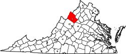 | |
| CDPs | ||
| Unincorporated communities |
| |
| Footnotes | ‡This populated place also has portions in an adjacent county or counties | |