Virgilina, Virginia
| Virgilina, Virginia | |
|---|---|
| Town | |
|
Street scene in Virgilina | |
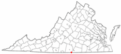 Location of Virgilina, Virginia | |
| Coordinates: 36°32′43″N 78°46′25″W / 36.54528°N 78.77361°WCoordinates: 36°32′43″N 78°46′25″W / 36.54528°N 78.77361°W | |
| Country | United States |
| State | Virginia |
| County | Halifax |
| Government | |
| • Mayor | Ralph Murray |
| • Chief of Police | Ralph Murray |
| Area | |
| • Total | 0.6 sq mi (1.6 km2) |
| • Land | 0.6 sq mi (1.6 km2) |
| • Water | 0.0 sq mi (0.0 km2) |
| Elevation | 551 ft (168 m) |
| Population (2000) | |
| • Total | 234 |
| • Density | 256.2/sq mi (98.9/km2) |
| Time zone | Eastern (EST) (UTC-5) |
| • Summer (DST) | EDT (UTC-4) |
| ZIP code | 24598 |
| Area code(s) | 434 |
| FIPS code | 51-81312[1] |
| GNIS feature ID | 1493858[2] |
.jpg)
Virgilina is a town in Halifax County, Virginia, United States. The population was 154 at the 2010 census. Virgilina was once a copper mining town. It is named Virgilina because it is located on the Virginia and North Carolina border. It is approximately 15 miles from Roxboro, North Carolina, which has a road, Virgilina Road, named in its honor.
Geography
Virgilina is located at 36°32′43″N 78°46′25″W / 36.54528°N 78.77361°W (36.545244, -78.773720).[3]
According to the United States Census Bureau, the town has a total area of 0.6 square miles (1.6 km²), all of it land.
Demographics
| Historical population | |||
|---|---|---|---|
| Census | Pop. | %± | |
| 1900 | 200 | — | |
| 1910 | 270 | 35.0% | |
| 1920 | 350 | 29.6% | |
| 1930 | 338 | −3.4% | |
| 1940 | 358 | 5.9% | |
| 1950 | 323 | −9.8% | |
| 1960 | 286 | −11.5% | |
| 1970 | 249 | −12.9% | |
| 1980 | 212 | −14.9% | |
| 1990 | 161 | −24.1% | |
| 2000 | 159 | −1.2% | |
| 2010 | 154 | −3.1% | |
| Est. 2015 | 143 | [4] | −7.1% |
As of the census[1] of 2000, there were 159 people, 76 households, and 43 families residing in the town. The population density was 256.2 people per square mile (99.0/km²). There were 86 housing units at an average density of 138.6 per square mile (53.6/km²). The racial makeup of the town was 97.08% White, 1.66% African American and 1.26% Native American.
There were 76 households out of which 15.8% had children under the age of 18 living with them, 42.1% were married couples living together, 10.5% had a female householder with no husband present, and 43.4% were non-families. 43.4% of all households were made up of individuals and 23.7% had someone living alone who was 65 years of age or older. The average household size was 2.09 and the average family size was 2.91.
In the town the population was spread out with 18.9% under the age of 18, 5.0% from 18 to 24, 25.8% from 25 to 44, 23.9% from 45 to 64, and 26.4% who were 65 years of age or older. The median age was 46 years. For every 100 females there were 82.8 males. For every 100 females age 18 and over, there were 81.7 males.
The median income for a household in the town was $33,333, and the median income for a family was $43,125. Males had a median income of $30,625 versus $28,125 for females. The per capita income for the town was $17,337. None of the families and 3.2% of the population were living below the poverty line, including no under eighteens and 11.4% of those over 64.
References
- 1 2 "American FactFinder". United States Census Bureau. Retrieved 2008-01-31.
- ↑ "US Board on Geographic Names". United States Geological Survey. 2007-10-25. Retrieved 2008-01-31.
- ↑ "US Gazetteer files: 2010, 2000, and 1990". United States Census Bureau. 2011-02-12. Retrieved 2011-04-23.
- ↑ "Annual Estimates of the Resident Population for Incorporated Places: April 1, 2010 to July 1, 2015". Retrieved July 2, 2016.
- ↑ "Census of Population and Housing". Census.gov. Retrieved June 4, 2015.
Municipalities and communities of Halifax County, Virginia, United States | ||
|---|---|---|
| Towns | 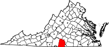 | |
| CDPs | ||
| Unincorporated communities | ||
| Footnotes | ‡This populated place also has portions in an adjacent county or counties | |