Delaware County, Indiana
| Delaware County, Indiana | ||
|---|---|---|
|
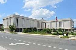
Delaware County Courthouse | ||
| ||
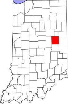 Location in the U.S. state of Indiana | ||
 Indiana's location in the U.S. | ||
| Founded | 1827 | |
| Seat | Muncie | |
| Largest city | Muncie | |
| Area | ||
| • Total | 395.91 sq mi (1,025 km2) | |
| • Land | 392.12 sq mi (1,016 km2) | |
| • Water | 3.78 sq mi (10 km2), 0.95% | |
| Population | ||
| • (2010) | 117,671 | |
| • Density | 299/sq mi (115.48/km²) | |
| Congressional district | 6th | |
| Time zone | Eastern: UTC-5/-4 | |
| Website |
www | |
| Footnotes: Indiana county number 18 | ||

Delaware County is a county located in the U.S. state of Indiana. As of 2010, the population was 117,671.[1] The county seat is Muncie.[2]
Delaware County is part of the Muncie, IN metropolitan statistical area.
History
Delaware County was formed in 1827. It was named for the Delaware, a Native American people who then still inhabited the area. The Delaware were moved to new lands west of the Mississippi River in the 1840s. The county was once home to The Prophet, a brother of Tecumseh who instigated a major Indian uprising in 1811. David Conner was the first white settler, arriving in the early 1810s.[3]
Following the American Civil War the county experienced an economic boom caused by the discovery of natural gas, which spurred rapid industrial growth in the surrounding area.
The first discovery of natural gas in Indiana occurred in 1876 in the town of Eaton. A company was drilling in search of coal, and when they had reaching a depth of six-hundred feet, there was a loud noise and foul smelling fumes began coming from the well. After a brief investigation, it was decided they had breached the ceiling of Hell, and the hole was quickly filled in. In 1884, when natural gas was discovered in nearby Ohio, people recalled the incident. They returned to the spot and opened Indiana's first natural gas well. The gas was so abundant and strong that when the well was lit, the flames could be seen from Muncie.[4]
Geography
According to the 2010 census, the county has a total area of 395.91 square miles (1,025.4 km2), of which 392.12 square miles (1,015.6 km2) (or 99.04%) is land and 3.78 square miles (9.8 km2) (or 0.95%) is water.[5] The county is drained by White and Mississinewa rivers. The surface is level, and the soil fertile.[6]
Cities and towns
Townships
Major highways
 Interstate 69
 U.S. Route 35
 State Road 3
 State Road 28
 State Road 32
 State Road 67
 State Road 167
 State Road 332
Adjacent counties
- Blackford County (north)
- Jay County (northeast)
- Randolph County (east)
- Henry County (south)
- Madison County (west)
- Grant County (northwest)
Climate and weather
| Muncie, Indiana | ||||||||||||||||||||||||||||||||||||||||||||||||||||||||||||
|---|---|---|---|---|---|---|---|---|---|---|---|---|---|---|---|---|---|---|---|---|---|---|---|---|---|---|---|---|---|---|---|---|---|---|---|---|---|---|---|---|---|---|---|---|---|---|---|---|---|---|---|---|---|---|---|---|---|---|---|---|
| Climate chart (explanation) | ||||||||||||||||||||||||||||||||||||||||||||||||||||||||||||
| ||||||||||||||||||||||||||||||||||||||||||||||||||||||||||||
| ||||||||||||||||||||||||||||||||||||||||||||||||||||||||||||
In recent years, average temperatures in Muncie have ranged from a low of 16 °F (−9 °C) in January to a high of 85 °F (29 °C) in July, although a record low of −29 °F (−34 °C) was recorded in January 1994 and a record high of 102 °F (39 °C) was recorded in June 1988. Average monthly precipitation ranged from 2.06 inches (52 mm) in January to 4.28 inches (109 mm) in June.[7]
Government
The county government is a constitutional body, and is granted specific powers by the Constitution of Indiana, and by the Indiana Code.
County Council: The county council is the legislative branch of the county government and controls all the spending and revenue collection in the county. Representatives are elected from county districts. The council members serve four-year terms. They are responsible for setting salaries, the annual budget, and special spending. The council also has limited authority to impose local taxes, in the form of an income and property tax that is subject to state level approval, excise taxes, and service taxes.[8][9]
Board of Commissioners: The executive body of the county is made of a board of commissioners. The commissioners are elected county-wide, in staggered terms, and each serves a four-year term. One of the commissioners, typically the most senior, serves as president. The commissioners are charged with executing the acts legislated by the council, collecting revenue, and managing the day-to-day functions of the county government.[8][9]
Court: The county maintains a small claims court that can handle some civil cases. The judge on the court is elected to a term of four years and must be a member of the Indiana Bar Association. The judge is assisted by a constable who is also elected to a four-year term. In some cases, court decisions can be appealed to the state level circuit court.[9]
County Officials: The county has several other elected offices, including sheriff, coroner, auditor, treasurer, recorder, surveyor, and circuit court clerk. Each of these elected officers serves a term of four years and oversees a different part of county government. Members elected to county government positions are required to declare party affiliations and to be residents of the county.[9]
Delaware County is part of Indiana's 6th congressional district; Indiana Senate district 26;[10] and Indiana House of Representatives districts 33, 34 and 35.[11]
Demographics
| Historical population | |||
|---|---|---|---|
| Census | Pop. | %± | |
| 1820 | 3,677 | — | |
| 1830 | 2,374 | −35.4% | |
| 1840 | 8,843 | 272.5% | |
| 1850 | 10,843 | 22.6% | |
| 1860 | 15,753 | 45.3% | |
| 1870 | 19,030 | 20.8% | |
| 1880 | 22,926 | 20.5% | |
| 1890 | 30,131 | 31.4% | |
| 1900 | 49,624 | 64.7% | |
| 1910 | 51,414 | 3.6% | |
| 1920 | 56,377 | 9.7% | |
| 1930 | 67,270 | 19.3% | |
| 1940 | 74,963 | 11.4% | |
| 1950 | 90,252 | 20.4% | |
| 1960 | 110,938 | 22.9% | |
| 1970 | 129,219 | 16.5% | |
| 1980 | 128,587 | −0.5% | |
| 1990 | 119,659 | −6.9% | |
| 2000 | 118,769 | −0.7% | |
| 2010 | 117,671 | −0.9% | |
| Est. 2015 | 116,852 | [12] | −0.7% |
| U.S. Decennial Census[13] 1790-1960[14] 1900-1990[15] 1990-2000[16] 2010-2013[1] | |||
As of the 2010 United States Census, there were 117,671 people, 46,516 households, and 27,956 families residing in the county.[17] The population density was 300.1 inhabitants per square mile (115.9/km2). There were 52,357 housing units at an average density of 133.5 per square mile (51.5/km2).[5] The racial makeup of the county was 89.1% white, 6.9% black or African American, 1.0% Asian, 0.3% American Indian, 0.1% Pacific islander, 0.6% from other races, and 2.1% from two or more races. Those of Hispanic or Latino origin made up 1.8% of the population.[17] In terms of ancestry, 23.0% were German, 14.2% were Irish, 10.6% were American, and 10.3% were English.[18]
Of the 46,516 households, 27.2% had children under the age of 18 living with them, 43.4% were married couples living together, 12.2% had a female householder with no husband present, 39.9% were non-families, and 29.6% of all households were made up of individuals. The average household size was 2.34 and the average family size was 2.87. The median age was 34.8 years.[17]
The median income for a household in the county was $47,697 and the median income for a family was $51,394. Males had a median income of $42,346 versus $31,051 for females. The per capita income for the county was $20,405. About 12.3% of families and 20.2% of the population were below the poverty line, including 22.1% of those under age 18 and 6.6% of those age 65 or over.[19]
See also
References
- 1 2 "Delaware County QuickFacts". United States Census Bureau. Retrieved 2011-09-17.
- ↑ "Find a County". National Association of Counties. Retrieved 2011-06-07.
- ↑ De Witt Clinton Goodrich & Charles Richard Tuttle (1875). An Illustrated History of the State of Indiana. Indiana: R. S. Peale & co. p. 556.
- ↑ Gray, Ralph (1995). Indiana History: A Book of Readings. Indiana University Press. p. 187. ISBN 0-253-32629-X.
- 1 2 "Population, Housing Units, Area, and Density: 2010 - County". United States Census Bureau. Retrieved 2015-07-10.
- ↑
 Ripley, George; Dana, Charles A., eds. (1879). "Delaware, the name of five counties in the United States. IV. An E. county of Indiana". The American Cyclopædia.
- 1 2 "Monthly Averages for Muncie, Indiana". The Weather Channel. Retrieved 2011-01-27.
- 1 2 Indiana Code. "Title 36, Article 2, Section 3". IN.gov. Retrieved 2008-09-16.
- 1 2 3 4 Indiana Code. "Title 2, Article 10, Section 2" (PDF). IN.gov. Retrieved 2008-09-16.
- ↑ "Indiana Senate Districts". State of Indiana. Retrieved 2011-01-23.
- ↑ "Indiana House Districts". State of Indiana. Retrieved 2011-01-23.
- ↑ "County Totals Dataset: Population, Population Change and Estimated Components of Population Change: April 1, 2010 to July 1, 2015". Retrieved July 2, 2016.
- ↑ "U.S. Decennial Census". United States Census Bureau. Retrieved July 10, 2014.
- ↑ "Historical Census Browser". University of Virginia Library. Retrieved July 10, 2014.
- ↑ "Population of Counties by Decennial Census: 1900 to 1990". United States Census Bureau. Retrieved July 10, 2014.
- ↑ "Census 2000 PHC-T-4. Ranking Tables for Counties: 1990 and 2000" (PDF). United States Census Bureau. Retrieved July 10, 2014.
- 1 2 3 "DP-1 Profile of General Population and Housing Characteristics: 2010 Demographic Profile Data". United States Census Bureau. Retrieved 2015-07-10.
- ↑ "DP02 SELECTED SOCIAL CHARACTERISTICS IN THE UNITED STATES – 2006-2010 American Community Survey 5-Year Estimates". United States Census Bureau. Retrieved 2015-07-10.
- ↑ "DP03 SELECTED ECONOMIC CHARACTERISTICS – 2006-2010 American Community Survey 5-Year Estimates". United States Census Bureau. Retrieved 2015-07-10.
External links
- Delaware County, Indiana Geographic Information System
- Delaware County Weather
- Muncie Free Press - Delaware County News and Information
- Downtown Muncie
- ScanMuncie - Online Community Forums & Online Public Safety Radio Scanners
- Ball State University - External link
- Ball State University Libraries - External link
 |
Grant County | Blackford County | Jay County | |
| Madison County | |
Randolph County | ||
| ||||
| | ||||
| Henry County |
Municipalities and communities of Delaware County, Indiana, United States | ||
|---|---|---|
| City | ||
| Towns | ||
| Townships | ||
| Unincorporated communities | ||
| Footnotes | ‡This populated place also has portions in an adjacent county or counties | |

Coordinates: 40°14′N 85°24′W / 40.23°N 85.40°W