National Register of Historic Places listings in Allen County, Ohio
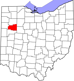
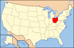
Location of Allen County in Ohio
This is a list of the National Register of Historic Places listings in Allen County, Ohio.
This is intended to be a complete list of the properties and districts on the National Register of Historic Places in Allen County, Ohio, United States. The locations of National Register properties and districts for which the latitude and longitude coordinates are included below, may be seen in a Google map.[1]
There are 30 properties and districts listed on the National Register in the county, including 1 National Historic Landmark. Another 2 properties were once listed but have been removed.
- This National Park Service list is complete through NPS recent listings posted December 2, 2016.[2]
Current listings
| [3] | Name on the Register[4] | Image | Date listed[5] | Location | City or town | Description |
|---|---|---|---|---|---|---|
| 1 | Adgate Block | 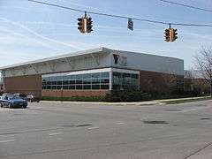 |
(#82001347) |
300-306 S. Main St. 40°44′13″N 84°06′20″W / 40.736944°N 84.105556°W |
Lima | A business block, now demolished and replaced with a YMCA |
| 2 | Allen County Courthouse | 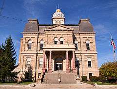 |
(#74001392) |
Courthouse Sq. 40°44′34″N 84°06′20″W / 40.742778°N 84.105556°W |
Lima | Large Second Empire-style courthouse |
| 3 | Armory-Latisona Building | 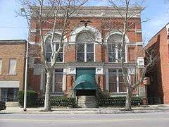 |
(#82001348) |
440 S. Main St. 40°44′06″N 84°06′19″W / 40.735°N 84.105278°W |
Lima | An armory, converted for civilian purposes |
| 4 | Barr Hotel | 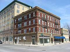 |
(#86001053) |
201-209 E. High and 200-218 N. Union Sts. 40°44′16″N 84°06′11″W / 40.737778°N 84.103056°W |
Lima | A two-part building from Lima's golden years |
| 5 | Griffith Breese Farm | 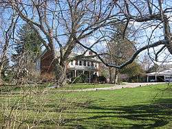 |
(#83001942) |
2875 Fort Amanda Rd., southwest of Lima 40°42′18″N 84°09′20″W / 40.704889°N 84.155556°W |
Shawnee Township | An old farmstead, home to one of the area's first settlers |
| 6 | Beck and R.C. Cahill Buildings |  |
(#82001349) |
200-206 S. Main St. 40°44′19″N 84°06′19″W / 40.738611°N 84.105278°W |
Lima | A business block, now demolished and replaced with a parking lot |
| 7 | Dorsey Building |  |
(#82001350) |
208 S. Main St. 40°44′16″N 84°06′20″W / 40.737778°N 84.105556°W |
Lima | An elaborate stone building, now demolished and replaced with a parking lot. |
| 8 | Elks Lodge | 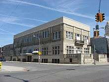 |
(#82001865) |
138 W. North St. 40°44′35″N 84°06′23″W / 40.743056°N 84.106389°W |
Lima | Built for an Elks lodge; now a church |
| 9 | First National Bank and Trust Building | 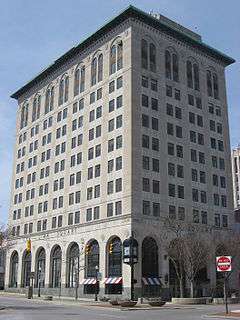 |
(#82001351) |
43-53 Public Sq. 40°44′24″N 84°06′20″W / 40.74°N 84.105556°W |
Lima | One of the tallest downtown buildings, constructed shortly before the end of Lima's golden age |
| 10 | Hotel Argonne | 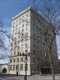 |
(#82001352) |
201 N. Elizabeth St. 40°44′29″N 84°06′25″W / 40.741389°N 84.106944°W |
Lima | A ten-story DeCurtins design named for the Meuse-Argonne Offensive |
| 11 | Klaus Block | 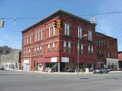 |
(#82001864) |
401-405 N. Main St. 40°44′39″N 84°06′19″W / 40.744167°N 84.105278°W |
Lima | A commercial block; home to the same business since 1870 |
| 12 | Lima Cleaning and Pressing Company | 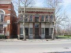 |
(#82001353) |
436-438 S. Main St. 40°44′07″N 84°06′19″W / 40.735278°N 84.105278°W |
Lima | A former laundry building; one of the few historic properties in a decaying neighborhood |
| 13 | Lima Memorial Hall | 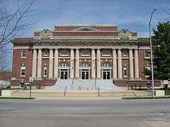 |
(#79001779) |
W. Elm and S. Elizabeth Sts. 40°44′15″N 84°06′23″W / 40.7375°N 84.106389°W |
Lima | Community center and performance hall |
| 14 | Lima Pennsylvania Railroad Passenger Depot | 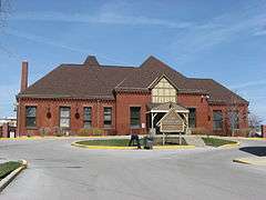 |
(#03000805) |
424 N. Central Ave. 40°44′42″N 84°06′07″W / 40.745°N 84.101944°W |
Lima | A Pennsylvania Railroad station, now used by the city government |
| 15 | Lima Stadium | 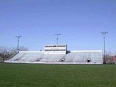 |
(#02000219) |
100 S. Calument Ave. and E. Market St. 40°44′23″N 84°05′32″W / 40.739722°N 84.092222°W |
Lima | Football stadium for Lima Senior High School |
| 16 | Linneman Building | 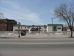 |
(#82001867) |
210-212 S. Main St. 40°44′15″N 84°06′20″W / 40.7375°N 84.105556°W |
Lima | A business block, now demolished and replaced with a parking lot |
| 17 | MacDonell House | 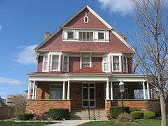 |
(#78001999) |
632 W. Market St. 40°44′25″N 84°06′58″W / 40.740278°N 84.116111°W |
Lima | Home to the Allen County Museum |
| 18 | Marks-Family House | 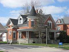 |
(#82003537) |
233 N. Franklin St. 40°50′39″N 84°20′14″W / 40.844167°N 84.337222°W |
Delphos | A well-preserved Queen Anne residence |
| 19 | Martin Block and Kibby Block | 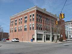 |
(#82001868) |
140-146 S. Main St. 40°44′19″N 84°06′19″W / 40.738611°N 84.105278°W |
Lima | A pair of Gothic Revival commercial buildings |
| 20 | Metropolitan Block |  |
(#79001780) |
300 N. Main St. 40°44′34″N 84°06′16″W / 40.742778°N 84.104444°W |
Lima | A turreted Romanesque Revival commercial building |
| 21 | Miami and Erie Canal Deep Cut | 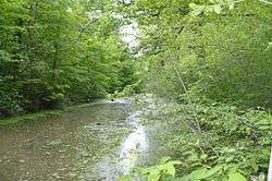 |
(#66000603) |
2 mi (3.2 km) south of Spencerville on State Route 66 40°41′06″N 84°21′57″W / 40.68497°N 84.36575°W |
Spencer Township | A portion of the Miami and Erie Canal; workers dug fifty feet into a hillside instead of building locks over it. Extends into Salem Township in Auglaize County |
| 22 | Neal Clothing | 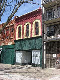 |
(#82001870) |
74 Public Sq. 40°44′26″N 84°06′17″W / 40.740556°N 84.104722°W |
Lima | The oldest building on Public Square |
| 23 | Neely-Sieber House | 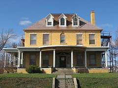 |
(#76001360) |
620 W. Spring St. 40°44′19″N 84°06′52″W / 40.738611°N 84.114444°W |
Lima | Built for an oil baron and longtime home of a local businessman |
| 24 | Ohio Theatre | 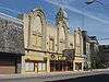 |
(#82001866) |
122 W. North St. 40°44′34″N 84°06′22″W / 40.742778°N 84.106111°W |
Lima | 1920s Movie palace in the Churrigueresque style |
| 25 | Renz Block | 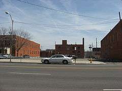 |
(#82001354) |
320 N. Main St. 40°44′36″N 84°06′18″W / 40.743333°N 84.105°W |
Lima | A business block, now demolished and replaced with a parking lot |
| 26 | Round Barn | 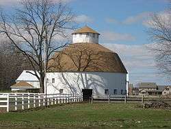 |
(#80002934) |
Along East Rd., south of Elida[6] 40°46′26″N 84°11′25″W / 40.773889°N 84.190278°W |
American Township | |
| 27 | St. John Catholic Church |  |
(#80002933) |
110 N. Franklin St. 40°50′35″N 84°20′10″W / 40.843056°N 84.336111°W |
Delphos | Large Romanesque Revival church built for a wealthy, largely German parish |
| 28 | U.S. Post Office | 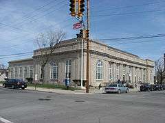 |
(#82001356) |
326 W. High St. 40°44′29″N 84°06′32″W / 40.741389°N 84.108889°W |
Lima | Neoclassical post office constructed at the beginning of the Great Depression |
| 29 | Union Block | 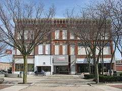 |
(#82001355) |
28-38 Public Sq. 40°44′23″N 84°06′17″W / 40.739722°N 84.104722°W |
Lima | Prominent commercial block on Public Square |
| 30 | West Market Street Boulevard Historic District |  |
(#04001201) |
1410-1529 W. Market St. 40°44′24″N 84°08′04″W / 40.740000°N 84.134417°W |
Lima |
Former listings
| [3] | Name on the Register | Image | Date listed | Date removed | Location | City or town | Summary |
|---|---|---|---|---|---|---|---|
| 1 | Round Barn | Upload image | (#80002932) | Off U.S. Route 30, east of Delphos |
Delphos | ||
| 2 | Wheeler Building |  |
(#82001869) | 131-135 W. Market Street 40°44′23″N 84°06′23″W / 40.739800°N 84.106300°W |
Lima |
See also
| Wikimedia Commons has media related to National Register of Historic Places in Allen County, Ohio. |
References
- ↑ The latitude and longitude information provided in this table was derived originally from the National Register Information System, which has been found to be fairly accurate for about 99% of listings. For about 1% of NRIS original coordinates, experience has shown that one or both coordinates are typos or otherwise extremely far off; some corrections may have been made. A more subtle problem causes many locations to be off by up to 150 yards, depending on location in the country: most NRIS coordinates were derived from tracing out latitude and longitudes off of USGS topographical quadrant maps created under the North American Datum of 1927, which differs from the current, highly accurate WGS84 GPS system used by most on-line maps. Chicago is about right, but NRIS longitudes in Washington are higher by about 4.5 seconds, and are lower by about 2.0 seconds in Maine. Latitudes differ by about 1.0 second in Florida. Some locations in this table may have been corrected to current GPS standards.
- ↑ "National Register of Historic Places: Weekly List Actions". National Park Service, United States Department of the Interior. Retrieved on December 2, 2016.
- 1 2 Numbers represent an ordering by significant words. Various colorings, defined here, differentiate National Historic Landmarks and historic districts from other NRHP buildings, structures, sites or objects.
- ↑ National Park Service (2008-04-24). "National Register Information System". National Register of Historic Places. National Park Service.
- ↑ The eight-digit number below each date is the number assigned to each location in the National Register Information System database, which can be viewed by clicking the number.
- ↑ Location derived from its Multiple Property Submission; the NRIS lists its specific location as "Address Restricted"

Municipalities and communities of Allen County, Ohio, United States | ||
|---|---|---|
| Cities | | |
| Villages | ||
| Townships | ||
| Unincorporated communities | ||
| Footnotes | ‡This populated place also has portions in an adjacent county or counties | |
This article is issued from Wikipedia - version of the 4/6/2016. The text is available under the Creative Commons Attribution/Share Alike but additional terms may apply for the media files.