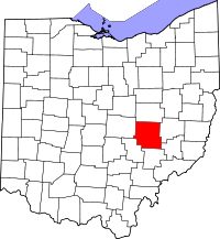
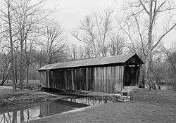
| [3] |
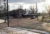
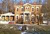
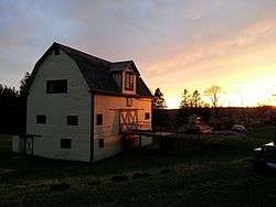
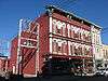
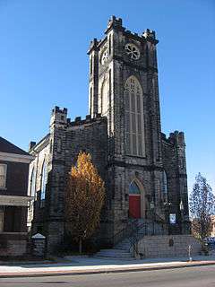
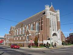
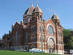
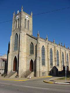
Name on the Register[4] |
Image |
Date listed[5] |
Location |
City or town |
Description |
|---|
| 1 |
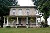
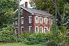
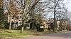
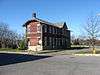
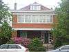
Adams-Gray House |
|
000000001979-12-05-0000December 5, 1979
(#79001797) |
Southeast of Trinway on Tobacco Hill Rd.
40°09′31″N 81°56′54″W / 40.158611°N 81.948333°W / 40.158611; -81.948333 (Adams-Gray House) |
Cass Township |
Extends into Virginia Township in Coshocton County
|
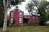
| 2 |
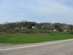
George W. Adams House |
Upload image |
000000001979-11-29-0000November 29, 1979
(#79001912) |
South of Trinway on Bottom Rd.
40°07′54″N 82°00′57″W / 40.131667°N 82.015833°W / 40.131667; -82.015833 (George W. Adams House) |
Cass Township |
Probably demolished. Last satellite photo in which it was present is May 2012
|
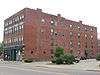
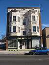
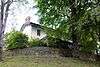
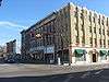
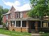
| 3 |
Adena Court Apartments |
|
000000001980-09-27-0000September 27, 1980
(#80003190) |
41 S. 4th St.
39°56′22″N 82°00′29″W / 39.939444°N 82.008056°W / 39.939444; -82.008056 (Adena Court Apartments) |
Zanesville |
|
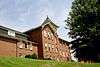
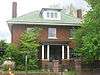
| 4 |
Alameda Apartments |
|
000000001982-06-17-0000June 17, 1982
(#82003623) |
7th St.
39°56′40″N 82°00′15″W / 39.944444°N 82.004167°W / 39.944444; -82.004167 (Alameda Apartments) |
Zanesville |
|
| 5 |
Arlington Hotel |
|
000000001982-12-16-0000December 16, 1982
(#82001482) |
722 Main St.
39°56′24″N 82°00′14″W / 39.94°N 82.003889°W / 39.94; -82.003889 (Arlington Hotel) |
Zanesville |
Destroyed
|
| 6 |
Baughman Memorial Park |
Upload image |
000000001979-08-27-0000August 27, 1979
(#79001909) |
West of Frazeysburg on State Route 586
40°06′41″N 82°10′37″W / 40.111389°N 82.176944°W / 40.111389; -82.176944 (Baughman Memorial Park) |
Jackson Township |
The park, home to sandstone statues sculpted by local artist Brice Baughman, was sold in February 2008 and resold six months later, at that time twelve of the statues were individually sold.[6]
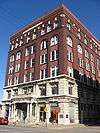
|
| 7 |
Belt Line and New York Central Freight House |
|
000000001983-03-24-0000March 24, 1983
(#83002015) |
3rd and Market Sts.
39°56′32″N 82°00′33″W / 39.942153°N 82.009097°W / 39.942153; -82.009097 (Belt Line and New York Central Freight House) |
Zanesville |
|
| 8 |
Black-Elliott Block |
|
000000001979-05-08-0000May 8, 1979
(#79001914) |
525 Main St.
39°56′25″N 82°00′21″W / 39.940278°N 82.005833°W / 39.940278; -82.005833 (Black-Elliott Block) |
Zanesville |
|
| 9 |
Blocksom-Rolls House |
|
000000001979-02-21-0000February 21, 1979
(#79001915) |
960 Eastman St.
39°56′34″N 81°59′59″W / 39.942778°N 81.999722°W / 39.942778; -81.999722 (Blocksom-Rolls House) |
Zanesville |
|
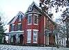
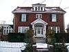
| 10 |
Charles Brendel House |
|
000000001980-11-25-0000November 25, 1980
(#80003191) |
427 Wayne Ave.
39°56′02″N 82°00′10″W / 39.933889°N 82.002778°W / 39.933889; -82.002778 (Charles Brendel House) |
Zanesville |
|
| 11 |
Brighton-Dryden Historic District |
|
000000001982-06-01-0000June 1, 1982
(#82003624) |
Dryden Rd., Brighton Boulevard, and Lexington and Stanberry Aves.
39°55′47″N 82°01′21″W / 39.929722°N 82.0225°W / 39.929722; -82.0225 (Brighton-Dryden Historic District) |
Zanesville |
|
| 12 |
Buckingham-Petty House |
Upload image |
000000001980-08-11-0000August 11, 1980
(#80003182) |
Mound Rd.
39°52′51″N 81°54′49″W / 39.880833°N 81.913611°W / 39.880833; -81.913611 (Buckingham-Petty House) |
Wayne Township |
|
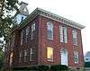
| 13 |
Nicholas Christman House |
|
000000001978-05-22-0000May 22, 1978
(#78002159) |
532 Wayne Ave.
39°55′51″N 82°00′05″W / 39.930833°N 82.001389°W / 39.930833; -82.001389 (Nicholas Christman House) |
Zanesville |
|
| 14 |
Howard Chandler Christy Art Studio |
|
000000002011-06-15-0000June 15, 2011
(#11000368) |
6020 S. River Rd., north of Blue Rock
39°51′22″N 81°53′52″W / 39.856111°N 81.897778°W / 39.856111; -81.897778 (Howard Chandler Christy Art Studio) |
Wayne Township |
1908-1909 estate of Howard Chandler Christy; also known as The Barracks[7]
|
| 15 |
Clossman Hardware Store |
|
000000001980-11-25-0000November 25, 1980
(#80003192) |
621-623 Main St.
39°56′24″N 82°00′18″W / 39.94°N 82.005°W / 39.94; -82.005 (Clossman Hardware Store) |
Zanesville |
|
| 16 |
Crescent Hill |
|
000000001986-01-09-0000January 9, 1986
(#86000034) |
44 W. 5th St.
40°07′23″N 82°00′57″W / 40.122972°N 82.015833°W / 40.122972; -82.015833 (Crescent Hill) |
Dresden |
|
| 17 |
William Denison House |
|
000000001982-04-29-0000April 29, 1982
(#82003620) |
7115 Adamsville Rd. (State Route 93), south of Adamsville
40°03′08″N 81°53′35″W / 40.052222°N 81.893056°W / 40.052222; -81.893056 (William Denison House) |
Salem Township |
|
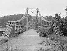
| 18 |
Dresden Suspension Bridge |
|
000000001978-12-01-0000December 1, 1978
(#78002153) |
State Routes 208 and 666
40°07′14″N 82°00′01″W / 40.120556°N 82.000278°W / 40.120556; -82.000278 (Dresden Suspension Bridge) |
Dresden and Madison Township |
|
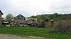
| 19 |
Factory Site |
|
000000001980-03-11-0000March 11, 1980
(#80003183) |
Along Moxahala Creek in Ironspot
39°49′13″N 82°03′51″W / 39.820278°N 82.064167°W / 39.820278; -82.064167 (Factory Site) |
Newton Township |
|
| 20 |
Fairmont Avenue Historic District |
|
000000001982-11-30-0000November 30, 1982
(#82001483) |
Fairmont Ave.
39°57′31″N 82°00′47″W / 39.958611°N 82.013056°W / 39.958611; -82.013056 (Fairmont Avenue Historic District) |
Zanesville |
|
| 21 |
Five Mile House |
Upload image |
000000001977-04-11-0000April 11, 1977
(#77001081) |
South of Zanesville off U.S. Route 22
39°52′55″N 82°03′32″W / 39.881944°N 82.058889°W / 39.881944; -82.058889 (Five Mile House) |
Newton Township |
|
| 22 |
James Galigher House |
|
000000001979-02-22-0000February 22, 1979
(#79001916) |
South of Zanesville on S. River Rd.
39°53′55″N 81°59′56″W / 39.898636°N 81.998970°W / 39.898636; -81.998970 (James Galigher House) |
Wayne Township |
|
| 23 |
Ernest J. Gorsuch House |
|
000000001980-03-11-0000March 11, 1980
(#80003193) |
1869 Norwood Boulevard
39°57′47″N 82°00′19″W / 39.963056°N 82.005278°W / 39.963056; -82.005278 (Ernest J. Gorsuch House) |
Zanesville |
|
| 24 |
Ralph Hardesty Stone House |
|
000000001980-03-11-0000March 11, 1980
(#80003184) |
Main St.
39°59′08″N 81°47′24″W / 39.985556°N 81.79°W / 39.985556; -81.79 (Ralph Hardesty Stone House) |
Norwich |
|
| 25 |
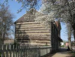
William Rainey Harper Log House |
|
000000001978-04-06-0000April 6, 1978
(#78002154) |
E. Main St.
39°59′38″N 81°44′05″W / 39.993889°N 81.734722°W / 39.993889; -81.734722 (William Rainey Harper Log House) |
New Concord |
|
| 26 |
Harper-Cosgrave Block |
|
000000001980-01-03-0000January 3, 1980
(#80003195) |
62 N. 3rd St.[8]
39°56′30″N 82°00′32″W / 39.9417°N 82.0089°W / 39.9417; -82.0089 (Harper-Cosgrave Block) |
Zanesville |
|
| 27 |
William B. Harris House |
|
000000001978-05-22-0000May 22, 1978
(#78002161) |
1320 Newman Dr.
39°56′24″N 81°59′28″W / 39.94°N 81.991111°W / 39.94; -81.991111 (William B. Harris House) |
Zanesville |
|
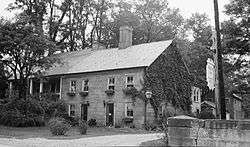
| 28 |
Headley Inn, Smith House and Farm |
|
000000001978-04-26-0000April 26, 1978
(#78002162) |
5255 West Pike
39°57′14″N 82°05′39″W / 39.953889°N 82.094167°W / 39.953889; -82.094167 (Headley Inn, Smith House and Farm) |
Falls Township |
|
| 29 |
James Hunter Stone House |
Upload image |
000000001980-01-03-0000January 3, 1980
(#80003181) |
East of Adamsville on Mercer Rd.
40°05′35″N 81°48′15″W / 40.093183°N 81.804199°W / 40.093183; -81.804199 (James Hunter Stone House) |
Monroe Township |
|
| 30 |
Johnston-Crossland House |
|
000000001982-03-15-0000March 15, 1982
(#82003625) |
N. 7th St.
39°56′36″N 82°00′15″W / 39.943333°N 82.004167°W / 39.943333; -82.004167 (Johnston-Crossland House) |
Zanesville |
Destroyed
|
| 31 |
George and Edward Kearns Houses |
|
000000001979-02-02-0000February 2, 1979
(#79001917) |
306 and 320 Luck Ave.
39°56′07″N 82°01′05″W / 39.935278°N 82.018056°W / 39.935278; -82.018056 (George and Edward Kearns Houses) |
Zanesville |
The Kearns-Hale House at 320 Luck Ave was destroyed between August & September 2009, The Kearns-Seabach House at 306 Luck Ave still stands.
|
| 32 |
Lafayette Lodge No. 79 |
|
000000001978-09-13-0000September 13, 1978
(#78002163) |
333 Market St.
39°56′32″N 82°00′28″W / 39.942222°N 82.007778°W / 39.942222; -82.007778 (Lafayette Lodge No. 79) |
Zanesville |
|
| 33 |
William D. Lash House |
|
000000001978-02-17-0000February 17, 1978
(#78002164) |
2261 Dresden Rd.
39°57′56″N 82°00′23″W / 39.965556°N 82.006389°W / 39.965556; -82.006389 (William D. Lash House) |
Zanesville |
|
| 34 |
Lilienthal Building |
|
000000001980-07-21-0000July 21, 1980
(#80003196) |
44 S. 6th St.
39°56′20″N 82°00′20″W / 39.938889°N 82.005556°W / 39.938889; -82.005556 (Lilienthal Building) |
Zanesville |
|
| 35 |
Locust Site (33MU160) |
|
000000001985-08-01-0000August 1, 1985
(#85001696) |
On a terrace along the Licking River east of Nashport[9]
40°03′25″N 82°09′22″W / 40.0569°N 82.156°W / 40.0569; -82.156 (Locust Site (33MU160)) |
Licking Township |
|
| 36 |
Masonic Temple Building |
|
000000001990-05-25-0000May 25, 1990
(#90000756) |
36-42 N. 4th St.
39°56′27″N 82°00′25″W / 39.940833°N 82.006944°W / 39.940833; -82.006944 (Masonic Temple Building) |
Zanesville |
|
| 37 |
Harry S. McClelland House |
|
000000001980-09-27-0000September 27, 1980
(#80003197) |
908 Laurel Ave.
39°57′15″N 82°00′55″W / 39.954167°N 82.015278°W / 39.954167; -82.015278 (Harry S. McClelland House) |
Zanesville |
|
| 38 |
McCully Log House |
Upload image |
000000001982-03-15-0000March 15, 1982
(#82003622) |
North of New Concord on Wharton Lane
40°05′21″N 81°44′55″W / 40.089167°N 81.748611°W / 40.089167; -81.748611 (McCully Log House) |
Monroe Township |
|
| 39 |
McIntire Terrace Historic District |
|
000000001979-09-06-0000September 6, 1979
(#79001918) |
Roughly bounded by Peter Alley, McIntire, Moorehead, Findley, Blue, and Adair Aves.
39°57′03″N 82°00′47″W / 39.950833°N 82.013056°W / 39.950833; -82.013056 (McIntire Terrace Historic District) |
Zanesville |
|
| 40 |
Mound House |
|
000000001979-06-06-0000June 6, 1979
(#79001908) |
400 Mound Rd.
39°52′47″N 81°54′41″W / 39.879722°N 81.911389°W / 39.879722; -81.911389 (Mound House) |
Wayne Township |
|
| 41 |
Mount Zion Presbyterian Church |
Upload image |
000000001978-12-19-0000December 19, 1978
(#78002152) |
Southeast of Chandlersville off State Route 146
39°51′45″N 81°44′59″W / 39.8625°N 81.749722°W / 39.8625; -81.749722 (Mount Zion Presbyterian Church) |
Rich Hill Township |
|
| 42 |
Muskingum College Campus Historic District |
|
000000001979-06-11-0000June 11, 1979
(#79001910) |
U.S. Route 22
39°59′47″N 81°44′09″W / 39.996389°N 81.735833°W / 39.996389; -81.735833 (Muskingum College Campus Historic District) |
New Concord |
|
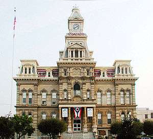
| 43 |
Muskingum County Courthouse and Jail |
|
000000001973-07-16-0000July 16, 1973
(#73001515) |
4th and Main Sts.
39°56′26″N 82°00′26″W / 39.940556°N 82.007222°W / 39.940556; -82.007222 (Muskingum County Courthouse and Jail) |
Zanesville |
|
| 44 |
Muskingum River Lock No. 10 and Canal |
|
000000001978-12-19-0000December 19, 1978
(#78002165) |
Northern bank of the Muskingum River, north of the railroad bridge south to the lock terminals
39°56′02″N 82°00′11″W / 39.933889°N 82.003194°W / 39.933889; -82.003194 (Muskingum River Lock No. 10 and Canal) |
Zanesville |
|
| 45 |
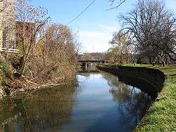
Muskingum River Navigation Historic District |
|
000000002007-02-09-0000February 9, 2007
(#07000025) |
Coshocton, Muskingum, Morgan, Washington Counties
40°09′27″N 81°56′41″W / 40.157500°N 81.944722°W / 40.157500; -81.944722 (Muskingum River Navigation Historic District) |
Numerous jurisdictions |
|
| 46 |
Nashport Mound |
Upload image |
000000001973-05-24-0000May 24, 1973
(#73001512) |
Along the Licking River below Nashport[10]
40°03′37″N 82°09′57″W / 40.0603°N 82.1659°W / 40.0603; -82.1659 (Nashport Mound) |
Licking Township |
|
| 47 |
Ohio Power Company |
|
000000001980-11-25-0000November 25, 1980
(#80003198) |
604 Main St.
39°56′24″N 82°00′18″W / 39.94°N 82.005°W / 39.94; -82.005 (Ohio Power Company) |
Zanesville |
|
| 48 |
Paul Hall, Muskingum College |
|
000000001973-04-23-0000April 23, 1973
(#73001514) |
Layton Dr., Muskingum College campus
39°59′43″N 81°44′04″W / 39.995278°N 81.734444°W / 39.995278; -81.734444 (Paul Hall, Muskingum College) |
New Concord |
|
| 49 |
Peairs Homestead |
Upload image |
000000001979-02-27-0000February 27, 1979
(#79001919) |
East of Zanesville on State Route 146
39°54′45″N 81°53′44″W / 39.912633°N 81.895540°W / 39.912633; -81.895540 (Peairs Homestead) |
Salt Creek Township |
|
| 50 |
Philo II Archeological District |
Upload image |
000000001978-11-29-0000November 29, 1978
(#78002156) |
Western bank of the Muskingum River below Philo[11]
39°48′17″N 81°54′18″W / 39.8047°N 81.905°W / 39.8047; -81.905 (Philo II Archeological District) |
Harrison Township |
|
| 51 |
Pittsburg, Cincinnati, and St. Louis Depot |
|
000000001983-03-24-0000March 24, 1983
(#83002016) |
Market St.
39°56′34″N 82°00′36″W / 39.942778°N 82.01°W / 39.942778; -82.01 (Pittsburg, Cincinnati, and St. Louis Depot) |
Zanesville |
|
| 52 |
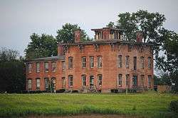
Prospect Place |
|
000000001979-05-10-0000May 10, 1979
(#79001913) |
South of Trinway on State Route 60
40°08′05″N 82°00′42″W / 40.134722°N 82.011667°W / 40.134722; -82.011667 (Prospect Place) |
Cass Township |
|
| 53 |
Putnam Historic District |
|
000000001975-06-30-0000June 30, 1975
(#75001511) |
Bounded by the former Penn Central Railroad tracks, Van Buren St., and the Muskingum River
39°55′55″N 82°00′26″W / 39.931944°N 82.007222°W / 39.931944; -82.007222 (Putnam Historic District) |
Zanesville |
|
| 54 |
C.W. Ransbottom House |
|
000000001980-03-11-0000March 11, 1980
(#80003185) |
291 Washington St.
39°48′35″N 82°04′16″W / 39.809861°N 82.071111°W / 39.809861; -82.071111 (C.W. Ransbottom House) |
Roseville |
|
| 55 |
Edward Ransbottom House |
|
000000001980-03-11-0000March 11, 1980
(#80003186) |
99 Main St.
39°48′22″N 82°04′22″W / 39.806000°N 82.072778°W / 39.806000; -82.072778 (Edward Ransbottom House) |
Roseville |
|
| 56 |
Frank M. Ransbottom House |
|
000000001980-03-11-0000March 11, 1980
(#80003187) |
289 Washington St.
39°48′35″N 82°04′16″W / 39.809722°N 82.071111°W / 39.809722; -82.071111 (Frank M. Ransbottom House) |
Roseville |
|
| 57 |
Mort Ransbottom House |
|
000000001980-03-11-0000March 11, 1980
(#80003188) |
152 N. Main St.
39°48′25″N 82°04′20″W / 39.807083°N 82.072222°W / 39.807083; -82.072222 (Mort Ransbottom House) |
Roseville |
|
| 58 |
Adam Rider House |
Upload image |
000000001979-11-29-0000November 29, 1979
(#79001911) |
9350 Athens Rd., south of Roseville
39°47′43″N 82°03′46″W / 39.795278°N 82.062778°W / 39.795278; -82.062778 (Adam Rider House) |
Clay Township |
|
| 59 |
Roseville High School |
|
000000001978-03-30-0000March 30, 1978
(#78002157) |
Stokeley and Perry Sts.
39°48′36″N 82°04′24″W / 39.810000°N 82.073333°W / 39.810000; -82.073333 (Roseville High School) |
Roseville |
|
| 60 |
"S" Bridge II |
|
000000001973-04-23-0000April 23, 1973
(#73001513) |
U.S. Route 40 west of New Concord
39°59′35″N 81°44′48″W / 39.993056°N 81.746667°W / 39.993056; -81.746667 ("S" Bridge II) |
Union Township |
|
| 61 |
St. James Episcopal Church |
|
000000001978-10-02-0000October 2, 1978
(#78002167) |
155 N. 6th St.
39°56′35″N 82°00′20″W / 39.943056°N 82.005556°W / 39.943056; -82.005556 (St. James Episcopal Church) |
Zanesville |
|
| 62 |
St. John's Evangelical Lutheran Church |
|
000000001980-01-03-0000January 3, 1980
(#80003189) |
South of Stovertown on State Route 555
39°49′59″N 81°59′17″W / 39.833056°N 81.988056°W / 39.833056; -81.988056 (St. John's Evangelical Lutheran Church) |
Brush Creek Township |
|
| 63 |
St. John's Lutheran Church |
|
000000001982-12-02-0000December 2, 1982
(#82001484) |
Market and N. 7th Sts.
39°56′31″N 82°00′15″W / 39.941944°N 82.004167°W / 39.941944; -82.004167 (St. John's Lutheran Church) |
Zanesville |
|
| 64 |
St. Nicholas's Catholic Church |
|
000000001975-09-25-0000September 25, 1975
(#75001512) |
925 Main St.
39°56′24″N 82°00′04″W / 39.94°N 82.001111°W / 39.94; -82.001111 (St. Nicholas's Catholic Church) |
Zanesville |
|
| 65 |
St. Thomas Aquinas Church |
|
000000001980-03-11-0000March 11, 1980
(#80003199) |
130 N. 5th St.
39°56′35″N 82°00′24″W / 39.943056°N 82.006667°W / 39.943056; -82.006667 (St. Thomas Aquinas Church) |
Zanesville |
|
| 66 |
Salt Creek Covered Bridge |
|
000000001974-09-10-0000September 10, 1974
(#74001587) |
3 mi (4.8 km) northwest of Norwich
39°59′55″N 81°50′24″W / 39.998611°N 81.84°W / 39.998611; -81.84 (Salt Creek Covered Bridge) |
Perry Township |
|
| 67 |
Frederick Augustus Seborn House |
|
000000001978-04-04-0000April 4, 1978
(#78002166) |
1115-1119 Maysville Pike
39°55′15″N 82°00′36″W / 39.920833°N 82.01°W / 39.920833; -82.01 (Frederick Augustus Seborn House) |
Zanesville |
|
| 68 |
William R. Smith House |
|
000000001982-06-01-0000June 1, 1982
(#82003627) |
920 Marietta St.
39°56′10″N 82°00′09″W / 39.936111°N 82.0025°W / 39.936111; -82.0025 (William R. Smith House) |
Zanesville |
Demolished
|
| 69 |
David Stormont House |
|
000000001983-04-21-0000April 21, 1983
(#83002017) |
103 W. Main St.
39°59′37″N 81°44′18″W / 39.993611°N 81.738333°W / 39.993611; -81.738333 (David Stormont House) |
New Concord |
|
| 70 |
Capt. James Boggs Tannehill House |
|
000000001979-08-27-0000August 27, 1979
(#79001921) |
367 Taylor St.
39°58′03″N 82°00′15″W / 39.9675°N 82.004167°W / 39.9675; -82.004167 (Capt. James Boggs Tannehill House) |
Zanesville |
|
| 71 |
William C. Tanner House |
Upload image |
000000001979-09-17-0000September 17, 1979
(#79001922) |
Northwest of Zanesville
39°59′49″N 82°05′53″W / 39.996944°N 82.098056°W / 39.996944; -82.098056 (William C. Tanner House) |
Falls Township |
|
| 72 |
Tavener-Sears Tavern |
Upload image |
000000001982-04-29-0000April 29, 1982
(#82003621) |
Main St. in Mount Sterling
39°57′24″N 82°09′02″W / 39.956667°N 82.150556°W / 39.956667; -82.150556 (Tavener-Sears Tavern) |
Hopewell Township |
|
| 73 |
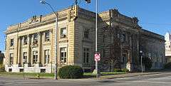
US Post Office and Federal Building-Zanesville |
|
000000001988-02-11-0000February 11, 1988
(#88000071) |
65 S. 5th St.
39°56′21″N 82°00′25″W / 39.939167°N 82.006944°W / 39.939167; -82.006944 (US Post Office and Federal Building-Zanesville) |
Zanesville |
Designed by architect George F. Hammond
|
| 74 |
West Union School |
|
000000001978-03-30-0000March 30, 1978
(#78002155) |
South of Norwich on County Road 200
39°56′56″N 81°47′59″W / 39.948889°N 81.799722°W / 39.948889; -81.799722 (West Union School) |
Union Township |
|
| 75 |
West View |
|
000000001982-03-05-0000March 5, 1982
(#82003628) |
444 Sunkel Boulevard
39°57′50″N 82°00′25″W / 39.963889°N 82.006944°W / 39.963889; -82.006944 (West View) |
Zanesville |
|
| 76 |
Perry Wiles Grocery Company |
|
000000001980-11-25-0000November 25, 1980
(#80003200) |
32-36 N. 3rd St.
39°56′27″N 82°00′32″W / 39.940833°N 82.008889°W / 39.940833; -82.008889 (Perry Wiles Grocery Company) |
Zanesville |
|
| 77 |
Y Bridge |
|
000000001973-11-02-0000November 2, 1973
(#73001516) |
At the foot of Main St., over the Licking and Muskingum rivers
39°56′25″N 82°00′48″W / 39.940278°N 82.013333°W / 39.940278; -82.013333 (Y Bridge) |
Zanesville |
|
| 78 |
Zanesville YMCA |
|
000000001985-10-29-0000October 29, 1985
(#83002018) |
34 S. 5th St.
39°56′20″N 82°00′24″W / 39.938889°N 82.006667°W / 39.938889; -82.006667 (Zanesville YMCA) |
Zanesville |
Destroyed
|
| 79 |
Zanesville YWCA |
|
000000001978-07-17-0000July 17, 1978
(#78002168) |
49 N. 6th St.
39°56′28″N 82°00′20″W / 39.941111°N 82.005556°W / 39.941111; -82.005556 (Zanesville YWCA) |
Zanesville |
|