| [3] |
Name on the Register[4] |
Image |
Date listed[5] |
Location |
City or town |
Description |
|---|
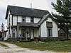
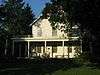
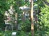
| 1 |
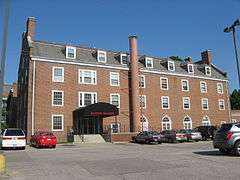
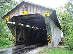
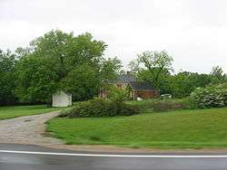
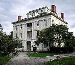
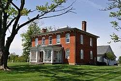
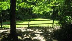
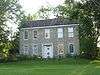
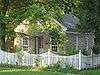
Austin Hall |
|
000000001985-03-18-0000March 18, 1985
(#85000631) |
Ohio Wesleyan University, W. Central Ave. and Elizabeth St.
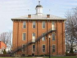
40°18′06″N 83°04′37″W / 40.301667°N 83.076944°W / 40.301667; -83.076944 (Austin Hall) |
Delaware |
|
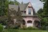
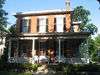
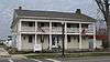
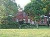
| 2 |
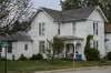
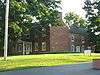
John Baker Tavern |
|
000000002006-09-06-0000September 6, 2006
(#06000766) |
4151 State Route 203, in Radnor
40°22′46″N 83°08′58″W / 40.379444°N 83.149444°W / 40.379444; -83.149444 (John Baker Tavern) |
Radnor Township |
|
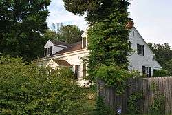
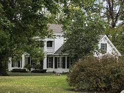
| 3 |
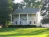
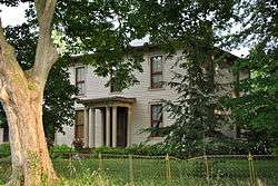
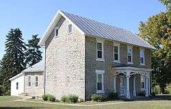
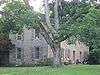
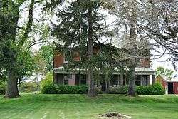
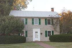
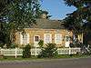
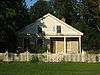
George Bieber House and Farm |
|
000000001991-10-03-0000October 3, 1991
(#91001426) |
2010 Stratford Rd., south of Delaware
40°15′56″N 83°03′53″W / 40.265556°N 83.064722°W / 40.265556; -83.064722 (George Bieber House and Farm) |
Delaware Township |
|
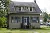
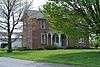
| 4 |
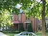
Building at 101 North Franklin Street |
|
000000001980-11-25-0000November 25, 1980
(#80002990) |
101 N. Franklin St.
40°24′38″N 82°57′18″W / 40.4105°N 82.955°W / 40.4105; -82.955 (Building at 101 North Franklin Street) |
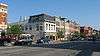
Ashley |
|
| 5 |
Building at 223 West High Street |
|
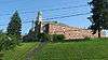
000000001980-11-25-0000November 25, 1980
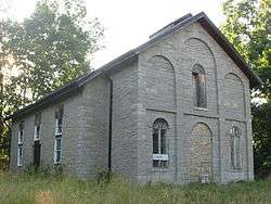
(#80002991) |
223 W. High St.
40°24′33″N 82°57′41″W / 40.409167°N 82.961389°W / 40.409167; -82.961389 (Building at 223 West High Street) |
Ashley |
|
| 6 |
Building at 500 East High Street |
|
000000001980-11-25-0000November 25, 1980
(#80002992) |
500 E. High St.
40°24′32″N 82°56′57″W / 40.408889°N 82.949167°W / 40.408889; -82.949167 (Building at 500 East High Street) |
Ashley |
|
| 7 |
Building at 505 East High Street |
|
000000001980-11-25-0000November 25, 1980
(#80002993) |
505 E. High St.
40°24′32″N 82°56′54″W / 40.408889°N 82.948333°W / 40.408889; -82.948333 (Building at 505 East High Street) |
Ashley |
|
| 8 |
Center Inn |
|
000000001983-01-11-0000January 11, 1983
(#83001956) |
Southeast of Sunbury on State Route 37
40°13′01″N 82°48′02″W / 40.216944°N 82.800556°W / 40.216944; -82.800556 (Center Inn) |
Trenton Township |
|
| 9 |
Chambers Road Covered Bridge |
|
000000001974-11-21-0000November 21, 1974
(#74001465) |
1.5 mi (2.4 km) northeast of Olive Green
40°20′17″N 82°49′05″W / 40.338056°N 82.818056°W / 40.338056; -82.818056 (Chambers Road Covered Bridge) |
Porter Township |
|
| 10 |
John Cook Farm |
|
000000001977-04-11-0000April 11, 1977
(#77001059) |
East of Harlem at Miller Paul Rd. and Gorsuch Rd.
40°09′05″N 82°49′26″W / 40.151389°N 82.823889°W / 40.151389; -82.823889 (John Cook Farm) |
Harlem Township |
|
| 11 |
Samuel Cooper Farmhouse |
|
000000001993-05-06-0000May 6, 1993
(#93000395) |
695 Lawrence Rd., south of Radnor
40°19′33″N 83°09′33″W / 40.325833°N 83.159167°W / 40.325833; -83.159167 (Samuel Cooper Farmhouse) |
Radnor Township |
|
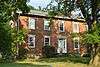
| 12 |
Crist Tavern Annex-Millworkers Boarding House |
|
000000001994-03-25-0000March 25, 1994
(#94000277) |
2966 Olentangy River Rd., south of Delaware
40°15′20″N 83°03′51″W / 40.255556°N 83.064167°W / 40.255556; -83.064167 (Crist Tavern Annex-Millworkers Boarding House) |
Delaware Township |
|
| 13 |
Marcus Curtiss Inn |
|
000000001976-12-12-0000December 12, 1976
(#76001415) |
South of Galena at 3860 Sunbury Rd.
40°11′30″N 82°52′26″W / 40.191667°N 82.873889°W / 40.191667; -82.873889 (Marcus Curtiss Inn) |
Genoa Township |
|
| 14 |
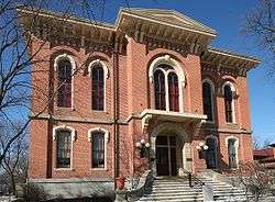
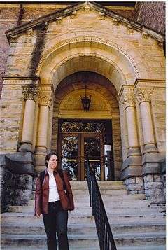
Delaware County Courthouse |
|
000000001973-05-22-0000May 22, 1973
(#73001429) |
N. Sandusky St. and Central Ave.
40°18′06″N 83°04′06″W / 40.301667°N 83.068333°W / 40.301667; -83.068333 (Delaware County Courthouse) |
Delaware |
|
| 15 |
Delaware County Jail and Sheriff's Residence |
|
000000001990-07-12-0000July 12, 1990
(#90001083) |
20 W. Central Ave.
40°18′06″N 83°04′09″W / 40.301667°N 83.069167°W / 40.301667; -83.069167 (Delaware County Jail and Sheriff's Residence) |
Delaware |
|
| 16 |
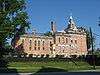
Delaware Public Library |
|
000000001983-01-11-0000January 11, 1983
(#83001957) |
101 N. Sandusky St.
40°18′08″N 83°03′56″W / 40.302222°N 83.065556°W / 40.302222; -83.065556 (Delaware Public Library) |
Delaware |
|
| 17 |
John Detwiller Tavern and Farmstead |
|
000000001993-04-16-0000April 16, 1993
(#93000294) |
2877 N. State Route 257, west of Radnor
40°22′00″N 83°11′19″W / 40.366667°N 83.188611°W / 40.366667; -83.188611 (John Detwiller Tavern and Farmstead) |
Thompson Township |
|
| 18 |
Edwards Gymnasium/Pfieffer Natatorium |
|
000000001985-03-18-0000March 18, 1985
(#85000632) |
Ohio Wesleyan University Main Campus, S. Sandusky St.
40°17′41″N 83°04′03″W / 40.294722°N 83.0675°W / 40.294722; -83.0675 (Edwards Gymnasium/Pfieffer Natatorium) |
Delaware |
|
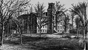
| 19 |
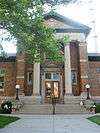
Elliott Hall, Sturges Library, and Merrick Hall |
|
000000001973-04-23-0000April 23, 1973
(#73001430) |
Ohio Wesleyan University campus
40°17′46″N 83°03′58″W / 40.296111°N 83.066111°W / 40.296111; -83.066111 (Elliott Hall, Sturges Library, and Merrick Hall) |
Delaware |
|
| 20 |
Felkner-Anderson House |
|
000000001988-02-11-0000February 11, 1988
(#88000074) |
9716 Fontanelle Rd., northwest of Ostrander
40°17′02″N 83°14′20″W / 40.283889°N 83.238889°W / 40.283889; -83.238889 (Felkner-Anderson House) |
Scioto Township |
|
| 21 |
Gooding House and Tavern |
|
000000002005-07-27-0000July 27, 2005
(#05000753) |
7669 Stagers Loop
40°10′53″N 83°01′29″W / 40.181389°N 83.024722°W / 40.181389; -83.024722 (Gooding House and Tavern) |
Orange Township |
|
| 22 |
Greenwood Farm |
|
000000001979-04-17-0000April 17, 1979
(#79001825) |
North of Delaware off U.S. Route 42
40°18′42″N 83°03′41″W / 40.311667°N 83.061389°W / 40.311667; -83.061389 (Greenwood Farm) |
Delaware Township |
|
| 23 |
High House |
|
000000001986-02-13-0000February 13, 1986
(#86000238) |
2360 Panhandle Rd., north of Delaware
40°19′51″N 83°03′44″W / 40.330833°N 83.062222°W / 40.330833; -83.062222 (High House) |
Troy Township |
|
| 24 |
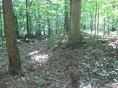
Highbank Park Works |
|
000000001974-02-15-0000February 15, 1974
(#74001466) |
On a bluff above the eastern bank of the Olentangy River[6]
40°08′27″N 83°01′51″W / 40.140972°N 83.030972°W / 40.140972; -83.030972 (Highbank Park Works) |
Orange Township |
|
| 25 |
Highbanks Metropolitan Park Mounds I and II |
|
000000001975-03-19-0000March 19, 1975
(#75001375) |
Eastern side of the Olentangy River, north of Worthington and east of Powell[7]
40°08′53″N 83°01′29″W / 40.148056°N 83.024722°W / 40.148056; -83.024722 (Highbanks Metropolitan Park Mounds I and II) |
Orange Township |
|
| 26 |
Historic Northwest District |
|
000000001996-02-29-0000February 29, 1996
(#96000225) |
Roughly bounded by Pennsylvania Ave., N. Sandusky St., W. William St., Elizabeth St., W. Fountain St., and N. Franklin St.
40°18′30″N 83°04′07″W / 40.308333°N 83.068611°W / 40.308333; -83.068611 (Historic Northwest District) |
Delaware |
|
| 27 |
Diadatus Keeler House |
|
000000001979-02-28-0000February 28, 1979
(#79001826) |
Southeast of Galena at 4567 Red Bank Rd.
40°10′45″N 82°51′50″W / 40.179167°N 82.863889°W / 40.179167; -82.863889 (Diadatus Keeler House) |
Genoa Township |
|
| 28 |
Samuel Lewis Farmhouse |
|
000000001993-04-16-0000April 16, 1993
(#93000295) |
5979 Radnor Rd., west of Radnor
40°22′59″N 83°11′00″W / 40.383056°N 83.183333°W / 40.383056; -83.183333 (Samuel Lewis Farmhouse) |
Radnor Township |
|
| 29 |
Limestone Vale |
|
000000001978-10-02-0000October 2, 1978
(#78002055) |
3490 Olentangy River Rd., south of Delaware
40°14′52″N 83°03′38″W / 40.247778°N 83.060556°W / 40.247778; -83.060556 (Limestone Vale) |
Liberty Township |
|
| 30 |
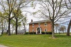
Forrest Meeker House and Farm |
|
000000001991-10-03-0000October 3, 1991
(#91001427) |
2690 Stratford Rd., south of Delaware
40°15′31″N 83°03′51″W / 40.258611°N 83.064167°W / 40.258611; -83.064167 (Forrest Meeker House and Farm) |
Delaware Township |
|
| 31 |
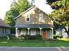
Mill Worker House No. 1 |
|
000000001991-10-03-0000October 3, 1991
(#91001431) |
2665 Stratford Rd., south of Delaware
40°15′32″N 83°03′48″W / 40.258889°N 83.063333°W / 40.258889; -83.063333 (Mill Worker House No. 1) |
Delaware Township |
|
| 32 |
Mill Worker House No. 3 |
|
000000001991-10-03-0000October 3, 1991
(#91001433) |
2505 Stratford Rd., south of Delaware
40°15′38″N 83°03′47″W / 40.260556°N 83.063056°W / 40.260556; -83.063056 (Mill Worker House No. 3) |
Delaware Township |
|
| 33 |
Mill Worker House No. 4 |
|
000000001991-10-03-0000October 3, 1991
(#91001434) |
2441 Stratford Rd., south of Delaware
40°15′39″N 83°03′47″W / 40.260833°N 83.063056°W / 40.260833; -83.063056 (Mill Worker House No. 4) |
Delaware Township |
|
| 34 |
Mill Worker House No. 5 |
|
000000001991-10-03-0000October 3, 1991
(#91001435) |
2441 Stratford Rd., south of Delaware
40°15′40″N 83°03′47″W / 40.261111°N 83.063056°W / 40.261111; -83.063056 (Mill Worker House No. 5) |
Delaware Township |
|
| 35 |
Edward E. Neff House |
|
000000001988-01-28-0000January 28, 1988
(#87002546) |
123 N. Franklin St.
40°18′10″N 83°04′09″W / 40.302778°N 83.069167°W / 40.302778; -83.069167 (Edward E. Neff House) |
Delaware |
|
| 36 |
O'Shaughnessy Dam and Bridge |
|
000000001990-07-05-0000July 5, 1990
(#90000482) |
County Road 126 between State Routes 257 and 745, east of Shawnee Hills
40°09′14″N 83°07′34″W / 40.153889°N 83.126111°W / 40.153889; -83.126111 (O'Shaughnessy Dam and Bridge) |
Concord and Liberty Townships |
|
| 37 |
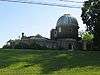
Ohio Wesleyan University Student Observatory |
|
000000001985-03-18-0000March 18, 1985
(#85000633) |
Ohio Wesleyan University, W. William St.
40°17′55″N 83°04′35″W / 40.298611°N 83.076389°W / 40.298611; -83.076389 (Ohio Wesleyan University Student Observatory) |
Delaware |
|
| 38 |
Norman Dewey Perry House |
|
000000001991-10-03-0000October 3, 1991
(#91001429) |
2367 Stratford Rd., south of Delaware
40°15′46″N 83°03′45″W / 40.262778°N 83.0625°W / 40.262778; -83.0625 (Norman Dewey Perry House) |
Delaware Township |
|
| 39 |
James Richey Farmhouse |
|
000000001993-09-02-0000September 2, 1993
(#93000891) |
1395 S. State Route 257
40°17′59″N 83°09′55″W / 40.299722°N 83.165278°W / 40.299722; -83.165278 (James Richey Farmhouse) |
Scioto Township |
|
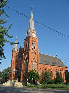
| 40 |
St. Mary's Church and Rectory |
|
000000001980-05-23-0000May 23, 1980
(#80002994) |
82 E. William St.
40°17′54″N 83°03′58″W / 40.298333°N 83.066111°W / 40.298333; -83.066111 (St. Mary's Church and Rectory) |
Delaware |
|
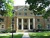
| 41 |
Sanborn Hall |
|
000000001985-03-18-0000March 18, 1985
(#85000634) |
Ohio Wesleyan University, W. Campus
40°18′01″N 83°04′36″W / 40.300278°N 83.076667°W / 40.300278; -83.076667 (Sanborn Hall) |
Delaware |
|
| 42 |
Sandusky Street Historic District |
|
000000001982-12-17-0000December 17, 1982
(#82001373) |
44 S. to 92 N. Sandusky, 46 E. to 31 W. Winter, and 9 E. to 17 W. William
40°17′56″N 83°04′04″W / 40.298889°N 83.067778°W / 40.298889; -83.067778 (Sandusky Street Historic District) |
Delaware |
|
| 43 |
Selby Field |
|
000000001985-03-18-0000March 18, 1985
(#85000635) |
Ohio Wesleyan University, Henry St.
40°17′48″N 83°03′49″W / 40.296667°N 83.063611°W / 40.296667; -83.063611 (Selby Field) |
Delaware |
|
| 44 |
Samuel Sharp House |
|
000000001982-07-29-0000July 29, 1982
(#82003563) |
7436 Horseshoe Rd., west of Ashley
40°24′00″N 83°02′07″W / 40.4°N 83.035278°W / 40.4; -83.035278 (Samuel Sharp House) |
Marlboro Township |
|
| 45 |
Stephen Sharp House |
|
000000001982-09-30-0000September 30, 1982
(#82003564) |
8025 Africa Rd.
40°08′36″N 82°56′20″W / 40.143333°N 82.938889°W / 40.143333; -82.938889 (Stephen Sharp House) |
Westerville |
|
| 46 |
Slocum Hall |
|
000000001985-03-18-0000March 18, 1985
(#85000636) |
Ohio Wesleyan University Main Campus, Sandusky St.
40°17′46″N 83°04′01″W / 40.296111°N 83.066944°W / 40.296111; -83.066944 (Slocum Hall) |
Delaware |
|
| 47 |
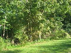
Spruce Run Earthworks |
|
000000001973-07-16-0000July 16, 1973
(#73001431) |
Along Spruce Run south of Galena[8]
40°10′40″N 82°51′52″W / 40.177778°N 82.864333°W / 40.177778; -82.864333 (Spruce Run Earthworks) |
Genoa Township |
|
| 48 |
Stratford Methodist Episcopal Church |
|
000000001991-10-03-0000October 3, 1991
(#91001436) |
Junction of U.S. Route 23 and State Route 315, south of Delaware
40°15′22″N 83°03′49″W / 40.256111°N 83.063611°W / 40.256111; -83.063611 (Stratford Methodist Episcopal Church) |
Delaware Township |
|
| 49 |
Stuyvesant Hall |
|
000000001985-03-18-0000March 18, 1985
(#85000637) |
Ohio Wesleyan University, W. William St.
40°17′54″N 83°04′33″W / 40.298333°N 83.075833°W / 40.298333; -83.075833 (Stuyvesant Hall) |
Delaware |
|
| 50 |
Sunbury Tavern |
|
000000001975-02-24-0000February 24, 1975
(#75001376) |
Northwestern corner of State Route 37 and Galena Rd.
40°14′31″N 82°51′36″W / 40.242°N 82.86°W / 40.242; -82.86 (Sunbury Tavern) |
Sunbury |
|
| 51 |
Sunbury Town Hall |
|
000000001975-02-20-0000February 20, 1975
(#75001377) |
Town Sq.
40°14′32″N 82°51′32″W / 40.242222°N 82.858889°W / 40.242222; -82.858889 (Sunbury Town Hall) |
Sunbury |
|
| 52 |
Ufferman Site |
Upload image |
000000001974-07-24-0000July 24, 1974
(#74001464) |
North of Delaware, near Delaware Lake[9]
|
Troy Township |
|
| 53 |
University Hall-Gray's Chapel |
|
000000001985-03-18-0000March 18, 1985
(#85000638) |
Ohio Wesleyan University Main Campus, Sandusky St.
40°17′47″N 83°04′01″W / 40.296389°N 83.066944°W / 40.296389; -83.066944 (University Hall-Gray's Chapel) |
Delaware |
|
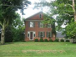
| 54 |
Henry Van Deman House |
|
000000001984-05-31-0000May 31, 1984
(#84003662) |
6 Darlington Rd.
40°18′31″N 83°04′30″W / 40.308611°N 83.075°W / 40.308611; -83.075 (Henry Van Deman House) |
Delaware |
|
| 55 |
Warren Tavern Complex |
|
000000001983-08-03-0000August 3, 1983
(#83001958) |
U.S. Route 36 west of Delaware
40°17′58″N 83°07′45″W / 40.299333°N 83.12925°W / 40.299333; -83.12925 (Warren Tavern Complex) |
Radnor Township |
|
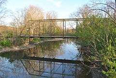
| 56 |
West Orange Road-Thomas Bridge |
|
000000002002-06-26-0000June 26, 2002
(#02000701) |
Orange Rd., east of its junction with State Route 315, and northeast of Powell
40°10′31″N 83°02′44″W / 40.175278°N 83.045556°W / 40.175278; -83.045556 (West Orange Road-Thomas Bridge) |
Liberty Township |
|