| [3] |
Name on the Register[4] |
Image |
Date listed[5] |
Location |
City or town |
Description |
|---|
| 1 |
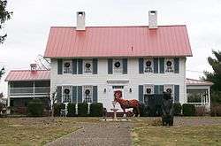
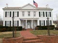
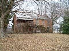
Charles Rice Ames House |
|
000000001978-02-14-0000February 14, 1978
(#78002208) |
2212 Miller Ave.
39°16′59″N 81°36′21″W / 39.283056°N 81.605833°W / 39.283056; -81.605833 (Charles Rice Ames House) |
Belpre |
|
| 2 |
Col. Joseph Barker House |
|
000000001978-06-23-0000June 23, 1978
(#78002210) |
North of Marietta on Masonic Park Rd.
39°29′11″N 81°29′19″W / 39.486389°N 81.488611°W / 39.486389; -81.488611 (Col. Joseph Barker House) |
Muskingum Township |
|
| 3 |
Judge Joseph Barker, Jr., House |
|
000000001979-07-26-0000July 26, 1979
(#79001979) |
Southwest of Newport on State Route 7
39°21′29″N 81°19′45″W / 39.358056°N 81.329167°W / 39.358056; -81.329167 (Judge Joseph Barker, Jr., House) |
Newport Township |
|
| 4 |
Becker Lumber and Manufacturing Company |
|
000000001987-06-18-0000June 18, 1987
(#87000988) |
121 Pike St.
39°24′55″N 81°26′28″W / 39.415383°N 81.441211°W / 39.415383; -81.441211 (Becker Lumber and Manufacturing Company) |
Marietta |
|
| 5 |
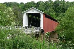
Bell Covered Bridge |
|
000000002012-10-03-0000October 3, 2012
(#12000836) |
Bell Rd., north of Vincent
39°25′52″N 81°40′34″W / 39.431111°N 81.676111°W / 39.431111; -81.676111 (Bell Covered Bridge) |
Barlow Township |
|
| 6 |
Cisler Terrace |
|
000000001983-01-19-0000January 19, 1983
(#83002065) |
7th and Ephraim Cutler Sts.
39°25′18″N 81°26′58″W / 39.421658°N 81.449439°W / 39.421658; -81.449439 (Cisler Terrace) |
Marietta |
|
| 7 |
Coal Run Historic District |
|
000000001996-02-22-0000February 22, 1996
(#96000115) |
Roughly along Main, Maple, and Hill Sts. in Coal Run
39°34′01″N 81°35′15″W / 39.566944°N 81.5875°W / 39.566944; -81.5875 (Coal Run Historic District) |
Waterford Township |
|
| 8 |
Walter Curtis House |
|
000000001980-10-03-0000October 3, 1980
(#80003244) |
South of Little Hocking
39°13′17″N 81°42′39″W / 39.221389°N 81.710833°W / 39.221389; -81.710833 (Walter Curtis House) |
Belpre Township |
|
| 9 |
Col. Simeon Deming House |
|
000000001980-03-24-0000March 24, 1980
(#80003245) |
Northeast of Watertown on Willis Rd.
39°29′21″N 81°36′35″W / 39.489167°N 81.609722°W / 39.489167; -81.609722 (Col. Simeon Deming House) |
Watertown Township |
|
| 10 |
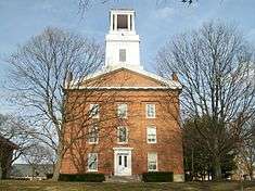
Erwin Hall, Marietta College |
|
000000001973-04-23-0000April 23, 1973
(#73001547) |
5th St. on Marietta College campus
39°25′01″N 81°27′02″W / 39.416944°N 81.450556°W / 39.416944; -81.450556 (Erwin Hall, Marietta College) |
Marietta |
|
| 11 |
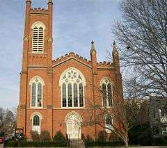
First Unitarian Church Of Marietta |
|
000000001973-10-03-0000October 3, 1973
(#73001548) |
232 3rd St.
39°24′58″N 81°27′11″W / 39.416111°N 81.453056°W / 39.416111; -81.453056 (First Unitarian Church Of Marietta) |
Marietta |
|
| 12 |
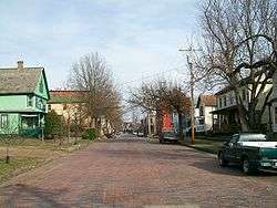
Harmar Historic District |
|
000000001974-12-19-0000December 19, 1974
(#74001645) |
Roughly bounded by the Ohio and Muskingum Rivers and the rear property line of Lancaster, George, and Franklin Sts.; also roughly bounded by Lancaster, Harmar, Putnam, and Franklin Sts. and the Ohio River, Fort Harmar Dr., and the Muskingum River
39°24′35″N 81°27′46″W / 39.409722°N 81.462778°W / 39.409722; -81.462778 (Harmar Historic District) |
Marietta |
Second set of boundaries represents a boundary increase of 1993
|
| 13 |
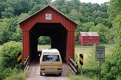
Harra Covered Bridge |
|
000000001976-10-08-0000October 8, 1976
(#76001547) |
2 mi (3.2 km) northwest of Watertown on State Route 172
39°29′16″N 81°38′53″W / 39.487778°N 81.648056°W / 39.487778; -81.648056 (Harra Covered Bridge) |
Watertown Township |
|
| 14 |
Hildreth Covered Bridge |
|
000000001978-02-08-0000February 8, 1978
(#78002211) |
5 mi (8.0 km) east of Marietta off State Route 26
39°25′38″N 81°21′42″W / 39.427222°N 81.361667°W / 39.427222; -81.361667 (Hildreth Covered Bridge) |
Newport Township |
|
| 15 |
Hune Covered Bridge |
|
000000001976-10-08-0000October 8, 1976
(#76001545) |
2.5 mi (4.0 km) north of Dart on State Route 26
39°30′38″N 81°15′02″W / 39.510556°N 81.250556°W / 39.510556; -81.250556 (Hune Covered Bridge) |
Lawrence Township |
|
| 16 |
William Hune Farm |
|
000000001991-03-28-0000March 28, 1991
(#91000303) |
State Route 26 north of Dart
39°30′43″N 81°14′56″W / 39.512083°N 81.248889°W / 39.512083; -81.248889 (William Hune Farm) |
Lawrence Township |
|
| 17 |
John Kaiser House |
|
000000001993-12-10-0000December 10, 1993
(#93001392) |
300 Bellevue St.
39°24′56″N 81°27′59″W / 39.415556°N 81.466389°W / 39.415556; -81.466389 (John Kaiser House) |
Marietta |
|
| 18 |
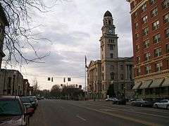
Marietta Historic District |
|
000000001974-12-19-0000December 19, 1974
(#74001646) |
Roughly bounded by the Muskingum and Ohio Rivers and Warren, 3rd, 5th, and 6th Sts.; also roughly bounded by Marion, Montgomery, Ohio, Greene, Butler, 2nd through 9th Sts., and the Ohio and Muskingum Rivers
39°25′04″N 81°27′19″W / 39.417778°N 81.455278°W / 39.417778; -81.455278 (Marietta Historic District) |
Marietta |
Second set of boundaries represents a boundary increase of 2001
|
| 19 |
Mason House |
|
000000001979-11-29-0000November 29, 1979
(#79001978) |
Township Road 393
39°33′51″N 81°35′05″W / 39.564028°N 81.584722°W / 39.564028; -81.584722 (Mason House) |
Waterford Township |
|
| 20 |
Mound Cemetery Mound |
|
000000001973-02-23-0000February 23, 1973
(#73001549) |
5th and Scammel Sts.
39°25′13″N 81°27′06″W / 39.420267°N 81.45175°W / 39.420267; -81.45175 (Mound Cemetery Mound) |
Marietta |
Mound Cemetery, home to the Mound Cemetery Mound (aka Conus or Great Mound) and reportedly home to the largest number of American Revolutionary War officers buried in one location
|
| 21 |
Muskingum River Navigation Historic District |
|
000000002007-02-09-0000February 9, 2007
(#07000025) |
Coshocton, Muskingum, Morgan, Washington Counties
39°28′14″N 81°29′28″W / 39.470556°N 81.491111°W / 39.470556; -81.491111 (Muskingum River Navigation Historic District) |
Numerous jurisdictions |
|
| 22 |
Ohio Company Land Office |
|
000000001970-11-10-0000November 10, 1970
(#70000523) |
Washington and 2nd Sts., Campus Martius Museum
39°25′16″N 81°27′42″W / 39.421111°N 81.461667°W / 39.421111; -81.461667 (Ohio Company Land Office) |
Marietta |
|
| 23 |
Old St. Mary's School |
|
000000001989-10-03-0000October 3, 1989
(#89001457) |
132 S. 4th St.
39°24′52″N 81°26′49″W / 39.414444°N 81.446944°W / 39.414444; -81.446944 (Old St. Mary's School) |
Marietta |
Destroyed
|
| 24 |
Rufus Putnam House |
|
000000001970-11-10-0000November 10, 1970
(#70000524) |
Campus Martius Museum, corner of 2nd and Washington Sts.
39°25′17″N 81°27′41″W / 39.421389°N 81.461389°W / 39.421389; -81.461389 (Rufus Putnam House) |
Marietta |
|
| 25 |
Rinard Covered Bridge |
|
000000001976-10-08-0000October 8, 1976
(#76001546) |
Northeast of Wingett Run on County Road 406
39°32′12″N 81°13′23″W / 39.536667°N 81.223056°W / 39.536667; -81.223056 (Rinard Covered Bridge) |
Ludlow Township |
|
| 26 |
Root Covered Bridge |
|
000000001975-03-27-0000March 27, 1975
(#75001552) |
0.5 mi (0.80 km) north of Decaturville on County Route 6
39°20′33″N 81°45′16″W / 39.3425°N 81.754444°W / 39.3425; -81.754444 (Root Covered Bridge) |
Decatur Township |
|
| 27 |
Sawyer-Curtis House |
|
000000001984-10-18-0000October 18, 1984
(#84002696) |
Off U.S. Route 50 in Little Hocking
39°15′39″N 81°41′47″W / 39.260833°N 81.696389°W / 39.260833; -81.696389 (Sawyer-Curtis House) |
Belpre Township |
|
| 28 |
Shinn Covered Bridge |
|
000000001976-10-08-0000October 8, 1976
(#76001544) |
Northeast of Bartlett off State Route 555
39°27′46″N 81°45′40″W / 39.462778°N 81.761111°W / 39.462778; -81.761111 (Shinn Covered Bridge) |
Palmer Township |
|
| 29 |
Sixth Street Railroad Bridge |
|
000000001982-12-10-0000December 10, 1982
(#82001785) |
East of the 5th Street Bridge
39°16′15″N 81°33′54″W / 39.27079°N 81.56503°W / 39.27079; -81.56503 (Sixth Street Railroad Bridge) |
Belpre |
Extends into Wood County, West Virginia
|
| 30 |
Spencer's Landing |
|
000000001992-08-18-0000August 18, 1992
(#92001035) |
4 E. 5th St.
39°16′37″N 81°33′59″W / 39.276919°N 81.566372°W / 39.276919; -81.566372 (Spencer's Landing) |
Belpre |
|
| 31 |
Jonathan Sprague House |
|
000000001983-01-11-0000January 11, 1983
(#83002067) |
West of Lowell off State Route 60
39°33′34″N 81°34′13″W / 39.559444°N 81.570278°W / 39.559444; -81.570278 (Jonathan Sprague House) |
Adams Township |
|
| 32 |
Capt. Jonathan Stone House |
|
000000001978-02-07-0000February 7, 1978
(#78002209) |
612 Blennerhassett Ave.
39°16′16″N 81°34′37″W / 39.271111°N 81.576944°W / 39.271111; -81.576944 (Capt. Jonathan Stone House) |
Belpre |
|
| 33 |
Vaughn-Stacy-Evans Farm Historic District |
|
000000002006-09-06-0000September 6, 2006
(#06000764) |
7700 State Route 60, southeast of Lowell
39°30′22″N 81°27′39″W / 39.506111°N 81.460833°W / 39.506111; -81.460833 (Vaughn-Stacy-Evans Farm Historic District) |
Muskingum Township |
|
| 34 |
W.P. SNYDER, JR. (steamboat) |
|
000000001970-11-10-0000November 10, 1970
(#70000522) |
On the Muskingum River at Sacra Via
39°25′13″N 81°27′48″W / 39.420278°N 81.463333°W / 39.420278; -81.463333 (W.P. SNYDER, JR. (steamboat)) |
Marietta |
|
| 35 |
Waernicke-Hille House and Store |
|
000000001979-11-29-0000November 29, 1979
(#79001977) |
Township Road 36 in Archers Fork
39°29′03″N 81°12′19″W / 39.484167°N 81.205278°W / 39.484167; -81.205278 (Waernicke-Hille House and Store) |
Independence Township |
|
| 36 |
Watertown Historic District |
|
000000001986-04-10-0000April 10, 1986
(#86000728) |
East of State Route 339 and north of State Route 676
39°27′59″N 81°37′57″W / 39.466389°N 81.6325°W / 39.466389; -81.6325 (Watertown Historic District) |
Watertown Township |
|
| 37 |
Wilcox-Mills House |
|
000000001973-04-13-0000April 13, 1973
(#73001550) |
301 5th St.
39°25′04″N 81°27′05″W / 39.417778°N 81.451389°W / 39.417778; -81.451389 (Wilcox-Mills House) |
Marietta |
|







.jpg)


