| [3] |
Name on the Register[4] |
Image |
Date listed[5] |
Location |
City or town |
Description |
|---|
| 1 |
Armco Park Mound I |
Upload image |
000000001975-05-29-0000May 29, 1975
(#75001550) |
Along Shaker Creek at Greentree Corners[6]
39°27′46″N 84°16′10″W / 39.462778°N 84.269444°W / 39.462778; -84.269444 (Armco Park Mound I) |
Turtlecreek Township |
|
| 2 |
Armco Park Mound II |
Upload image |
000000001975-05-29-0000May 29, 1975
(#75001551) |
Along Shaker Creek at Greentree Corners[6]
39°27′45″N 84°16′10″W / 39.462500°N 84.269444°W / 39.462500; -84.269444 (Armco Park Mound II) |
Turtlecreek Township |
|
| 3 |
Bone Mound II |
|
000000001974-07-15-0000July 15, 1974
(#74001643) |
Northwestern quarter of the southwestern quarter of Section 9 of Wayne Township, northwest of Oregonia[7]:27
39°28′54″N 84°07′20″W / 39.481667°N 84.122222°W / 39.481667; -84.122222 (Bone Mound II) |
Wayne Township |
|
| 4 |
Bone Stone Graves |
|
000000001974-07-15-0000July 15, 1974
(#74001644) |
Northwestern quarter of the southwestern quarter of Section 9 of Wayne Township, northwest of Oregonia[7]:27
39°28′53″N 84°07′19″W / 39.481389°N 84.121944°W / 39.481389; -84.121944 (Bone Stone Graves) |
Wayne Township |
|
| 5 |
Charles Butler House |
|
000000001982-04-29-0000April 29, 1982
(#82003664) |
13 E. Jackson St.
39°33′51″N 84°17′59″W / 39.564167°N 84.299722°W / 39.564167; -84.299722 (Charles Butler House) |
Franklin |
|
| 6 |
Goldsmith Coffeen House |
|
000000001984-10-10-0000October 10, 1984
(#84000165) |
419 Cincinnati Ave.
39°25′47″N 84°12′55″W / 39.429861°N 84.215278°W / 39.429861; -84.215278 (Goldsmith Coffeen House) |
Lebanon |
|
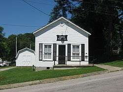
| 7 |
Corwin Council House and Jail |
|
000000002001-05-30-0000May 30, 2001
(#01000589) |
946 Harveysburg Rd.
39°31′29″N 84°04′40″W / 39.524722°N 84.077778°W / 39.524722; -84.077778 (Corwin Council House and Jail) |
Corwin |
|
| 8 |
Corwin House |
|
000000001984-10-10-0000October 10, 1984
(#84000166) |
1255 State Route 48
39°27′16″N 84°12′19″W / 39.454306°N 84.205278°W / 39.454306; -84.205278 (Corwin House) |
Lebanon |
|
| 9 |
Corwin-Bolin House |
|
000000001984-10-10-0000October 10, 1984
(#84000167) |
1443 State Route 48
39°27′20″N 84°12′18″W / 39.455556°N 84.205000°W / 39.455556; -84.205000 (Corwin-Bolin House) |
Lebanon |
|
| 10 |
Jonathan Crane Farm |
|
000000001978-02-17-0000February 17, 1978
(#78002202) |
South of Franklin on State Route 741
39°29′11″N 84°15′09″W / 39.486389°N 84.2525°W / 39.486389; -84.2525 (Jonathan Crane Farm) |
Clearcreek Township |
|
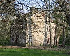
| 11 |
Crossed Keys Tavern |
|
000000001976-10-21-0000October 21, 1976
(#76001542) |
East of Lebanon on State Route 350
39°24′24″N 84°06′12″W / 39.406667°N 84.103333°W / 39.406667; -84.103333 (Crossed Keys Tavern) |
Turtlecreek Township |
|
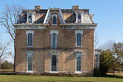
| 12 |
Daniel L. Deardoff House |
|
000000001984-05-31-0000May 31, 1984
(#84003810) |
4374 Union Rd., south of Franklin
39°30′26″N 84°18′57″W / 39.507222°N 84.315833°W / 39.507222; -84.315833 (Daniel L. Deardoff House) |
Franklin Township |
|
| 13 |
Henry Decker Farmstead |
|
000000002000-09-08-0000September 8, 2000
(#00001063) |
2595 W. Lower Springboro Rd., southwest of Springboro
39°32′47″N 84°14′41″W / 39.546389°N 84.244722°W / 39.546389; -84.244722 (Henry Decker Farmstead) |
Clearcreek Township |
|
| 14 |
East End Historic District |
|
000000001984-10-10-0000October 10, 1984
(#84000419) |
Roughly bounded by South, Mound, Pleasant, and Cherry Sts.
39°26′04″N 84°12′07″W / 39.434444°N 84.201944°W / 39.434444; -84.201944 (East End Historic District) |
Lebanon |
|
| 15 |
John Ferney House |
|
000000001984-10-10-0000October 10, 1984
(#84000423) |
475 Glosser Rd.
39°25′40″N 84°13′33″W / 39.427778°N 84.225833°W / 39.427778; -84.225833 (John Ferney House) |
Lebanon |
|
| 16 |
Floraville Historic District |
|
000000001984-10-10-0000October 10, 1984
(#84002102) |
Roughly bounded by Cincinnati and Orchard Aves. and East and Keever Sts.
39°25′46″N 84°12′32″W / 39.429444°N 84.208889°W / 39.429444; -84.208889 (Floraville Historic District) |
Lebanon |
|
| 17 |
Fort Ancient |
|
000000001966-10-15-0000October 15, 1966
(#66000625) |
State Route 350, east of Lebanon
39°24′29″N 84°05′21″W / 39.408056°N 84.089167°W / 39.408056; -84.089167 (Fort Ancient) |
Washington Township |
|
| 18 |
Glendower |
|
000000001970-11-10-0000November 10, 1970
(#70000521) |
U.S. Route 42 (Cincinnati Ave.)
39°25′47″N 84°12′36″W / 39.429861°N 84.210000°W / 39.429861; -84.210000 (Glendower) |
Lebanon |
|
| 19 |
Golden Lamb |
|
000000001978-01-12-0000January 12, 1978
(#78002204) |
27-31 S. Broadway
39°26′01″N 84°12′30″W / 39.433611°N 84.208333°W / 39.433611; -84.208333 (Golden Lamb) |
Lebanon |
|
| 20 |
Elizabeth Harvey Free Negro School |
|
000000001977-11-17-0000November 17, 1977
(#77001089) |
North St.
39°30′12″N 84°00′25″W / 39.503333°N 84.006944°W / 39.503333; -84.006944 (Elizabeth Harvey Free Negro School) |
Harveysburg |
|
| 21 |
Hatton Farm |
|
000000001978-03-29-0000March 29, 1978
(#78002203) |
East of central Harveysburg on State Route 73
39°30′01″N 84°00′02″W / 39.500278°N 84.000556°W / 39.500278; -84.000556 (Hatton Farm) |
Harveysburg |
|
| 22 |
Hill-Kinder Mound |
|
000000001971-11-05-0000November 5, 1971
(#71000657) |
Northeast of downtown Franklin[6]
39°34′29″N 84°16′40″W / 39.574722°N 84.277778°W / 39.574722; -84.277778 (Hill-Kinder Mound) |
Franklin |
|
| 23 |
Hunt-Forman Farm |
|
000000002004-06-16-0000June 16, 2004
(#04000607) |
2945 N. State Route 741, south of Franklin
39°28′56″N 84°15′17″W / 39.482222°N 84.254722°W / 39.482222; -84.254722 (Hunt-Forman Farm) |
Turtlecreek Township |
|
| 24 |
Kern Effigy (33WA372) |
|
000000001986-07-21-0000July 21, 1986
(#86001922) |
Along the Little Miami River on the grounds of YMCA Camp Kern, 5291 State Route 350[8]
39°24′19″N 84°06′21″W / 39.405389°N 84.105833°W / 39.405389; -84.105833 (Kern Effigy (33WA372)) |
Turtlecreek Township |
|
| 25 |
Ahimaaz King House |
|
000000002008-12-19-0000December 19, 2008
(#08001199) |
1720 E. King Ave. in Kings Mills
39°21′29″N 84°14′44″W / 39.358056°N 84.245556°W / 39.358056; -84.245556 (Ahimaaz King House) |
Deerfield Township |
|
| 26 |
Landen Mounds I and II |
|
000000001975-05-27-0000May 27, 1975
(#75001549) |
Near Socialville-Foster Rd. by the northern side of Landen Lake, west of Foster[7]:29–30
39°19′16″N 84°16′29″W / 39.321111°N 84.274722°W / 39.321111; -84.274722 (Landen Mounds I and II) |
Deerfield Township |
|
| 27 |
Lebanon Academy |
|
000000001984-10-10-0000October 10, 1984
(#84000427) |
190 New St.
39°26′20″N 84°12′17″W / 39.438889°N 84.204722°W / 39.438889; -84.204722 (Lebanon Academy) |
Lebanon |
|
| 28 |
Lebanon Cemetery Entrance Arch |
|
000000001984-10-18-0000October 18, 1984
(#84000157) |
Hunter St.
39°26′13″N 84°12′49″W / 39.436944°N 84.213611°W / 39.436944; -84.213611 (Lebanon Cemetery Entrance Arch) |
Lebanon |
|
| 29 |
Lebanon Cemetery Superintendent's House |
|
000000001984-10-18-0000October 18, 1984
(#84000159) |
416 W. Silver St.
39°26′09″N 84°12′49″W / 39.435833°N 84.213611°W / 39.435833; -84.213611 (Lebanon Cemetery Superintendent's House) |
Lebanon |
|
| 30 |
Lebanon Commercial District |
|
000000001984-10-10-0000October 10, 1984
(#84000429) |
Roughly Broadway, Mechanic, Silver, Mulberry, and Main Sts.
39°26′02″N 84°12′29″W / 39.433889°N 84.208056°W / 39.433889; -84.208056 (Lebanon Commercial District) |
Lebanon |
|
| 31 |
Mackinaw Historic District |
|
000000001980-07-21-0000July 21, 1980
(#80003242) |
Off State Route 123
39°33′50″N 84°18′26″W / 39.563889°N 84.307222°W / 39.563889; -84.307222 (Mackinaw Historic District) |
Franklin |
|
| 32 |
Maplewood Sanitorium |
|
000000001984-10-10-0000October 10, 1984
(#84000432) |
Maple and Deerfield Sts.
39°25′31″N 84°12′25″W / 39.425278°N 84.206944°W / 39.425278; -84.206944 (Maplewood Sanitorium) |
Lebanon |
|
| 33 |
Moses McKay House |
|
000000001978-02-17-0000February 17, 1978
(#78002207) |
East of Waynesville, on New Burlington Rd.
39°32′37″N 84°00′57″W / 39.543611°N 84.015833°W / 39.543611; -84.015833 (Moses McKay House) |
Wayne Township |
|
| 34 |
Miami Monthly Meeting Historic District |
|
000000001998-09-18-0000September 18, 1998
(#98001180) |
Vicinity of 4th and High Sts.
39°31′46″N 84°05′27″W / 39.529444°N 84.090833°W / 39.529444; -84.090833 (Miami Monthly Meeting Historic District) |
Waynesville |
|
| 35 |
Moar Mound and Village |
|
000000001976-01-01-0000January 1, 1976
(#76001543) |
Back a lane on the northern side of Lebanon-Union Rd., west of Morrow[7]:29
39°21′49″N 84°11′45″W / 39.363611°N 84.195833°W / 39.363611; -84.195833 (Moar Mound and Village) |
Hamilton Township |
|
| 36 |
Mohrman-Jack-Evans House |
|
000000001984-10-10-0000October 10, 1984
(#84000433) |
342 Columbus Ave.
39°26′16″N 84°11′56″W / 39.437778°N 84.198889°W / 39.437778; -84.198889 (Mohrman-Jack-Evans House) |
Lebanon |
|
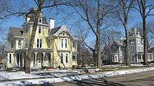
| 37 |
North Broadway Historic District |
|
000000001984-10-10-0000October 10, 1984
(#84000435) |
Roughly Broadway, Warren, Pleasant, New, and Mechanic Sts.
39°26′13″N 84°12′26″W / 39.436944°N 84.207222°W / 39.436944; -84.207222 (North Broadway Historic District) |
Lebanon |
|
| 38 |
Old Log Post Office |
|
000000001976-03-17-0000March 17, 1976
(#76001541) |
5th and River Sts.
39°33′35″N 84°18′24″W / 39.559722°N 84.306528°W / 39.559722; -84.306528 (Old Log Post Office) |
Franklin |
|
| 39 |
Peters Cartridge Company |
|
000000001985-10-10-0000October 10, 1985
(#85003115) |
1915 Grandin Rd., southeast of Kings Mills
39°21′01″N 84°14′33″W / 39.350278°N 84.2425°W / 39.350278; -84.2425 (Peters Cartridge Company) |
Hamilton Township |
|
| 40 |
Edmund Robinson House |
|
000000001979-04-16-0000April 16, 1979
(#79001974) |
North of Lebanon at 3208 State Route 48
39°29′04″N 84°12′03″W / 39.484583°N 84.200833°W / 39.484583; -84.200833 (Edmund Robinson House) |
Clearcreek Township |
|
| 41 |
John Satterthwaite House |
|
000000001988-03-30-0000March 30, 1988
(#88000239) |
498 N. 3rd St.
39°32′09″N 84°04′56″W / 39.535833°N 84.082222°W / 39.535833; -84.082222 (John Satterthwaite House) |
Waynesville |
|
| 42 |
Smith-Davis House |
|
000000001985-02-06-0000February 6, 1985
(#85000245) |
206 W. Silver St.
39°26′09″N 84°12′40″W / 39.435833°N 84.211111°W / 39.435833; -84.211111 (Smith-Davis House) |
Lebanon |
|
| 43 |
Springboro Historic District |
|
000000001999-08-10-0000August 10, 1999
(#99000914) |
Roughly bounded by Main, East, and Mill Sts., and Central Ave.
39°33′18″N 84°13′57″W / 39.555°N 84.2325°W / 39.555; -84.2325 (Springboro Historic District) |
Springboro |
|
| 44 |
Stanton Farm |
|
000000001980-05-29-0000May 29, 1980
(#80003243) |
North of downtown Springboro on Lytle-Five Points Rd.
39°34′22″N 84°13′34″W / 39.572778°N 84.226111°W / 39.572778; -84.226111 (Stanton Farm) |
Springboro |
|
| 45 |
Benjamin A. Stokes House |
|
000000001983-07-18-0000July 18, 1983
(#83002064) |
5587 State Route 48, north of Lebanon
39°31′01″N 84°11′10″W / 39.516944°N 84.186111°W / 39.516944; -84.186111 (Benjamin A. Stokes House) |
Clearcreek Township |
|
| 46 |
Stubbs Earthworks |
|
000000001978-04-04-0000April 4, 1978
(#78002205) |
Campus of Little Miami High School[9]
39°21′26″N 84°09′37″W / 39.357222°N 84.160278°W / 39.357222; -84.160278 (Stubbs Earthworks) |
Hamilton Township |
|
| 47 |
Taylor Mound and Village Site |
|
000000001978-03-31-0000March 31, 1978
(#78002206) |
Just south of the confluence of Caesar's Creek and the Little Miami River[6][10]
39°29′22″N 84°06′04″W / 39.489333°N 84.101111°W / 39.489333; -84.101111 (Taylor Mound and Village Site) |
Wayne Township |
|
| 48 |
Trevey Mound (33WA193) |
Upload image |
000000001986-06-20-0000June 20, 1986
(#86001345) |
Address Restricted
|
Morrow |
|
| 49 |
Waynesville Engine House and Lockup |
|
000000001999-01-21-0000January 21, 1999
(#98001643) |
260 Chapman St.
39°31′56″N 84°05′08″W / 39.532222°N 84.085694°W / 39.532222; -84.085694 (Waynesville Engine House and Lockup) |
Waynesville |
|
| 50 |
Waynesville Greek Revival Houses |
|
000000001979-08-08-0000August 8, 1979
(#79001976) |
5303 and 5323 Wilkerson Lane
39°31′30″N 84°05′34″W / 39.525°N 84.092778°W / 39.525; -84.092778 (Waynesville Greek Revival Houses) |
Waynesville |
|
| 51 |
Waynesville Main Street Historic District |
|
000000002002-03-20-0000March 20, 2002
(#02000220) |
Main St.
39°31′48″N 84°05′11″W / 39.53°N 84.086389°W / 39.53; -84.086389 (Waynesville Main Street Historic District) |
Waynesville |
|
| 52 |
West Baptist Church |
|
000000001984-10-18-0000October 18, 1984
(#84000161) |
500 W. Mulberry St.
39°26′06″N 84°12′51″W / 39.435°N 84.214167°W / 39.435; -84.214167 (West Baptist Church) |
Lebanon |
|
| 53 |
Dr. Aaron Wright House |
|
000000001979-08-03-0000August 3, 1979
(#79001975) |
155 W. Central Ave.
39°33′27″N 84°14′18″W / 39.5575°N 84.238333°W / 39.5575; -84.238333 (Dr. Aaron Wright House) |
Springboro |
|
