| [3] |
Name on the Register[4] |
Image |
Date listed[5] |
Location |
City or town |
Description |
|---|
| 1 |
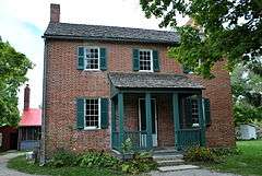
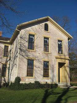
Arnold Homestead |
|
000000001977-11-07-0000November 7, 1977
(#77001077) |
North of Dayton on State Route 201
39°52′20″N 84°05′46″W / 39.872222°N 84.096111°W / 39.872222; -84.096111 (Arnold Homestead) |
Huber Heights |
|
| 2 |
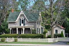
Aullwood House and Garden |
|
000000001999-02-05-0000February 5, 1999
(#99000092) |
900 Aullwood Rd., northwest of Dayton
39°52′05″N 84°16′32″W / 39.868056°N 84.275556°W / 39.868056; -84.275556 (Aullwood House and Garden) |
Butler Township |
|
| 3 |
Ausenbaugh-McElhenny House |
|
000000001975-07-18-0000July 18, 1975
(#75001503) |
7373 Taylorsville Rd.
39°51′39″N 84°06′09″W / 39.860833°N 84.1025°W / 39.860833; -84.1025 (Ausenbaugh-McElhenny House) |
Huber Heights |
|
| 4 |
George Bixler Farm |
|
000000002002-08-22-0000August 22, 2002
(#02000888) |
13213 Providence Pike, south of Brookville
39°48′19″N 84°25′40″W / 39.805278°N 84.427778°W / 39.805278; -84.427778 (George Bixler Farm) |
Perry Township |
|
| 5 |
Robert Bradford House |
|
000000001979-03-21-0000March 21, 1979
(#79001897) |
South of Centerville on Social Row Rd.
39°35′22″N 84°08′26″W / 39.589444°N 84.140556°W / 39.589444; -84.140556 (Robert Bradford House) |
Washington Township |
|
| 6 |
Erma Bombeck House |
|
000000002015-02-23-0000February 23, 2015
(#15000043) |
162 Cushwa Dr.
39°38′32″N 84°09′07″W / 39.642361°N 84.152083°W / 39.642361; -84.152083 (Erma Bombeck House) |
Centerville |
|
| 7 |
Carlisle Fort |
|
000000001974-02-15-0000February 15, 1974
(#74001584) |
Western bank of Twin Creek, south of Germantown[6]
39°35′26″N 84°21′15″W / 39.5906°N 84.3543°W / 39.5906; -84.3543 (Carlisle Fort) |
German Township |
|
| 8 |
Centerville Historic District |
|
000000001974-12-17-0000December 17, 1974
(#74001577) |
Irregular pattern at Franklin and Main Sts.
39°37′42″N 84°09′38″W / 39.628333°N 84.160556°W / 39.628333; -84.160556 (Centerville Historic District) |
Centerville |
|
| 9 |
Deerwood Farm |
|
000000001975-11-12-0000November 12, 1975
(#75001507) |
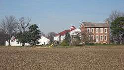
North of Dayton at 7200 Peters Pike
39°51′07″N 84°13′37″W / 39.851944°N 84.226944°W / 39.851944; -84.226944 (Deerwood Farm) |
Butler Township |
|
| 10 |
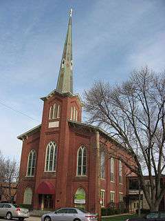
Emmanuel's Evangelical Lutheran Church |
|
000000001990-09-06-0000September 6, 1990
(#90001292) |
30 W. Warren St.
39°37′40″N 84°22′18″W / 39.627778°N 84.371667°W / 39.627778; -84.371667 (Emmanuel's Evangelical Lutheran Church) |
Germantown |
|
| 11 |
Joseph Flory House |
|
000000001978-03-29-0000March 29, 1978
(#78002143) |
Northwest of Clayton on Diamond Mill Rd.
39°51′58″N 84°22′07″W / 39.866111°N 84.368611°W / 39.866111; -84.368611 (Joseph Flory House) |
Clay Township |
|
| 12 |
Fox Hollow |
|
000000002006-06-09-0000June 9, 2006
(#06000481) |
6320 Mad River Rd.
39°39′22″N 84°11′29″W / 39.656111°N 84.191389°W / 39.656111; -84.191389 (Fox Hollow) |
Washington Township |
|
| 13 |
Gunckel's Town Plan Historic District |
|
000000001976-05-13-0000May 13, 1976
(#76001502) |
Roughly bounded by Mulberry and Walnut Sts. and Warren and Market Sts.
39°37′32″N 84°22′14″W / 39.625556°N 84.370556°W / 39.625556; -84.370556 (Gunckel's Town Plan Historic District) |
Germantown |
|
| 14 |
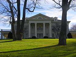
Hawthorn Hill |
|
000000001974-10-18-0000October 18, 1974
(#74001585) |
Harman and Park Aves.
39°43′20″N 84°10′34″W / 39.722222°N 84.176111°W / 39.722222; -84.176111 (Hawthorn Hill) |
Oakwood |
|
| 15 |
Jacob's Church |
|
000000001990-09-06-0000September 6, 1990
(#90001290) |
213 E. Central Ave.
39°38′31″N 84°17′11″W / 39.641944°N 84.286389°W / 39.641944; -84.286389 (Jacob's Church) |
Miamisburg |
|
| 16 |
Ethol Kellog House |
|
000000001976-06-18-0000June 18, 1976
(#76001498) |
West of Centerville off State Route 725 on Yankee St.
39°37′47″N 84°12′02″W / 39.629722°N 84.200556°W / 39.629722; -84.200556 (Ethol Kellog House) |
Washington Township |
|
| 17 |
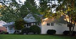
Charles F. Kettering House |
|
000000001977-12-22-0000December 22, 1977
(#77001080) |
3965 Southern Boulevard
39°41′37″N 84°11′38″W / 39.693611°N 84.193889°W / 39.693611; -84.193889 (Charles F. Kettering House) |
Kettering |
Burned down in 1995.
|
| 18 |
Koehne-Poast Farm |
|
000000001977-04-11-0000April 11, 1977
(#77001079) |
West of Germantown off State Route 725
39°37′29″N 84°23′08″W / 39.624722°N 84.385556°W / 39.624722; -84.385556 (Koehne-Poast Farm) |
German Township and Germantown |
|
| 19 |
Krug House |
|
000000001992-08-12-0000August 12, 1992
(#92000973) |
3473 Sweet Potato Ridge Rd.
39°53′30″N 84°19′10″W / 39.891667°N 84.319444°W / 39.891667; -84.319444 (Krug House) |
Union |
|
| 20 |
Long-Mueller House |
|
000000001987-04-23-0000April 23, 1987
(#87000637) |
986 Laurelwood Rd.
39°42′02″N 84°11′16″W / 39.700556°N 84.187778°W / 39.700556; -84.187778 (Long-Mueller House) |
Kettering |
|
| 21 |
Long-Romspert House |
|
000000001987-12-21-0000December 21, 1987
(#87001522) |
1947 Far Hills Ave.
39°42′51″N 84°10′20″W / 39.714028°N 84.172222°W / 39.714028; -84.172222 (Long-Romspert House) |
Oakwood |
|
| 22 |
Market Square |
|
000000001975-11-10-0000November 10, 1975
(#75001510) |
Both sides of Main St. including junctions at Central and Linden Aves.
39°38′27″N 84°17′22″W / 39.640833°N 84.289333°W / 39.640833; -84.289333 (Market Square) |
Miamisburg |
|
| 23 |
Samuel Martindale House |
|
000000001978-05-22-0000May 22, 1978
(#78002148) |
Northeast of Englewood off U.S. Route 40
39°53′43″N 84°16′54″W / 39.895278°N 84.281750°W / 39.895278; -84.281750 (Samuel Martindale House) |
Butler Township |
|
| 24 |
Miami-Erie Canal Lock No. 70 |
|
000000001982-12-20-0000December 20, 1982
(#82001479) |
Fishburg and Endicott Rds.
39°50′28″N 84°09′32″W / 39.841111°N 84.158889°W / 39.841111; -84.158889 (Miami-Erie Canal Lock No. 70) |
Huber Heights |
|
| 25 |
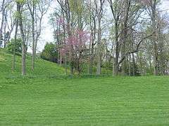
Miamisburg Mound |
|
000000001970-11-10-0000November 10, 1970
(#70000511) |
Southeast of Miamisburg on State Route 725
39°37′38″N 84°16′51″W / 39.627222°N 84.280833°W / 39.627222; -84.280833 (Miamisburg Mound) |
Miamisburg |
|
| 26 |
Miami Valley Golf Course and Clubhouse |
|
000000002015-06-30-0000June 30, 2015
(#15000372) |
3311 Salem Ave.
39°47′31″N 84°14′34″W / 39.791944°N 84.242778°W / 39.791944; -84.242778 (Miami Valley Golf Course and Clubhouse) |
Harrison Township |
Extends into Dayton
|
| 27 |
Normandy Farms |
|
000000001983-11-25-0000November 25, 1983
(#83004322) |
450 W. Alex-Bell Rd., northwest of Centerville
39°38′43″N 84°10′08″W / 39.645278°N 84.168889°W / 39.645278; -84.168889 (Normandy Farms) |
Washington Township |
|
| 28 |
Pease Homestead |
|
000000001980-08-11-0000August 11, 1980
(#80003169) |
2123 Alexander-Bellbrook Rd., northwest of Centerville
39°40′17″N 84°12′23″W / 39.671389°N 84.206389°W / 39.671389; -84.206389 (Pease Homestead) |
Miami Township |
|
| 29 |
David Rohr Mansion and Carriage House |
|
000000001978-05-22-0000May 22, 1978
(#78002149) |
Astoria Rd. and State Route 725
39°37′20″N 84°23′06″W / 39.622222°N 84.385°W / 39.622222; -84.385 (David Rohr Mansion and Carriage House) |
Germantown |
|
| 30 |
Salem Bear Creek Church, Salem Evangelical Lutheran Church |
|
000000001990-09-06-0000September 6, 1990
(#90001291) |
Roughly bounded by Union Rd., Dayton Germantown Pike, and Bear Creek
39°40′48″N 84°18′34″W / 39.68°N 84.309444°W / 39.68; -84.309444 (Salem Bear Creek Church, Salem Evangelical Lutheran Church) |
Moraine |
|
| 31 |
Schantz Park Historic District |
|
000000001992-10-16-0000October 16, 1992
(#92001492) |
Roughly bounded by Far Hills, Irving, Mahart and Schenck Aves.
39°43′54″N 84°10′37″W / 39.731667°N 84.176944°W / 39.731667; -84.176944 (Schantz Park Historic District) |
Oakwood |
|
| 32 |
Adam Schantz, Sr., House |
|
000000001980-03-07-0000March 7, 1980
(#80003178) |
314-316 Schantz Ave.
39°43′54″N 84°10′35″W / 39.731667°N 84.176389°W / 39.731667; -84.176389 (Adam Schantz, Sr., House) |
Oakwood |
|
| 33 |
Schuter Carpenter Shop and House |
|
000000001980-09-27-0000September 27, 1980
(#80003179) |
3224 W. Alexandersville-Bellbrook Rd., east of West Carrollton
39°40′24″N 84°13′37″W / 39.673333°N 84.226944°W / 39.673333; -84.226944 (Schuter Carpenter Shop and House) |
Miami Township |
|
| 34 |
Shuey's Mill |
|
000000001975-09-05-0000September 5, 1975
(#75001508) |
Main St.
39°37′15″N 84°22′13″W / 39.620833°N 84.370278°W / 39.620833; -84.370278 (Shuey's Mill) |
Germantown |
|
| 35 |
Skywood Farms |
|
000000001996-02-22-0000February 22, 1996
(#96000117) |
732 W. Alex-Bell Rd., northwest of Centerville
39°38′58″N 84°10′46″W / 39.649444°N 84.179444°W / 39.649444; -84.179444 (Skywood Farms) |
Washington Township |
|
| 36 |
Samuel Spitler House |
|
000000001973-09-28-0000September 28, 1973
(#73001507) |
14 Market St.
39°50′08″N 84°24′50″W / 39.835556°N 84.413889°W / 39.835556; -84.413889 (Samuel Spitler House) |
Brookville |
Designed by architect George Franklin Barber
|
| 37 |
John Stump House and Mill |
|
000000001975-07-07-0000July 7, 1975
(#75001509) |
Southwest of Germantown at the junction of Sigel and Oxford Rds.
39°37′02″N 84°23′28″W / 39.617222°N 84.391111°W / 39.617222; -84.391111 (John Stump House and Mill) |
German Township |
|
| 38 |
Taylorsville Canal Inn |
|
000000001977-11-16-0000November 16, 1977
(#77001078) |
4240 Taylorsville Rd.
39°51′48″N 84°09′54″W / 39.863333°N 84.165°W / 39.863333; -84.165 (Taylorsville Canal Inn) |
Huber Heights |
|
| 39 |
Trailsend |
|
000000001979-05-22-0000May 22, 1979
(#79001905) |
3500 Governors Trail
39°42′04″N 84°11′57″W / 39.701111°N 84.199167°W / 39.701111; -84.199167 (Trailsend) |
Kettering |
|
| 40 |
Trotwood Railroad Station and Depot |
|
000000001981-01-26-0000January 26, 1981
(#81000448) |
2 E. Main St.
39°47′49″N 84°18′40″W / 39.797083°N 84.311111°W / 39.797083; -84.311111 (Trotwood Railroad Station and Depot) |
Trotwood |
|
| 41 |
Watkins House |
|
000000001974-12-24-0000December 24, 1974
(#74001578) |
9950 Lebanon Pike, south of Centerville
39°35′57″N 84°09′40″W / 39.599167°N 84.161111°W / 39.599167; -84.161111 (Watkins House) |
Washington Township |
|
| 42 |
Wright Library |
|
000000002013-12-24-0000December 24, 2013
(#13000981) |
1776 Far Hills Ave.
39°42′56″N 84°10′16″W / 39.715556°N 84.171111°W / 39.715556; -84.171111 (Wright Library) |
Oakwood |
|
| 43 |
Wolf Creek Mound |
|
000000001973-06-04-0000June 4, 1973
(#73001511) |
Atop the highest hill at the confluence of Poplar Run and Wolf Creek, west of central Trotwood[7]:15
39°48′14″N 84°20′48″W / 39.803889°N 84.346667°W / 39.803889; -84.346667 (Wolf Creek Mound) |
Trotwood |
|
.jpg)
