| [3] |
Name on the Register[4] |
Image |
Date listed[5] |
Location |
City or town |
Description |
|---|
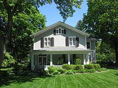
| 1 |
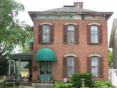
Maj. John C. Baker House |
|
000000001985-08-29-0000August 29, 1985
(#85001875) |
202 W. Main St.
40°04′31″N 83°33′35″W / 40.075278°N 83.559722°W / 40.075278; -83.559722 (Maj. John C. Baker House) |
Mechanicsburg |
|
| 2 |
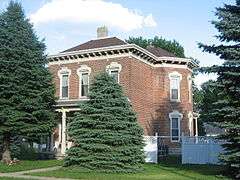
Barr House |
|
000000001985-08-29-0000August 29, 1985
(#85001876) |
Locust and Sandusky Sts.
40°04′24″N 83°33′17″W / 40.07334°N 83.55465°W / 40.07334; -83.55465 (Barr House) |
Mechanicsburg |
|
| 3 |
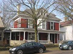
Henry Burnham House |
|
000000001985-08-29-0000August 29, 1985
(#85001877) |
N. Main St. and State Route 559
40°04′30″N 83°33′32″W / 40.075000°N 83.558889°W / 40.075000; -83.558889 (Henry Burnham House) |
Mechanicsburg |
|
| 4 |
Church Of Our Savior |
|
000000001985-08-29-0000August 29, 1985
(#85001878) |
56 S. Main St.[6]
40°04′15″N 83°33′16″W / 40.070833°N 83.554444°W / 40.070833; -83.554444 (Church Of Our Savior) |
Mechanicsburg |
1890s Gothic Revival church; built in the parish's earliest years
|
| 5 |
Dr. Clark House |
|
000000001985-08-29-0000August 29, 1985
(#85001879) |
21 N. Main St.
40°04′21″N 83°33′24″W / 40.072500°N 83.556667°W / 40.072500; -83.556667 (Dr. Clark House) |
Mechanicsburg |
1875 Italianate home of a prominent local physician
|
| 6 |
William Culbertson House |
|
000000001985-08-29-0000August 29, 1985
(#85001880) |
103 Race St.
40°04′27″N 83°33′21″W / 40.074250°N 83.555750°W / 40.074250; -83.555750 (William Culbertson House) |
Mechanicsburg |
Italianate home of a local industrialist
|
| 7 |
Demand-Gest House |
|
000000001985-08-29-0000August 29, 1985
(#85001881) |
37 N. Main St.
40°04′23″N 83°33′26″W / 40.072944°N 83.557222°W / 40.072944; -83.557222 (Demand-Gest House) |
Mechanicsburg |
Colonial Revival home of local businessmen
|
| 8 |
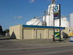
Hamer's General Store |
|
000000001985-08-29-0000August 29, 1985
(#85001882) |
88 S. Main St.
40°04′12″N 83°33′13″W / 40.070000°N 83.553611°W / 40.070000; -83.553611 (Hamer's General Store) |
Mechanicsburg |
A traditional-style general store; no longer standing
|
| 9 |
Norvall Hunter Farm |
|
000000001985-08-29-0000August 29, 1985
(#85001883) |
129 S. Main St.
40°04′03″N 83°33′12″W / 40.0675°N 83.553333°W / 40.0675; -83.553333 (Norvall Hunter Farm) |
Mechanicsburg |
|
| 10 |
Kimball House |
|
000000001985-08-29-0000August 29, 1985
(#85001884) |
115 N. Main St.
40°04′25″N 83°33′29″W / 40.073611°N 83.558056°W / 40.073611; -83.558056 (Kimball House) |
Mechanicsburg |
Town home of a prosperous farmer
|
| 11 |
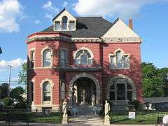
Kiser Mansion |
|
000000002011-02-04-0000February 4, 2011
(#10001211) |
149 E. Main St.
40°07′40″N 83°57′27″W / 40.127778°N 83.957500°W / 40.127778; -83.957500 (Kiser Mansion) |
St. Paris |
|
| 12 |
Lawler's Tavern |
|
000000001985-08-29-0000August 29, 1985
(#85001885) |
N. Main St.
40°04′20″N 83°33′24″W / 40.072222°N 83.556667°W / 40.072222; -83.556667 (Lawler's Tavern) |
Mechanicsburg |
1830 inn; one of the oldest buildings in the village
|
| 13 |
Magruder Building |
|
000000001985-08-29-0000August 29, 1985
(#85001886) |
16 S. Main St.
40°04′19″N 83°33′19″W / 40.071833°N 83.555278°W / 40.071833; -83.555278 (Magruder Building) |
Mechanicsburg |
|
| 14 |
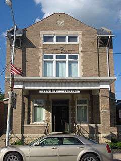
Masonic Temple |
|
000000001985-08-29-0000August 29, 1985
(#85001887) |
N. Main St.
40°04′21″N 83°33′21″W / 40.072500°N 83.555833°W / 40.072500; -83.555833 (Masonic Temple) |
Mechanicsburg |
|
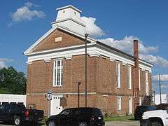
| 15 |
Mechanicsburg Baptist Church |
|
000000001985-08-29-0000August 29, 1985
(#85001888) |
Walnut and Sandusky Sts.
40°04′16″N 83°33′27″W / 40.071111°N 83.557500°W / 40.071111; -83.557500 (Mechanicsburg Baptist Church) |
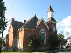
Mechanicsburg |
Large Gothic Revival church built for a Methodist Protestant congregation
|
| 16 |
Mechanicsburg Commercial Historic District |
|
000000001985-08-29-0000August 29, 1985
(#85001895) |
1-11 S. Main St.
40°04′18″N 83°33′21″W / 40.071667°N 83.555833°W / 40.071667; -83.555833 (Mechanicsburg Commercial Historic District) |
Mechanicsburg |
|
| 17 |
Monitor House |
|
000000001974-05-02-0000May 2, 1974
(#74001408) |
375 W. Main St.
40°07′46″N 83°58′02″W / 40.129444°N 83.967222°W / 40.129444; -83.967222 (Monitor House) |
St. Paris |
A rare example of a house with a monitor
|
| 18 |
Dr. Adam Mosgrove House |
|
000000001982-07-15-0000July 15, 1982
(#82003550) |
127 Miami St.
40°06′29″N 83°45′14″W / 40.108056°N 83.753889°W / 40.108056; -83.753889 (Dr. Adam Mosgrove House) |
Urbana |
Home of one of Urbana's earliest doctors
|
| 19 |
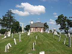
Mt. Tabor Church Building, Cemetery and Hitching Lot |
|
000000001995-11-22-0000November 22, 1995
(#95001329) |
State Route 245, 300 meters south of its junction with Mt. Tabor Rd.
40°13′44″N 83°41′38″W / 40.228889°N 83.693889°W / 40.228889; -83.693889 (Mt. Tabor Church Building, Cemetery and Hitching Lot) |
Salem Township |
An abandoned Methodist church and cemetery with graves of Revolutionary War veterans
|
| 20 |
Dr. Nincehelser House |
|
000000001985-08-29-0000August 29, 1985
(#85001889) |
28 N. Main St.
40°04′23″N 83°33′24″W / 40.072917°N 83.556667°W / 40.072917; -83.556667 (Dr. Nincehelser House) |
Mechanicsburg |
Home of a wealthy physician
|
| 21 |
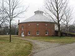
Nutwood Place |
|
000000001976-12-12-0000December 12, 1976
(#76002265) |
1428 Nutwood Place
40°07′36″N 83°45′11″W / 40.126667°N 83.753056°W / 40.126667; -83.753056 (Nutwood Place) |
Urbana |
A farmstead with a brick round barn
|
| 22 |
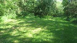
Carl Potter Mound |
|
000000001974-08-13-0000August 13, 1974
(#74001407) |
Eastern side of State Route 56, southwest of Mechanicsburg[7]
40°02′21″N 83°36′05″W / 40.039111°N 83.601250°W / 40.039111; -83.601250 (Carl Potter Mound) |
Union Township |
A heavily eroded Adena mound
|
| 23 |
Richards-Sewall House |
|
000000001995-08-14-0000August 14, 1995
(#95000937) |
222 College St.
40°06′14″N 83°45′20″W / 40.103889°N 83.755556°W / 40.103889; -83.755556 (Richards-Sewall House) |
Urbana |
Formerly home to the Urbana University president
|
| 24 |
St. Michael Catholic Church |
|
000000001985-08-29-0000August 29, 1985
(#85001892) |
40 Walnut St.
40°04′20″N 83°33′30″W / 40.072222°N 83.558333°W / 40.072222; -83.558333 (St. Michael Catholic Church) |
Mechanicsburg |
Small Gothic Revival church in a residential neighborhood
|
| 25 |
St. Paul AME Church |
|
000000001997-09-05-0000September 5, 1997
(#97000954) |
316 E. Market St.
40°06′25″N 83°44′56″W / 40.106944°N 83.748889°W / 40.106944; -83.748889 (St. Paul AME Church) |
Urbana |
1870s church building; home to a church founded in the 1820s
|
| 26 |
Scioto Street Historic District |
|
000000001984-02-09-0000February 9, 1984
(#84002908) |
Scioto St. from Locust to E. Lawn Ave.
40°06′28″N 83°44′45″W / 40.107706°N 83.745936°W / 40.107706; -83.745936 (Scioto Street Historic District) |
Urbana |
|
| 27 |
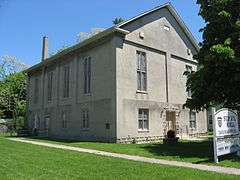
Second Baptist Church |
|
000000001985-08-29-0000August 29, 1985
(#85001891) |
Sandusky St.
40°04′21″N 83°33′17″W / 40.072500°N 83.554722°W / 40.072500; -83.554722 (Second Baptist Church) |
Mechanicsburg |
Mechanicsburg's oldest extant church building, a Greek Revival structure
|
| 28 |
United Methodist Church |
|
000000001985-08-29-0000August 29, 1985
(#85001893) |
N. Main and Race Sts.
40°04′24″N 83°33′26″W / 40.073333°N 83.557222°W / 40.073333; -83.557222 (United Methodist Church) |
Mechanicsburg |
Gothic Revival church with a central dome
|
| 29 |
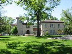
Urbana College Historic Buildings |
|
000000001980-10-03-0000October 3, 1980
(#80002952) |
College Way
40°06′08″N 83°45′43″W / 40.102222°N 83.761944°W / 40.102222; -83.761944 (Urbana College Historic Buildings) |
Urbana |
The oldest buildings on the Urbana University campus
|
| 30 |
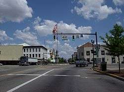
Urbana Monument Square Historic District |
|
000000001984-03-01-0000March 1, 1984
(#84002909) |
Roughly bounded by Market, Walnut, Church, and Locust Sts.
40°06′29″N 83°45′09″W / 40.108056°N 83.752500°W / 40.108056; -83.752500 (Urbana Monument Square Historic District) |
Urbana |
Urbana's commercial district, centered around a roundabout with a war memorial
|
| 31 |
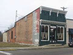
Village Hobby Shop |
|
000000001985-08-29-0000August 29, 1985
(#85001894) |
N. Main St.
40°04′20″N 83°33′23″W / 40.072111°N 83.556389°W / 40.072111; -83.556389 (Village Hobby Shop) |
Mechanicsburg |
Small Italianate commercial building
|
| 32 |
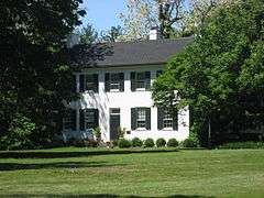
John Q.A. Ward House |
|
000000001974-07-30-0000July 30, 1974
(#74001409) |
335 College St.
40°06′12″N 83°45′27″W / 40.103250°N 83.757500°W / 40.103250; -83.757500 (John Q.A. Ward House) |
Urbana |
1820 home of a local sculptor |


