| [3] |
Name on the Register[4] |
Image |
Date listed[5] |
Location |
City or town |
Description |
|---|
| 1 |
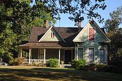
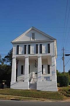
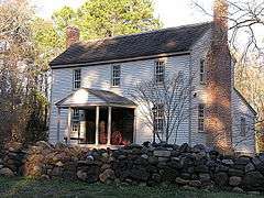
Alston-DeGraffenried House |
Upload image |
000000001974-11-18-0000November 18, 1974
(#74001339) |
West of Pittsboro off U.S. 64; also the northern side of U.S. Route 64, 0.4 miles (0.64 km) west of its junction with NC 1564
35°43′51″N 79°14′38″W / 35.730833°N 79.243889°W / 35.730833; -79.243889 (Alston-DeGraffenried House) |
Pittsboro |
Second set of boundaries represents a boundary increase of 000000001993-10-21-0000October 21, 1993, the Alston-DeGraffenried Plantation
|
| 2 |
Aspen Hall |
Upload image |
000000001982-07-29-0000July 29, 1982
(#82003441) |
West of Pittsboro on US 64
35°44′02″N 79°16′24″W / 35.733889°N 79.273333°W / 35.733889; -79.273333 (Aspen Hall) |
Pittsboro |
|
| 3 |
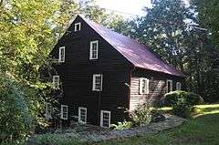
Baldwin's Mill |
|
000000001986-01-02-0000January 2, 1986
(#86000007) |
SR 1520
35°49′35″N 79°14′04″W / 35.826389°N 79.234444°W / 35.826389; -79.234444 (Baldwin's Mill) |
Pittsboro |
|
| 4 |
Bowen-Jordan Farm |
Upload image |
000000001985-07-05-0000July 5, 1985
(#85001451) |
SR 1100
35°40′51″N 79°30′30″W / 35.680833°N 79.508333°W / 35.680833; -79.508333 (Bowen-Jordan Farm) |
Siler City |
|
| 5 |
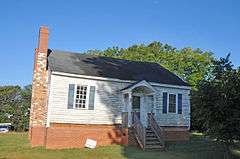
Cadmus N. Bray House |
Upload image |
000000001999-12-30-0000December 30, 1999
(#99001620) |
229 W. Second St.
35°43′25″N 79°27′42″W / 35.723611°N 79.461667°W / 35.723611; -79.461667 (Cadmus N. Bray House) |
Siler City |
|
| 6 |
Bray-Paschal House |
Upload image |
000000002011-12-27-0000December 27, 2011
(#11000973) |
2488 Wade Paschal Rd.
35°40′59″N 79°29′15″W / 35.683033°N 79.487528°W / 35.683033; -79.487528 (Bray-Paschal House) |
Siler City |
part of the Chatham County Multiple Resource Area
|
| 7 |
Sheriff Stephen Wiley Brewer Farmstead |
Upload image |
000000002003-08-21-0000August 21, 2003
(#03000801) |
365 Thompson St.
35°43′27″N 79°10′15″W / 35.724167°N 79.170833°W / 35.724167; -79.170833 (Sheriff Stephen Wiley Brewer Farmstead) |
Pittsboro |
|
| 8 |
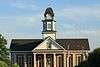
Chatham County Courthouse |
|
000000001979-05-10-0000May 10, 1979
(#79001691) |
NC 15-501 and Highway 64
35°43′12″N 79°10′39″W / 35.72°N 79.1775°W / 35.72; -79.1775 (Chatham County Courthouse) |
Pittsboro |
|
| 9 |
Luther Clegg House |
Upload image |
000000001982-10-05-0000October 5, 1982
(#82001283) |
South of Pittsboro on SR 1012
35°41′54″N 79°09′49″W / 35.698333°N 79.163611°W / 35.698333; -79.163611 (Luther Clegg House) |
Pittsboro |
|
| 10 |
Deep River Camelback Truss Bridge |
|
000000001995-06-09-0000June 9, 1995
(#95000696) |
Adjacent to NC 2153 over Deep River
35°34′13″N 79°14′28″W / 35.570278°N 79.241111°W / 35.570278; -79.241111 (Deep River Camelback Truss Bridge) |
Cumnock-Gulf |
|
| 11 |
DeGraffenreidt-Johnson House |
Upload image |
000000001985-07-05-0000July 5, 1985
(#85001452) |
SR 1346
35°46′37″N 79°18′15″W / 35.776944°N 79.304167°W / 35.776944; -79.304167 (DeGraffenreidt-Johnson House) |
Silk Hope |
|
| 12 |
East Raleigh Street Historic District |
Upload image |
000000002000-05-11-0000May 11, 2000
(#00000488) |
300-400 blocks of E. Second St., and 300-600 blocks of E. Raleigh St.
35°43′30″N 79°27′32″W / 35.725°N 79.458889°W / 35.725; -79.458889 (East Raleigh Street Historic District) |
Siler City |
|
| 13 |
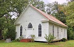
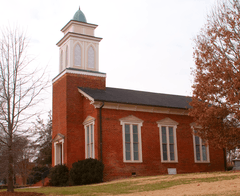
Ebenezer Methodist Church |
|
000000001985-07-05-0000July 5, 1985
(#85001450) |
SR 1008
35°43′37″N 79°00′23″W / 35.726944°N 79.006389°W / 35.726944; -79.006389 (Ebenezer Methodist Church) |
Bells |
|
| 14 |
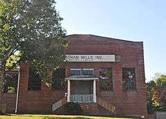
Former High Point Bending and Chair Company |
Upload image |
000000001999-11-12-0000November 12, 1999
(#99001332) |
108 W. 3rd St.
35°43′33″N 79°28′01″W / 35.725833°N 79.466944°W / 35.725833; -79.466944 (Former High Point Bending and Chair Company) |
Siler City |
|
| 15 |
Lewis Freeman House |
Upload image |
000000001982-10-05-0000October 5, 1982
(#82001284) |
205 W. Salisbury St.
35°43′17″N 79°10′49″W / 35.721389°N 79.180278°W / 35.721389; -79.180278 (Lewis Freeman House) |
Pittsboro |
|
| 16 |
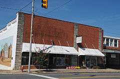
Goldston Commercial Historic District |
Upload image |
000000001987-11-25-0000November 25, 1987
(#87002014) |
Roughly S. Bellevue and S. Main Sts. between W. Goldbar & Colonial Sts.
35°35′33″N 79°19′41″W / 35.5925°N 79.328056°W / 35.5925; -79.328056 (Goldston Commercial Historic District) |
Goldston |
|
| 17 |
Goodwin Farm Complex |
Upload image |
000000001985-07-05-0000July 5, 1985
(#85001453) |
SR 1900
35°43′11″N 78°57′37″W / 35.719722°N 78.960278°W / 35.719722; -78.960278 (Goodwin Farm Complex) |
Bells |
|
| 18 |
Gregson-Hadley House |
Upload image |
000000001985-07-05-0000July 5, 1985
(#85001454) |
322 E. Raleigh St.
35°43′27″N 79°27′34″W / 35.724167°N 79.459444°W / 35.724167; -79.459444 (Gregson-Hadley House) |
Siler City |
|
| 19 |
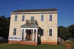
Hadley House and Grist Mill |
Upload image |
000000001980-11-25-0000November 25, 1980
(#80002807) |
Northwest of Pittsboro on SR 2165
35°42′32″N 79°18′02″W / 35.708889°N 79.300556°W / 35.708889; -79.300556 (Hadley House and Grist Mill) |
Pittsboro |
|
| 20 |
Hall-London House |
|
000000001982-10-05-0000October 5, 1982
(#82001285) |
206 Hillsboro St.
35°43′19″N 79°10′37″W / 35.721944°N 79.176944°W / 35.721944; -79.176944 (Hall-London House) |
Pittsboro |
|
| 21 |
Haughton-McIver House |
Upload image |
000000001985-07-05-0000July 5, 1985
(#85001455) |
SR 1007
35°33′26″N 79°17′05″W / 35.557222°N 79.284722°W / 35.557222; -79.284722 (Haughton-McIver House) |
Gulf |
|
| 22 |
Hotel Hadley |
Upload image |
000000001985-07-05-0000July 5, 1985
(#85001456) |
103 N. Chatham St.
35°43′24″N 79°27′49″W / 35.723333°N 79.463611°W / 35.723333; -79.463611 (Hotel Hadley) |
Siler City |
|
| 23 |
Marion Jasper Jordan Farm |
Upload image |
000000001988-02-25-0000February 25, 1988
(#88000169) |
R. Jordan Rd./SR 2145
35°33′27″N 79°16′13″W / 35.5575°N 79.270278°W / 35.5575; -79.270278 (Marion Jasper Jordan Farm) |
Gulf |
|
| 24 |
Kelvin |
Upload image |
000000001982-10-05-0000October 5, 1982
(#82001286) |
503 W. Salisbury St.
35°43′16″N 79°11′03″W / 35.721111°N 79.184167°W / 35.721111; -79.184167 (Kelvin) |
Pittsboro |
Destroyed[6]
|
| 25 |
Lockville Dam, Canal and Powerhouse |
|
000000001984-11-20-0000November 20, 1984
(#84000305) |
West of Moncure at Deep River and U.S. 1
35°37′10″N 79°05′45″W / 35.619444°N 79.095833°W / 35.619444; -79.095833 (Lockville Dam, Canal and Powerhouse) |
Moncure |
|
| 26 |
London Cottage |
Upload image |
000000001982-10-05-0000October 5, 1982
(#82001287) |
North of Pittsboro on SR 1516
35°43′36″N 79°11′13″W / 35.726667°N 79.186944°W / 35.726667; -79.186944 (London Cottage) |
Pittsboro |
|
| 27 |
Henry Adolphus London House |
|
000000001998-09-03-0000September 3, 1998
(#98001143) |
440 W. Salisbury St.
35°43′21″N 79°11′07″W / 35.7225°N 79.185278°W / 35.7225; -79.185278 (Henry Adolphus London House) |
Pittsboro |
|
| 28 |
John A. Mason House |
Upload image |
000000001974-10-23-0000October 23, 1974
(#74001338) |
Southwest of Durham off NC 751
35°49′31″N 78°59′38″W / 35.825278°N 78.993889°W / 35.825278; -78.993889 (John A. Mason House) |
Farrington |
|
| 29 |
McClenahan House |
|
000000001982-10-05-0000October 5, 1982
(#82001288) |
Address Restricted
|
Pittsboro |
The house has been moved within Pittsboro
|
| 30 |
Robert Joseph Moore House |
Upload image |
000000001998-09-03-0000September 3, 1998
(#98001142) |
NC 1713, at junction with NC 1711
35°46′43″N 79°08′00″W / 35.778611°N 79.133333°W / 35.778611; -79.133333 (Robert Joseph Moore House) |
Bynum |
|
| 31 |
Moore-Manning House |
Upload image |
000000001982-10-05-0000October 5, 1982
(#82001289) |
400 Hillsboro St.
35°43′31″N 79°10′37″W / 35.725278°N 79.176944°W / 35.725278; -79.176944 (Moore-Manning House) |
Pittsboro |
|
| 32 |
Mount Vernon Springs Historic District |
Upload image |
000000001987-12-03-0000December 3, 1987
(#87002045) |
SR 1134 & SR 1135
35°39′32″N 79°26′38″W / 35.658889°N 79.443889°W / 35.658889; -79.443889 (Mount Vernon Springs Historic District) |
Bonlee |
|
| 33 |
New Hope Rural Historical Archeological District |
Upload image |
000000001985-02-25-0000February 25, 1985
(#85000382) |
Address Restricted
|
Wilsonville |
|
| 34 |
Newkirk State (Site 3lCH366) |
Upload image |
000000001983-11-14-0000November 14, 1983
(#83003813) |
Address Restricted
|
Moncure |
|
| 35 |
North Third Avenue Historic District |
Upload image |
000000002000-07-20-0000July 20, 2000
(#00000824) |
Roughly bounded by N. Second Ave., E. Fourth St., N. Third Ave., and E. Third St.
35°43′34″N 79°27′47″W / 35.726111°N 79.463056°W / 35.726111; -79.463056 (North Third Avenue Historic District) |
Siler City |
|
| 36 |
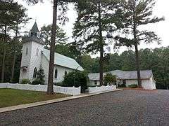
O'Kelly's Chapel |
|
000000001985-07-05-0000July 5, 1985
(#85001457) |
NC 751
35°51′56″N 78°56′41″W / 35.865556°N 78.944722°W / 35.865556; -78.944722 (O'Kelly's Chapel) |
Farrington |
|
| 37 |
Paschal-Womble House |
Upload image |
000000001984-04-26-0000April 26, 1984
(#84001957) |
421 Main St.
35°35′40″N 79°19′44″W / 35.594444°N 79.328889°W / 35.594444; -79.328889 (Paschal-Womble House) |
Goldston |
|
| 38 |
Pittsboro Historic District |
|
000000002000-05-05-0000May 5, 2000
(#00000442) |
Roughly bounded by Chatham St., Small St., Rectory St., and Launis St.
35°43′21″N 79°10′36″W / 35.7225°N 79.176667°W / 35.7225; -79.176667 (Pittsboro Historic District) |
Pittsboro |
|
| 39 |
Pittsboro Masonic Lodge |
|
000000001978-01-31-0000January 31, 1978
(#78001938) |
East and Masonic Sts.
35°43′13″N 79°10′32″W / 35.720278°N 79.175556°W / 35.720278; -79.175556 (Pittsboro Masonic Lodge) |
Pittsboro |
|
| 40 |
Pittsboro Presbyterian Church |
|
000000001978-01-30-0000January 30, 1978
(#78001939) |
N. East St.
35°43′13″N 79°10′34″W / 35.720278°N 79.176111°W / 35.720278; -79.176111 (Pittsboro Presbyterian Church) |
Pittsboro |
|
| 41 |
Reid House |
Upload image |
000000001982-10-05-0000October 5, 1982
(#82001290) |
200 W. Salisbury St.
35°43′18″N 79°10′47″W / 35.721667°N 79.179722°W / 35.721667; -79.179722 (Reid House) |
Pittsboro |
|
| 42 |
William Alston Rives House |
Upload image |
000000001985-07-05-0000July 5, 1985
(#85001459) |
End of SR 2183 off SR 2187
35°37′24″N 79°18′22″W / 35.623333°N 79.306111°W / 35.623333; -79.306111 (William Alston Rives House) |
Goldston |
|
| 43 |
Siler City City Hall |
Upload image |
000000001998-10-30-0000October 30, 1998
(#98001302) |
311 N. Second Ave.
35°43′31″N 79°27′52″W / 35.725278°N 79.464444°W / 35.725278; -79.464444 (Siler City City Hall) |
Siler City |
|
| 44 |
Siler City Commercial Historic District |
|
000000002000-07-27-0000July 27, 2000
(#00000841) |
Roughly bounded by Second Ave., Birch Ave., Third St. and Beaver St.
35°43′23″N 79°27′50″W / 35.723056°N 79.463889°W / 35.723056; -79.463889 (Siler City Commercial Historic District) |
Siler City |
|
| 45 |
Siler City High School |
Upload image |
000000001998-07-15-0000July 15, 1998
(#98000873) |
119 S. Third Ave.
35°43′23″N 79°27′36″W / 35.723056°N 79.46°W / 35.723056; -79.46 (Siler City High School) |
Siler City |
|
| 46 |
Snipes-Fox House |
Upload image |
000000001998-09-03-0000September 3, 1998
(#98001144) |
306 S. Dogwood Ave.
35°43′08″N 79°28′00″W / 35.718889°N 79.466667°W / 35.718889; -79.466667 (Snipes-Fox House) |
Siler City |
|
| 47 |
Patrick St. Lawrence House |
|
000000001982-10-05-0000October 5, 1982
(#82001291) |
Address Restricted
|
Pittsboro |
Moved adjacent to the McClenahan House
|
| 48 |
Joseph B. Stone House |
|
000000001982-06-01-0000June 1, 1982
(#82003440) |
SR 1008
35°46′47″N 79°00′25″W / 35.779722°N 79.006944°W / 35.779722; -79.006944 (Joseph B. Stone House) |
Farrington |
|
| 49 |
William Teague House |
Upload image |
000000001985-07-05-0000July 5, 1985
(#85001458) |
SR 1004
35°46′24″N 79°26′41″W / 35.773333°N 79.444722°W / 35.773333; -79.444722 (William Teague House) |
Siler City |
|
| 50 |
A. P. Terry House |
Upload image |
000000001982-10-05-0000October 5, 1982
(#82001292) |
601 Womack St.
35°43′05″N 79°11′14″W / 35.718056°N 79.187222°W / 35.718056; -79.187222 (A. P. Terry House) |
Pittsboro |
|
| 51 |
James A. Thomas Farm |
Upload image |
000000001985-07-05-0000July 5, 1985
(#85001460) |
SR 1941
35°42′21″N 79°04′43″W / 35.705833°N 79.078611°W / 35.705833; -79.078611 (James A. Thomas Farm) |
Pittsboro |
|
| 52 |
Dr. E. H. Ward Farm |
|
000000001985-07-05-0000July 5, 1985
(#85001461) |
SR 1700
35°46′44″N 79°05′47″W / 35.778889°N 79.096389°W / 35.778889; -79.096389 (Dr. E. H. Ward Farm) |
Bynum |
19th century homestead of a traveling physician, Dr. Edward Hiram Ward (August 1829 – June 1896) was the son of Hiram Ward (1794–1842) and Sara Hackney (1806–1848) and lived in Chatham County, North Carolina. Private residence, outdoor wedding and event location venue - Ward's Hollow. |
|
| 53 |
Whitehead-Fogleman Farm |
Upload image |
000000001985-07-05-0000July 5, 1985
(#85001462) |
SR 1352 & SR 1351 junction
35°50′01″N 79°27′20″W / 35.833611°N 79.455556°W / 35.833611; -79.455556 (Whitehead-Fogleman Farm) |
Crutchfield Crossroads |
|
| 54 |
Burdett Woody House |
Upload image |
000000002008-08-06-0000August 6, 2008
(#08000773) |
2232 White Smith Rd.
35°48′25″N 79°18′50″W / 35.806922°N 79.313783°W / 35.806922; -79.313783 (Burdett Woody House) |
Siler City |
|


.jpg)