| [3] |
Name on the Register[4] |
Image |
Date listed[5] |
Location |
City or town |
Description |
|---|
| 1 |
Audubon Trolley Station |
|
000000001993-08-05-0000August 5, 1993
(#93000736) |
Junction of Park Ave. and Audubon Boulevard
34°12′55″N 77°53′47″W / 34.215278°N 77.896389°W / 34.215278; -77.896389 (Audubon Trolley Station) |
Wilmington |
|
| 2 |
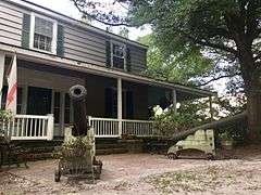
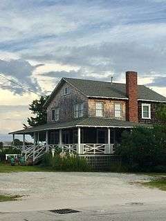
Bradley-Latimer Summer House |
|
000000001987-07-20-0000July 20, 1987
(#87001181) |
Southern side of NC 1411 east of its junction with U.S. Route 76
34°12′55″N 77°49′52″W / 34.215278°N 77.831111°W / 34.215278; -77.831111 (Bradley-Latimer Summer House) |
Wrightsville Beach |
|
| 3 |
Brookwood Historic District |
|
000000002014-12-02-0000December 2, 2014
(#14000990) |
Roughly bounded by Market St., Keaton Ave., Burnt Mill Creek, and Wallace Park
34°14′13″N 77°55′02″W / 34.2369°N 77.9172°W / 34.2369; -77.9172 (Brookwood Historic District) |
Wilmington |
|
| 4 |
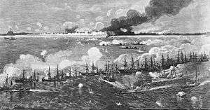
Cape Fear Civil War Shipwreck Discontiguous District |
Upload image |
000000001985-12-23-0000December 23, 1985
(#85003195) |
Multiple locations off the North Carolina coast
|
Kure Beach, Wrightsville Beach and Wilmington Beach |
|
| 5 |
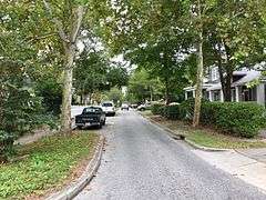
Carolina Heights Historic District |
|
000000001999-07-29-0000July 29, 1999
(#99000317) |
Roughly bounded by Market St., 13th St., Rankin St., and 19th St.; also the 1200 block of Market St. and the 100 and 200 blocks of N. 13th St.
34°14′21″N 77°55′44″W / 34.239167°N 77.928889°W / 34.239167; -77.928889 (Carolina Heights Historic District) |
Wilmington |
Second set of addresses represents a boundary increase of 000000001999-11-30-0000November 30, 1999
|
| 6 |
Carolina Place Historic District |
|
000000001992-08-31-0000August 31, 1992
(#92001086) |
Bounded by Market St., Wallace Park, Gibson Ave., Wrightsville Ave., and S. 18th St.
34°14′06″N 77°55′24″W / 34.235°N 77.923333°W / 34.235; -77.923333 (Carolina Place Historic District) |
Wilmington |
|
| 7 |
City Hall/Thalian Hall |
|
000000001970-04-03-0000April 3, 1970
(#70000464) |
100 N. 3rd. St.
34°14′14″N 77°56′48″W / 34.237222°N 77.946667°W / 34.237222; -77.946667 (City Hall/Thalian Hall) |
Wilmington |
|
| 8 |
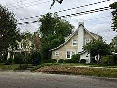
Delgrado School |
|
000000002001-10-20-0000October 20, 2001
(#01001135) |
1930 Colwell Ave.
34°13′45″N 77°55′21″W / 34.229167°N 77.9225°W / 34.229167; -77.9225 (Delgrado School) |
Wilmington |
|
| 9 |
Federal Building and Courthouse |
|
000000001974-05-02-0000May 2, 1974
(#74001363) |
N. Water between Market and Princess St.
34°14′07″N 77°57′00″W / 34.235278°N 77.95°W / 34.235278; -77.95 (Federal Building and Courthouse) |
Wilmington |
|
| 10 |
Fort Fisher |
|
000000001966-10-15-0000October 15, 1966
(#66000595) |
18 miles south of Wilmington on U.S. Route 421
33°57′57″N 77°55′37″W / 33.965833°N 77.926944°W / 33.965833; -77.926944 (Fort Fisher) |
Wilmington |
|
| 11 |
Gabriel's Landing |
Upload image |
000000002008-05-07-0000May 7, 2008
(#08000382) |
1005 Airlie Rd.
34°12′50″N 77°49′27″W / 34.2139774°N 77.824118°W / 34.2139774; -77.824118 (Gabriel's Landing) |
Wilmington |
|
| 12 |
Homesite (31Nh95**1) |
Upload image |
000000001997-03-13-0000March 13, 1997
(#97000165) |
Address Restricted
|
Carolina Beach |
|
| 13 |
William Hooper School (Former) |
|
000000001998-03-12-0000March 12, 1998
(#98000231) |
410 Meares St.
34°13′17″N 77°56′34″W / 34.221389°N 77.942778°W / 34.221389; -77.942778 (William Hooper School (Former)) |
Wilmington |
|
| 14 |
Joy Lee Apartment Building and Annex |
Upload image |
000000001997-04-03-0000April 3, 1997
(#97000256) |
317 Carolina Beach Ave., N.
34°02′14″N 77°53′30″W / 34.037222°N 77.891667°W / 34.037222; -77.891667 (Joy Lee Apartment Building and Annex) |
Carolina Beach |
|
| 15 |
Market Street Mansion District |
|
000000001975-04-21-0000April 21, 1975
(#75001284) |
1704, 1705, 1710, and 1713 Market St.
34°14′12″N 77°55′38″W / 34.236667°N 77.927222°W / 34.236667; -77.927222 (Market Street Mansion District) |
Wilmington |
|
| 16 |
Masonboro Sound Historic District |
Upload image |
000000001992-10-22-0000October 22, 1992
(#92001334) |
Eastern side of Magnolia Dr. and 7301-7601, 7424, and 7506 Masonboro Sound Rd.
34°10′40″N 77°50′45″W / 34.177778°N 77.845833°W / 34.177778; -77.845833 (Masonboro Sound Historic District) |
Wilmington |
|
| 17 |
Mount Lebanon Chapel and Cemetery |
Upload image |
000000001986-10-16-0000October 16, 1986
(#86002879) |
NC 1411
34°12′50″N 77°49′35″W / 34.213889°N 77.826389°W / 34.213889; -77.826389 (Mount Lebanon Chapel and Cemetery) |
Wrightsville Beach |
|
| 18 |
Newton Homesite and Cemetery |
Upload image |
000000001997-03-13-0000March 13, 1997
(#97000166) |
Off Dow Road South[6]
34°01′05″N 77°54′47″W / 34.0181°N 77.9131°W / 34.0181; -77.9131 (Newton Homesite and Cemetery) |
Carolina Beach |
|
| 19 |
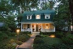
James D. and Frances Sprunt Cottage |
|
000000002013-12-18-0000December 18, 2013
(#13000935) |
207 N. Lumina Ave.
34°12′39″N 77°47′40″W / 34.210703°N 77.794325°W / 34.210703; -77.794325 (James D. and Frances Sprunt Cottage) |
Wrightsville Beach |
|
| 20 |
Sunset Park Historic District |
|
000000002003-12-10-0000December 10, 2003
(#03001265) |
Roughly bounded by Carolina Beach Rd., Southern Boulevard, Burnett Boulevard, and Sunset Ave.
34°12′14″N 77°56′45″W / 34.203889°N 77.945833°W / 34.203889; -77.945833 (Sunset Park Historic District) |
Wilmington |
|
| 21 |
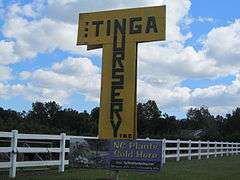
Tinga Nursery |
|
000000002000-10-04-0000October 4, 2000
(#00001185) |
U.S. Route 117, 0.62 miles north of its junction with NC 132
34°17′55″N 77°55′04″W / 34.298611°N 77.917778°W / 34.298611; -77.917778 (Tinga Nursery) |
Wrightsboro |
|
| 22 |
USS NORTH CAROLINA (BB-55) National Historic Landmark |
|
000000001982-11-10-0000November 10, 1982
(#82004893) |
Western bank of the Cape Fear River
34°14′11″N 77°57′16″W / 34.236506°N 77.954433°W / 34.236506; -77.954433 (USS NORTH CAROLINA (BB-55) National Historic Landmark) |
Wilmington |
|
| 23 |
U.S.S. PETERHOFF |
Upload image |
000000001975-08-06-0000August 6, 1975
(#75001283) |
Address Restricted
|
Fort Fisher |
|
| 24 |
James Walker Nursing School Quarters |
|
000000001989-07-20-0000July 20, 1989
(#89000944) |
1020 Rankin St.
34°14′27″N 77°56′11″W / 34.240833°N 77.936389°W / 34.240833; -77.936389 (James Walker Nursing School Quarters) |
Wilmington |
|
| 25 |
Westbrook-Ardmore Historic District |
|
000000002009-02-05-0000February 5, 2009
(#08001414) |
Bounded by Dock St., Wrightsville Ave., Queen and Lingo Sts., and by S. 14th St.
34°13′55″N 77°55′40″W / 34.232017°N 77.927664°W / 34.232017; -77.927664 (Westbrook-Ardmore Historic District) |
Wilmington |
|
| 26 |
Wilmington Historic and Archeological District |
|
000000001974-05-06-0000May 6, 1974
(#74001364) |
Roughly bounded by Wright, S. 7th, and Harnett Sts., and a north-south line 100 yards west of the North East Cape Fear River; also roughly bounded by Harnett, 7th, 3rd, and Howard, Campbell, 9th, 12th, and Princess, Dock, Castle 8th, and 14th, and 9th, Wright, and Greenfield
34°14′06″N 77°57′03″W / 34.235°N 77.950833°W / 34.235; -77.950833 (Wilmington Historic and Archeological District) |
Wilmington |
Second set of boundaries represents a boundary increase of 000000002003-05-01-0000May 1, 2003, the Wilmington Historic District
|
| 27 |
Wilmington National Cemetery |
|
000000001997-01-31-0000January 31, 1997
(#97000021) |
2011 Market St.
34°14′16″N 77°55′33″W / 34.237778°N 77.925833°W / 34.237778; -77.925833 (Wilmington National Cemetery) |
Wilmington |
|

.JPG)
_2.JPG)
_3.JPG)
.JPG)
.JPG)
.JPG)

_2.JPG)

.JPG)

