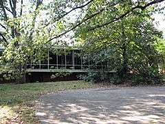
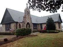
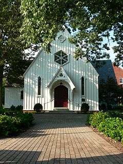
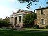
| [3] |
Name on the Register[4] |
Image |
Date listed[5] |
Location |
City or town |
Description |
|---|
| 1 |
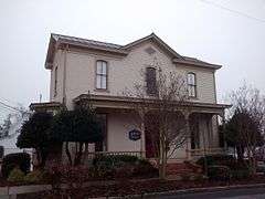
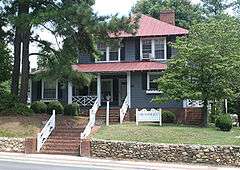
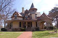
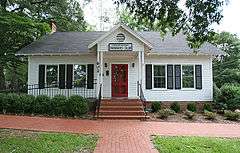
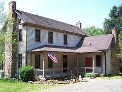
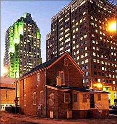
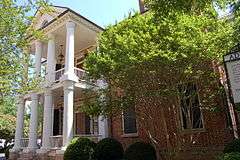
Adams-Edwards House |
Upload image |
000000002006-12-06-0000December 6, 2006
(#06001109) |
5321 Tryon Rd.
35°44′46″N 78°43′46″W / 35.746062°N 78.729510°W / 35.746062; -78.729510 (Adams-Edwards House) |
Raleigh |
|
| 2 |
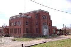
Agriculture Building |
|
000000001976-06-16-0000June 16, 1976
(#76001341) |
E. Edenton St.
35°46′53″N 78°38′22″W / 35.781389°N 78.639444°W / 35.781389; -78.639444 (Agriculture Building) |
Raleigh |
|
| 3 |
Andrews-Duncan House |
|
000000001972-01-20-0000January 20, 1972
(#72000998) |
407 N. Blount St.
35°47′05″N 78°38′11″W / 35.784628°N 78.636264°W / 35.784628; -78.636264 (Andrews-Duncan House) |
Raleigh |
|
| 4 |
Apex City Hall |
|
000000001985-12-05-0000December 5, 1985
(#85003077) |
N. Salem St.
35°43′57″N 78°51′03″W / 35.7325°N 78.850833°W / 35.7325; -78.850833 (Apex City Hall) |
Apex |
|
| 5 |
Apex Historic District |
|
000000001994-03-17-0000March 17, 1994
(#94000185) |
Roughly bounded by N. Elm, N. Salem, Center, S. Salem, and W. Chatham Sts.; also roughly bounded by E. Chatham, S. Hughes, S. Mason, and E. Moore Sts.; also Grove and Thompson Sts., and parts of Hunter St.; also roughly centered on Hunter, Center, Chatham, Cunningham, Holleman, and Hughes Sts.
35°43′53″N 78°51′05″W / 35.731389°N 78.851389°W / 35.731389; -78.851389 (Apex Historic District) |
Apex |
Second, third, and fourth set of boundaries represent boundary increases of 000000001995-03-10-0000March 10, 1995, 000000002002-02-14-0000February 14, 2002, and 000000002008-01-31-0000January 31, 2008 respectively
|
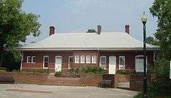
| 6 |
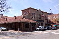
Apex Union Depot |
|
000000001988-12-01-0000December 1, 1988
(#88002697) |
SE corner N. Salem St. and Center St.
35°43′55″N 78°51′01″W / 35.731944°N 78.850278°W / 35.731944; -78.850278 (Apex Union Depot) |
Apex |
|
| 7 |
G. Dewey and Elma Arndt House |
|
000000002011-12-07-0000December 7, 2011
(#11000892) |
1428 Canterbury Rd.
35°48′27″N 78°40′10″W / 35.807567°N 78.669317°W / 35.807567; -78.669317 (G. Dewey and Elma Arndt House) |
Raleigh |
part of the Post-World War II and Modern Architecture in Raleigh, North Carolina 1945-1965 MPS
|
| 8 |
Dr. Thomas H. Avera House |
Upload image |
000000002003-09-11-0000September 11, 2003
(#03000928) |
6600 Robertson Pond Rd.
35°49′07″N 78°24′11″W / 35.818611°N 78.403056°W / 35.818611; -78.403056 (Dr. Thomas H. Avera House) |
Wendell |
|
| 9 |
Bailey-Estes House |
Upload image |
000000002010-12-28-0000December 28, 2010
(#10001097) |
9020 Mangum Dairy Rd.
36°02′08″N 78°36′09″W / 36.035556°N 78.6025°W / 36.035556; -78.6025 (Bailey-Estes House) |
Wake Forest |
Wake County MPS
|
| 10 |
George and Neva Barbee House |
|
000000002007-08-28-0000August 28, 2007
(#07000881) |
216 W. Gannon Ave.
35°49′30″N 78°19′05″W / 35.825°N 78.318056°W / 35.825; -78.318056 (George and Neva Barbee House) |
Zebulon |
|
| 11 |
Battery Heights Historic District |
Upload image |
000000002011-01-03-0000January 3, 2011
(#10001111) |
Bounded roughly by East Martin St. on the north, Battery Dr. on the east, East Davie St. on the south, and Sherrybrook Dr. on the west
35°46′31″N 78°36′54″W / 35.775278°N 78.615°W / 35.775278; -78.615 (Battery Heights Historic District) |
Raleigh |
Post-World War II and Modern Architecture in Raleigh, North Carolina, 1945-1965 MPS
|
| 12 |
Beaver Dam |
|
000000001987-01-06-0000January 6, 1987
(#86003529) |
SR 2049 at SR 2233
35°48′45″N 78°29′06″W / 35.8125°N 78.485°W / 35.8125; -78.485 (Beaver Dam) |
Knightdale |
|
| 13 |
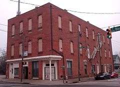
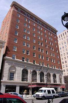
Ben-Wiley Hotel |
|
000000001997-02-27-0000February 27, 1997
(#97000195) |
331 S. Main St.
35°34′51″N 78°47′59″W / 35.580833°N 78.799722°W / 35.580833; -78.799722 (Ben-Wiley Hotel) |
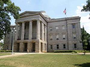
Fuquay-Varina |
|
| 14 |
Dr. Nathan M. Blalock House |
Upload image |
000000002005-12-23-0000December 23, 2005
(#05001449) |
6741 Rock Service Station Rd.
35°35′42″N 78°38′49″W / 35.595°N 78.646944°W / 35.595; -78.646944 (Dr. Nathan M. Blalock House) |
Raleigh |
|
| 15 |
Bloomsbury Historic District |
Upload image |
000000002002-05-16-0000May 16, 2002
(#02000497) |
Roughly bounded by Fairview Rd., St. Mary's St., Byrd St., Sunset Dr. and Whitaker Mill Rd.
35°48′38″N 78°38′53″W / 35.810556°N 78.648056°W / 35.810556; -78.648056 (Bloomsbury Historic District) |
Raleigh |
|
| 16 |
Boylan Apartments |
Upload image |
000000002007-09-05-0000September 5, 2007
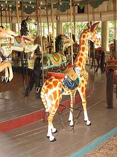
(#07000902) |
817 Hillsborough St.
35°46′57″N 78°39′05″W / 35.7825°N 78.651389°W / 35.7825; -78.651389 (Boylan Apartments) |
Raleigh |
|
| 17 |
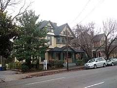
Boylan Heights |
|
000000001985-07-29-0000July 29, 1985
(#85001671) |
Roughly bounded by the Norfolk Southern railroad line, Mountford, Martin and Florence Sts. and Dorothea Dr.
35°46′26″N 78°39′07″W / 35.773889°N 78.651944°W / 35.773889; -78.651944 (Boylan Heights) |
Raleigh |
|
| 18 |
Briggs Hardware Building |
|
000000001973-10-25-0000October 25, 1973
(#73001372) |
220 Fayetteville St.
35°46′39″N 78°38′23″W / 35.7775°N 78.639722°W / 35.7775; -78.639722 (Briggs Hardware Building) |
Raleigh |
|
| 19 |
Bennett Bunn Plantation |
|
000000001986-02-04-0000February 4, 1986
(#86000157) |
NC 97
35°50′14″N 78°16′59″W / 35.837222°N 78.283056°W / 35.837222; -78.283056 (Bennett Bunn Plantation) |
Zebulon |
|
| 20 |
Cameron Park |
Upload image |
000000001985-07-29-0000July 29, 1985
(#85001673) |
Roughly bounded by Clark Ave., W. Peace and Saint Mary's Sts., College Pl., Hillsborough St. and Oberlin Rd.
35°47′07″N 78°39′29″W / 35.785278°N 78.658056°W / 35.785278; -78.658056 (Cameron Park) |
Raleigh |
|
| 21 |
Cameron Village Historic District |
|
000000002011-12-22-0000December 22, 2011
(#11000956) |
Roughly bounded by Daniels St., Wade Ave., Woodburn Rd., & Smallwood Dr.
35°47′38″N 78°39′27″W / 35.793761°N 78.657603°W / 35.793761; -78.657603 (Cameron Village Historic District) |
Raleigh |
part of the Post-World War II and Modern Architecture in Raleigh, North Carolina 1945-1965 MPS
|
| 22 |
Cannady-Brogden Farm |
Upload image |
000000002001-04-25-0000April 25, 2001
(#01000424) |
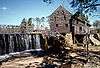
15260 Brogden Rd.
36°03′55″N 78°41′09″W / 36.065142°N 78.685803°W / 36.065142; -78.685803 (Cannady-Brogden Farm) |
Creedmoor |
|
| 23 |
Capehart House |
|
000000001975-01-17-0000January 17, 1975
(#75001293) |
N. Blount St.
35°56′28″N 78°34′03″W / 35.941111°N 78.5675°W / 35.941111; -78.5675 (Capehart House) |
Raleigh |
|
| 24 |
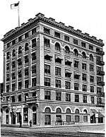
Capital Club Building |
|
000000001985-12-05-0000December 5, 1985
(#85003076) |
16 W. Martin St.
35°46′38″N 78°38′26″W / 35.777222°N 78.640556°W / 35.777222; -78.640556 (Capital Club Building) |
Raleigh |
|
| 25 |
Capitol Area Historic District |
|
000000001978-04-15-0000April 15, 1978
(#78001978) |
State Capitol building and environs
35°46′48″N 78°38′15″W / 35.78°N 78.6375°W / 35.78; -78.6375 (Capitol Area Historic District) |
Raleigh |
|
| 26 |
Capitol Heights Historic District |
|
000000002011-01-03-0000January 3, 2011
(#10001112) |
Roughly bounded by Penn Rd., North State St., Glascock St., and Madison Rd.
35°47′26″N 78°37′18″W / 35.790556°N 78.621667°W / 35.790556; -78.621667 (Capitol Heights Historic District) |
Raleigh |
Post-World War II and Modern Architecture in Raleigh, North Carolina, 1945-1965 MPS
|
| 27 |
Caraleigh Mills |
Upload image |
000000002001-05-25-0000May 25, 2001
(#01000557) |
421 Maywood Ave.
35°45′41″N 78°39′12″W / 35.761389°N 78.653333°W / 35.761389; -78.653333 (Caraleigh Mills) |
Raleigh |
|
| 28 |
Carolina Coach Garage and Shop |
|
000000002009-08-27-0000August 27, 2009
(#09000661) |
510 E. Davie St.
35°46′31″N 78°37′54″W / 35.775344°N 78.631572°W / 35.775344; -78.631572 (Carolina Coach Garage and Shop) |
Raleigh |
|
| 29 |
Carolina Power and Light Company Car Barn and Automobile Garage |
|
000000001997-10-30-0000October 30, 1997
(#97001304) |
116 N. West St.
35°46′56″N 78°38′44″W / 35.782222°N 78.645556°W / 35.782222; -78.645556 (Carolina Power and Light Company Car Barn and Automobile Garage) |
Raleigh |
|
| 30 |
Carpenter Historic District |
|
000000002000-05-26-0000May 26, 2000
(#00000549) |
Along Capenter-Morrisville Road, east of CSX Transportation tracks and west of Davis Drive
35°49′18″N 78°51′47″W / 35.821667°N 78.863056°W / 35.821667; -78.863056 (Carpenter Historic District) |
Cary |
|
| 31 |
Cary Historic District |
Upload image |
000000002001-04-25-0000April 25, 2001
(#01000425) |
Roughly along Dry Ave., S. Academy St., and Park St.
35°47′09″N 78°46′56″W / 35.785833°N 78.782222°W / 35.785833; -78.782222 (Cary Historic District) |
Cary |
|
| 32 |
John Chavis Memorial Park |
|
000000002016-04-19-0000April 19, 2016
(#16000188) |
505 Martin Luther King Blvd.
35°46′10″N 78°37′48″W / 35.769416°N 78.630057°W / 35.769416; -78.630057 (John Chavis Memorial Park) |
Raleigh |
|
| 33 |
Christ Episcopal Church |
|
000000001970-07-28-0000July 28, 1970
(#70000469) |
120 E. Edenton St.
35°46′52″N 78°39′36″W / 35.781111°N 78.66°W / 35.781111; -78.66 (Christ Episcopal Church) |
Raleigh |
Designated a National Historic Landmark on December 23, 1987
|
| 34 |
City Cemetery |
|
000000002008-09-12-0000September 12, 2008
(#08000889) |
17 S. E. St.
35°46′45″N 78°37′51″W / 35.779069°N 78.63095°W / 35.779069; -78.63095 (City Cemetery) |
Raleigh |
|
| 35 |
Crabtree Creek Recreational Demonstration Area |
Upload image |
000000001995-06-30-0000June 30, 1995
(#95000783) |
Roughly bounded by Interstate 40, U.S. Route 70, and the Raleigh-Durham Airport
35°51′17″N 78°45′09″W / 35.854722°N 78.7525°W / 35.854722; -78.7525 (Crabtree Creek Recreational Demonstration Area) |
Raleigh |
|
| 36 |
William A. Curtis House |
Upload image |
000000002008-09-24-0000September 24, 2008
(#08000939) |
1415 Poole Rd.
35°46′44″N 78°37′01″W / 35.778772°N 78.616808°W / 35.778772; -78.616808 (William A. Curtis House) |
Raleigh |
|
| 37 |
Josephus Daniels House |
|
000000001976-12-08-0000December 8, 1976
(#76001342) |
1520 Caswell St.
35°47′57″N 78°38′50″W / 35.799167°N 78.647222°W / 35.799167; -78.647222 (Josephus Daniels House) |
Raleigh |
|
| 38 |
Davis-Adcock Store |
Upload image |
000000002006-09-06-0000September 6, 2006
(#06000788) |
2013 Piney Grove-Wilbon Rd., on the eastern side of Piney Grove-Wilbon Rd., and 0.2 miles (0.32 km) north of its junction with Wilbon Rd.
35°36′11″N 78°50′21″W / 35.603056°N 78.839167°W / 35.603056; -78.839167 (Davis-Adcock Store) |
Wilbon |
|
| 39 |
Depot Historic District |
|
000000002002-09-06-0000September 6, 2002
(#02000946) |
Bounded by W. Hargett, S. McDowell, S. Dawson, and W. Cabarrus St.
35°46′42″N 78°38′38″W / 35.778333°N 78.643889°W / 35.778333; -78.643889 (Depot Historic District) |
Raleigh |
|
| 40 |
Dix Hill |
|
000000001990-11-07-0000November 7, 1990
(#90001638) |
Roughly bounded by Dorothea Dr., Lake Wheeler Rd. and the Norfolk Southern RR tracks
35°46′06″N 78°39′15″W / 35.768333°N 78.654167°W / 35.768333; -78.654167 (Dix Hill) |
Raleigh |
|
| 41 |
Dodd-Hinsdale House |
|
000000001971-11-12-0000November 12, 1971
(#71000623) |
330 Hillsborough St.
35°46′51″N 78°38′41″W / 35.780851°N 78.6447676°W / 35.780851; -78.6447676 (Dodd-Hinsdale House) |
Raleigh |
|
| 42 |
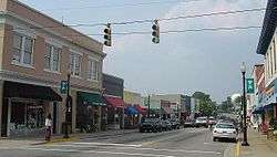
Downtown Garner Historic District |
Upload image |
000000001989-12-21-0000December 21, 1989
(#89002157) |
Roughly Garner Rd. and Main St. from New Rand Rd. to Broughton St.
35°42′27″N 78°36′25″W / 35.7075°N 78.606944°W / 35.7075; -78.606944 (Downtown Garner Historic District) |
Garner |
|
| 43 |
Downtown Wake Forest Historic District |
Upload image |
000000002002-02-20-0000February 20, 2002
(#02000059) |
South White St. roughly from E. Roosevelt Ave. to Owen Ave.
35°58′48″N 78°30′36″W / 35.980000°N 78.510000°W / 35.980000; -78.510000 (Downtown Wake Forest Historic District) |
Wake Forest |
|
| 44 |
W. E. B. DuBois School |
Upload image |
000000001993-10-05-0000October 5, 1993
(#93000998) |
536 Franklin St.
35°59′06″N 78°30′04″W / 35.985°N 78.501111°W / 35.985; -78.501111 (W. E. B. DuBois School) |
Wake Forest |
|
| 45 |
East Raleigh-South Park Historic District |
|
000000001990-10-11-0000October 11, 1990
(#90001527) |
Roughly bounded by Bragg, East, E. Lenoir, Alston, Camden, Hargett, Swain, Davis, and S. Blount Sts.
35°46′20″N 78°38′00″W / 35.772222°N 78.633333°W / 35.772222; -78.633333 (East Raleigh-South Park Historic District) |
Raleigh |
|
| 46 |
Edenwood |
Upload image |
000000001993-07-02-0000July 2, 1993
(#93000544) |
7620 Old Stage Rd.
35°40′26″N 78°39′38″W / 35.673889°N 78.660556°W / 35.673889; -78.660556 (Edenwood) |
Garner |
|
| 47 |
Elmwood |
|
000000001975-10-29-0000October 29, 1975
(#75001294) |
16 N. Boylan Ave.
35°46′53″N 78°38′56″W / 35.781389°N 78.648889°W / 35.781389; -78.648889 (Elmwood) |
Raleigh |
|
| 48 |
Estey Hall |
|
000000001973-05-25-0000May 25, 1973
(#73001373) |
E. South St. on Shaw University campus
35°46′17″N 78°38′14″W / 35.771389°N 78.637222°W / 35.771389; -78.637222 (Estey Hall) |
Raleigh |
|
| 49 |
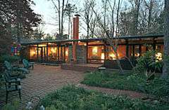
Fadum House |
|
000000001993-06-10-0000June 10, 1993
(#93000440) |
3056 Granville Dr.
35°49′19″N 78°39′51″W / 35.821944°N 78.664167°W / 35.821944; -78.664167 (Fadum House) |
Raleigh |
|
| 50 |
Falls of the Neuse Manufacturing Company |
Upload image |
000000001983-09-19-0000September 19, 1983
(#83001921) |
Neuse River at SR 2000
35°56′20″N 78°34′44″W / 35.938889°N 78.578889°W / 35.938889; -78.578889 (Falls of the Neuse Manufacturing Company) |
Falls |
|
| 51 |
Fayetteville Street Historic District |
|
000000002008-02-27-0000February 27, 2008
(#07001412) |
Roughly 100-400 blks. of Fayetteville, 00-100 blks. of W. Hargett, 00 blk. of W. Martin, 100-400 S. Salisbury Sts.
35°46′39″N 78°38′21″W / 35.777486°N 78.639261°W / 35.777486; -78.639261 (Fayetteville Street Historic District) |
Raleigh |
|
| 52 |
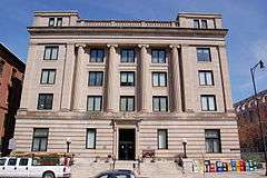
Federal Building |
|
000000001971-05-06-0000May 6, 1971
(#71000624) |
300 Fayetteville St.
35°46′38″N 78°38′40″W / 35.777222°N 78.644444°W / 35.777222; -78.644444 (Federal Building) |
Raleigh |
|
| 53 |
Forestville Baptist Church |
|
000000001984-10-25-0000October 25, 1984
(#84000118) |
1350 South Main Street
35°57′36″N 78°31′13″W / 35.96°N 78.520278°W / 35.96; -78.520278 (Forestville Baptist Church) |
Forestville |
|
| 54 |
Free Church of the Good Shepherd |
|
000000002008-09-10-0000September 10, 2008
(#08000888) |
110 S. East St.
35°46′44″N 78°37′57″W / 35.77887°N 78.632592°W / 35.77887; -78.632592 (Free Church of the Good Shepherd) |
Raleigh |
|
| 55 |
Fuquay Mineral Spring |
|
000000001986-12-04-0000December 4, 1986
(#86003457) |
NE corner of Main and W. Spring Sts.
35°34′48″N 78°48′03″W / 35.58°N 78.800833°W / 35.58; -78.800833 (Fuquay Mineral Spring) |
Fuquay-Varina |
|
| 56 |
Fuquay Springs High School |
Upload image |
000000002002-05-16-0000May 16, 2002
(#02000495) |
112 N. Ennis St.
35°35′12″N 78°47′38″W / 35.586667°N 78.793889°W / 35.586667; -78.793889 (Fuquay Springs High School) |
Fuquay-Varina |
|
| 57 |
Fuquay Springs Historic District |
|
000000001996-11-29-0000November 29, 1996
(#96001398) |
Roughly, S. Main St. and Fuquay Ave. from Spring St. to Sunset Dr. and Spring St. from Spring Ave. to Angier Rd.
35°34′49″N 78°47′55″W / 35.580278°N 78.798611°W / 35.580278; -78.798611 (Fuquay Springs Historic District) |
Fuquay-Varina |
|
| 58 |
Fuquay Springs Teacherage |
|
000000002005-12-23-0000December 23, 2005
(#05001448) |
602 E Academy St.
35°35′09″N 78°47′35″W / 35.585833°N 78.793056°W / 35.585833; -78.793056 (Fuquay Springs Teacherage) |
Fuquay-Varina |
|
| 59 |
Fuquay-Varina Woman's Club Clubhouse |
|
000000002007-04-24-0000April 24, 2007
(#07000352) |
602 N. Ennis St.
35°35′32″N 78°47′35″W / 35.592222°N 78.793056°W / 35.592222; -78.793056 (Fuquay-Varina Woman's Club Clubhouse) |
Fuquay-Varina |
|
| 60 |
Glen Royall Mill Village Historic District |
Upload image |
000000001999-08-27-0000August 27, 1999
(#99001046) |
Roughly bounded by N. Main St., E. Cedar Ave., CSX RR, and Royall Cotton Mill
35°59′20″N 78°30′10″W / 35.988889°N 78.502778°W / 35.988889; -78.502778 (Glen Royall Mill Village Historic District) |
Wake Forest |
|
| 61 |
Glenwood |
Upload image |
000000001985-07-29-0000July 29, 1985
(#85001672) |
Roughly bounded by W. Peace St., St. Mary's St., Wills Forest St., and Glenwood Ave.
35°47′36″N 78°38′45″W / 35.793333°N 78.645833°W / 35.793333; -78.645833 (Glenwood) |
Raleigh |
Present boundaries reflect a boundary increase and decrease of 000000002002-02-20-0000February 20, 2002; original boundaries were "roughly bounded by Wade Ave., the Norfolk and Southern railroad line, Belmont St., and Glenwood Ave."
|
| 62 |
Willis M. Graves House |
Upload image |
000000002002-05-16-0000May 16, 2002
(#02000500) |
802 Oberlin Rd.
35°47′45″N 78°39′42″W / 35.795833°N 78.661667°W / 35.795833; -78.661667 (Willis M. Graves House) |
Raleigh |
|
| 63 |
Green Level Historic District |
Upload image |
000000002001-04-05-0000April 5, 2001
(#01000340) |
Jct. Green Level Church, Green Level West Rd., and Beaver Dam Rd.
35°47′06″N 78°54′11″W / 35.785°N 78.903056°W / 35.785; -78.903056 (Green Level Historic District) |
Cary |
|
| 64 |
Herman Green House |
Upload image |
000000002003-09-11-0000September 11, 2003
(#03000930) |
NC 1371, 0.4 miles (0.64 km) north of NC 1375 (5500 Lake Wheeler Rd.)
35°42′34″N 78°41′22″W / 35.709444°N 78.689444°W / 35.709444; -78.689444 (Herman Green House) |
Raleigh |
|
| 65 |
Green-Hartsfield House |
Upload image |
000000001989-12-21-0000December 21, 1989
(#89002158) |
SR 2303 at jct. with SR 2304
35°55′02″N 78°22′57″W / 35.917222°N 78.3825°W / 35.917222; -78.3825 (Green-Hartsfield House) |
Rolesville |
|
| 66 |
Grosvenor Gardens Apartments |
|
000000001992-11-12-0000November 12, 1992
(#92001602) |
1101 Hillsborough St.
35°46′53″N 78°39′18″W / 35.781389°N 78.655°W / 35.781389; -78.655 (Grosvenor Gardens Apartments) |
Raleigh |
|
| 67 |
Rev. Plummer T. Hall House |
Upload image |
000000002002-05-16-0000May 16, 2002
(#02000501) |
814 Oberlin Rd.
35°47′49″N 78°39′40″W / 35.796944°N 78.661111°W / 35.796944; -78.661111 (Rev. Plummer T. Hall House) |
Raleigh |
|
| 68 |
Harmony Plantation |
Upload image |
000000002008-01-29-0000January 29, 2008
(#07001504) |
5104 Riley Hill Rd.
35°51′54″N 78°26′38″W / 35.865°N 78.443889°W / 35.865; -78.443889 (Harmony Plantation) |
Wendell |
|
| 69 |
Harwell Hamilton and Jean Bangs Harris House and Office |
Upload image |
000000002010-12-28-0000December 28, 2010
(#10001098) |
122 Cox Ave.
35°47′02″N 78°39′40″W / 35.783889°N 78.661111°W / 35.783889; -78.661111 (Harwell Hamilton and Jean Bangs Harris House and Office) |
Raleigh |
Early Modern Architecture Associated with NCSU School of Design Faculty MPS
|
| 70 |
Hawkins-Hartness House |
Upload image |
000000001972-02-01-0000February 1, 1972
(#72000999) |
310 N. Blount St.
35°48′19″N 78°36′57″W / 35.805278°N 78.615833°W / 35.805278; -78.615833 (Hawkins-Hartness House) |
Raleigh |
|
| 71 |
Hayes Barton Historic District |
Upload image |
000000002002-05-16-0000May 16, 2002
(#02000496) |
Roughly bounded by St. Mary's St., Fairview Rd., Aycock St., Scales St. and Williamson Dr.
35°48′14″N 78°38′57″W / 35.803889°N 78.649167°W / 35.803889; -78.649167 (Hayes Barton Historic District) |
Raleigh |
|
| 72 |
Haywood Hall |
|
000000001970-07-28-0000July 28, 1970
(#70000470) |
211 New Bern Ave.
35°46′50″N 78°38′09″W / 35.7806595°N 78.6358413°W / 35.7806595; -78.6358413 (Haywood Hall) |
Raleigh |
|
| 73 |
Hi-Mount Historic District |
Upload image |
000000002011-07-29-0000July 29, 2011
(#11000484) |
Roughly bounded by E. Whitaker Mill Rd., Bernard, Peebles, Main & Hilton Sts.
35°48′41″N 78°37′53″W / 35.811389°N 78.631389°W / 35.811389; -78.631389 (Hi-Mount Historic District) |
Raleigh |
Post-World War II and Modern Architecture in Raleigh, NC, 1845-1965 MPS
|
| 74 |
Dr. Hubert Benbury Haywood House |
Upload image |
000000001995-12-13-0000December 13, 1995
(#95001440) |
634 N . Blount St.
35°47′19″N 78°38′10″W / 35.788611°N 78.636111°W / 35.788611; -78.636111 (Dr. Hubert Benbury Haywood House) |
Raleigh |
|
| 75 |
Richard B. Haywood House |
|
000000001970-07-28-0000July 28, 1970
(#70000471) |
127 E. Edenton St.
35°47′08″N 78°38′17″W / 35.785556°N 78.638056°W / 35.785556; -78.638056 (Richard B. Haywood House) |
Raleigh |
|
| 76 |
Heartsfield-Perry Farm |
Upload image |
000000002003-01-23-0000January 23, 2003
(#02001728) |
NC 2224, 0.1 miles (0.16 km) southeast of NC 2300
35°54′55″N 78°23′33″W / 35.915278°N 78.3925°W / 35.915278; -78.3925 (Heartsfield-Perry Farm) |
Rolesville |
|
| 77 |
Heck-Andrews House |
|
000000001972-01-20-0000January 20, 1972
(#72001000) |
309 N. Blount St.
35°48′19″N 78°36′58″W / 35.805278°N 78.616111°W / 35.805278; -78.616111 (Heck-Andrews House) |
Raleigh |
|
| 78 |
Heck-Lee, Heck-Wynne, and Heck-Pool Houses |
|
000000001973-04-13-0000April 13, 1973
(#73001374) |
503 and 511 E. Jones St. and 218 N. East St.
35°46′58″N 78°37′58″W / 35.782778°N 78.632778°W / 35.782778; -78.632778 (Heck-Lee, Heck-Wynne, and Heck-Pool Houses) |
Raleigh |
|
| 79 |
Isabelle Bowen Henderson House and Gardens |
Upload image |
000000001989-08-07-0000August 7, 1989
(#89001049) |
2134 Oberlin Rd.
35°47′13″N 78°39′45″W / 35.786944°N 78.6625°W / 35.786944; -78.6625 (Isabelle Bowen Henderson House and Gardens) |
Raleigh |
|
| 80 |
Samuel Bartley Holleman House |
|
000000002008-01-30-0000January 30, 2008
(#07001503) |
3424 Avent Ferry Rd.
35°37′07″N 78°54′36″W / 35.618611°N 78.91°W / 35.618611; -78.91 (Samuel Bartley Holleman House) |
New Hill |
|
| 81 |
Holly Springs Masonic Lodge |
|
000000002010-04-07-0000April 7, 2010
(#10000164) |
224 Raleigh St.
35°39′07″N 78°49′57″W / 35.651878°N 78.832619°W / 35.651878; -78.832619 (Holly Springs Masonic Lodge) |
Holly Springs |
|
| 82 |
Hood-Anderson Farm |
Upload image |
000000001999-04-29-0000April 29, 1999
(#99000509) |
Old Battle Bridge Rd., 0.4 miles (0.64 km) south of the junction with Old Tarboro Rd.
35°47′46″N 78°24′20″W / 35.796111°N 78.405556°W / 35.796111; -78.405556 (Hood-Anderson Farm) |
Eagle Rock |
|
| 83 |
Rufus J. Ivey House |
Upload image |
000000002006-04-05-0000April 5, 2006
(#06000223) |
6115 Louisburg
35°51′35″N 78°33′12″W / 35.859722°N 78.553333°W / 35.859722; -78.553333 (Rufus J. Ivey House) |
Raleigh |
|
| 84 |
Ivey-Ellington House |
Upload image |
000000002008-05-15-0000May 15, 2008
(#08000414) |
135 W. Chatham St.
35°47′14″N 78°46′56″W / 35.787233°N 78.782339°W / 35.787233; -78.782339 (Ivey-Ellington House) |
Cary |
|
| 85 |
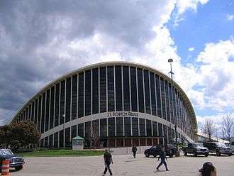
J. S. Dorton Arena |
|
000000001973-04-11-0000April 11, 1973
(#73001375) |
North Carolina State Fairgrounds, W. Hillsborough St.
35°47′37″N 78°42′36″W / 35.793611°N 78.71°W / 35.793611; -78.71 (J. S. Dorton Arena) |
Raleigh |
|
| 86 |
J. Beale Johnson House |
|
000000001991-09-05-0000September 5, 1991
(#91001375) |
6321 Johnson Pond Rd.
35°36′40″N 78°45′21″W / 35.611111°N 78.755833°W / 35.611111; -78.755833 (J. Beale Johnson House) |
Fuquay-Varina |
|
| 87 |
Kemp B. Johnson House |
|
000000002005-09-15-0000September 15, 2005
(#05001028) |
7116 Johnson Pond Rd.
35°35′58″N 78°45′49″W / 35.599444°N 78.763611°W / 35.599444; -78.763611 (Kemp B. Johnson House) |
Fuquay-Varina |
|
| 88 |
Alpheus Jones House |
Upload image |
000000001975-07-07-0000July 7, 1975
(#75001295) |
Northeast of Raleigh on US 401
35°51′50″N 78°32′50″W / 35.863889°N 78.547222°W / 35.863889; -78.547222 (Alpheus Jones House) |
Raleigh |
|
| 89 |
Nancy Jones House |
Upload image |
000000001984-03-01-0000March 1, 1984
(#84002540) |
NC 54
35°47′54″N 78°48′09″W / 35.798333°N 78.8025°W / 35.798333; -78.8025 (Nancy Jones House) |
Cary |
|
| 90 |
Nathaniel Jones Jr. House |
|
000000001973-06-04-0000June 4, 1973
(#73001376) |
3108 Hillmer Drive
35°49′20″N 78°37′26″W / 35.822271°N 78.624001°W / 35.822271; -78.624001 (Nathaniel Jones Jr. House) |
Raleigh |
Listing renamed from "Crabtree Jones House" in 2016.
|
| 91 |
Jones-Johnson-Ballentine Historic District |
Upload image |
000000001990-01-26-0000January 26, 1990
(#89002352) |
SR 1301-522 Sunset Rd.
35°36′36″N 78°46′21″W / 35.61°N 78.7725°W / 35.61; -78.7725 (Jones-Johnson-Ballentine Historic District) |
Fuquay-Varina |
|
| 92 |
Henry L. Kamphoefner House |
|
000000001996-03-12-0000March 12, 1996
(#96000197) |
3060 Granville Dr.
35°49′21″N 78°39′46″W / 35.8225°N 78.662778°W / 35.8225; -78.662778 (Henry L. Kamphoefner House) |
Raleigh |
|
| 93 |
Henry H. and Bettie S. Knight Farm |
Upload image |
000000001988-01-12-0000January 12, 1988
(#87002234) |
US 64
35°48′04″N 78°29′34″W / 35.801111°N 78.492778°W / 35.801111; -78.492778 (Henry H. and Bettie S. Knight Farm) |
Knightdale |
|
| 94 |
Joel Lane House |
|
000000001970-07-28-0000July 28, 1970
(#70000472) |
728 W. Hargett St.
35°46′40″N 78°39′03″W / 35.777778°N 78.650833°W / 35.777778; -78.650833 (Joel Lane House) |
Raleigh |
|
| 95 |
Lane-Bennett House |
Upload image |
000000001983-06-30-0000June 30, 1983
(#77001011) |
7408 Ebenezer Church Rd.
35°52′17″N 78°44′27″W / 35.871389°N 78.740833°W / 35.871389; -78.740833 (Lane-Bennett House) |
Raleigh |
|
| 96 |
Rev. M.L. Latta House |
Upload image |
000000002002-05-16-0000May 16, 2002
(#02000502) |
1001 Parker St.
35°47′53″N 78°39′47″W / 35.798056°N 78.663056°W / 35.798056; -78.663056 (Rev. M.L. Latta House) |
Raleigh |
Burned on January 8, 2007.
|
| 97 |
Calvin Wray Lawrence House |
Upload image |
000000002008-09-23-0000September 23, 2008
(#08000937) |
8528 Ragan Rd.
35°43′00″N 78°56′23″W / 35.716675°N 78.9396°W / 35.716675; -78.9396 (Calvin Wray Lawrence House) |
Apex |
|
| 98 |
Dr. Elmo N. Lawrence House |
Upload image |
000000002005-04-20-0000April 20, 2005
(#05000320) |
2121 Lake Wheeler Rd.
35°45′09″N 78°40′05″W / 35.7525°N 78.668056°W / 35.7525; -78.668056 (Dr. Elmo N. Lawrence House) |
Raleigh |
|
| 99 |
Lea Laboratory |
Upload image |
000000001975-05-29-0000May 29, 1975
(#75001298) |
Southeastern Baptist Theological Seminary campus
35°58′52″N 78°30′42″W / 35.981111°N 78.511667°W / 35.981111; -78.511667 (Lea Laboratory) |
Wake Forest |
|
| 100 |
Leslie-Alford-Mims House |
|
000000001997-03-08-0000March 8, 1997
(#97000218) |
100 Avent Ferry Rd.
35°39′07″N 78°50′11″W / 35.651944°N 78.836389°W / 35.651944; -78.836389 (Leslie-Alford-Mims House) |
Holly Springs |
|
| 101 |
Lewis-Smith House |
|
000000001972-12-11-0000December 11, 1972
(#72001001) |
N. Blount St.
35°47′08″N 78°38′08″W / 35.785556°N 78.635556°W / 35.785556; -78.635556 (Lewis-Smith House) |
Raleigh |
|
| 102 |
Longview Gardens Historic District |
Upload image |
000000002011-01-03-0000January 3, 2011
(#10001113) |
Bounded roughly by King Charles Rd., Poole Rd., Donald Ross Dr., Albemarle Ave., Longview Lake Dr., and New Bern Ave.
35°46′37″N 78°35′50″W / 35.776944°N 78.597222°W / 35.776944; -78.597222 (Longview Gardens Historic District) |
Raleigh |
Post-World War II and Modern Architecture in Raleigh, North Carolina, 1945-1965 MPS
|
| 103 |
Lumsden-Boone Building |
|
000000001983-09-08-0000September 8, 1983
(#83001923) |
226 Fayetteville St. Mall
35°46′38″N 78°38′23″W / 35.777222°N 78.639722°W / 35.777222; -78.639722 (Lumsden-Boone Building) |
Raleigh |
|
| 104 |
Madonna Acres Historic District |
Upload image |
000000002010-09-01-0000September 1, 2010
(#10000632) |
Delany Dr., Dillon, Summerville, and Tierney Circles
35°47′27″N 78°36′55″W / 35.790833°N 78.615278°W / 35.790833; -78.615278 (Madonna Acres Historic District) |
Raleigh |
|
| 105 |
Mahler and Carolina Trust Buildings |
|
000000002000-11-29-0000November 29, 2000
(#00000457) |
228-232 Fayetteville St. Mall
35°46′38″N 78°38′23″W / 35.777222°N 78.639722°W / 35.777222; -78.639722 (Mahler and Carolina Trust Buildings) |
Raleigh |
|
| 106 |
Maiden Lane Historic District |
Upload image |
000000002006-05-03-0000May 3, 2006
(#06000338) |
2-20 Maiden Ln.
35°47′19″N 78°39′47″W / 35.788611°N 78.663056°W / 35.788611; -78.663056 (Maiden Lane Historic District) |
Raleigh |
|
| 107 |
James Mangum House |
|
000000001974-11-18-0000November 18, 1974
(#74001379) |
Southwest of Durham off NC 751
36°01′22″N 78°41′58″W / 36.022778°N 78.699444°W / 36.022778; -78.699444 (James Mangum House) |
Creedmoor |
Creedmoor is in Granville County. The geocode coordinates in the NRIS are in Chatham County. NC-751 southwest of Durham places the site in either Durham or Chatham County.
|
| 108 |
Marshall-Harris-Richardson House |
|
000000001986-03-05-0000March 5, 1986
(#86000403) |
116 N. Person St.
35°46′53″N 78°38′05″W / 35.781389°N 78.634722°W / 35.781389; -78.634722 (Marshall-Harris-Richardson House) |
Raleigh |
|
| 109 |
Mary Elizabeth Hospital |
Upload image |
000000002009-02-05-0000February 5, 2009
(#08001415) |
1100 Wake Forest Rd.
35°47′37″N 78°37′53″W / 35.793528°N 78.631311°W / 35.793528; -78.631311 (Mary Elizabeth Hospital) |
Raleigh |
|
| 110 |
Masonic Temple Building |
|
000000001984-05-03-0000May 3, 1984
(#84002533) |
427 S. Blount St.
35°46′27″N 78°38′12″W / 35.774167°N 78.636667°W / 35.774167; -78.636667 (Masonic Temple Building) |
Raleigh |
|
| 111 |
Masonic Temple Building |
|
000000001979-09-17-0000September 17, 1979
(#79003341) |
133 Fayetteville St. Mall
35°46′42″N 78°38′21″W / 35.778333°N 78.639167°W / 35.778333; -78.639167 (Masonic Temple Building) |
Raleigh |
|
| 112 |
Matsumoto House |
|
000000001994-09-21-0000September 21, 1994
(#94001089) |
821 Runnymeade Rd.
35°48′55″N 78°40′31″W / 35.815278°N 78.675278°W / 35.815278; -78.675278 (Matsumoto House) |
Raleigh |
|
| 113 |
Meadowbrook Country Club |
Upload image |
000000002009-12-16-0000December 16, 2009
(#09001106) |
8025 Country Club Dr.
35°39′37″N 78°34′10″W / 35.660333°N 78.569356°W / 35.660333; -78.569356 (Meadowbrook Country Club) |
Garner |
|
| 114 |
Merrimon-Wynne House |
|
000000002014-08-25-0000August 25, 2014
(#14000523) |
500 N. Blount St.
35°47′11″N 78°38′09″W / 35.7863°N 78.6359°W / 35.7863; -78.6359 (Merrimon-Wynne House) |
Raleigh |
|
| 115 |
Midway Plantation House and Outbuildings |
|
000000002007-06-15-0000June 15, 2007
(#07000543) |
1625 Old Crews Rd.
35°49′24″N 78°29′13″W / 35.823433°N 78.486953°W / 35.823433; -78.486953 (Midway Plantation House and Outbuildings) |
Knightdale |
Buildings relocated in 2006. Original listing (70000473) cancelled and replaced by this listing.
|
| 116 |
Montfort Hall |
|
000000001978-03-08-0000March 8, 1978
(#78001979) |
308 Boylan Ave.
35°46′35″N 78°39′04″W / 35.776389°N 78.651111°W / 35.776389; -78.651111 (Montfort Hall) |
Raleigh |
|
| 117 |
Moore Square Historic District |
|
000000001983-08-03-0000August 3, 1983
(#83001924) |
Roughly bounded by Person, Morgan, Wilmington, and Davie Sts.
35°46′39″N 78°38′14″W / 35.7775°N 78.637222°W / 35.7775; -78.637222 (Moore Square Historic District) |
Raleigh |
|
| 118 |
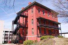
Mordecai House |
|
000000001970-07-01-0000July 1, 1970
(#70000474) |
Mimosa St.
35°47′33″N 78°38′00″W / 35.7925°N 78.633333°W / 35.7925; -78.633333 (Mordecai House) |
Raleigh |
Boundary increase (listed December 28, 2000): 208 Delway St.
|
| 119 |
Mordecai Place Historic District |
Upload image |
000000001998-02-04-0000February 4, 1998
(#97001668) |
Roughly bounded by N. Blount St., Courtland Dr., Old Wake Forest Rd., and Mordecai Dr.; also 208 Delway St.
35°47′30″N 78°37′58″W / 35.791667°N 78.632778°W / 35.791667; -78.632778 (Mordecai Place Historic District) |
Raleigh |
208 Delway represents a boundary increase of 000000002000-12-28-0000December 28, 2000
|
| 120 |
Morrisville Christian Church |
|
000000002012-11-06-0000November 6, 2012
(#12000913) |
222 Church St.
35°49′30″N 78°49′42″W / 35.824981°N 78.828256°W / 35.824981; -78.828256 (Morrisville Christian Church) |
Morrisville |
Part of the Wake County MPS
|
| 121 |
Mount Hope Cemetery |
Upload image |
000000002009-01-08-0000January 8, 2009
(#08001292) |
1100 Fayetteville St.
35°45′57″N 78°38′35″W / 35.765814°N 78.643014°W / 35.765814; -78.643014 (Mount Hope Cemetery) |
Raleigh |
|
| 122 |
New Hill Historic District |
|
000000002001-04-25-0000April 25, 2001
(#01000426) |
Roughly 0.5 miles (0.80 km) south of the junction of Old U.S. Route 1 and NC 1127, and 2 miles (3.2 km) west of the junction with Old U.S. Route 1
35°40′48″N 78°56′26″W / 35.68°N 78.940556°W / 35.68; -78.940556 (New Hill Historic District) |
New Hill |
|
| 123 |
Norburn Terrace |
Upload image |
000000001980-02-01-0000February 1, 1980
(#80002902) |
216 Lafayette St.
35°47′38″N 78°37′47″W / 35.793889°N 78.629722°W / 35.793889; -78.629722 (Norburn Terrace) |
Raleigh |
|
| 124 |
North Carolina Agricultural Experiment Station Cottage |
|
000000002001-10-15-0000October 15, 2001
(#01001112) |
2714 Vanderbilt Ave.
35°47′30″N 78°40′20″W / 35.791667°N 78.672222°W / 35.791667; -78.672222 (North Carolina Agricultural Experiment Station Cottage) |
Raleigh |
|
| 125 |
North Carolina Executive Mansion |
|
000000001970-02-26-0000February 26, 1970
(#70000475) |
210 N. Blount St.
35°46′59″N 78°38′09″W / 35.7831387°N 78.6357752°W / 35.7831387; -78.6357752 (North Carolina Executive Mansion) |
Raleigh |
|
| 126 |
North Carolina School for the Blind and Deaf Dormitory |
|
000000001976-08-11-0000August 11, 1976
(#76001343) |
216 W. Jones St.
35°46′58″N 78°38′35″W / 35.782778°N 78.643056°W / 35.782778; -78.643056 (North Carolina School for the Blind and Deaf Dormitory) |
Raleigh |
|
| 127 |
North Carolina State Capitol |
|
000000001970-02-26-0000February 26, 1970
(#70000476) |
Capitol Sq.
35°46′59″N 78°38′20″W / 35.783056°N 78.638889°W / 35.783056; -78.638889 (North Carolina State Capitol) |
Raleigh |
|
| 128 |
North Carolina State Fair Commercial & Education Buildings |
Upload image |
000000001987-06-05-0000June 5, 1987
(#87000855) |
NW corner Jct. of Blue Ridge Rd. and Hillsborough St.
35°47′40″N 78°42′28″W / 35.794444°N 78.707778°W / 35.794444; -78.707778 (North Carolina State Fair Commercial & Education Buildings) |
Raleigh |
|
| 129 |
Oak View |
Upload image |
000000001991-04-03-0000April 3, 1991
(#91000359) |
Jct. of Poole Rd. and Raleigh Beltline
35°46′10″N 78°34′20″W / 35.769444°N 78.572222°W / 35.769444; -78.572222 (Oak View) |
Raleigh |
|
| 130 |
Oakforest |
Upload image |
000000001998-06-11-0000June 11, 1998
(#98000689) |
9958 Seawell Dr.
35°56′32″N 78°31′26″W / 35.942354°N 78.523869°W / 35.942354; -78.523869 (Oakforest) |
Wake Forest |
|
| 131 |
Oakwood Historic District |
|
000000001974-06-25-0000June 25, 1974
(#74001380) |
Roughly bounded by N. Boundary, Person, Jones, and Linden Sts., and Oakwood Cemetery; also the eastern side of Linden Ave. and the northern side of the 700 block of E. Lane St.; also portions of N. and S. Bloodworth St., N. and S. East St., N. Person St., E. Morgan St., New Bern Ave., and E. Edenton St.; also roughly bounded by E. Franklin St., Wautauga St., Boundary St., and N. Bloodworth St.
35°47′14″N 78°38′20″W / 35.787222°N 78.638889°W / 35.787222; -78.638889 (Oakwood Historic District) |
Raleigh |
Second, third, and fourth sets of boundaries represent boundary increases of 000000001987-10-21-0000October 21, 1987, 000000001988-01-06-0000January 6, 1988, and 000000001989-01-09-0000January 9, 1989 respectively
|
| 132 |
Oaky Grove |
|
000000001993-09-30-0000September 30, 1993
(#93001021) |
Jct. of NC 2506 and NC 2507, SE corner
35°44′23″N 78°26′18″W / 35.739722°N 78.438333°W / 35.739722; -78.438333 (Oaky Grove) |
Shotwell |
|
| 133 |
Occidental Life Insurance Company Building |
Upload image |
000000002003-09-11-0000September 11, 2003
(#03000929) |
1001 Wade Ave.
35°47′55″N 78°39′25″W / 35.798611°N 78.656944°W / 35.798611; -78.656944 (Occidental Life Insurance Company Building) |
Raleigh |
|
| 134 |
Odd Fellows Building |
|
000000001997-12-01-0000December 1, 1997
(#97001498) |
19 W Hargett St.
35°46′40″N 78°38′24″W / 35.777778°N 78.64°W / 35.777778; -78.64 (Odd Fellows Building) |
Raleigh |
|
| 135 |
Williamson Page House |
|
000000002012-04-16-0000April 16, 2012
(#12000218) |
116 S. Page St.
35°49′17″N 78°49′30″W / 35.821358°N 78.82513°W / 35.821358; -78.82513 (Williamson Page House) |
Morrisville |
|
| 136 |
Page-Walker Hotel |
|
000000001979-05-29-0000May 29, 1979
(#79003339) |
119 Ambassador St.
35°47′19″N 78°46′46″W / 35.788611°N 78.779444°W / 35.788611; -78.779444 (Page-Walker Hotel) |
Cary |
|
| 137 |
Panther Branch School |
Upload image |
000000002001-05-08-0000May 8, 2001
(#01000421) |
NC 2727, 0.5 miles (0.80 km) south of NC 183
35°37′59″N 78°38′28″W / 35.633056°N 78.641111°W / 35.633056; -78.641111 (Panther Branch School) |
Raleigh |
|
| 138 |
Paschal House |
|
000000001994-09-21-0000September 21, 1994
(#94001088) |
3334 Alamance Dr.
35°49′41″N 78°39′48″W / 35.828056°N 78.663333°W / 35.828056; -78.663333 (Paschal House) |
Raleigh |
Demolished in 2013.[6]
|
| 139 |
Peace College Main Building |
|
000000001973-06-19-0000June 19, 1973
(#73001377) |
Peace St. and N end of Wilmington St.
35°47′21″N 78°38′18″W / 35.789167°N 78.638333°W / 35.789167; -78.638333 (Peace College Main Building) |
Raleigh |
|
| 140 |
Jesse Penny House and Outbuildings |
|
000000002002-03-13-0000March 13, 2002
(#02000165) |
NC 1379, 1 mile (1.6 km) southwest of NC 1371
35°42′40″N 78°42′06″W / 35.711111°N 78.701667°W / 35.711111; -78.701667 (Jesse Penny House and Outbuildings) |
Raleigh |
|
| 141 |
Perry Farm |
Upload image |
000000001994-08-26-0000August 26, 1994
(#94001025) |
NC 2320 south side, east of the junction with NC 2300
35°51′07″N 78°24′09″W / 35.851944°N 78.4025°W / 35.851944; -78.4025 (Perry Farm) |
Riley Hill |
|
| 142 |
Pilot Mill |
Upload image |
000000001989-06-05-0000June 5, 1989
(#89000441) |
1121 Haynes St.
35°47′43″N 78°38′17″W / 35.795278°N 78.638056°W / 35.795278; -78.638056 (Pilot Mill) |
Raleigh |
|
| 143 |
Pine Hall |
Upload image |
000000002006-09-06-0000September 6, 2006
(#06000789) |
5300 Castlebrook Dr.
35°49′18″N 78°32′59″W / 35.821667°N 78.549722°W / 35.821667; -78.549722 (Pine Hall) |
Raleigh |
|
| 144 |
Pine State Creamery, (Former) |
|
000000001997-12-01-0000December 1, 1997
(#97001499) |
414 Glenwood Ave.
35°47′08″N 78°38′49″W / 35.785556°N 78.646944°W / 35.785556; -78.646944 (Pine State Creamery, (Former)) |
Raleigh |
|
| 145 |
Leonidas L. Polk House |
|
000000001977-04-13-0000April 13, 1977
(#77001012) |
612 N. Blount St.
35°47′18″N 78°38′09″W / 35.788333°N 78.635833°W / 35.788333; -78.635833 (Leonidas L. Polk House) |
Raleigh |
|
| 146 |
Wayland E. Poole House |
Upload image |
000000002003-09-25-0000September 25, 2003
(#03000967) |
NC 2555, 0.2 miles (0.32 km) south of the junction with NC 1004 (4800 Auburn-Knightdale Rd.)
35°41′31″N 78°33′02″W / 35.691944°N 78.550556°W / 35.691944; -78.550556 (Wayland E. Poole House) |
Auburn |
|
| 147 |
Dr. M.T. Pope House |
|
000000001999-11-22-0000November 22, 1999
(#99001392) |
511 S Wilmington St.
35°46′24″N 78°38′19″W / 35.773333°N 78.638611°W / 35.773333; -78.638611 (Dr. M.T. Pope House) |
Raleigh |
|
| 148 |
Powell House |
Upload image |
000000001974-10-15-0000October 15, 1974
(#74001381) |
Southwest of Wake Forest off US 1
35°55′24″N 78°32′33″W / 35.923333°N 78.5425°W / 35.923333; -78.5425 (Powell House) |
Wake Forest |
|
| 149 |
Professional Building |
|
000000001983-09-08-0000September 8, 1983
(#83001925) |
123-127 W. Hargett and McDowell Sts.
35°46′42″N 78°38′28″W / 35.778333°N 78.641111°W / 35.778333; -78.641111 (Professional Building) |
Raleigh |
|
| 150 |
Pugh House |
Upload image |
000000002014-06-19-0000June 19, 2014
(#14000334) |
103 Page St.
35°49′21″N 78°49′34″W / 35.8226°N 78.826°W / 35.8226; -78.826 (Pugh House) |
Morrisville |
|
| 151 |
Pullen Park Carousel |
|
000000001976-09-08-0000September 8, 1976
(#76001344) |
Pullen Park, Western Blvd.
35°46′46″N 78°39′52″W / 35.779444°N 78.664444°W / 35.779444; -78.664444 (Pullen Park Carousel) |
Raleigh |
|
| 152 |
Purefoy-Chappell House and Outbuildings |
|
000000002008-10-22-0000October 22, 2008
(#08001016) |
1255 S. Main St.
35°57′43″N 78°31′05″W / 35.962025°N 78.518078°W / 35.962025; -78.518078 (Purefoy-Chappell House and Outbuildings) |
Wake Forest |
|
| 153 |
Purefoy-Dunn Plantation |
Upload image |
000000001988-03-24-0000March 24, 1988
(#88000238) |
East side US 1, 0.3 miles (0.48 km) north of US 1A
35°57′32″N 78°32′19″W / 35.958889°N 78.538611°W / 35.958889; -78.538611 (Purefoy-Dunn Plantation) |
Wake Forest |
|
| 154 |
Raleigh Banking and Trust Company Building |
|
000000001993-06-17-0000June 17, 1993
(#93000543) |
5 W. Hargett St.
35°46′39″N 78°38′23″W / 35.7775°N 78.639722°W / 35.7775; -78.639722 (Raleigh Banking and Trust Company Building) |
Raleigh |
|
| 155 |
Raleigh Bonded Warehouse |
Upload image |
000000002006-08-24-0000August 24, 2006
(#06000790) |
1505 Capital Blvd.
35°48′07″N 78°37′43″W / 35.801944°N 78.628611°W / 35.801944; -78.628611 (Raleigh Bonded Warehouse) |
Raleigh |
|
| 156 |
Raleigh Electric Company Power House |
|
000000001997-10-30-0000October 30, 1997
(#97001305) |
513-515 W. Jones St.
35°46′56″N 78°38′48″W / 35.782222°N 78.646667°W / 35.782222; -78.646667 (Raleigh Electric Company Power House) |
Raleigh |
|
| 157 |
Raleigh National Cemetery |
|
000000001997-01-31-0000January 31, 1997
(#97000022) |
501 Rock Quarry Rd.
35°46′25″N 78°37′14″W / 35.773611°N 78.620556°W / 35.773611; -78.620556 (Raleigh National Cemetery) |
Raleigh |
|
| 158 |
Raleigh Water Tower |
|
000000001971-12-16-0000December 16, 1971
(#71000625) |
115 W. Morgan St.
35°46′45″N 78°38′42″W / 35.779167°N 78.645°W / 35.779167; -78.645 (Raleigh Water Tower) |
Raleigh |
|
| 159 |
Raleigh Water Works and E.B. Bain Water Treatment Plant |
|
000000001999-11-22-0000November 22, 1999
(#99001452) |
1810 Fayetteville Rd.
35°45′28″N 78°38′33″W / 35.757778°N 78.6425°W / 35.757778; -78.6425 (Raleigh Water Works and E.B. Bain Water Treatment Plant) |
Raleigh |
|
| 160 |
Sir Walter Raleigh Hotel |
|
000000001978-08-11-0000August 11, 1978
(#78001980) |
400-412 Fayetteville St.
35°46′31″N 78°38′24″W / 35.775278°N 78.64°W / 35.775278; -78.64 (Sir Walter Raleigh Hotel) |
Raleigh |
|
| 161 |
Riley Hill School |
Upload image |
000000002001-04-25-0000April 25, 2001
(#01000415) |
NC 2320, 0.2 miles (0.32 km) east of NC 2318
35°51′34″N 78°24′59″W / 35.859444°N 78.416389°W / 35.859444; -78.416389 (Riley Hill School) |
Wendell |
|
| 162 |
Ritcher House |
|
000000001994-09-21-0000September 21, 1994
(#94001087) |
3039 Churchill Rd.
35°48′20″N 78°40′39″W / 35.805556°N 78.6775°W / 35.805556; -78.6775 (Ritcher House) |
Raleigh |
|
| 163 |
Roanoke Park Historic District |
Upload image |
000000002003-05-09-0000May 9, 2003
(#03000389) |
Roughly bounded by Whitaker Mill Rd. Fairview Rd. Morrison Ave., Sunrise Ave. and Brickett Blvd.
35°48′10″N 78°38′30″W / 35.802778°N 78.641667°W / 35.802778; -78.641667 (Roanoke Park Historic District) |
Raleigh |
|
| 164 |
Rochester Heights Historic District |
Upload image |
000000002011-12-07-0000December 7, 2011
(#11000893) |
Roughly bounded by Bailey Dr., Boaz Rd., Calloway Dr. & Garner Rd.
35°45′16″N 78°37′40″W / 35.754561°N 78.627817°W / 35.754561; -78.627817 (Rochester Heights Historic District) |
Raleigh |
part of the Post-World War II and Modern Architecture in Raleigh, North Carolina 1945-1965 MPS
|
| 165 |
Rock Cliff Farm |
Upload image |
000000002007-08-29-0000August 29, 2007
(#07000879) |
western end of Bent Rd.
35°59′59″N 78°38′47″W / 35.999747°N 78.646461°W / 35.999747; -78.646461 (Rock Cliff Farm) |
Wake Forest |
|
| 166 |
Rogers-Bagley-Daniels-Pegues House |
Upload image |
000000001979-03-21-0000March 21, 1979
(#79001759) |
125 E. South St.
35°46′19″N 78°38′15″W / 35.771944°N 78.6375°W / 35.771944; -78.6375 (Rogers-Bagley-Daniels-Pegues House) |
Raleigh |
|
| 167 |
Rogers-Whitaker-Haywood House |
Upload image |
000000001985-09-19-0000September 19, 1985
(#85002418) |
NC 2044 and U.S. Route 401
35°53′50″N 78°30′30″W / 35.897222°N 78.508333°W / 35.897222; -78.508333 (Rogers-Whitaker-Haywood House) |
Raleigh |
|
| 168 |
Mae and Philip Rothstein House |
Upload image |
000000002005-04-15-0000April 15, 2005
(#05000321) |
912 Williamson Dr.
35°48′03″N 78°39′06″W / 35.800833°N 78.651667°W / 35.800833; -78.651667 (Mae and Philip Rothstein House) |
Raleigh |
|
| 169 |
Royal Baking Company |
Upload image |
000000001997-12-30-0000December 30, 1997
(#97001593) |
3801 Hillsborough St.
35°47′38″N 78°41′18″W / 35.793889°N 78.688333°W / 35.793889; -78.688333 (Royal Baking Company) |
Raleigh |
|
| 170 |
Royall Cotton Mill Commissary |
Upload image |
000000001991-10-16-0000October 16, 1991
(#91001504) |
Jct. of Brick and Brewer Sts.
35°59′21″N 78°30′05″W / 35.989167°N 78.501389°W / 35.989167; -78.501389 (Royall Cotton Mill Commissary) |
Wake Forest |
|
| 171 |
Seaboard Coast Line Railroad Company Office Building |
|
000000001971-05-06-0000May 6, 1971
(#71000626) |
413 North Salisbury Street
35°47′08″N 78°38′25″W / 35.785550°N 78.640230°W / 35.785550; -78.640230 (Seaboard Coast Line Railroad Company Office Building) |
Raleigh |
Completed (with two stories) in 1862 on Halifax St., the buiiding was home to one of the earliest N.C. railroads, the Raleigh & Gaston, eventually incorporated into the 20th century's Seaboard Coast Line. Acquired by the state in the 1970s for use as an office building & moved to its present location on N. Salisbury Street.
|
| 172 |
Small House |
Upload image |
000000001994-09-21-0000September 21, 1994
(#94001086) |
310 Lake Boone Trail
35°48′59″N 78°39′55″W / 35.816389°N 78.665278°W / 35.816389; -78.665278 (Small House) |
Raleigh |
|
| 173 |
G. Milton Small and Associates Office Building |
|
000000001994-09-21-0000September 21, 1994
(#94001085) |
105 Brooks Ave.
35°47′22″N 78°40′25″W / 35.789444°N 78.673611°W / 35.789444; -78.673611 (G. Milton Small and Associates Office Building) |
Raleigh |
|
| 174 |
Frank and Mary Smith House |
Upload image |
000000002003-09-11-0000September 11, 2003
(#03000931) |
2935 John Adams Rd.
35°34′34″N 78°41′07″W / 35.576111°N 78.685278°W / 35.576111; -78.685278 (Frank and Mary Smith House) |
Willow Spring |
|
| 175 |
Turner and Amelia Smith House |
Upload image |
000000002005-06-10-0000June 10, 2005
(#05000549) |
12244 Old Stage Rd.
35°34′44″N 78°41′38″W / 35.578889°N 78.693889°W / 35.578889; -78.693889 (Turner and Amelia Smith House) |
Willow Spring |
|
| 176 |
South Brick House |
Upload image |
000000002014-05-27-0000May 27, 2014
(#14000265) |
112 E. South Ave.
35°58′42″N 78°30′44″W / 35.978428°N 78.512161°W / 35.978428; -78.512161 (South Brick House) |
Wake Forest |
Part of the Wake County MPS
|
| 177 |
Spring Hill |
Upload image |
000000001983-12-29-0000December 29, 1983
(#83004003) |
705 Barbour Dr.
35°46′21″N 78°40′34″W / 35.7725°N 78.676111°W / 35.7725; -78.676111 (Spring Hill) |
Raleigh |
|
| 178 |
St. Augustine's College Campus |
|
000000001980-03-28-0000March 28, 1980
(#80002903) |
Oakwood Ave.
35°47′08″N 78°37′19″W / 35.785556°N 78.621944°W / 35.785556; -78.621944 (St. Augustine's College Campus) |
Raleigh |
|
| 179 |
St. Mary's Chapel |
|
000000001970-11-20-0000November 20, 1970
(#70000477) |
900 Hillsborough St.
35°46′54″N 78°39′11″W / 35.781667°N 78.653056°W / 35.781667; -78.653056 (St. Mary's Chapel) |
Raleigh |
|
| 180 |
St. Mary's College |
|
000000001978-12-19-0000December 19, 1978
(#78001981) |
St. Marys and Hillsborough Sts.
35°46′56″N 78°39′09″W / 35.782222°N 78.6525°W / 35.782222; -78.6525 (St. Mary's College) |
Raleigh |
|
| 181 |
St. Matthews School |
Upload image |
000000002001-04-25-0000April 25, 2001
(#01000416) |
US 401, 0.5 miles (0.80 km) northeast of NC 2213
35°51′37″N 78°33′41″W / 35.860278°N 78.561389°W / 35.860278; -78.561389 (St. Matthews School) |
Raleigh |
|
| 182 |
St. Paul A.M.E. Church |
|
000000001987-11-05-0000November 5, 1987
(#80004607) |
402 W. Edenton St.
35°46′54″N 78°38′44″W / 35.781667°N 78.645556°W / 35.781667; -78.645556 (St. Paul A.M.E. Church) |
Raleigh |
|
| 183 |
State Bank of North Carolina |
|
000000001970-07-01-0000July 1, 1970
(#70000478) |
11 New Bern Ave.
35°46′59″N 78°38′15″W / 35.783056°N 78.6375°W / 35.783056; -78.6375 (State Bank of North Carolina) |
Raleigh |
|
| 184 |
Wayland H. and Mamie Burt Stevens House |
Upload image |
000000002014-12-10-0000December 10, 2014
(#14001023) |
408 N. Ennis St.
35°35′22″N 78°47′33″W / 35.5895°N 78.7926°W / 35.5895; -78.7926 (Wayland H. and Mamie Burt Stevens House) |
Fuquay-Varina |
|
| 185 |
Sunnyside |
|
000000002001-10-15-0000October 15, 2001
(#01001113) |
210 S. Selma Rd.
35°46′39″N 78°21′46″W / 35.7775°N 78.362778°W / 35.7775; -78.362778 (Sunnyside) |
Wendell |
|
| 186 |
Thompson House |
Upload image |
000000002005-09-15-0000September 15, 2005
(#05001030) |
2528 Old NC 98
35°58′10″N 78°34′08″W / 35.969444°N 78.568889°W / 35.969444; -78.568889 (Thompson House) |
Wake Forest |
|
| 187 |
Tucker Carriage House |
|
000000001975-02-13-0000February 13, 1975
(#75001297) |
114 St. Mary's Street
35°46′55″N 78°39′02″W / 35.781944°N 78.650556°W / 35.781944; -78.650556 (Tucker Carriage House) |
Raleigh |
|
| 188 |
Garland Scott and Toler Moore Tucker House |
Upload image |
000000002014-12-10-0000December 10, 2014
(#14001024) |
418 N. Person St.
35°47′07″N 78°38′04″W / 35.7853°N 78.6344°W / 35.7853; -78.6344 (Garland Scott and Toler Moore Tucker House) |
Raleigh |
|
| 189 |
John T. and Mary Turner House |
Upload image |
000000002002-05-16-0000May 16, 2002
(#02000499) |
1002 Oberlin Rd.
35°47′52″N 78°39′37″W / 35.797778°N 78.660278°W / 35.797778; -78.660278 (John T. and Mary Turner House) |
Raleigh |
|
| 190 |
Utley-Council House |
Upload image |
000000002002-05-16-0000May 16, 2002
(#02000498) |
NC 1390, near jct. with NC 1387
35°39′48″N 78°46′02″W / 35.663333°N 78.767222°W / 35.663333; -78.767222 (Utley-Council House) |
Apex |
|
| 191 |
Vanguard Park Historic District |
Upload image |
000000002003-05-09-0000May 9, 2003
(#03000391) |
Roughly bounded by McCarthy St., Whitaker Mill Rd., Pine Ave., and Hudson St.
35°48′26″N 78°38′20″W / 35.807125°N 78.638997°W / 35.807125; -78.638997 (Vanguard Park Historic District) |
Raleigh |
|
| 192 |
Varina Commercial Historic District |
Upload image |
000000001990-01-31-0000January 31, 1990
(#89002351) |
Broad and Fayetteville Sts. between Stewart St. and Ransdell Rd.
35°35′34″N 78°47′40″W / 35.592778°N 78.794444°W / 35.592778; -78.794444 (Varina Commercial Historic District) |
Fuquay-Varina |
|
| 193 |
Wachovia Building Company Contemporary Ranch House |
Upload image |
000000002014-12-10-0000December 10, 2014
(#14001025) |
823 Bryan St.
35°47′42″N 78°39′16″W / 35.7951°N 78.6544°W / 35.7951; -78.6544 (Wachovia Building Company Contemporary Ranch House) |
Raleigh |
|
| 194 |
Wake Forest Historic District |
Upload image |
000000002003-12-18-0000December 18, 2003
(#03001301) |
Bounded by Oak St., RR tracks, Holding St., W. Vernon Ave., S. Wingate, N. Wingate, Durham Rd. and N. College Sts.
35°58′55″N 78°30′44″W / 35.981944°N 78.512222°W / 35.981944; -78.512222 (Wake Forest Historic District) |
Wake Forest |
|
| 195 |
Wakefield Dairy Complex |
Upload image |
000000002003-01-15-0000January 15, 2003
(#02001719) |
West side Falls of Neuse Rd., 1.2 miles (1.9 km) north of the Neuse River
35°57′28″N 78°34′07″W / 35.957778°N 78.568611°W / 35.957778; -78.568611 (Wakefield Dairy Complex) |
Wake Forest |
|
| 196 |
Wakefields |
Upload image |
000000001974-10-16-0000October 16, 1974
(#74001378) |
Southeast of Creedmoor off U.S. 15A
36°00′08″N 78°31′23″W / 36.002222°N 78.523056°W / 36.002222; -78.523056 (Wakefields) |
Wake Forest |
|
| 197 |
Wakelon School |
|
000000001976-05-13-0000May 13, 1976
(#76001345) |
Arendell St.
35°49′51″N 78°19′15″W / 35.830833°N 78.320833°W / 35.830833; -78.320833 (Wakelon School) |
Zebulon |
|
| 198 |
Walnut Hill Cotton Gin |
|
000000001986-08-14-0000August 14, 1986
(#86001631) |
NC 2509
35°43′58″N 78°27′17″W / 35.732778°N 78.454722°W / 35.732778; -78.454722 (Walnut Hill Cotton Gin) |
Knightdale |
|
| 199 |
Walnut Hill Historic District |
|
000000002000-10-06-0000October 6, 2000
(#00001183) |
Along Mial Plantation Rd., jct with Major Slade Rd. and Smithfield Rd.
35°44′02″N 78°26′44″W / 35.733889°N 78.445556°W / 35.733889; -78.445556 (Walnut Hill Historic District) |
Knightdale |
|
| 200 |
Washington Graded and High School |
|
000000002005-02-02-0000February 2, 2005
(#04001584) |
1000 Fayetteville St.
35°46′08″N 78°38′39″W / 35.768889°N 78.644167°W / 35.768889; -78.644167 (Washington Graded and High School) |
Raleigh |
|
| 201 |
Paul and Ellen Welles House |
Upload image |
000000002009-01-29-0000January 29, 2009
(#08001388) |
3227 Birnamwood Rd.
35°46′08″N 78°38′39″W / 35.768889°N 78.644167°W / 35.768889; -78.644167 (Paul and Ellen Welles House) |
Raleigh |
|
| 202 |
Wendell Boulevard Historic District |
|
000000002009-06-03-0000June 3, 2009
(#09000382) |
Roughly bounded by Wendell Blvd., Mattox St., Old Zebulon Rd., Buffalo St. and Main St.
35°47′04″N 78°21′58″W / 35.784369°N 78.366222°W / 35.784369; -78.366222 (Wendell Boulevard Historic District) |
Wendell |
|
| 203 |
Wendell Commercial Historic District |
|
000000001998-07-31-0000July 31, 1998
(#98000947) |
Roughly along jct. of Main St. and Third St.
35°46′52″N 78°22′15″W / 35.781111°N 78.370833°W / 35.781111; -78.370833 (Wendell Commercial Historic District) |
Wendell |
|
| 204 |
West Raleigh Historic District |
|
000000002003-12-18-0000December 18, 2003
(#03001300) |
Roughly bounded by Mayview Rd., Enterprise St., Hillsbourgh St. and Faircloth St.
35°47′42″N 78°40′24″W / 35.795°N 78.673333°W / 35.795; -78.673333 (West Raleigh Historic District) |
Raleigh |
|
| 205 |
White-Holman House |
|
000000001971-04-16-0000April 16, 1971
(#71000627) |
New Bern Ave.
35°46′46″N 78°38′11″W / 35.779444°N 78.636389°W / 35.779444; -78.636389 (White-Holman House) |
Raleigh |
|
| 206 |
Leonidas R. Wyatt House |
|
000000001990-07-05-0000July 5, 1990
(#90001030) |
107 S Bloodworth St.
35°46′43″N 78°37′59″W / 35.778611°N 78.633056°W / 35.778611; -78.633056 (Leonidas R. Wyatt House) |
Raleigh |
|
| 207 |
Yates Mill |
|
000000001970-02-26-0000February 26, 1970
(#70000479) |
Lake Wheeler Rd.
35°43′07″N 78°41′18″W / 35.718611°N 78.688333°W / 35.718611; -78.688333 (Yates Mill) |
Raleigh |
|
| 208 |
Dr. Lawrence Branch Young House |
Upload image |
000000002003-09-25-0000September 25, 2003
(#03000966) |
119 W. Young St.
35°55′40″N 78°27′28″W / 35.927778°N 78.457778°W / 35.927778; -78.457778 (Dr. Lawrence Branch Young House) |
Rolesville |
|


.jpg)


.jpg)
.jpg)


.png)


.jpg)
.jpg)

.jpg)
.jpg)

.jpg)