Wallendbeen
| Wallendbeen New South Wales | |
|---|---|
 Streetscape at Wallendbeen | |
|
Wallendbeen | |
| Coordinates | 34°32′0″S 148°09′0″E / 34.53333°S 148.15000°ECoordinates: 34°32′0″S 148°09′0″E / 34.53333°S 148.15000°E |
| Population | 305 (2011 census)[1] |
| Postcode(s) | 2588 |
| Location |
|
| LGA(s) | Gundagai Council |
| State electorate(s) | Cootamundra |
| Federal Division(s) | Hume |
Wallendbeen is a small town in southern New South Wales, Australia, administered by Gundagai Council. At the 2011 census, Wallendbeen and the surrounding area had a population of 305.[1] The town's name is derived from an aboriginal word for "stony hill".[2]
The town is located on the intersection of the Olympic Highway and the Burley Griffin Way and on the Sydney–Melbourne railway, opened to Wallendbeen in 1877. Wheat is an important industry for the area. It has a fine oval, which has supported a cricket club since 1887.[3] Wallendbeen Post Office opened on 1 July 1885.[4]
It is now becoming a dormitory suburb of Cootamundra.
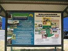 Wallendbeen information sign (2016)
 Mackay Park , Wallendbeen
References
- 1 2 Australian Bureau of Statistics (31 October 2012). "Wallendbeen (State Suburb)". 2011 Census QuickStats. Retrieved 3 April 2015.
- ↑ "Wallendbeen". Geographical Names Register (GNR) of NSW. Geographical Names Board of New South Wales. Retrieved 11 August 2013.
- ↑ "Wallendbeen". Australian Explorer. Retrieved 2007-02-09.
- ↑ Premier Postal History. "Post Office List". Retrieved 2009-06-11.
External links
![]() Media related to Wallendbeen at Wikimedia Commons
Media related to Wallendbeen at Wikimedia Commons
| Preceding station | Rail transport in New South Wales | Following station | ||
|---|---|---|---|---|
towards Albury | Main Southern Line | towards Sydney |
This article is issued from Wikipedia - version of the 10/16/2016. The text is available under the Creative Commons Attribution/Share Alike but additional terms may apply for the media files.