Willbriggie, New South Wales
| Willbriggie New South Wales | |
|---|---|
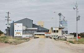 The silo at Willbriggie | |
|
Willbriggie | |
| Coordinates | 34°28′S 146°01′E / 34.467°S 146.017°ECoordinates: 34°28′S 146°01′E / 34.467°S 146.017°E |
| Population | 376 (2006 census)[1] |
| Postcode(s) | 2680 |
| Elevation | 122 m (400 ft) |
| Location |
|
| LGA(s) | City of Griffith |
| County | Cooper |
| State electorate(s) | Murray |
Willbriggie is a community in the central part of the Riverina nearby to the city of Griffith. It is situated by road, about 16 kilometres north from Darlington Point and 17 kilometres south from Hanwood. At the 2006 census, Willbriggie had a population of 376.[1]
Darlington Point Railway Station Post Office opened on 16 November 1881, was renamed Darlington Railway Station office in 1882, Willbriggie in 1909 and closed in 1975.[2]
Notes and references
- 1 2 Australian Bureau of Statistics (25 October 2007). "Willbriggie (State Suburb)". 2006 Census QuickStats. Retrieved 24 February 2010.
- ↑ Premier Postal History, Post Office List, retrieved 2009-06-11
| Preceding station | NSW Branch lines | Following station | ||
|---|---|---|---|---|
Benerembah towards Hay | Hay Line (closed section) | towards Junee |
| Wikimedia Commons has media related to Willbriggie, New South Wales. |
This article is issued from Wikipedia - version of the 3/30/2015. The text is available under the Creative Commons Attribution/Share Alike but additional terms may apply for the media files.