Rosewood, New South Wales
| Rosewood New South Wales | |
|---|---|
 Entering Rosewood | |
|
Rosewood | |
| Coordinates | 35°40′29″S 147°51′50″E / 35.67472°S 147.86389°ECoordinates: 35°40′29″S 147°51′50″E / 35.67472°S 147.86389°E |
| Population | 364 (2006 census)[1] |
| Postcode(s) | 2652 |
| Elevation | 435 m (1,427 ft) |
| Location |
|
| LGA(s) | Snowy Valleys Council |
| County | Selwyn |
| State electorate(s) | Albury |
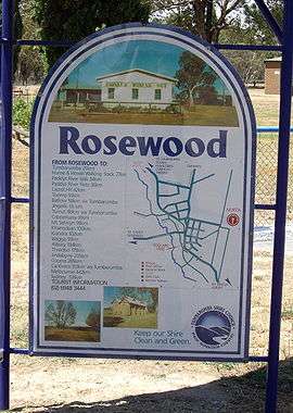
Rosewood is a village community in the south east part of the Riverina. It is situated about 16 kilometres (9.9 mi) south east from Carabost and 19 kilometres (12 mi) north west from Tumbarumba. At the 2006 census, Rosewood had a population of 364.[1] The village is administered at the local government level by the Snowy Valleys Council.
Rosewood Post Office opened on 1 August 1885.[2]
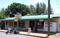
Rosewood General Store and Post Office
References
- 1 2 Australian Bureau of Statistics (25 October 2007). "Rosewood (Tumbarumba) (State Suburb)". 2006 Census QuickStats. Retrieved 16 November 2009.
- ↑ Premier Postal History, Post Office List, retrieved 2009-06-11
External links
![]() Media related to Rosewood, New South Wales at Wikimedia Commons
Media related to Rosewood, New South Wales at Wikimedia Commons
This article is issued from Wikipedia - version of the 5/14/2016. The text is available under the Creative Commons Attribution/Share Alike but additional terms may apply for the media files.