Alderson, West Virginia
| Alderson, West Virginia | |
|---|---|
| Town | |
|
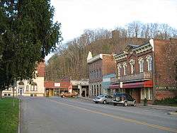
Historic section on the Monroe County side | |
 Location of Alderson, West Virginia | |
| Coordinates: 37°43′39″N 80°38′29″W / 37.72750°N 80.64139°WCoordinates: 37°43′39″N 80°38′29″W / 37.72750°N 80.64139°W | |
| Country | United States |
| State | West Virginia |
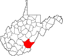
| Counties | Greenbrier, Monroe |
| Government | |
| • Mayor | Travis Copenhaver |
| Area[1] | |
| • Total | 0.95 sq mi (2.46 km2) |
| • Land | 0.89 sq mi (2.31 km2) |
| • Water | 0.06 sq mi (0.16 km2) |
| Elevation | 1,549 ft (472 m) |
| Population (2010)[2] | |
| • Total | 1,184 |
| • Estimate (2012[3]) | 1,184 |
| • Density | 1,330.3/sq mi (513.6/km2) |
| Time zone | Eastern (EST) (UTC-5) |
| • Summer (DST) | EDT (UTC-4) |
| ZIP code | 24910 |
| Area code(s) | 304 |
| FIPS code | 54-00772[4] |
| GNIS feature ID | 1534854[5] |
Alderson is a town with portions in Greenbrier and Monroe counties, West Virginia, USA. Although split physically by the Greenbrier River, the town functions as one entity, including that of town government. The population was 1,184 at the 2010 census.
History
Alderson is a community located along the Greenbrier River in Greenbrier County and Monroe County, incorporated in 1881. Alderson was originally settled in 1777 by "Elder" John Alderson, a frontier missionary for whom the town is named, who organized the first Baptist church in the Greenbrier Valley. In 1763, the nearby Muddy Creek settlements were destroyed by Shawnee Indians under Chief Cornstalk. Alderson is the location of the historic Federal Reformatory for Women, opened in 1927, the first Federal prison for women. During the early 1900s, Alderson became a hub of higher education in the state. It was home to three separate institutions of higher education, including the Alderson Academy and Junior College, which eventually was integrated into Alderson–Broaddus College in 1932.
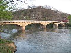
The Alexander McVeigh Miller House in Greenbrier County is listed on the National Register of Historic Places. Sunset Hill is listed in Monroe County. The Alderson Bridge and Alderson Historic District are located in both counties.[6]
Geography
According to the United States Census Bureau, the town has a total area of 0.95 square miles (2.46 km2), of which 0.89 square miles (2.31 km2) is land and 0.06 square miles (0.16 km2) is water.[1]
Climate
| Climate data for Alderson, West Virginia | |||||||||||||
|---|---|---|---|---|---|---|---|---|---|---|---|---|---|
| Month | Jan | Feb | Mar | Apr | May | Jun | Jul | Aug | Sep | Oct | Nov | Dec | Year |
| Average high °F (°C) | 45.3 (7.4) |
47.6 (8.7) |
56.7 (13.7) |
69.6 (20.9) |
77.0 (25) |
83.5 (28.6) |
86.4 (30.2) |
85.2 (29.6) |
79.3 (26.3) |
70.8 (21.6) |
57.9 (14.4) |
45.3 (7.4) |
67.05 (19.48) |
| Average low °F (°C) | 23.8 (−4.6) |
24.3 (−4.3) |
30.3 (−0.9) |
39.2 (4) |
47.6 (8.7) |
56.6 (13.7) |
60.7 (15.9) |
60.3 (15.7) |
52.8 (11.6) |
41.9 (5.5) |
30.3 (−0.9) |
24.1 (−4.4) |
40.99 (5) |
| Average precipitation inches (mm) | 3.0 (76) |
2.8 (71) |
3.5 (89) |
3.2 (81) |
3.8 (97) |
3.4 (86) |
3.9 (99) |
3.1 (79) |
3.1 (79) |
2.5 (64) |
2.6 (66) |
3.0 (76) |
37.9 (963) |
| Source: Weatherbase [7] | |||||||||||||
Demographics
| Historical population | |||
|---|---|---|---|
| Census | Pop. | %± | |
| 1880 | 478 | — | |
| 1890 | 663 | 38.7% | |
| 1900 | 518 | −21.9% | |
| 1910 | 1,252 | 141.7% | |
| 1920 | 1,401 | 11.9% | |
| 1930 | 1,458 | 4.1% | |
| 1940 | 1,493 | 2.4% | |
| 1950 | 1,489 | −0.3% | |
| 1960 | 1,225 | −17.7% | |
| 1970 | 1,278 | 4.3% | |
| 1980 | 1,375 | 7.6% | |
| 1990 | 1,152 | −16.2% | |
| 2000 | 1,091 | −5.3% | |
| 2010 | 1,184 | 8.5% | |
| Est. 2015 | 1,182 | [8] | −0.2% |
2010 census
As of the census[2] of 2010, there were 1,184 people, 518 households, and 315 families residing in the town. The population density was 1,330.3 inhabitants per square mile (513.6/km2). There were 602 housing units at an average density of 676.4 per square mile (261.2/km2). The racial makeup of the town was 91.0% White, 5.0% African American, 0.3% Native American, 0.3% Asian, and 3.5% from two or more races. Hispanic or Latino of any race were 2.9% of the population.
There were 518 households of which 26.6% had children under the age of 18 living with them, 39.2% were married couples living together, 14.9% had a female householder with no husband present, 6.8% had a male householder with no wife present, and 39.2% were non-families. 31.9% of all households were made up of individuals and 17.2% had someone living alone who was 65 years of age or older. The average household size was 2.29 and the average family size was 2.83.
The median age in the town was 42.8 years. 20.4% of residents were under the age of 18; 9.7% were between the ages of 18 and 24; 22.8% were from 25 to 44; 27.5% were from 45 to 64; and 19.7% were 65 years of age or older. The gender makeup of the town was 48.9% male and 51.1% female.
2000 census
As of the census[4] of 2000, there were 1,091 people, 481 households, and 305 families residing in the town. The population density was 1,214.5 inhabitants per square mile (468.0/km²). There were 586 housing units at an average density of 652.3 per square mile (251.4/km²). The racial makeup of the town was 90.83% White, 6.60% African American, 0.27% Native American, 0.18% Asian, and 2.11% from two or more races. Hispanic or Latino of any race were 1.10% of the population.
There were 481 households out of which 25.8% had children under the age of 18 living with them, 43.0% were married couples living together, 16.0% had a female householder with no husband present, and 36.4% were non-families. 34.5% of all households were made up of individuals and 17.5% had someone living alone who was 65 years of age or older. The average household size was 2.27 and the average family size was 2.87.
In the town the population was spread out with 23.8% under the age of 18, 8.0% from 18 to 24, 22.9% from 25 to 44, 23.6% from 45 to 64, and 21.7% who were 65 years of age or older. The median age was 41 years. For every 100 females there were 90.4 males. For every 100 females age 18 and over, there were 83.4 males.
The median income for a household in the town was $23,043, and the median income for a family was $29,028. Males had a median income of $31,000 versus $20,938 for females. The per capita income for the town was $14,474. About 17.8% of families and 22.9% of the population were below the poverty line, including 35.7% of those under age 18 and 9.6% of those age 65 or over.
Transportation
Amtrak, the national passenger rail service, provides service to Alderson under the Cardinal route.
Economy

The Federal Bureau of Prisons facility Federal Prison Camp, Alderson, where media mogul Martha Stewart was imprisoned,[10] is the largest employer in Alderson.[11] Marguerite Higgins of The Washington Times said that the fact that Stewart was sent to FPC Alderson was "a boon" for Alderson.[12] A portion of FPC Alderson is located in unincorporated Monroe County, while the other portion of the prison lies in unincorporated Summers County.[13][14]
The Alderson Federal Prison Camp is located on the spot on which the earliest settlers of the area chose to settle and called their settlement Baughman's Fort. Baughman's Fort was built in the 1750s and the settlement was supposedly destroyed by Native Americans shortly thereafter, though no factual evidence exists to support this theory. Few archaeological remains of the early fort remain after the building of the Federal Prison Camp in the early 20th century. Only notations in early journals refer to the location of the fort.[15]
Betty Alderson, who is married to a descendant of the original founders of Alderson, stated "every business profited" when Martha Stewart was incarcerated at Alderson and media attention was focused on the community. Residents planted bulbs into a garden that was to be named "Martha's Garden."[16]
Local Events
Alderson has the second largest Fourth of July Celebration in West Virginia (behind Ripley). Each year the events span an entire week, always ending with a "Rubber Ducky" race on the Greenbrier River. Each year, events include...a fireman's rodeo, an old-fashion gospel sing, a band each night, a car show, a grand parade, field events, talent show, pageant, fireworks and more.
Notable People Born in Alderson
Ada Beatrice Queen Victoria Louise Virginia Smith, better known as Bricktop (August 14, 1894 – February 1, 1984) was an American dancer, singer, vaudevillian, and self-described saloon-keeper who owned the nightclub Chez Bricktop in Paris from 1924 to 1961, as well as clubs in Mexico City and Rome. She has been called "...one of the most legendary and enduring figures of 20th-century American cultural history."
References
- 1 2 "US Gazetteer files 2010". United States Census Bureau. Archived from the original on 24 January 2012. Retrieved 2013-01-24.
- 1 2 "American FactFinder". United States Census Bureau. Retrieved 2013-01-24.
- ↑ "Population Estimates". United States Census Bureau. Archived from the original on 17 June 2013. Retrieved 2013-06-26.
- 1 2 "American FactFinder". United States Census Bureau. Archived from the original on 11 September 2013. Retrieved 2008-01-31.
- ↑ "US Board on Geographic Names". United States Geological Survey. 2007-10-25. Retrieved 2008-01-31.
- ↑ National Park Service (2010-07-09). "National Register Information System". National Register of Historic Places. National Park Service.
- ↑ "Historical Weather for Alderson, West Virginia". Weatherbase. Retrieved 29 September 2012.
- ↑ "Annual Estimates of the Resident Population for Incorporated Places: April 1, 2010 to July 1, 2015". Retrieved July 2, 2016.
- ↑ "Census of Population and Housing". Census.gov. Archived from the original on 11 May 2015. Retrieved June 4, 2015.
- ↑ de Vries, Lloyd (20 September 2005). "How Martha Coped At 'Yale'". CBS News. Retrieved 29 September 2012.
- ↑ "Welcome to Alderson; Stewart began her 5 months before dawn at W.Va. prison". The Washington Times. 9 October 2004. Retrieved 29 September 2012.
- ↑ Higgins, Marguerite (9 October 2004). "Stewart's prison sentence a boon for West Virginia town". The Washington Times. Retrieved 29 September 2012.
- ↑ "Martha's Prison Thanksgiving". The Cincinnati Post. 24 November 2004. Retrieved 29 September 2012.
Mullins said the prison dormitories are in Summers County.
- ↑ "FPC Alderson Contact Information". Federal Bureau of Prisons. Retrieved 29 September 2012.
- ↑ Rice, Otis (1983). "The History of Greenbrier County". Journal of the Greenbrier Historical Society.
- ↑ Hancock, David (4 March 2005). "Martha: There's No Place Like Home". CBS News. Retrieved 29 September 2012.
External links
Municipalities and communities of Monroe County, West Virginia, United States | ||
|---|---|---|
| Towns | 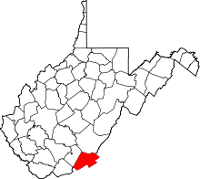 | |
| Unincorporated communities |
| |
| Ghost town | ||
| Footnotes | ‡This populated place also has portions in an adjacent county or counties | |