Sophia, West Virginia
| Sophia, West Virginia | |
|---|---|
| Town | |
|
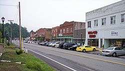
Main Street (West Virginia Route 16) in Sophia in 2007 | |
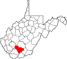
 Location of Sophia, West Virginia | |
| Coordinates: 37°42′51″N 81°15′2″W / 37.71417°N 81.25056°WCoordinates: 37°42′51″N 81°15′2″W / 37.71417°N 81.25056°W | |
| Country | United States |
| State | West Virginia |
| County | Raleigh |
| Government | |
| • Mayor | Danny Barr |
| • Fire Chief | Jeffrey Pittman |
| • Police Chief | Randy White |
| • Sanitation Dept. | Rob Godbey |
| Area[1] | |
| • Total | 0.69 sq mi (1.79 km2) |
| • Land | 0.69 sq mi (1.79 km2) |
| • Water | 0 sq mi (0 km2) |
| Elevation | 2,320 ft (707 m) |
| Population (2010)[2] | |
| • Total | 1,344 |
| • Estimate (2012[3]) | 1,338 |
| • Density | 1,947.8/sq mi (752.0/km2) |
| Time zone | Eastern (EST) (UTC-5) |
| • Summer (DST) | EDT (UTC-4) |
| ZIP code | 25921 |
| Area code(s) | 304 |
| FIPS code | 54-75172[4] |
| GNIS feature ID | 1555660[5] |
Sophia is a town in Raleigh County, West Virginia, United States. It was incorporated in 1912. The population was 1,344 at the 2010 census. Sophia was the hometown of the late U.S. Senator Robert C. Byrd.
History
A post office called Sophia has been in operation since 1909.[6] The town was named for Sophia McGinnis, the family member of a local civil servant.[7] The town incorporated in 1912.[8]
Geography
.jpg)
Sophia is located at 37°42′51″N 81°15′2″W / 37.71417°N 81.25056°W (37.714197, -81.250659).[9]
According to the United States Census Bureau, the town has a total area of 0.69 square miles (1.79 km2), all of it land.[1]
Demographics
| Historical population | |||
|---|---|---|---|
| Census | Pop. | %± | |
| 1920 | 240 | — | |
| 1930 | 611 | 154.6% | |
| 1940 | 1,160 | 89.9% | |
| 1950 | 1,430 | 23.3% | |
| 1960 | 1,284 | −10.2% | |
| 1970 | 1,303 | 1.5% | |
| 1980 | 1,216 | −6.7% | |
| 1990 | 1,182 | −2.8% | |
| 2000 | 1,301 | 10.1% | |
| 2010 | 1,344 | 3.3% | |
| Est. 2015 | 1,318 | [10] | −1.9% |
2010 census
As of the census[2] of 2010, there were 1,344 people, 590 households, and 391 families residing in the town. The population density was 1,947.8 inhabitants per square mile (752.0/km2). There were 655 housing units at an average density of 949.3 per square mile (366.5/km2). The racial makeup of the town was 97.2% White, 0.7% African American, 0.2% Native American, 0.7% Asian, 0.1% from other races, and 1.0% from two or more races. Hispanic or Latino of any race were 0.1% of the population.
There were 590 households of which 30.7% had children under the age of 18 living with them, 46.4% were married couples living together, 14.2% had a female householder with no husband present, 5.6% had a male householder with no wife present, and 33.7% were non-families. 29.8% of all households were made up of individuals and 14.2% had someone living alone who was 65 years of age or older. The average household size was 2.28 and the average family size was 2.77.
The median age in the town was 40.1 years. 22.2% of residents were under the age of 18; 7.1% were between the ages of 18 and 24; 27% were from 25 to 44; 26.7% were from 45 to 64; and 17% were 65 years of age or older. The gender makeup of the town was 46.0% male and 54.0% female.
2000 census
As of the census[4] of 2000, there were 1,301 people, 588 households, and 386 families residing in the town. The population density was 1,902.5 inhabitants per square mile (738.7/km²). There were 643 housing units at an average density of 940.3 per square mile (365.1/km²). The racial makeup of the town was 96.62% White, 1.15% African American, 0.31% Native American, 0.54% Asian, 0.15% from other races, and 1.23% from two or more races. Hispanic or Latino of any race were 0.61% of the population.
There were 588 households out of which 26.2% had children under the age of 18 living with them, 45.1% were married couples living together, 17.2% had a female householder with no husband present, and 34.2% were non-families. 31.3% of all households were made up of individuals and 15.1% had someone living alone who was 65 years of age or older. The average household size was 2.21 and the average family size was 2.75.
In the town the population was spread out with 21.5% under the age of 18, 7.8% from 18 to 24, 27.8% from 25 to 44, 26.6% from 45 to 64, and 16.2% who were 65 years of age or older. The median age was 41 years. For every 100 females there were 82.7 males. For every 100 females age 18 and over, there were 76.3 males.
The median income for a household in the town was $26,008, and the median income for a family was $31,200. Males had a median income of $30,875 versus $17,273 for females. The per capita income for the town was $15,296. About 22.1% of families and 23.6% of the population were below the poverty line, including 41.9% of those under age 18 and 15.1% of those age 65 or over.
Notable people
- Robert Byrd, United States Senator
References
- 1 2 "US Gazetteer files 2010". United States Census Bureau. Retrieved 2013-01-24.
- 1 2 "American FactFinder". United States Census Bureau. Retrieved 2013-01-24.
- ↑ "Population Estimates". United States Census Bureau. Retrieved 2013-06-26.
- 1 2 "American FactFinder". United States Census Bureau. Retrieved 2008-01-31.
- ↑ "US Board on Geographic Names". United States Geological Survey. 2007-10-25. Retrieved 2008-01-31.
- ↑ "Raleigh County". Jim Forte Postal History. Retrieved 30 April 2015.
- ↑ Capace, Nancy (1999). Encyclopedia of West Virginia. North American Book Dist LLC. p. 191. ISBN 978-0-403-09843-9.
- ↑ Kenny, Hamill (1945). West Virginia Place Names: Their Origin and Meaning, Including the Nomenclature of the Streams and Mountains. Piedmont, WV: The Place Name Press. p. 592.
- ↑ "US Gazetteer files: 2010, 2000, and 1990". United States Census Bureau. 2011-02-12. Retrieved 2011-04-23.
- ↑ "Annual Estimates of the Resident Population for Incorporated Places: April 1, 2010 to July 1, 2015". Retrieved July 2, 2016.
- ↑ "Census of Population and Housing". Census.gov. Retrieved June 4, 2015.