Gilbert, West Virginia
| Gilbert, West Virginia | |
|---|---|
| Town | |
|
Central Avenue in Gilbert | |
| Motto: You should see the hills from here! | |
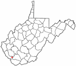 Location of Gilbert, West Virginia | |
| Coordinates: 37°36′52″N 81°52′2″W / 37.61444°N 81.86722°WCoordinates: 37°36′52″N 81°52′2″W / 37.61444°N 81.86722°W | |
| Country | United States |
| State | West Virginia |
| County | Mingo |
| Government | |
| • Mayor | Vivian Livingood |
| • Recorder | Michael Fox |
| • Council | Randy Livingood, Sharon Murphy, Jennifer Miller, Todd Westfall, Curtis Lester |
| Area[1] | |
| • Total | 1.04 sq mi (2.69 km2) |
| • Land | 0.99 sq mi (2.56 km2) |
| • Water | 0.05 sq mi (0.13 km2) |
| Elevation | 840 ft (256 m) |
| Population (2010)[2] | |
| • Total | 450 |
| • Estimate (2012[3]) | 435 |
| • Density | 454.5/sq mi (175.5/km2) |
| Time zone | Eastern (EST) (UTC-5) |
| • Summer (DST) | EDT (UTC-4) |
| ZIP code | 25621 |
| Area code(s) | 304 |
| FIPS code | 54-30772[4] |
| GNIS feature ID | 1539390[5] |

Gilbert is a town in Mingo County, West Virginia, United States, along the Guyandotte River. The population was 450 at the 2010 census. Gilbert was incorporated in 1918 and named for Gilbert Creek, which derives its name from the name of an early traveler in the area who was killed by Native Americans in the area. Gilbert is known nationwide for the Hatfield-McCoy ATV Trails that are located in the area. There are a number of lodges and restaurants in Gilbert.
Geography
Gilbert is located at 37°36′52″N 81°52′2″W / 37.61444°N 81.86722°W (37.614497, -81.867212).[6]
According to the United States Census Bureau, the town has a total area of 1.04 square miles (2.69 km2), of which 0.99 square miles (2.56 km2) is land and 0.05 square miles (0.13 km2) is water.[1]
Demographics
| Historical population | |||
|---|---|---|---|
| Census | Pop. | %± | |
| 1930 | 451 | — | |
| 1940 | 490 | 8.6% | |
| 1950 | 722 | 47.3% | |
| 1960 | 874 | 21.1% | |
| 1970 | 778 | −11.0% | |
| 1980 | 757 | −2.7% | |
| 1990 | 456 | −39.8% | |
| 2000 | 417 | −8.6% | |
| 2010 | 450 | 7.9% | |
| Est. 2015 | 423 | [7] | −6.0% |
2010 census
As of the census[2] of 2010, there were 450 people, 212 households, and 137 families residing in the town. The population density was 454.5 inhabitants per square mile (175.5/km2). There were 262 housing units at an average density of 264.6 per square mile (102.2/km2). The racial makeup of the town was 99.1% White, 0.2% Asian, and 0.7% from two or more races.
There were 212 households of which 21.2% had children under the age of 18 living with them, 51.9% were married couples living together, 10.4% had a female householder with no husband present, 2.4% had a male householder with no wife present, and 35.4% were non-families. 32.1% of all households were made up of individuals and 17.4% had someone living alone who was 65 years of age or older. The average household size was 2.12 and the average family size was 2.64.
The median age in the town was 49.7 years. 15.3% of residents were under the age of 18; 8.2% were between the ages of 18 and 24; 18.6% were from 25 to 44; 36% were from 45 to 64; and 21.8% were 65 years of age or older. The gender makeup of the town was 45.1% male and 54.9% female.
2000 census
As of the census[4] of 2000, there were 417 people, 187 households, and 120 families residing in the town. The population density was 407.6 inhabitants per square mile (157.8/km²). There were 227 housing units at an average density of 221.9 per square mile (85.9/km²). The racial makeup of the town was 97.84% White, 0.96% Asian, and 1.20% from two or more races.
There were 187 households out of which 27.8% had children under the age of 18 living with them, 50.3% were married couples living together, 10.7% had a female householder with no husband present, and 35.8% were non-families. 31.6% of all households were made up of individuals and 15.5% had someone living alone who was 65 years of age or older. The average household size was 2.23 and the average family size was 2.82.
In the town the population was spread out with 20.9% under the age of 18, 6.7% from 18 to 24, 28.5% from 25 to 44, 27.1% from 45 to 64, and 16.8% who were 65 years of age or older. The median age was 43 years. For every 100 females there were 98.6 males. For every 100 females age 18 and over, there were 90.8 males.
The median income for a household in the town was $29,219, and the median income for a family was $32,250. Males had a median income of $38,750 versus $25,938 for females. The per capita income for the town was $20,219. About 11.7% of families and 15.5% of the population were below the poverty line, including 16.7% of those under age 18 and 16.9% of those age 65 or over.
Notable people
- Keith Perry, country music artist
- Patsy Paugh, Miss West Virginia 1977, mother of JonBenet Ramsey
- James H. "Buck" Harless, Coal Baron
References
- 1 2 "US Gazetteer files 2010". United States Census Bureau. Retrieved 2013-01-24.
- 1 2 "American FactFinder". United States Census Bureau. Retrieved 2013-01-24.
- ↑ "Population Estimates". United States Census Bureau. Retrieved 2013-06-26.
- 1 2 "American FactFinder". United States Census Bureau. Retrieved 2008-01-31.
- ↑ "US Board on Geographic Names". United States Geological Survey. 2007-10-25. Retrieved 2008-01-31.
- ↑ "US Gazetteer files: 2010, 2000, and 1990". United States Census Bureau. 2011-02-12. Retrieved 2011-04-23.
- ↑ "Annual Estimates of the Resident Population for Incorporated Places: April 1, 2010 to July 1, 2015". Retrieved July 2, 2016.
- ↑ "Census of Population and Housing". Census.gov. Retrieved June 4, 2015.
External links
Municipalities and communities of Mingo County, West Virginia, United States | ||
|---|---|---|
| City | 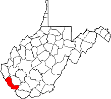 | |
| Towns | ||
| CDPs | ||
| Other communities |
| |
| Footnotes | ‡This populated place also has portions in an adjacent county or counties | |