Rainelle, West Virginia
| Rainelle, West Virginia | |
|---|---|
| Town | |
| Motto: "A Town Built to Carry On" | |
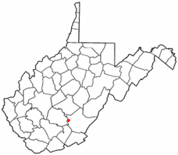 Location of Rainelle, West Virginia | |
| Coordinates: 37°58′11″N 80°46′2″W / 37.96972°N 80.76722°WCoordinates: 37°58′11″N 80°46′2″W / 37.96972°N 80.76722°W | |
| Country | United States |
| State | West Virginia |
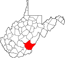
| County | Greenbrier |
| Incorporated | April 25, 1913 |
| Government | |
| • Type | City/Town |
| • Mayor | Andrea "Andy" Pendleton |
| • Council | Ron Fleshman, Howard Randy Pendleton, David Spitzer, Monica S. Venable, Gary Harris |
| Area[1] | |
| • Total | 1.11 sq mi (2.87 km2) |
| • Land | 1.11 sq mi (2.87 km2) |
| • Water | 0 sq mi (0 km2) |
| Elevation | 2,405 ft (733 m) |
| Population (2010)[2] | |
| • Total | 1,505 |
| • Estimate (2012[3]) | 1,491 |
| • Density | 1,355.9/sq mi (523.5/km2) |
| Time zone | Eastern (EST) (UTC-5) |
| • Summer (DST) | EDT (UTC-4) |
| Zip code(s) | 25962 |
| Area code(s) | 304/681 |
| FIPS code | 54-66652[4] |
| GNIS feature ID | 1555435[5] |
| Website | http://www.rainelle-wv.com |
Rainelle is a small town on the western edge of Greenbrier County, West Virginia, in the United States. It sits at the base of Sewell Mountain and Sims Mountain, and is bisected by the Meadow River. The only means of transportation to and from Rainelle are roads; primarily US 60 and WV 20, which merge on the west end of the town, and the James River and Kanawha Turnpike, which enters from the south. The population was 1,505 at the 2010 census.
History
Rainelle was named for the Raine family.[6] Thomas and his brother John Raine moved there from Pennsylvania in 1906 to harvest a large stand of hardwoods for building homes, etc. Their Meadow River Lumber Company operated for 60 years, and at one time was the largest hardwood sawmill in the world. In 1970, the owners sold it to Georgia-Pacific Corporation, which tore it down in 1975.[7]
The Midland Trail, now part of U.S. Route 60, runs through the town.[8]
The town was devastated during the 2016 West Virginia flood.[9]
Geography
Rainelle is located at 37°58′11″N 80°46′2″W / 37.96972°N 80.76722°W (37.969639, -80.767210).[10]
According to the United States Census Bureau, the town has a total area of 1.11 square miles (2.87 km2), all of it land.[1] The Meadow River flows through the town in a westerly direction on its way to eventually join the Gauley River.
Demographics
| Historical population | |||
|---|---|---|---|
| Census | Pop. | %± | |
| 1920 | 566 | — | |
| 1930 | 920 | 62.5% | |
| 1940 | 985 | 7.1% | |
| 1950 | 853 | −13.4% | |
| 1960 | 649 | −23.9% | |
| 1970 | 1,826 | 181.4% | |
| 1980 | 1,983 | 8.6% | |
| 1990 | 1,681 | −15.2% | |
| 2000 | 1,545 | −8.1% | |
| 2010 | 1,505 | −2.6% | |
| Est. 2015 | 1,481 | [11] | −1.6% |
2010 census
As of the census[2] of 2010, there were 1,505 people, 675 households, and 387 families residing in the town. The population density was 1,355.9 inhabitants per square mile (523.5/km2). There were 806 housing units at an average density of 726.1 per square mile (280.3/km2). The racial makeup of the town was 96.9% White, 0.7% African American, 0.2% Native American, 0.3% Asian, 0.3% from other races, and 1.7% from two or more races. Hispanic or Latino of any race were 0.7% of the population.
There were 675 households of which 25.9% had children under the age of 18 living with them, 37.6% were married couples living together, 16.0% had a female householder with no husband present, 3.7% had a male householder with no wife present, and 42.7% were non-families. 36.6% of all households were made up of individuals and 18.8% had someone living alone who was 65 years of age or older. The average household size was 2.14 and the average family size was 2.76.
The median age in the town was 45.3 years. 19.7% of residents were under the age of 18; 6.3% were between the ages of 18 and 24; 23.6% were from 25 to 44; 26.8% were from 45 to 64; and 23.5% were 65 years of age or older. The gender makeup of the town was 44.7% male and 55.3% female.
2000 census
As of the census[4] of 2000, there were 1,545 people, 696 households, and 421 families residing in the town. The population density was 1,402.3 inhabitants per square mile (542.3/km²). There were 802 housing units at an average density of 727.9 per square mile (281.5/km²). The racial makeup of the town was 97.22% White, 0.71% African American, 1.17% Native American, 0.13% Asian, and 0.78% from two or more races. Hispanic or Latino of any race were 0.65% of the population.
There were 696 households out of which 23.4% had children under the age of 18 living with them, 43.1% were married couples living together, 13.6% had a female householder with no husband present, and 39.5% were non-families. 36.5% of all households were made up of individuals and 19.1% had someone living alone who was 65 years of age or older. The average household size was 2.14 and the average family size was 2.78.
In the town the population was spread out with 18.4% under the age of 18, 8.4% from 18 to 24, 21.8% from 25 to 44, 26.7% from 45 to 64, and 24.7% who were 65 years of age or older. The median age was 46 years. For every 100 females there were 82.4 males. For every 100 females age 18 and over, there were 77.2 males.
The median income for a household in the town was $19,491, and the median income for a family was $26,528. Males had a median income of $22,000 versus $14,900 for females. The per capita income for the town was $14,069. About 23.8% of families and 28.7% of the population were below the poverty line, including 42.3% of those under age 18 and 14.9% of those age 65 or over.
Notable people
- Rainelle has produced one Major League Baseball player, Cincinnati Reds pitcher Arnold Carter.
References
- 1 2 "US Gazetteer files 2010". United States Census Bureau. Retrieved 2013-01-24.
- 1 2 "American FactFinder". United States Census Bureau. Retrieved 2013-01-24.
- ↑ "Population Estimates". United States Census Bureau. Retrieved 2013-06-26.
- 1 2 "American FactFinder". United States Census Bureau. Retrieved 2008-01-31.
- ↑ "US Board on Geographic Names". United States Geological Survey. 2007-10-25. Retrieved 2008-01-31.
- ↑ Kenny, Hamill (1945). West Virginia Place Names: Their Origin and Meaning, Including the Nomenclature of the Streams and Mountains. Piedmont, WV: The Place Name Press. p. 517.
- ↑ Meadow River Lumber Company, Blue Ridge Country, January–February 2005, retrieved 2007-08-01
- ↑ Alvey, Tina (Associated Press) (19 December 2010). Hayslette painting auctioned as fundraiser, Charleston Daily Mail (noting that the Midland Trail goes through the town)
- ↑ Wiederspiel, Alex. "Rainelle natives and mayor uncertain of what's next after flash flood". West Virginia MetroNews. Retrieved 25 June 2016.
- ↑ "US Gazetteer files: 2010, 2000, and 1990". United States Census Bureau. 2011-02-12. Retrieved 2011-04-23.
- ↑ "Annual Estimates of the Resident Population for Incorporated Places: April 1, 2010 to July 1, 2015". Retrieved July 2, 2016.
- ↑ "Census of Population and Housing". Census.gov. Retrieved June 4, 2015.