Bayard, West Virginia
| Town of Bayard, West Virginia | |
|---|---|
| Town | |
|
Front Street in Bayard | |
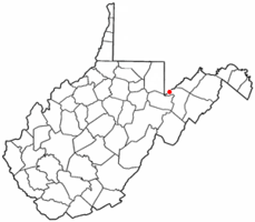 Location of Bayard in West Virginia | |
| Coordinates: 39°16′19″N 79°21′54″W / 39.27194°N 79.36500°WCoordinates: 39°16′19″N 79°21′54″W / 39.27194°N 79.36500°W | |
| Country | United States |
| State | West Virginia |
| County | Grant |
| Government | |
| • Mayor | Tim Collins |
| Area[1] | |
| • Total | 0.31 sq mi (0.80 km2) |
| • Land | 0.31 sq mi (0.80 km2) |
| • Water | 0 sq mi (0 km2) |
| Elevation | 2,343 ft (714 m) |
| Population (2010)[2] | |
| • Total | 290 |
| • Estimate (2012[3]) | 285 |
| • Density | 935.5/sq mi (361.2/km2) |
| Time zone | EST (UTC-5) |
| • Summer (DST) | EDT (UTC-4) |
| ZIP code | 26707 |
| Area code(s) | 304 |
| FIPS code | 54-04924[4] |
| GNIS feature ID | 1553813[5] |
_between_Buffalo_Avenue_and_Potomac_Avenue_in_Bayard%2C_Grant_County%2C_West_Virginia.jpg)
Bayard is a town in Grant County, West Virginia, United States. The population was 290 at the 2010 census. Bayard was incorporated in 1893 and named in honor of Thomas F. Bayard, Jr.,[6] who later became a United States Senator from Delaware (1923–1929). Bayard was founded on the West Virginia Central and Pittsburgh Railroad as a coal mining community. Coal mining has remained the town's chief industry.
Geography
Bayard is located at 39°16′19″N 79°21′54″W / 39.27194°N 79.36500°W (39.272062, -79.365043).[7]
According to the United States Census Bureau, the town has a total area of 0.31 square miles (0.80 km2), all of it land.[1]
Demographics
| Historical population | |||
|---|---|---|---|
| Census | Pop. | %± | |
| 1900 | 540 | — | |
| 1910 | 417 | −22.8% | |
| 1920 | 1,074 | 157.6% | |
| 1930 | 743 | −30.8% | |
| 1940 | 585 | −21.3% | |
| 1950 | 589 | 0.7% | |
| 1960 | 484 | −17.8% | |
| 1970 | 475 | −1.9% | |
| 1980 | 540 | 13.7% | |
| 1990 | 414 | −23.3% | |
| 2000 | 299 | −27.8% | |
| 2010 | 290 | −3.0% | |
| Est. 2015 | 276 | [8] | −4.8% |
2010 census
As of the census[2] of 2010, there were 290 people, 126 households, and 86 families residing in the town. The population density was 935.5 inhabitants per square mile (361.2/km2). There were 151 housing units at an average density of 487.1 per square mile (188.1/km2). The racial makeup of the town was 98.3% White, 1.4% Native American, and 0.3% from two or more races. Hispanic or Latino of any race were 0.3% of the population.
There were 126 households of which 28.6% had children under the age of 18 living with them, 56.3% were married couples living together, 6.3% had a female householder with no husband present, 5.6% had a male householder with no wife present, and 31.7% were non-families. 27.8% of all households were made up of individuals and 8.8% had someone living alone who was 65 years of age or older. The average household size was 2.30 and the average family size was 2.80.
The median age in the town was 44.5 years. 19.3% of residents were under the age of 18; 5.6% were between the ages of 18 and 24; 26.5% were from 25 to 44; 29.3% were from 45 to 64; and 19.3% were 65 years of age or older. The gender makeup of the town was 52.4% male and 47.6% female.
2000 census
As of the census[4] of 2000, there were 299 people, 141 households, and 93 families residing in the town. The population density was 949.2 inhabitants per square mile (372.4/km²). There were 172 housing units at an average density of 546.0 per square mile (214.2/km²). The racial makeup of the town was 96.66% White, 0.67% African American, 2.01% Native American, and 0.67% from two or more races. Hispanic or Latino of any race were 0.67% of the population.
There were 141 households out of which 21.3% had children under the age of 18 living with them, 50.4% were married couples living together, 9.9% had a female householder with no husband present, and 34.0% were non-families. 29.8% of all households were made up of individuals and 18.4% had someone living alone who was 65 years of age or older. The average household size was 2.12 and the average family size was 2.60.
In the town the population was spread out with 16.4% under the age of 18, 9.4% from 18 to 24, 21.7% from 25 to 44, 32.1% from 45 to 64, and 20.4% who were 65 years of age or older. The median age was 46 years. For every 100 females there were 104.8 males. For every 100 females age 18 and over, there were 101.6 males.
The median income for a household in the town was $25,156, and the median income for a family was $31,750. Males had a median income of $30,313 versus $14,583 for females. The per capita income for the town was $13,882. About 7.2% of families and 14.3% of the population were below the poverty line, including 22.5% of those under the age of eighteen and 5.3% of those sixty five or over.
Climate
The climate in this area has mild differences between highs and lows, and there is adequate rainfall year round. According to the Köppen Climate Classification system, Bayard has a marine west coast climate, abbreviated "Cfb" on climate maps.[10]
References
- 1 2 "US Gazetteer files 2010". United States Census Bureau. Archived from the original on 2012-01-24. Retrieved 2013-01-24.
- 1 2 "American FactFinder". United States Census Bureau. Retrieved 2013-01-24.
- ↑ "Population Estimates". United States Census Bureau. Archived from the original on 2013-06-17. Retrieved 2013-06-26.
- 1 2 "American FactFinder". United States Census Bureau. Archived from the original on 2013-09-11. Retrieved 2008-01-31.
- ↑ "US Board on Geographic Names". United States Geological Survey. 2007-10-25. Retrieved 2008-01-31.
- ↑ Kenny, Hamill (1945). West Virginia Place Names: Their Origin and Meaning, Including the Nomenclature of the Streams and Mountains. Piedmont, WV: The Place Name Press. p. 98.
- ↑ "US Gazetteer files: 2010, 2000, and 1990". United States Census Bureau. 2011-02-12. Retrieved 2011-04-23.
- ↑ "Annual Estimates of the Resident Population for Incorporated Places: April 1, 2010 to July 1, 2015". Retrieved July 2, 2016.
- ↑ "Census of Population and Housing". Census.gov. Archived from the original on May 11, 2015. Retrieved June 4, 2015.
- ↑ Climate Summary for Bayard, West Virginia
External links
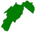
Municipalities and communities of Grant County, West Virginia, United States | ||
|---|---|---|
| City |  | |
| Town | ||
| Unincorporated communities | ||
| Footnotes | ‡This populated place also has portions in an adjacent county or counties | |