Tunnelton, West Virginia
| Tunnelton, West Virginia | |
|---|---|
| Town | |
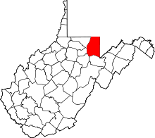
 Location in Preston County and the state of West Virginia. | |
| Coordinates: 39°23′42″N 79°44′47″W / 39.39500°N 79.74639°WCoordinates: 39°23′42″N 79°44′47″W / 39.39500°N 79.74639°W | |
| Country | United States |
| State | West Virginia |
| County | Preston |
| Area[1] | |
| • Total | 0.34 sq mi (0.88 km2) |
| • Land | 0.34 sq mi (0.88 km2) |
| • Water | 0 sq mi (0 km2) |
| Elevation | 1,824 ft (556 m) |
| Population (2010)[2] | |
| • Total | 294 |
| • Estimate (2012[3]) | 297 |
| • Density | 864.7/sq mi (333.9/km2) |
| Time zone | Eastern (EST) (UTC-5) |
| • Summer (DST) | EDT (UTC-4) |
| ZIP code | 26444 |
| Area code(s) | 304 |
| FIPS code | 54-81268[4] |
| GNIS feature ID | 1548320[5] |
Tunnelton is a town in Preston County, West Virginia, United States. The population was 294 at the 2010 census.
History
Tunnelton took its name after the nearby Kingwood Tunnel.[6][7] The Tunnelton Railroad Depot was listed on the National Register of Historic Places in 1996.[8]
Geography
Tunnelton is located at 39°23′42″N 79°44′47″W / 39.395000°N 79.746438°W (39.395000, -79.746438).[9]
According to the United States Census Bureau, the town has a total area of 0.34 square miles (0.88 km2), all of it land.[1]
Demographics
| Historical population | |||
|---|---|---|---|
| Census | Pop. | %± | |
| 1900 | 479 | — | |
| 1910 | 792 | 65.3% | |
| 1920 | 703 | −11.2% | |
| 1930 | 595 | −15.4% | |
| 1940 | 552 | −7.2% | |
| 1950 | 544 | −1.4% | |
| 1960 | 359 | −34.0% | |
| 1970 | 369 | 2.8% | |
| 1980 | 510 | 38.2% | |
| 1990 | 331 | −35.1% | |
| 2000 | 336 | 1.5% | |
| 2010 | 294 | −12.5% | |
| Est. 2015 | 299 | [10] | 1.7% |
2010 census
As of the census[2] of 2010, there were 294 people, 110 households, and 74 families residing in the town. The population density was 864.7 inhabitants per square mile (333.9/km2). There were 117 housing units at an average density of 344.1 per square mile (132.9/km2). The racial makeup of the town was 99.0% White, 0.3% African American, and 0.7% from two or more races. Hispanic or Latino of any race were 0.7% of the population.
There were 110 households of which 37.3% had children under the age of 18 living with them, 50.9% were married couples living together, 12.7% had a female householder with no husband present, 3.6% had a male householder with no wife present, and 32.7% were non-families. 21.8% of all households were made up of individuals and 11.8% had someone living alone who was 65 years of age or older. The average household size was 2.67 and the average family size was 3.09.
The median age in the town was 38 years. 25.5% of residents were under the age of 18; 7.9% were between the ages of 18 and 24; 28.9% were from 25 to 44; 24.7% were from 45 to 64; and 12.9% were 65 years of age or older. The gender makeup of the town was 48.0% male and 52.0% female.
2000 census
As of the census[4] of 2000, there were 336 people, 130 households, and 86 families residing in the town. The population density was 893.5 inhabitants per square mile (341.4/km2). There were 143 housing units at an average density of 380.3 per square mile (145.3/km2). The racial makeup of the town was 100.00% White. Hispanic or Latino of any race were 0.60% of the population.
There were 130 households out of which 31.5% had children under the age of 18 living with them, 57.7% were married couples living together, 6.2% had a female householder with no husband present, and 33.1% were non-families. 25.4% of all households were made up of individuals and 14.6% had someone living alone who was 65 years of age or older. The average household size was 2.58 and the average family size was 3.11.
In the town the population was spread out with 25.6% under the age of 18, 9.2% from 18 to 24, 30.7% from 25 to 44, 20.5% from 45 to 64, and 14.0% who were 65 years of age or older. The median age was 35 years. For every 100 females there were 98.8 males. For every 100 females age 18 and over, there were 88.0 males.
The median income for a household in the town was $18,125, and the median income for a family was $19,625. Males had a median income of $19,063 versus $13,000 for females. The per capita income for the town was $7,978. About 27.1% of families and 35.8% of the population were below the poverty line, including 45.0% of those under age 18 and 10.8% of those age 65 or over.
Notable people
- Jay Bonafield, film producer.
References
- 1 2 "US Gazetteer files 2010". United States Census Bureau. Retrieved 2013-01-24.
- 1 2 "American FactFinder". United States Census Bureau. Retrieved 2013-01-24.
- ↑ "Population Estimates". United States Census Bureau. Retrieved 2013-06-26.
- 1 2 "American FactFinder". United States Census Bureau. Retrieved 2008-01-31.
- ↑ "US Board on Geographic Names". United States Geological Survey. 2007-10-25. Retrieved 2008-01-31.
- ↑ Capace, Nancy (1999). Encyclopedia of West Virginia. North American Book Dist LLC. p. 194. ISBN 978-0-403-09843-9.
- ↑ Kenny, Hamill (1945). West Virginia Place Names: Their Origin and Meaning, Including the Nomenclature of the Streams and Mountains. Piedmont, WV: The Place Name Press. p. 634.
- ↑ National Park Service (2010-07-09). "National Register Information System". National Register of Historic Places. National Park Service.
- ↑ "US Gazetteer files: 2010, 2000, and 1990". United States Census Bureau. 2011-02-12. Retrieved 2011-04-23.
- ↑ "Annual Estimates of the Resident Population for Incorporated Places: April 1, 2010 to July 1, 2015". Retrieved July 2, 2016.
- ↑ "Census of Population and Housing". Census.gov. Retrieved June 4, 2015.