Iaeger, West Virginia
| Iaeger, West Virginia | |
|---|---|
| Town | |
 Location of Iaeger, West Virginia | |
| Coordinates: 37°28′1″N 81°48′31″W / 37.46694°N 81.80861°WCoordinates: 37°28′1″N 81°48′31″W / 37.46694°N 81.80861°W | |
| Country | United States |
| State | West Virginia |
| County | McDowell |
| Area[1] | |
| • Total | 0.83 sq mi (2.15 km2) |
| • Land | 0.79 sq mi (2.05 km2) |
| • Water | 0.04 sq mi (0.10 km2) |
| Elevation | 984 ft (300 m) |
| Population (2010)[2] | |
| • Total | 302 |
| • Estimate (2012[3]) | 293 |
| • Density | 382.3/sq mi (147.6/km2) |
| Time zone | Eastern (EST) (UTC-5) |
| • Summer (DST) | EDT (UTC-4) |
| ZIP code | 24844 |
| Area code(s) | 304 Exchange: 938 |
| FIPS code | 54-39652[4] |
| GNIS feature ID | 1540647[5] |
Iaeger (pronounced YAY-ger) is a town in McDowell County, West Virginia, USA. The population was 302 at the 2010 census. Iaeger was incorporated in 1917 and named for Colonel William G. W. Iaeger, an early settler.[6]
Geography
Iaeger is located at 37°28′1″N 81°48′31″W / 37.46694°N 81.80861°W (37.466932, -81.808541).[7]
According to the United States Census Bureau, the town has a total area of 0.83 square miles (2.15 km2), of which, 0.79 square miles (2.05 km2) is land and 0.04 square miles (0.10 km2) is water.[1]
Climate
The climate in this area is characterized by hot, humid summers and generally mild to cool winters. According to the Köppen Climate Classification system, Iaeger has a humid subtropical climate, abbreviated "Cfa" on climate maps.[8]
Demographics
| Historical population | |||
|---|---|---|---|
| Census | Pop. | %± | |
| 1920 | 481 | — | |
| 1930 | 1,066 | 121.6% | |
| 1940 | 986 | −7.5% | |
| 1950 | 1,271 | 28.9% | |
| 1960 | 930 | −26.8% | |
| 1970 | 822 | −11.6% | |
| 1980 | 833 | 1.3% | |
| 1990 | 551 | −33.9% | |
| 2000 | 358 | −35.0% | |
| 2010 | 302 | −15.6% | |
| Est. 2015 | 275 | [9] | −8.9% |
2010 census
As of the census[2] of 2010, there were 302 people, 131 households, and 83 families residing in the town. The population density was 382.3 inhabitants per square mile (147.6/km2). There were 167 housing units at an average density of 211.4 per square mile (81.6/km2). The racial makeup of the town was 98.3% White, 1.3% African American, and 0.3% from two or more races.
There were 131 households of which 28.2% had children under the age of 18 living with them, 49.6% were married couples living together, 9.9% had a female householder with no husband present, 3.8% had a male householder with no wife present, and 36.6% were non-families. 32.1% of all households were made up of individuals and 21.4% had someone living alone who was 65 years of age or older. The average household size was 2.31 and the average family size was 2.88.
The median age in the town was 45.3 years. 18.2% of residents were under the age of 18; 9.4% were between the ages of 18 and 24; 21.8% were from 25 to 44; 29.5% were from 45 to 64; and 21.2% were 65 years of age or older. The gender makeup of the town was 48.0% male and 52.0% female.
2000 census
As of the census[4] of 2000, there were 358 people, 167 households, and 106 families residing in the town. The population density was 435.4 inhabitants per square mile (168.1/km2). There were 216 housing units at an average density of 262.7 per square mile (101.4/km2). The racial makeup of the town was 96.37% White, 2.51% African American, and 1.12% from two or more races. Hispanic or Latino of any race were 0.56% of the population.
There were 167 households out of which 21.6% had children under the age of 18 living with them, 51.5% were married couples living together, 10.8% had a female householder with no husband present, and 36.5% were non-families. 34.7% of all households were made up of individuals and 19.2% had someone living alone who was 65 years of age or older. The average household size was 2.14 and the average family size was 2.75.
In the town the population was spread out with 17.9% under the age of 18, 6.1% from 18 to 24, 27.9% from 25 to 44, 29.6% from 45 to 64, and 18.4% who were 65 years of age or older. The median age was 44 years. For every 100 females there were 79.0 males. For every 100 females age 18 and over, there were 83.8 males.
The median income for a household in the town was $14,886, and the median income for a family was $21,250. Males had a median income of $23,750 versus $35,000 for females. The per capita income for the town was $17,263. About 29.0% of families and 32.8% of the population were below the poverty line, including 30.0% of those under age 18 and 29.3% of those age 65 or over.
.jpg)
References
- 1 2 "US Gazetteer files 2010". United States Census Bureau. Archived from the original on January 24, 2012. Retrieved 2013-01-24.
- 1 2 "American FactFinder". United States Census Bureau. Retrieved 2013-01-24.
- ↑ "Population Estimates". United States Census Bureau. Archived from the original on June 17, 2013. Retrieved 2013-06-26.
- 1 2 "American FactFinder". United States Census Bureau. Retrieved 2008-01-31.
- ↑ "US Board on Geographic Names". United States Geological Survey. 2007-10-25. Retrieved 2008-01-31.
- ↑ Kenny, Hamill (1945). West Virginia Place Names: Their Origin and Meaning, Including the Nomenclature of the Streams and Mountains. Piedmont, WV: The Place Name Press. p. 323.
- ↑ "US Gazetteer files: 2010, 2000, and 1990". United States Census Bureau. 2011-02-12. Retrieved 2011-04-23.
- ↑ Climate Summary for Iaeger, West Virginia
- ↑ "Annual Estimates of the Resident Population for Incorporated Places: April 1, 2010 to July 1, 2015". Retrieved July 2, 2016.
- ↑ "Census of Population and Housing". Census.gov. Archived from the original on May 11, 2015. Retrieved June 4, 2015.
External links
Municipalities and communities of McDowell County, West Virginia, United States | ||
|---|---|---|
| Cities | 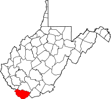 | |
| Towns | ||
| CDPs | ||
| Unincorporated communities |
| |
| Ghost town | ||
| Footnotes | ‡This populated place also has portions in an adjacent county or counties | |