Farmington, West Virginia
| Farmington, West Virginia | |
|---|---|
| Town | |
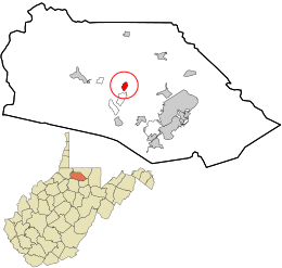 Location in Marion County and the state of West Virginia. | |
| Coordinates: 39°30′47″N 80°15′7″W / 39.51306°N 80.25194°WCoordinates: 39°30′47″N 80°15′7″W / 39.51306°N 80.25194°W | |
| Country | United States |
| State | West Virginia |
| County | Marion |
| Area[1] | |
| • Total | 0.43 sq mi (1.11 km2) |
| • Land | 0.42 sq mi (1.09 km2) |
| • Water | 0.01 sq mi (0.03 km2) |
| Elevation | 932 ft (284 m) |
| Population (2010)[2] | |
| • Total | 375 |
| • Estimate (2012[3]) | 378 |
| • Density | 892.9/sq mi (344.8/km2) |
| Time zone | Eastern (EST) (UTC-5) |
| • Summer (DST) | EDT (UTC-4) |
| ZIP code | 26571 |
| Area code(s) | 304 |
| FIPS code | 54-26932[4] |
| GNIS feature ID | 1554446[5] |
Farmington is a town in Marion County, West Virginia, United States. The population was 375 at the 2010 census. It is best known for being the site of the 1968 Farmington Mine disaster.
The community was named for the fact a large share of the first settlers were farmers.[6]
Geography
Farmington is located at 39°30′47″N 80°15′7″W / 39.51306°N 80.25194°W (39.512979, -80.252060),[7] along Buffalo Creek.[8]
According to the United States Census Bureau, the town has a total area of 0.43 square miles (1.11 km2), of which 0.42 square miles (1.09 km2) is land and 0.01 square miles (0.03 km2) is water.[1]
Demographics
| Historical population | |||
|---|---|---|---|
| Census | Pop. | %± | |
| 1870 | 89 | — | |
| 1880 | 179 | 101.1% | |
| 1910 | 519 | — | |
| 1920 | 679 | 30.8% | |
| 1930 | 819 | 20.6% | |
| 1940 | 880 | 7.4% | |
| 1950 | 824 | −6.4% | |
| 1960 | 709 | −14.0% | |
| 1970 | 595 | −16.1% | |
| 1980 | 583 | −2.0% | |
| 1990 | 414 | −29.0% | |
| 2000 | 387 | −6.5% | |
| 2010 | 375 | −3.1% | |
| Est. 2015 | 377 | [9] | 0.5% |
2010 census
As of the census[2] of 2010, there were 375 people, 163 households, and 111 families residing in the town. The population density was 892.9 inhabitants per square mile (344.8/km2). There were 192 housing units at an average density of 457.1 per square mile (176.5/km2). The racial makeup of the town was 97.9% White, 0.3% Asian, and 1.9% from two or more races. Hispanic or Latino of any race were 0.3% of the population.
There were 163 households of which 30.7% had children under the age of 18 living with them, 51.5% were married couples living together, 9.8% had a female householder with no husband present, 6.7% had a male householder with no wife present, and 31.9% were non-families. 28.8% of all households were made up of individuals and 13.5% had someone living alone who was 65 years of age or older. The average household size was 2.30 and the average family size was 2.80.
The median age in the town was 39.6 years. 21.9% of residents were under the age of 18; 5.2% were between the ages of 18 and 24; 31.4% were from 25 to 44; 24.3% were from 45 to 64; and 17.1% were 65 years of age or older. The gender makeup of the town was 49.9% male and 50.1% female.
2000 census
As of the census[4] of 2000, there were 387 people, 163 households, and 108 families residing in the town. The population density was 917.3 inhabitants per square mile (355.8/km²). There were 194 housing units at an average density of 459.8 per square mile (178.3/km²). The racial makeup of the town was 96.90% White, 1.81% African American, and 1.29% from two or more races.
There were 163 households out of which 26.4% had children under the age of 18 living with them, 42.9% were married couples living together, 17.2% had a female householder with no husband present, and 33.7% were non-families. 30.1% of all households were made up of individuals and 19.0% had someone living alone who was 65 years of age or older. The average household size was 2.37 and the average family size was 2.93.
In the town the population was spread out with 23.5% under the age of 18, 7.0% from 18 to 24, 27.4% from 25 to 44, 23.0% from 45 to 64, and 19.1% who were 65 years of age or older. The median age was 37 years. For every 100 females there were 85.2 males. For every 100 females age 18 and over, there were 81.6 males.
The median income for a household in the town was $29,375, and the median income for a family was $39,688. Males had a median income of $31,250 versus $18,750 for females. The per capita income for the town was $15,990. About 5.9% of families and 9.0% of the population were below the poverty line, including 17.3% of those under age 18 and 1.3% of those age 65 or over.
Notable people
- Waitman T. Willey, was born in a log cabin near Farmington
- Frank Gatski, athlete in the Pro Football Hall of Fame
- Joe Manchin, current U.S. Senator
- Sam Huff, Pro Football Hall of Fame
See also
References
- 1 2 "US Gazetteer files 2010". United States Census Bureau. Retrieved 2013-01-24.
- 1 2 "American FactFinder". United States Census Bureau. Retrieved 2013-01-24.
- ↑ "Population Estimates". United States Census Bureau. Retrieved 2013-06-26.
- 1 2 "American FactFinder". United States Census Bureau. Retrieved 2008-01-31.
- ↑ "US Board on Geographic Names". United States Geological Survey. 2007-10-25. Retrieved 2008-01-31.
- ↑ Kenny, Hamill (1945). West Virginia Place Names: Their Origin and Meaning, Including the Nomenclature of the Streams and Mountains. Piedmont, WV: The Place Name Press. p. 239.
- ↑ "US Gazetteer files: 2010, 2000, and 1990". United States Census Bureau. 2011-02-12. Retrieved 2011-04-23.
- ↑ West Virginia Atlas & Gazetteer. Yarmouth, Me.: DeLorme. 1997. p. 25. ISBN 0-89933-246-3.
- ↑ "Annual Estimates of the Resident Population for Incorporated Places: April 1, 2010 to July 1, 2015". Retrieved July 2, 2016.
- ↑ "Census of Population and Housing". Census.gov. Retrieved June 4, 2015.
External links
Municipalities and communities of Marion County, West Virginia, United States | ||
|---|---|---|
| Cities | 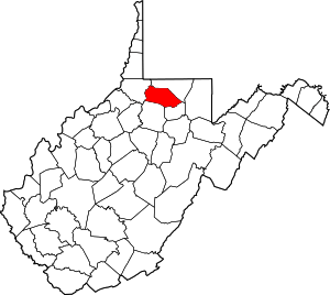 | |
| Towns | ||
| CDPs | ||
| Unincorporated communities |
| |
| Fictional places | ||
| Footnotes | ‡This populated place also has portions in an adjacent county or counties | |