Bras-d'Asse
| Bras-d'Asse | ||
|---|---|---|
|
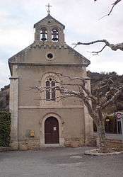
The church of Saint-Nicolas, in Bras-d'Asse | ||
| ||
 Bras-d'Asse | ||
|
Location within Provence-A.-C.d'A. region  Bras-d'Asse | ||
| Coordinates: 43°55′35″N 6°07′35″E / 43.9264°N 6.1264°ECoordinates: 43°55′35″N 6°07′35″E / 43.9264°N 6.1264°E | ||
| Country | France | |
| Region | Provence-Alpes-Côte d'Azur | |
| Department | Alpes-de-Haute-Provence | |
| Arrondissement | Digne-les-Bains | |
| Canton | Mézel | |
| Intercommunality | Asse | |
| Government | ||
| • Mayor (2008–2014) | Jean Arnaud | |
| Area1 | 26.1 km2 (10.1 sq mi) | |
| Population (2008)2 | 498 | |
| • Density | 19/km2 (49/sq mi) | |
| Time zone | CET (UTC+1) | |
| • Summer (DST) | CEST (UTC+2) | |
| INSEE/Postal code | 04031 / 04270 | |
| Elevation |
455–812 m (1,493–2,664 ft) (avg. 475 m or 1,558 ft) | |
|
1 French Land Register data, which excludes lakes, ponds, glaciers > 1 km² (0.386 sq mi or 247 acres) and river estuaries. 2 Population without double counting: residents of multiple communes (e.g., students and military personnel) only counted once. | ||

Bras-d'Asse is a commune in the Alpes-de-Haute-Provence department in southeastern France.
Geography
The village lies in the middle of the commune, on the right bank of the Asse, which flows southwest through the commune.
Population
| Historical population | ||
|---|---|---|
| Year | Pop. | ±% |
| 1765 | 428 | — |
| 1793 | 437 | +2.1% |
| 1800 | 458 | +4.8% |
| 1806 | 458 | +0.0% |
| 1821 | 421 | −8.1% |
| 1831 | 436 | +3.6% |
| 1836 | 459 | +5.3% |
| 1841 | 482 | +5.0% |
| 1846 | 491 | +1.9% |
| 1851 | 493 | +0.4% |
| 1856 | 465 | −5.7% |
| 1861 | 438 | −5.8% |
| 1866 | 425 | −3.0% |
| 1872 | 444 | +4.5% |
| 1876 | 467 | +5.2% |
| 1881 | 460 | −1.5% |
| 1886 | 462 | +0.4% |
| 1891 | 425 | −8.0% |
| 1896 | 428 | +0.7% |
| 1901 | 444 | +3.7% |
| 1906 | 463 | +4.3% |
| 1911 | 458 | −1.1% |
| 1921 | 382 | −16.6% |
| 1926 | 388 | +1.6% |
| 1931 | 384 | −1.0% |
| 1936 | 376 | −2.1% |
| 1946 | 332 | −11.7% |
| 1954 | 316 | −4.8% |
| 1962 | 324 | +2.5% |
| 1968 | 352 | +8.6% |
| 1975 | 331 | −6.0% |
| 1982 | 318 | −3.9% |
| 1990 | 378 | +18.9% |
| 1999 | 395 | +4.5% |
| 2008 | 498 | +26.1% |
See also
References
| Wikimedia Commons has media related to Bras-d'Asse. |
This article is issued from Wikipedia - version of the 2/3/2015. The text is available under the Creative Commons Attribution/Share Alike but additional terms may apply for the media files.