Alberta Highway 41
| ||||
|---|---|---|---|---|
| Buffalo Trail | ||||
 | ||||
| Route information | ||||
| Length: | 686 km (426 mi) | |||
| Major junctions | ||||
| South end: |
| |||
|
| ||||
| North end: |
| |||
| Location | ||||
| Specialized and rural municipalities: | Cypress County, Special Area No. 2, Acadia No. 34 M.D., Special Area No. 3, Special Area No. 4, Provost No. 52 M.D., Wainwright No. 61 M.D., Vermilion River County, Two Hills No. 21 County, St. Paul No. 19 County, Bonnyville No. 87 M.D. | |||
| Towns: | Oyen, Wainwright, Vermilion, Elk Point, Bonnyville | |||
| Villages: | Consort, Czar | |||
| Highway system | ||||
|
Provincial highways in Alberta
| ||||
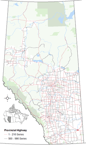
Alberta Provincial Highway No. 41,[1] also named Buffalo Trail, is a 686 km (426 mi) north-south highway located in eastern Alberta, Canada. It extends from the Hamlet of La Corey at Highway 55 to the United States border at Wild Horse.
Major intersections
From south to north:
Highway 41A

Segment of Highway 41A in Alberta
Alberta Provincial Highway No. 41A[1] is the designation of an alternate route off Highway 41 serving the City of Medicine Hat. It branches off Highway 41 approximately 7 km (4.3 mi) north of the Trans-Canada Highway and runs approximately 12 km (7.5 mi). It winds through Medicine Hat and terminates at its junction with the Trans-Canada Highway and the Crowsnest Highway (Highway 3) west of the downtown core.
References
External links
- 2010 Provincial Highways 1 - 216 Series Progress Chart (map, 8 MB) by Alberta Transportation.
This article is issued from Wikipedia - version of the 11/11/2016. The text is available under the Creative Commons Attribution/Share Alike but additional terms may apply for the media files.

.svg.png)