Flixecourt
| Flixecourt | |
|---|---|
 | |
 Flixecourt | |
|
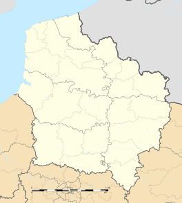
Location within Hauts-de-France region  Flixecourt | |
| Coordinates: 50°00′49″N 2°04′55″E / 50.0136°N 2.0819°ECoordinates: 50°00′49″N 2°04′55″E / 50.0136°N 2.0819°E | |
| Country | France |
| Region | Hauts-de-France |
| Department | Somme |
| Arrondissement | Amiens |
| Canton | Picquigny |
| Intercommunality | Val de Nièvre et environs |
| Government | |
| • Mayor (1989–present) | René Lognon |
| Area1 | 11.84 km2 (4.57 sq mi) |
| Population (2009)2 | 3,222 |
| • Density | 270/km2 (700/sq mi) |
| Time zone | CET (UTC+1) |
| • Summer (DST) | CEST (UTC+2) |
| INSEE/Postal code | 80318 / 80420 |
| Elevation |
6–105 m (20–344 ft) (avg. 82 m or 269 ft) |
|
1 French Land Register data, which excludes lakes, ponds, glaciers > 1 km² (0.386 sq mi or 247 acres) and river estuaries. 2 Population without double counting: residents of multiple communes (e.g., students and military personnel) only counted once. | |
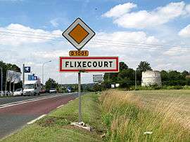
Flixecourt is a commune in the Somme department in Hauts-de-France in northern France.
Geography
Flixecourt is situated on the N1 road and the banks of the river Nièvre, a tributary of the river Somme, some 20 miles (32 km) south of Abbeville. A junction with the A16 autoroute is about a mile away.
History
In the 12th century, Flixecourt was a fief of Amiens and the site of a leper hospice.
The fiefdom passed to the Louvencourt family, then in 1276 to the Fieffes family, who built a priory, entrusting the management of it to the vidame of Picquigny,
The town that was established here comprised 140 homes at the start of the Hundred Years War, but only 40 in 1548.
In 1545, Charles d'Ailly obtained permission from the King to create a weekly market. This privilege continued for his son, Louis d'Ailly, in 1567.
In 1603, a huge fire burnt down half the town.
Near the site of the present-day church are vestiges of a château, mentioned in a notarial document in 1618, in which Philibert-Emmanuel d’Ailly, granted the structure to a certain Louis de la Massonière, provided he financed the repairs.
Towards the end of the French revolution, the château belonged to the Croquoison family.
The present church was built in 1721.
The town’s commerce at this time was based on the production of peat and of linen
In 1815, there were two watermills and two windmills.
The discovery of a new natural fibre, jute, changed the destiny of both the town and the region. In 1840, the Saint brothers set up a weaving factory, employing locals and Scottish weavers. The factory was electrified in 1907. Before the outbreak of World War I, 14,000 people were employed here.
The town was the factory, and the factory was the town. The owners set in place all manner of improvements to the daily and social life of the workers. Piped water supplies and electricity to all homes, a school, a creche, a pharmacy, a maternity hospital and a cooperative. After World War II and the advent of man-made fibres, the factory went into irreversible decline.
Population
| Year | 1851 | 1962 | 1968 | 1975 | 1982 | 1990 | 1999 | 2006 |
|---|---|---|---|---|---|---|---|---|
| Population | 1699 | 3285 | 3459 | 3546 | 3276 | 2931 | 2978 | 3185 |
| From the year 1962 on: No double counting—residents of multiple communes (e.g. students and military personnel) are counted only once. | ||||||||
Places of interest
The town has a rich architectural heritage, typical of the first industrial revolution. Many are in a bad state of repair. Some have been restored but more needs to be done.
- The château (Folly) of the Saint family
- The buildings of ‘La Prévoyance’, near the railway
- The church (the tower was rebuilt in 1940)
- The railway station, dating from 1875, (destroyed by a fire at the beginning of the 21st century)
Personalities
Teddy Bertin, a French professional footballer, was born in Flixecourt, as was former World and Olympic track cycling champion Philippe Ermenault.
See also
References
External links
| Wikimedia Commons has media related to Flixecourt. |
- Flixecourt on the Quid website (French)