Liercourt
| Liercourt | |
|---|---|
 | |
 Liercourt | |
|
Location within Hauts-de-France region  Liercourt | |
| Coordinates: 50°02′24″N 1°54′03″E / 50.04°N 1.9008°E / 50.04; 1.9008Coordinates: 50°02′24″N 1°54′03″E / 50.04°N 1.9008°E / 50.04; 1.9008 | |
| Country | France |
| Region | Hauts-de-France |
| Department | Somme |
| Arrondissement | Abbeville |
| Canton | Hallencourt |
| Intercommunality | Région d'Hallencourt |
| Government | |
| • Mayor (2001–2008) | Régis Bilhaut |
| Area1 | 5.53 km2 (2.14 sq mi) |
| Population (2006)2 | 359 |
| • Density | 65/km2 (170/sq mi) |
| Time zone | CET (UTC+1) |
| • Summer (DST) | CEST (UTC+2) |
| INSEE/Postal code | 80476 / 80580 |
| Elevation |
7–104 m (23–341 ft) (avg. 9 m or 30 ft) |
|
1 French Land Register data, which excludes lakes, ponds, glaciers > 1 km² (0.386 sq mi or 247 acres) and river estuaries. 2 Population without double counting: residents of multiple communes (e.g., students and military personnel) only counted once. | |
Liercourt is a commune in the Somme department in Hauts-de-France in northern France.
Geography
Liercourt is situated at the junction of the D3 and D901 roads, in the valley of the Somme River, 7 miles (11 km) southeast of Abbeville.
Population
| 1962 | 1968 | 1975 | 1982 | 1990 | 1999 | 2006 |
|---|---|---|---|---|---|---|
| 276 | 290 | 289 | 332 | 289 | 320 | 359 |
| Starting in 1962: Population without duplicates | ||||||
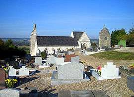
Places of interest
- The church
See also
References
External links
| Wikimedia Commons has media related to Liercourt. |
- Liercourt on the Quid website (French)
This article is issued from Wikipedia - version of the 11/8/2016. The text is available under the Creative Commons Attribution/Share Alike but additional terms may apply for the media files.