Moyencourt-lès-Poix
| Moyencourt-lès-Poix | |
|---|---|
 | |
 Moyencourt-lès-Poix | |
|
Location within Hauts-de-France region  Moyencourt-lès-Poix | |
| Coordinates: 49°48′12″N 2°02′10″E / 49.8033°N 2.0361°ECoordinates: 49°48′12″N 2°02′10″E / 49.8033°N 2.0361°E | |
| Country | France |
| Region | Hauts-de-France |
| Department | Somme |
| Arrondissement | Amiens |
| Canton | Poix-de-Picardie |
| Intercommunality | Sud-Ouest Amiénois |
| Government | |
| • Mayor (2001–2008) | Jean-Pierre Demarquet |
| Area1 | 10.45 km2 (4.03 sq mi) |
| Population (2006)2 | 164 |
| • Density | 16/km2 (41/sq mi) |
| Time zone | CET (UTC+1) |
| • Summer (DST) | CEST (UTC+2) |
| INSEE/Postal code | 80577 / 80290 |
| Elevation |
104–177 m (341–581 ft) (avg. 160 m or 520 ft) |
|
1 French Land Register data, which excludes lakes, ponds, glaciers > 1 km² (0.386 sq mi or 247 acres) and river estuaries. 2 Population without double counting: residents of multiple communes (e.g., students and military personnel) only counted once. | |
Moyencourt-lès-Poix is a commune in the Somme department in Hauts-de-France in northern France.
Geography
The commune is situated just off the N29, on th D94 road, some 15 miles (24 km) southwest of Amiens. Not to be confused with another commune, Moyencourt, further east in the same département.
Population
| 1962 | 1968 | 1975 | 1982 | 1990 | 1999 | 2006 |
|---|---|---|---|---|---|---|
| 148 | 153 | 171 | 172 | 159 | 159 | 164 |
| Starting in 1962: Population without duplicates | ||||||
_1.jpg)
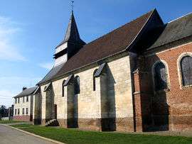
The Chateau pavillon
See also
References
External links
| Wikimedia Commons has media related to Moyencourt-lès-Poix. |
This article is issued from Wikipedia - version of the 11/8/2016. The text is available under the Creative Commons Attribution/Share Alike but additional terms may apply for the media files.