Hangard
| Hangard | |
|---|---|
 Hangard | |
|
Location within Hauts-de-France region  Hangard | |
| Coordinates: 49°49′25″N 2°30′47″E / 49.8236°N 2.5131°ECoordinates: 49°49′25″N 2°30′47″E / 49.8236°N 2.5131°E | |
| Country | France |
| Region | Hauts-de-France |
| Department | Somme |
| Arrondissement | Montdidier |
| Canton | Moreuil |
| Intercommunality | Avre Luce Moreuil |
| Government | |
| • Mayor (2001–2008) | Dominique Paille |
| Area1 | 6.34 km2 (2.45 sq mi) |
| Population (2006)2 | 117 |
| • Density | 18/km2 (48/sq mi) |
| Time zone | CET (UTC+1) |
| • Summer (DST) | CEST (UTC+2) |
| INSEE/Postal code | 80414 / 80110 |
| Elevation |
35–102 m (115–335 ft) (avg. 50 m or 160 ft) |
|
1 French Land Register data, which excludes lakes, ponds, glaciers > 1 km² (0.386 sq mi or 247 acres) and river estuaries. 2 Population without double counting: residents of multiple communes (e.g., students and military personnel) only counted once. | |
Hangard is a commune in the Somme department in Hauts-de-France in northern France. The commune is centered on Hangard village, located at longitude 2.5131E and latitude 49.8236N. Inhabitants of this commune were called "red boyeux Hangard"
Gallery
 saint-Martin Hangard
.svg.png) Hangard Shield
Hangard Shield.JPG) Hangard
Hangard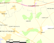 Map of the commune
Geography
Hangard is situated on the D76 road, some 13 miles (21 km) southeast of Abbeville, and is at an elevation of about 35m.
Population
| Year | 1962 | 1968 | 1975 | 1982 | 1990 | 1999 | 2006 |
|---|---|---|---|---|---|---|---|
| Population | 71 | 75 | 82 | 73 | 87 | 100 | 117 |
| From the year 1962 on: No double counting—residents of multiple communes (e.g. students and military personnel) are counted only once. | |||||||
Census records show that at the French Revolution the village had 244 inhabitants, but by 1846 this had risen to 345 after which the population began to decline until it was 172 just prior to the First World War. The village was destroyed in the second battle of Villers-Bretonneux, and thereafter has maintained a population of about 100.
History
The name comes from a personal name "Hano" and the Germanic "Gardo" and means ‘Hano’s garden’.
In 1135 the name was spelt ‘Hangardum’.
Neolithic
Stone-age tools of flint, in the shape of blades, arrows and axes have been found in the area. The excavations made in 1890 revealed weapons of worked stones were found near the village, including carved polished flint stones, each shaped knife, scraper and other axe-shaped.
A dolmen once stood nearby but has now disappeared into the marshy land.
During World War I, on 28 March 1918, the village was evacuated. By April 1918 the village had been totally destroyed.
Middle Ages
In the 12th century, the Lord of Hangard was Foulques Lehardi, a valiant knight, known for his strength and his bravery in many battles, in the crusades. He was however, wounded, captured and ransomed during the crusade. In 1362, the village is mentioned in a census as the stronghold of Madam Jehanne of Rivery. A number of other lords of the village are known, including:
- Bernard of Hangard 1146;
- Jehan de Hangard 1219;
- Henri Hangard 1248;
- Drieu of Hangard 1337;
- Jean de Hangard 1350;
- Jean de Hangard 1380;
- Gilles de Hangard 1437;
- Jacques de Hangard 1473.
- Pierre-François of Incourt Lord of Hangard (c.1725 - 1760)
Religion
The village Church is dedicated to Saint Martin and was built in 1523. Under the Bell Tower is the tombstone of Frucourt, wife of Jacques de Roye, the Lord of Hangard Claire. She died April 25, 1523 and it is considered that she commissioned the Church.
In 1612, the peel of two bells was installed and four new bells in 1786. An additional Bell was installed in 1839. Between the years 1670-1690, a number of inhabitants moved to Neunkirchen, Germany due to the persecution of protestants under Louis XIV.
World War I
During the First World War the village was caught up in the second battle of Villers-Bretonneux. A specific action at the village was called the battle of Hangard Wood. On March 28, 1918, the evacuation of the village is organized by Mr. Farcy teacher and Secretary of the City Hall of Hangard. Only Timothée Gaby remained with his wife until March 31.
On 24 April, there is fierce fighting in the streets, the village was utterly destroyed. Latter a gift from the city of Tangier (Morocco) will allow the rebuilding of the village. 1st Moroccan Infantry Division (France)|A Moroccan unit]] was involved in the battle.
By July the municipality has housed 102 000 men, 3 000 officers, 40 000 horses.
See also
References
External links
| Wikimedia Commons has media related to Hangard. |