Falvy
| Falvy | |
|---|---|
|
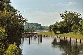
Falvy Lake | |
 Falvy | |
|
Location within Hauts-de-France region  Falvy | |
| Coordinates: 49°49′30″N 2°57′35″E / 49.825°N 2.9597°ECoordinates: 49°49′30″N 2°57′35″E / 49.825°N 2.9597°E | |
| Country | France |
| Region | Hauts-de-France |
| Department | Somme |
| Arrondissement | Péronne |
| Canton | Nesle |
| Intercommunality | Nesle |
| Government | |
| • Mayor (2001–2008) | Jean-Louis Duclaux |
| Area1 | 6.32 km2 (2.44 sq mi) |
| Population (2006)2 | 142 |
| • Density | 22/km2 (58/sq mi) |
| Time zone | CET (UTC+1) |
| • Summer (DST) | CEST (UTC+2) |
| INSEE/Postal code | 80300 / 80190 |
| Elevation |
51–91 m (167–299 ft) (avg. 60 m or 200 ft) |
|
1 French Land Register data, which excludes lakes, ponds, glaciers > 1 km² (0.386 sq mi or 247 acres) and river estuaries. 2 Population without double counting: residents of multiple communes (e.g., students and military personnel) only counted once. | |
Falvy is a commune in the Somme department in Hauts-de-France in northern France.
Geography
Falvy is situated on the D103 road, on the banks of the river Somme, some 19 miles (31 km) west of Saint Quentin.
History
Falvy originated as a Gaulish village. Known by different names over the centuries :Fala, Falvicum in 1135, Phalevi in 1146, then Fallevy or Falevi sur Somme and finally Falvy Principle events :
- In the 12th century, Raoul I de Nesle, seigneur of both Nesle and Falvy, gave the windmill of Falvy-sur-Somme to the church at Saint-Quentin.
- 1629 and Louis XIII dismantles the château, a medieval fortress
- On 22 November 1916, fighter-ace-pilot Georges Guynemer claimed his 23rd victim at Falvy.
- On 9 August 1918, the bridge at Falvy was attacked by Lieutenant James Alfred Keating, an American volunteer in the RFC. He won the Distinguished Flying Cross.
Population
| Year | 1954 | 1962 | 1968 | 1975 | 1982 | 1990 | 1999 | 2006 |
|---|---|---|---|---|---|---|---|---|
| Population | 138 | 117 | 118 | 108 | 116 | 106 | 100 | 142 |
| From the year 1962 on: No double counting—residents of multiple communes (e.g. students and military personnel) are counted only once. | ||||||||
Places of interest
- The church of Saint Benoite has dimensions that are relative to a time when the population was larger. Its origin was as a chapel to the chateau. It was victim of revolutionary vandalism in 1792, losing much of its embellishment and harmony by such destruction.
- The lake
See also
References
External links
| Wikimedia Commons has media related to Falvy. |
- Falvy on the Quid website (French)
This article is issued from Wikipedia - version of the 11/8/2016. The text is available under the Creative Commons Attribution/Share Alike but additional terms may apply for the media files.