Gaya, India
| Gaya गया | |
|---|---|
| Metropolitan City | |
|
Vishnupadh Temple in Gaya, contains footprints of Lord Vishnu | |
 Gaya 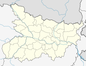 Gaya Location of Gaya in Bihar | |
| Coordinates: 24°45′N 85°01′E / 24.75°N 85.01°ECoordinates: 24°45′N 85°01′E / 24.75°N 85.01°E | |
| Country |
|
| State | Bihar |
| Region | Magadha |
| Division | Magadh Division |
| District | Gaya |
| Government | |
| • Type | Municipal corporation |
| • Body | Gaya Nagar Nigam |
| • Mayor | Soni Kumari |
| Area[1] | |
| • Total | 90.17 km2 (34.81 sq mi) |
| Elevation | 111 m (364 ft) |
| Population (2011) | |
| • Total | 470,839[2] |
| • Rank | India of most populous cities in India|98th |
| • Density | 9,482/km2 (24,560/sq mi) |
| Demonym(s) | Gayaite, Gayavi [3] |
| Languages | |
| • Official | Hindi, English, Urdu |
| Time zone | IST (UTC+5:30) |
| PIN | 823001 - 13 |
| Telephone code | 91-631 |
| Vehicle registration | BR 02 |
| Railway Station | Gaya Junction |
| Airport | Gaya International Airport |
| Website |
www |

Gaya (/ɡʌjɑː/) is a city of ancient historical and mythological significance. It is one of the major tourist attractions of Bihar. The city is the 2nd largest city of Bihar, and is also the headquarters of Gaya district and Magadh division.
Gaya is 100 kilometres (62 mi) south of Patna, the capital city of Bihar. Situated on the banks of the Phalgu River (or Niranjana, as mentioned in Ramayana), it is a place sanctified by the Jain, Hindu, Islam and Buddhist religions. It is surrounded by small rocky hills (Mangla-Gauri, Shringa-Sthan, Ram-Shila and Brahmayoni) by three sides and the river flowing on the fourth (eastern) side. The city has a mix of natural surroundings, age old buildings, green areas and narrow bylanes.
Gaya finds mention in the great epics, Ramayana and Mahabharata. Rama, along with Sita and Lakshmana, visited Gaya to offer pind-daan to their father Dasharath. In the Mahabharata, the place is referred to as Gayapuri. About the origin of the name ‘Gaya' as referred to in Vayu Purana is that Gaya was the name of a demon (Asura) whose body was pious after he performed rigid penance and secured blessings from Vishnu. It was said that the Gayasura's body would continue to be known as Gaya Kshetra.
Origin of Name
Gaya derives its name from the mythological demon Gayasur (which literally means Gaya the demon). According to Vayu Purana, Gaya was the name of a demon (Asura) whose body was pious after he performed rigid penance and secured blessings from Vishnu. It was said that the body of Gayasura was transformed into the series of rocky hills that make up the landscape of Gaya.[4]
History
Ancient history
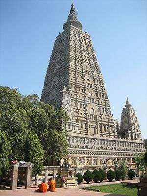
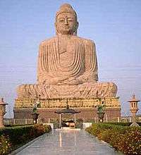
Documented history of Gaya dates back to the enlightenment of Gautam Buddha. About 11 km from Gaya town is Bodh Gaya, the place where Gautam Buddha attained enlightenment. Gautam Buddha was a sage on whose teachings, the religion Buddhism was founded.Since then Gaya has been a place of pilgrimage for people all over the world. Gaya further flourished under the rule of dynasties like the Mauryans who ruled from Pataliputra (modern Patna) and covered the area beyond the boundaries of the Indian subcontinent. During this period, Gaya was a part of the Magadh region.
Gaya experienced the rise and fall of many dynasties in the Magadh Region. From the 6th century BC to the 18th century AD, about 2300–2400 years, Gaya has been occupying an important place in the cultural history of the region. It opened up with the Sisunaga dynasty founded by Sisunaga, who exercised power over Patna and Gaya around 600 BC. Bimbisara, fifth in line, who lived and ruled around 519 BC, had projected Gaya to the outer world. Having attained an important place in the history of civilisation, the area experienced the bliss of Gautam Buddha and Bhagwan Mahavir during the reign of Bimbisara. After a short spell of Nanda dynasty, Gaya and the entire Magadha region came under the Mauryan rule with Ashoka (272 BC – 232 BC) embracing Buddhism. He visited Gaya and built the first temple at Bodh Gaya to commemorate Prince Gautama's attainment of supreme enlightenment.
The period of Hindu revivalism commenced with the coming of the Guptas during the 4th and 5th century A.D. Samudragupta of Magadh helped to bring Gaya in limelight. It was the headquarters of Bihar district during the Gupta empire.
Gaya then passed on to the Pala Empire with Gopala as the ruler. It is believed that the present temple of Bodh Gaya was built during the reign of Dharmapala, son of Gopala.
Gaya, in the 12th century, was invaded by Muhammad Bakhtiyar Khilji. But the Hindu rulers defeated his generals later. The place finally passed on to the Britishers after the battle of Buxar in 1764. Gaya, along with other parts of the country, won freedom in 1947.
Modern history
The town of Gaya, in about 1810 AD, consisted of two parts : one the residence of the priests, which properly was called Gaya ; and the other the residence of lawyers and tradesmen, which was originally called Elahabad, but later on,as developed by a renowned collector "Saheb"- Mr.Thomas Law, it was called Sahebgunj.It is the birthplace of eminent nationalist Bihar Vibhuti Dr Anugrah Narain Sinha;Bihar's first deputy Chief Minister cum Finance Minister.The last great ruler of Magadha was maharaja of Tekari.
The leader of Kisan Andolan, Swami Sahajanand Saraswati established an ashram at Neyamatpur, Gaya (Bihar) which later became the centre of freedom struggle in Bihar. Many prominent leaders of Indian National Congress visited there frequently to meet Yadunandan (Jadunandan) Sharma, the leader of Kisan Andolan who resided in the ashram set up by Swamiji. Yadunandan Sharma became the undisputed leader of peasants in the Gaya district and second in command to the legendary freedom fighter and peasant leader Swami Sahajanand Saraswati.[5] Gaya has also immensely contributed in the Indian Independence Movement.
During the independence movement, the All India session of the Congress was held under the presidency of Deshbandhu Chittaranjan Das in 1922, which was attended by great illumanaries and prominent leaders of the Indian Independence Movement, such as Mohandas K. Gandhi, Dr. Rajendra Prasad,Dr Anugrah Narayan Sinha, Sardar Patel, Maulana Azad, Jawaharlal Nehru and Sri Krishna Sinha.
The former Bihar Chief Minister Late Satyendra Narain Sinha also hailed from Gaya.
Shri Ishwar Chaudhary was a member of Fifth, Sixth and Ninth Lok Sabha during 1971-79 and 1989-91 representing Gaya constituency of Bihar.
Establishment of the Gaya District
Gaya was established in the year 1865. Earlier Gaya was a part of the district of erstwhile Behar of Ramgarh (now in Jharkhand state) till 1864. It was given the status of independent district on 3 October 1865. Subsequently, in May 1981, Magadh division was created by the Bihar state government with the districts of Gaya, Nawada, Aurangabad and Jehanabad. All these district were at the level of sub-division, when the Gaya district was created. Gaya has seen three district partitioned off from its territory, Aurangabad and Nawada in 1976; and Jehanabad in 1988. Gaya district occupies an area of 4,976 km2 (1,921 mile2) comparatively equivalent to the island of Trinidad.
Climate
As Gaya is surrounded by hills from three sides and one side by rivers so the climate of Gaya is seasonable (means in winter it is too cold and in summer it is too hot). Climate is characterised by relatively high temperatures and evenly distributed precipitation throughout the year. The Köppen Climate Classification sub-type for this climate is "Cfa" (Humid Subtropical Climate).[6]
| Climate data for Gaya, India | |||||||||||||
|---|---|---|---|---|---|---|---|---|---|---|---|---|---|
| Month | Jan | Feb | Mar | Apr | May | Jun | Jul | Aug | Sep | Oct | Nov | Dec | Year |
| Average high °C (°F) | 24 (75) |
27 (80) |
33 (92) |
39 (102) |
41 (105) |
38 (101) |
33 (92) |
32 (90) |
33 (91) |
32 (89) |
29 (84) |
25 (77) |
32 (90) |
| Average low °C (°F) | 10 (50) |
13 (55) |
18 (64) |
23 (74) |
27 (80) |
28 (82) |
26 (79) |
26 (78) |
25 (77) |
22 (71) |
14 (58) |
10 (50) |
20 (68) |
| Average precipitation mm (inches) | 20 (0.8) |
20 (0.8) |
13 (0.5) |
8 (0.3) |
20 (0.8) |
137 (5.4) |
315 (12.4) |
328 (12.9) |
206 (8.1) |
53 (2.1) |
10 (0.4) |
3 (0.1) |
1,130 (44.5) |
| Source: Weatherbase[7] | |||||||||||||
Economy
Gaya is the second biggest economy contributor after Patna for Bihar. It has a large number of household industries like production of agarbattis, production of tilkut and lai, stone crafting, power looms, Small Scale manufacturing industries,packing industries,plastic products industries,Scrap Industries and hand looms. Gaya functions as a service centre for the surrounding towns and villages. Commercial activities are located along the important roads of the town. The main vegetable market in the city is the Kedarnath Market. In additional the city has a large number of informal shops. On account of Gaya being an important centre for religious tourism, the city has a large number of costly and affordable Hotels and accommodations. Gaya has the highest number of hotels in Bihar & Jharkhand. One Five Star hotel is also proposed in Bodh gaya.Maha Bodhi Hotel, Resort, Convention Centre is the largest and most beautiful hotel in bodhgaya on the other hand Sambodhi Retreat the best resort of Bihar and Jharkhand is also in the city.[8]
Recently, Gaya has been chosen as one of the heritage cities for HRIDAY - Heritage City Development and Augmentation Yojana scheme of Government of India.
Demographics
As per 2011 census, Gaya Urban Agglomeration had a population of 474,093.[9] Gaya Urban Agglomeration includes Gaya (Municipal Corporation), Kaler (Out Growth) and Paharpur (Census Town).[10] Gaya Municipal Corporation had a total population of 468,614[11] out of which 247,572 were males and 221,042 were females. The population below 5 years was 59,669. The sex ratio was 986. The literacy rate for the 7+ population was 85.74 per cent.[12]
Transportation
Gaya is well connected to the rest of India by roads, airways and railways. The Grand Chord section of the Indian Railways passes through Gaya. It also has an airport which has services for some South-Asian destinations and also to many places in our country.
Local transport
Many city buses, taxis, private taxi company Ola Cabs is providing services across city and Bodhgaya, in Bihar it operates only in Patna and Gaya, tongas, auto rickshaw, cycle rickshaws ply across the city and for Bodhgaya. The main bus stands are Govt. Bus Stand, Sikaria More Bus Stand, Gaurkashni Bus Stand (Manpur), Delha Bus Stand etc. The local transport facility is very good. Nearly, many auto rickshaws are available to various destinations in the city.
Roadways
Regular direct bus services run from Gaya to Patna, Bhagalpur, Munger, Nalanda, Rajgir, Varanasi, Ranchi, Jamshedpur, Hazaribagh, Durgapur, Asansol, Kolkata and Dhanbad. In 2011, A/C Mercedes-Benz Luxury services have been introduced by Bihar State Road Transport Corporation for Muzaffarpur, Patna, Munger, Bhagalpur, Motihari, Hazaribagh, Koderma, and Ramgarh.
The National Highway 2 Grand Trunk Road from Kolkata to Delhi passes about 30 km from Gaya. This connects Gaya to Patna, Ranchi, Jamshedpur, Bokaro, Rourkela, Durgapur, Kolkata (495 km), Varanasi (252 km), Allahabad, Kanpur, Delhi, Amritsar, and to the Pakistani cities of Lahore and Peshawar. Gaya is connected to Patna (105 km) by NH 83, Nawada, Rajgir (78 km) and Bihar Sharif by NH 82. Plans have been made to construct a four lane road from Gaya to Patna
Railways
Gaya Junction railway station is a junction station serving the city. Gaya junction was also proposed in the list of 66 Station to be built of International standard by Mamta Banerji in UPA II gov.Gaya junction was the only station in Bihar and Jharkhand qualify in the list of 66. Gaya falls under the jurisdiction of Mughalsarai railway division of the East Central Railway zone. Grand Chord rail-line that connects Howrah and New Delhi passes through Gaya. It lies between Mughalsarai Junction on the Delhi side and Dhanbad Junction on the Howrah side. It is located at 24°48′13″N 84°59′57″E / 24.80361°N 84.99917°E.[13] It has an elevation of 117 metres (384 ft). Gaya is connected with most of the states through rail network. Very few trains do-not stop here . There are also two other broad gauge train lines from Gaya, one to Patna and the other to Kiul Junction. The city has major two railway station Gaya Junction & Manpur Junction. Gaya is well connected with Patna, Jehanabad, Biharsharif, Rajgir, Islampur, Nawada through daily passenger and express train services.
There are direct trains from Gaya to important stations in India like Delhi, Kolkata, durgapur, Asansol, Chennai,Kamakhya - [Guwahati], Ranchi, Parasnath(Shikharji), Bokaro, Varanasi, Lucknow, Kota, Kanpur, Allahabad, Agra, Bareilly, Mathura, Jabalpur, Bhopal, Indore, Nagpur, Mumbai, Pune, Puri, Ahmedabad, Jodhpur, Amritsar, Dehradun, Kalka, Jammu, Gwalior, Dehradun, Jamshedpur(Tatanagar), Bhuvaneshwar, etc. Gaya has the highest number of Rajdhani train stoppage in Bihar and Jharkhand.It the most important railway route for West Bengal. Several frequent electrified local passenger trains also run from Gaya to Patna and other neighbouring destinations at regular intervals.[14][15]
Airport
Situated between Gaya (7 km) and Bodh Gaya (11 km), Gaya Airport is the largest (by area) and only operating international airport in Bihar and Jharkhand. It is connected to Jeddah, Saudi Arabia for carrying Hajis every year for annual pilgrimage to holy city Makkah, Saudi Arabia; Colombo, Sri Lanka through two airline operators; Bangkok, Thailand; Singapore and Paro, Bhutan. It is said to be being developed as a stand-by to the Kolkata airport.[16] Gaya Airport is served by Air India for domestic flights and Sri Lankan Airlines, Drukair, Jet Airways, Thai Airways and Indian Airlines for international flights. Currently, there are domestic operations to New Delhi, Kolkata, Varanasi from this airport. Gaya International Airport has been also granted to facilitate e-Visa on arrival to 87 countries including European Countries, United States, Japan, Thailand and others. Visa on Arrival is the only facility available in Gaya in Eastern Part of India.
Market & Shopping Areas
Gaya is a big market of Bihar and it is also a wholesale market for neighbour area and small towns. Chowk, Ghani Market, G. B. Road, K. P. Road are the famous place of wholesale retails business Few shopping centre like APR City Centre, Big Bazaar, V Mart, V2 Retail has also opened and a few are underconstruction.
References
- ↑ "City Development Plan for Gaya: EXECUTIVE SUMMARY" (PDF). Urban Development and Housing Department, Government of Bihar. p. 4. Retrieved 8 October 2012.
- ↑ "UA/Cities 1 lakh and above" (PDF). Government of India.
- ↑
- ↑ "The Hare Krsnas - Battles of Vishnu Avatars - Gayasur". Harekrsna.com. Retrieved 2016-01-07.
- ↑ Das, Arvind Narayan (1982). Agrarian Movements in India: Studies on 20th century Bihar. Routledge.
- ↑ "Climate Summary for Gaya, India". Weatherbase.com. Retrieved 2016-01-07.
- ↑ "Weatherbase.com". Weatherbase. 2013. Retrieved on 31 July 2013.
- ↑ http://dcmsme.gov.in/dips/Gaya_BIHAR.pdf
- ↑ "Urban Agglomerations/Cities having population 1 lakh and above" (PDF). Provisional Population Totals, Census of India 2011. Retrieved 2012-04-16.
- ↑ "Constituents of urban Agglomerations Having Population 1 Lakh & above" (PDF). Provisional Population Totals, Census of India 2011. Retrieved 2012-04-16.
- ↑
- ↑ "Cities having population 1 lakh and above" (PDF). Provisional Population Totals, Census of India 2011. Retrieved 2012-04-16.
- ↑ "Gaya Junction". Wikimapia. Retrieved 2011-12-01.
- ↑ "Trains at Gaya". India Rail Info. Retrieved 1 April 2012.
- ↑ "Ghanbad Junction Railway Station Details". indiantrains.org. Retrieved 1 April 2012.
- ↑ "Airport land issue: Patna's loss, Gaya's gain". The Times Of India.
External links
| Wikimedia Commons has media related to Gaya, India. |
- Entry on Gaya in the Buddhist Dictionary of Pali Proper Names
- Suttas spoken by Gautama Buddha concerning Gaya: (more)
-
 Gaya travel guide from Wikivoyage
| State symbols | |
|---|---|
| History |
|
| Administration | |
| Overviews | |
| Divisions and districts | |
| Cities | |
| Poltics | |
| Culture | |